
Longreach is a town and a locality in the Longreach Region, Queensland, Australia. In the 2016 census, Longreach had a population of 2,970 people. It is the administrative centre of the Longreach Regional Council, which was established in 2008 as a merger of the former Longreach, Ilfracombe, and Isisford shires.

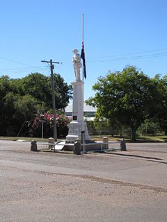
Barcaldine is a rural town and locality in the Barcaldine Region in Queensland, Australia. In the 2016 census, Barcaldine had a population of 1,422 people. This is the administrative centre of the Barcaldine Region. Barcaldine played a major role in the Australian labour movement.
Aramac is a rural town and locality in the Barcaldine Region, Queensland, Australia. In the 2016 census, Aramac had a population of 299 people.

Muttaburra is a town and locality in the Barcaldine Region, Queensland, Australia. In the 2016 census, Muttaburra had a population of 88 people. The undeveloped town of Scarrbury is within the locality.

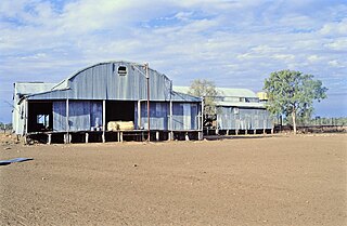
Ilfracombe is a small town and locality in the Longreach Region in Central West Queensland, Australia. Ilfracombe calls itself The Hub of the West. The main industry is sheep rearing, mainly for wool. Ilfracombe is situated on the Landsborough Highway, about 27 kilometres (17 mi) east of Longreach, 214 metres above sea level. In the 2016 census, Ilfracombe had a population of 259 people.

The Shire of Longreach was a local government area located in central western Queensland, centred on the town of Longreach, from which the shire was administered. It covered an area of 23,561.4 square kilometres (9,097.1 sq mi), and existed as a local government entity from 1900 until 2008, when it amalgamated with the Shires of Ilfracombe and Isisford to form the Longreach Region.

The Barcaldine Region is a local government area in Central West Queensland, Australia. Established in 2008, it was preceded by three previous local government areas which had existed for over a century.

The Longreach Region is a local government area in Central West Queensland, Australia. Established in 2008, it superseded three previous local government areas that had existed for more than a century.
Morella was a rural locality within Longreach Region, Queensland, Australia. It has been amalgamated into the locality of Longreach.

Cornish Creek is a former rural locality in the Barcaldine Region, Queensland, Australia. In the 2016 census, Cornish Creek had a population of 16 people.

Vergemont was a rural locality in the Longreach Region, Queensland, Australia. It was amalgamated into the locality of Longreach.
Tocal was a rural locality in the Longreach Region, Queensland, Australia. It was amalgamated into the locality of Longreach.
Chorregon was a rural locality in the Longreach Region, Queensland, Australia. It is now part of the locality of Longreach.
Ernestina was a rural locality in the Longreach Region, Queensland, Australia. It is now part of Longreach.
Maneroo was a rural locality in the Longreach Region, Queensland, Australia. It is now part of Longreach.
Tablederry is a former rural locality in the Barcaldine Region, Queensland, Australia. In the 2016 census, Tablederry had a population of 32 people.
Bangall is a former rural locality in the Barcaldine Region, Queensland, Australia. In the 2016 census, Bangall had a population of 4 people.
Sardine is a former rural locality in the Barcaldine Region, Queensland, Australia. In the 2016 census, Sardine had a population of 5 people.

Barcaldine Downs is a former rural locality in the Barcaldine Region, Queensland, Australia. In the 2016 census, Barcaldine Downs had a population of 14 people.
Tara Station is a former rural locality in the Barcaldine Region, Queensland, Australia. In the 2016 census, Tara Station had a population of 10 people.
