Ensenada, New Mexico | |
|---|---|
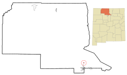 Location of Ensenada, New Mexico | |
 Ensenada, New Mexico Location in the United States | |
| Coordinates: 36°43′51″N106°32′13″W / 36.73083°N 106.53694°W | |
| Country | United States |
| State | New Mexico |
| County | Rio Arriba |
| Area | |
• Total | 1.46 sq mi (3.78 km2) |
| • Land | 1.46 sq mi (3.78 km2) |
| • Water | 0.00 sq mi (0.00 km2) |
| Elevation | 7,520 ft (2,290 m) |
| Population | |
• Total | 107 |
| • Density | 73.39/sq mi (28.34/km2) |
| Time zone | UTC-7 (Mountain (MST)) |
| • Summer (DST) | UTC-6 (MDT) |
| ZIP code | 87575 |
| Area code | 505 |
| FIPS code | 35-24960 |
| GNIS feature ID | 2584095 [2] |
Ensenada is a census-designated place (CDP) in Rio Arriba County, New Mexico, United States. The population was 107 at the 2010 census. It had a post office from 1906 to 1958. [4]

