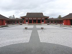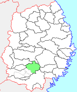
Mizusawa was a city located in Iwate Prefecture, Japan. It is currently part of the city of Ōshū. Mizusawa is home to one of the six International Latitude Observatories. The observatories were close to the parallel of 39 degrees 8 minutes north latitude. They worked together to study the Earth's "wobble" using stars selected by Dr. Kimura, the astronomer in charge of the Mizusawa station. Twelve groups of stars that had six pairs of stars each were chosen. Two groups of stars were observed at each station following a schedule of dates, time, and duration prepared by Kimura.

Hanamaki is a city in Iwate Prefecture, Japan. As of 31 March 2020, the city had an estimated population of 94,691, and a population density of 100 persons per km², in 37,773 households. The total area of the city is 908.39 square kilometres (350.73 sq mi). Hanamaki is famous as the birthplace of Kenji Miyazawa and for its hot spring resorts.
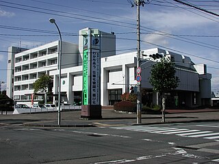
Kitakami is a city located in Iwate Prefecture, Japan. As of 1 June 2019, the city had an estimated population of 92,311, and a population density of 210 persons per km2 in 37,085 households. The total area of the city is 437.55 square kilometres (168.94 sq mi). The city is famous for the sakura that bloom in Tenshochi Park.

Shiwa is a town in Iwate Prefecture, Japan. As of 31 March 2020, the town had an estimated population of 33,090, in 12338 households, and a population density of 134 persons per km². The total area of the town is 238.98 square kilometres (92.27 sq mi).

Kanegasaki is a town located in Iwate Prefecture, Japan. As of 30 April 2020, the town had an estimated population of 15,580, and a population density of 87 persons per km² in 6,155 households. The total area of the town is 179.76 square kilometres (69.41 sq mi). In June 2001, the 34.8 hectare old centre of town was protected as an Important Preservation District by the national government for its traditional samurai residences.

Maesawa was a town located in Isawa District, Iwate Prefecture, Japan. It is currently part of the city of Ōshū. Maesawa is well known for its “Maesawa beef”.

Isawa was a town located in Isawa District, Iwate Prefecture, Japan. It is currently part of the city of Ōshū. Isawa is well known for its capsicum.

Koromogawa was a village located in Isawa District, Iwate Prefecture, Japan. It is currently part of the city of Ōshū.
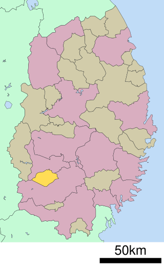
Isawa is a district located in Iwate Prefecture, Japan.

Hiraizumi is a town located in Nishiiwai District, Iwate Prefecture, Japan. As of 30 April 2020, the town had an estimated population of 7,408 and a population density of 120 inhabitants per square kilometre (310/sq mi) in 2,616 households. The total area of the town was 63.39 km2 (24.48 sq mi). It is noted for the Historic Monuments and Sites of Hiraizumi, which achieved UNESCO World Heritage Site status in 2011.

Sumita is a town located in Iwate Prefecture, Japan. As of 31 March 2020, the town had an estimated population of 5,315, and a population density of 16 persons per km² in 2142 households. The total area of the town is 334.84 square kilometres (129.28 sq mi).

Yamada is a town in Iwate Prefecture, Japan. As of 1 May 2020, the town had an estimated population of 15,195 and a population density of 58 persons per km², in 6,554 households. The total area of the town is 262.81 square kilometres (101.47 sq mi).

Iwaizumi is a town located in Iwate Prefecture, Japan. As of 31 March 2020, the town had an estimated population of 8,987, and a population density of 9.1 persons per km² in 4366 households. The total area of the town is 992.36 square kilometres (383.15 sq mi).

Ichinohe is a town located in Iwate Prefecture, Japan. As of 1 April 2020, the town had an estimated population of 12,053, and a population density of 40 persons per km² in 5645 households. The total area of the town is 300.03 square kilometres (115.84 sq mi).

Kikonai is a town located in Oshima Subprefecture, Hokkaido, Japan.
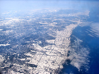
Esashi is a town in Sōya Subprefecture, Hokkaido, Japan.

Hachimantai is a city located in Iwate Prefecture, Japan. As of 1 April 2020, the city had an estimated population of 25,076, and a population density of 29 persons per km2 in 10,531 households. The total area of the city is 862.30 square kilometres (332.94 sq mi).

Ōshū is a city located in Iwate Prefecture, Japan. As of 30 April 2020, the city had an estimated population of 114,620 and a population density of 120 persons per km² in 45,728 households. The total area of the city is 993.30 square kilometres (383.52 sq mi). Ōshū is famous for its Maesawa Beef, numerous festivals, historic temples and shrines and Fujiwara no Sato, a theme park and movie lot based on the exploits of the Northern Fujiwaras in the 12th century. Many famous people claim Ōshū as their home, including Ichiro Ozawa, the long-time leader of the Democratic Party of Japan.
List of provinces of ancient Japan > Tōsandō > Rikuchu Province > Esashi District

Ichinoseki is a city located in Iwate Prefecture, in the Tōhoku region of northern Japan. As of 1 May 2020, the city had a population of 114,476 and a population density of 91 persons per km² in 46,375 households. It is currently the second largest city by population in the prefecture, after Morioka. The total area of the city was 1,256.42 square kilometers (485.11 sq mi).
