This article relies largely or entirely on a single source .(July 2017) |
Essenwood | |
|---|---|
 | |
 Essenwood  Essenwood | |
| Coordinates: 29°50′09″S31°00′24″E / 29.8358°S 31.0067°E | |
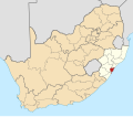
| Country | South Africa |
| Province | KwaZulu-Natal |
| Municipality | eThekwini |
| Main Place | Durban |
| Area | |
• Total | 2.06 km2 (0.80 sq mi) |
| Population (2011) [1] | |
• Total | 11,318 |
| • Density | 5,490/km2 (14,200/sq mi) |
| Racial makeup (2011) | |
| • Black African | 22.7% |
| • Coloured | 3.7% |
| • Indian/Asian | 34.3% |
| • White | 38.3% |
| • Other | 1.1% |
| First languages (2011) | |
| • English | 77.5% |
| • Zulu | 11.1% |
| • Afrikaans | 3.6% |
| • Xhosa | 2.6% |
| • Other | 5.2% |
| Time zone | UTC+2 (SAST) |
| Postal code (street) | 4001 |
| PO box | n/a |
| Area code | 031 |
Essenwood is a central suburb of Durban, KwaZulu-Natal, South Africa, approximately 3 kilometres (1.9 mi) north-west of the city centre. It is administered by the eThekwini Metropolitan Municipality, the municipality governing Durban and its surrounding suburbs.