Bluff | |
---|---|
Coordinates: 29°55′29″S31°0′14″E / 29.92472°S 31.00389°E | |
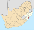
Country | South Africa |
Province | KwaZulu-Natal |
Municipality | eThekwini |
Main Place | Durban |
Area | |
• Total | 21.68 km2 (8.37 sq mi) |
Population (2011) [1] | |
• Total | 68,124 |
• Density | 3,100/km2 (8,100/sq mi) |
Racial makeup (2011) | |
• Black African | 15.6% |
• Coloured | 36.6% |
• Indian/Asian | 30.1% |
• White | 17.1% |
• Other | 0.6% |
First languages (2011) | |
• English | 79.8% |
• Zulu | 8.1% |
• Afrikaans | 7.2% |
• Xhosa | 1.7% |
• Other | 3.3% |
Time zone | UTC+2 (SAST) |
Postal code (street) | 4052 |
PO box | 4036 |
Bluff or The Bluff is a geographical area, containing eight suburbs in Durban, eThekwini Metropolitan Municipality, KwaZulu-Natal Province, South Africa. The Bluff forms a large part of the South Durban Basin, a sub-region located south of Durban.
The promontory on which Bluff is situated is Durban's most prominent natural landmark. Accordingly, it probably served as an important visual reference for navigational approaches into Durban Harbour. [2]
Between 1907 and 1975, the exposed south-east side of The Bluff housed a whaling station. Since the mid-Nineteenth Century, the region has been purposed for navigational and military uses. This use has provided protection for much of the area's native vegetation. Today, the area is considered important in the ecological management of Durban and environment. [2]
The traditional Zulu name for Bluff is isibubulungu, meaning a long, round-shaped ridge. It also means "white man’s bluff", which may be a reference to habitation by shipwreck survivors. [2]
The name of the area is derived from the long bluff - two ancient sand dunes on which most of the suburbs lie.
The Bluff promonotory is a remnant of an extensive coastal dune system that formed along the shoreline of KwaZulu-Natal between two and five million years ago. [2]
Lying just south of the Durban city centre, the Bluff is one of the main enclosing elements of the Port of Durban from the Indian Ocean, and forms the southern quayside of the port. The coastal area is bounded by the Port of Durban (Island View) to the northwest, the defunct Durban International Airport and the SAPREF Petrochemical Refinery to the south, Mobeni to the southwest and the Port of Durban (Bayhead) and Clairwood to the west.
Within the area referred to as "The Bluff" lie the suburbs of Brighton Beach, Fynnland, Grosvenor, Jacobs, Merebank, Ocean View, Treasure Beach and Wentworth.
The Bluff is a popular holiday destination, with extensive accommodation and plentiful seaside recreation. The area is known for its abundant sea life, including dolphins, and, in the winter months, whales. [3]
The Bluff has access to six beaches including Ansteys Beach, Brighton Beach, Cuttings Beach, Garvies Beach and Treasure Beach. Amongst these beaches Ansteys and Brighton beaches are the most popular with Ansteys Beach home to two pools and Brighton Beach to three pools including one tidal pool. Most of the other beaches along the Bluff remain quiet and unspoilt.
Bluff National Park Golf Club is a large 18-hole golf course situated between the suburbs of Grosvenor and Ocean View. [4]
At the south end of the Bluff are two main residential suburbs: Wentworth and Merebank. Interspersed among the houses are a number of industries, including two of South Africa's largest oil refineries (Sapref and Engen facilities), the Mondi Paper Mill and other smaller factories. Durban's main airport was nearby until 2010. Durban International Airport moved and changed its name on 1 May 2010, relocating from the South Durban Basin to La Mercy on the North Coast.
The mixture of residential homes and large industries in the basin creates a challenge for all those who live and work in the area. Air pollution, water pollution, overcrowding and litter are some of the problems that residents and industries need to deal with. Community groups are attempting to resolve the issue by working with the large industries in the area.
There are two shopping centres in Wentworth serving the Bluff, namely Bluff Towers and Hillside Mall. Other shopping centres serving the area include Merebank Mall in Merebank and the Bluff Shopping Centre in Grosvenor. [5] [6]
Wentworth District Hospital is a government-funded hospital and is the sole hospital in the Bluff, aimed at serving the area. [7]
The Bluff is divided over two SAPS precincts with the southern part including Merebank, Merewent, Treasure Beach and Jacobs covered by Wentworth SAPS while the northern part including Wentworth, Brighton Beach, Ocean View, Fynnlands and Grosvenor covered by Brighton Beach SAPS. [8]
The main freeway passing the Bluff is the M4 (Inkosi Albert Luthuli Freeway), connecting the Durban CBD to the north with the South Coast (via the N2) to the south. The M7 connects the Bluff with Queensburgh to the west and is formed by many roads such as Solomon Mahlangu Drive (previously Edwin Swales VC Drive), Bluff Road, Old Mission Road and Grays Inn Road.
The main suburban routes in the Bluff include Marine Drive, which is the coastal road connecting Merebank and the coastal suburbs of Treasure Beach, Brighton Beach and Ocean View and Tara Road, which is the inland road connecting Merebank and the suburbs of Jacobs, Wentworth, Grosvenor and Fynnlands.
KwaZulu-Natal is a province of South Africa that was created in 1994 when the government merged the Zulu bantustan of KwaZulu and Natal Province.
Durban is the third-most populous city in South Africa, after Johannesburg and Cape Town, and the largest city in the province of KwaZulu-Natal. Situated on the east coast of South Africa, on the Natal Bay of the Indian Ocean, Durban is South Africa's busiest port and was formerly named Port Natal. North of the harbour and city centre lies the mouth of the Umgeni River; the flat city centre rises to the hills of the Berea on the west; and to the south, running along the coast, is the Bluff. Durban is the seat of the larger eThekwini Metropolitan Municipality, which spans an area of 2,556 km2 (987 sq mi) and had a population of 4.2 million in 2022, making the metropolitan population one of Africa's largest on the Indian Ocean. Within the city limits, Durban's population was 595,061 in 2011. The city has a humid subtropical climate, with hot, wet summers and mild, dry winters.
Ballito is an affluent coastal town located in KwaZulu-Natal, South Africa. Ballito is about 40 kilometres (25 mi) north of Durban and 24 kilometres south of KwaDukuza. It forms part of the KwaDukuza Local Municipality, and iLembe District Municipality. Dolphins and Whales are common on this stretch of the North Coast shoreline, hence the nickname Dolphin Coast.
Port Edward is a small resort town situated on the south coast of KwaZulu-Natal in South Africa and lies on the border between KwaZulu-Natal and the Eastern Cape. It is situated on the R61 road between Port Shepstone and Lusikisiki.
Umkomaas, also known by its official name eMkhomazi, is a small coastal village on the subtropical South Coast of KwaZulu-Natal, South Africa was formed when a harbour was built in 1861 to export sugar. The village rests beside the mouth of the navigable uMkhomazi River, also known as the Mkhomazi or Umkomaas. With the successful dredging of Durban harbour's sandbar and arrival of the railway, like Port Shepstone, the harbour fell into disuse, but the village came to life. It is administered as eMkhomazi Area, together with the nearby areas of Craigieburn, Clansthal, Crowder, Amahlongwa and Hull Valley as part Ward 99 in the eThekwini Metropolitan Municipality
Amanzimtoti, locally nicknamed Toti, and officially renamed to eManzimtoti, is a coastal town just south of Durban in KwaZulu-Natal, South Africa. Situated along the Sapphire Coast, the town is well known for its warm climate and numerous beaches, and is a popular tourist destination, particularly with surfers.
Isipingo is a town situated 19 kilometres (12 mi) south of Durban in KwaZulu-Natal, South Africa and currently forms part of eThekwini Metropolitan Municipality. The town is named after the Siphingo River, which in turn is thought to be named for the intertwining cat-thorn shrubs (Scutia myrtina) present in the area, or the river's winding course.
Kingsburgh is a coastal resort town along the South Coast of KwaZulu-Natal, South Africa, approximately 32 kilometres south-west of Durban.
Winklespruit is a small seaside resort on the South Coast of KwaZulu-Natal in South Africa and now forms part of the coastal town of Kingsburgh and the eThekwini Metropolitan Municipality, the Greater Durban metropolitan area.
Queensburgh is a town in KwaZulu-Natal, South Africa that is situated inland (southwest) from Durban and now forms part of eThekwini, the Greater Durban metropolitan area.
Mount Edgecombe or Mt Edgecombe is a town in KwaZulu-Natal, South Africa, situated just north of Durban, which forms part of eThekwini, the Greater Durban Metropolitan area. Much of the suburb is cordoned off as a gated settlement comprising resorts, golf courses and a retirement home. It was previously a sugar growing area. The population increased by 89% between 2001 and 2011 from 3,874 to 7,323. Its name is derived from Mount Edgcumbe House in Cornwall, England, the family seat of the Earls of Mount Edgcumbe.
The N2 is a national route in South Africa that runs from Cape Town through George, Gqeberha, East London, Mthatha, Port Shepstone and Durban to Ermelo. It is the main highway along the Indian Ocean coast of the country. Its current length of 2,255 kilometres (1,401 mi) makes it the longest numbered route in South Africa.
Chatsworth is a large township in KwaZulu-Natal, South Africa established in the 1950s to segregate the Indian population and create a buffer between the white suburbs of Durban to the north and the black townships of Durban to the south. Located in the Southern Durban basin and roughly bordered by the Umhlatuzana River in the North and Umlaas River in the South, the suburb is made up mainly of Indian/Asian and Black African people.
uMhlanga, alternatively rendered Umhlanga, is a residential, commercial and resort town north of Durban on the coast of KwaZulu-Natal, South Africa. It is part of the eThekwini Metropolitan Municipality, which was created in 2000 and includes the greater Durban area. The name means "place of reeds" in the Zulu language, and the correct pronunciation of "hl" in uMhlanga is similar to the Welsh "ll".
Morningside is an affluent suburb of Durban, KwaZulu-Natal, South Africa.
Wentworth is an area of Durban, South Africa in the province of KwaZulu-Natal. It is completely located inside the South Durban Basin. The Wentworth area is located near the major freeways M4 and M7 and is approximately 11 km south of the Durban city center.
Umbogintwini is a suburb located approximately 23 km south-west of Durban, in the KwaZulu-Natal province of South Africa and it forms part of the eThekwini Metropolitan Municipality.
Athlone Park is a small coastal suburb located between Durban and Amanzimtoti in KwaZulu-Natal, South Africa. Considered as one of Amanzimtoti’s most sought-after suburbs, Athlone Park forms part of the eThekwini Metropolitan Municipality as a Southern Suburb.
KwaZulu-Natal South Coast is a region along the southern stretch of coastline of KwaZulu-Natal, South Africa, south of the coastal city of Durban.