Kenockee Township is a civil township of St. Clair County in the U.S. state of Michigan. The population was 2,470 at the 2010 Census.

The Shire of Pyrenees is a local government area (LGA) in Victoria, Australia, located in the western part of the state. It covers an area of 3,435 square kilometres (1,326 sq mi) and in June 2018 had a population of 7,353.

The Avoca River, an inland intermittent river of the north–central catchment, part of the Murray-Darling basin, is located in the lower Riverina bioregion and Central Highlands and Wimmera regions of the Australian state of Victoria. The headwaters of the Avoca River rise on the northern slopes of the Pyrenees Range and descend to flow into the ephemeral Kerang Lakes.

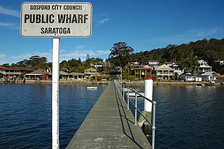
Saratoga is a residential south-eastern village and suburb of the Central Coast region of New South Wales, Australia, located on a peninsula of Brisbane Water and part of the Central Coast Council local government area. The suburb is characterised by its largely settled shoreline, with houses extending up coastal slopes to the base of the tall hills that comprise the core of the peninsula.

Avoca is a small town near Arklow, in County Wicklow, Ireland. It is situated on the River Avoca.

Homebush was a gold mining town 10 kilometres (6 mi) from Avoca in central Victoria, Australia. It is located within the Pyrenees Shire.

Avoca is a rural locality in the local government areas (LGA) of Northern Midlands (99%) and Break O'Day (1%) in the Central and North-east LGA regions of Tasmania. The locality is about 69 kilometres (43 mi) south-east of the town of Longford. The 2021 census recorded a population of 192 for Avoca.

Avoca Beach is a coastal suburb of the Central Coast region of New South Wales, Australia, about 95 kilometres (59 mi) north of Sydney. Avoca Beach is primarily a residential suburb, which is now often considered part of the Greater Sydney area, but also a popular tourist destination. Avoca Beach village has a variety of restaurants and cafes as well as a post office, newsagent, pharmacy and mini-mart. Avoca Beach also has a historic cinema, a hotel, bowling club, motel and caravan park. It is located within the Central Coast Council local government area.

Durban North is an area to the north of Durban in the eThekwini Metropolitan Municipality, KwaZulu-Natal, South Africa. Durban North lies between the N2 freeway and the eastern seashore, with the Umgeni River forming its southern boundary. It has residential suburbs that are some of Durban's most affluent and is flanked by La Lucia in the north.

The Avoca Lake, formerly known as Avoca Lagoon and as Bulbararing Lagoon, is an intermittently closed intermediate saline coastal lagoon that is located on the Central Coast region of New South Wales, Australia. Avoca Lake is located between the beachside settlements of North Avoca and Avoca Beach, and adjacent to the east coast, about 85 kilometres (53 mi) north of Sydney.

Avoca was an electoral district of the Legislative Assembly in the Australian state of Victoria from 1859 to 1889. It was based in northern Victoria. It was defined by the 1858 Electoral Act as:
Commencing at the source of the River Avoca in the Main Dividing Range ; thence northwards by that river and by a line bearing north to the River Murray ; thence by the River Murray to the River Loddon; thence south-wards by the River Loddon to McNeil's Creek; thence by McNeil's Creek to the Main Dividing Range; and thence westerly by the Main Dividing Range to the commencing point aforesaid, including the parish of Tarnagulla.
Kara Kara was an electoral district of the Legislative Assembly in the Australian state of Victoria from 1877 to 1927 and 1955 to 1976. It was based in north-western Victoria and included the subdivisions of Donald, Charlton, Minyip, Murtoa, St. Arnaud, Wedderburn, Inglewood, Dunnolly, Landsborough, Avoca, Maryborough and Carisbrook.
The Electoral district of Avoca was an electoral district of the old unicameral Victorian Legislative Council of 1851 to 1856. Victoria being a colony in Australia at the time. Avoca was added to the Council in 1855, along with four other districts.
Avoca is a suburb of Bundaberg in the Bundaberg Region, Queensland, Australia. In the 2016 census, Avoca had a population of 4,904 people.
A-H-S-T Community School District was a school district headquartered in Avoca, Iowa.
Avoca School District 37 is a school district in the Chicago metropolitan area. Its headquarters are in Marie Murphy School in Wilmette, which has middle school and preschool levels. It also operates Avoca West School, with elementary grades, in Glenview. In addition to portions of Glenview and Wilmette, it serves portions of Northfield, Winnetka, and some unincorporated areas with Winnetka postal addresses. It feeds into the New Trier Township High School District 203. The name "Avoca", meaning "Fountain of Knowledge", is a Gaelic word.
The M19 is a metropolitan route in the eThekwini Metropolitan Municipality, South Africa, connecting Pinetown to Springfield in Durban.
Newlands East is a township located 17 km north-west of Durban in the province of KwaZulu-Natal, South Africa.


