Warner Beach

Last updated
Warner Beach
South Africa KwaZulu-Natal location map.svg
Red pog.svg
Warner Beach
South Africa adm location map.svg
Red pog.svg
Warner Beach
Coordinates: 30°05′06″S30°51′43″E / 30.085°S 30.862°E / -30.085; 30.862
Country South Africa
Province KwaZulu-Natal
Municipality eThekwini
Main Place Kingsburgh
Area
[1]
  Total2.04 km2 (0.79 sq mi)
Population
 (2011) [1]
  Total3,453
  Density1,700/km2 (4,400/sq mi)
Racial makeup (2011)
[1]
   Black African 10.5%
   Coloured 2.7%
   Indian/Asian 4.4%
   White 82.1%
  Other0.4%
First languages (2011)
[1]
   English 63.7%
   Afrikaans 28.3%
   Zulu 4.8%
  Other3.3%
Time zone UTC+2 (SAST)
Postal code (street)
4126
PO box
4140
Area code 031

Warner Beach is a small resort town south of the Little Manzimtoti River in KwaZulu-Natal, South Africa, and it forms part of eThekwini. It was laid out by surveyor P.A. Warner as a residential area in 1910 for government pensioners. [2]

Contents

History

Fred Mohnhaupt and Gus Brown are the forefounders of Warner Beach. Gus Brown was born in Durban and lived on the Berea. Very close friends, Gus and Fred both worked in the wool trade in Durban; Fred who was his superior and a wealthy businessman, making his money in the wool trade in South Africa. Both loved the entertainment world, and had many friends in Durban and afar, together travelling abroad on many occasions.

With a vision, in 1914, Gus and Fred moved to Warner Beach, where Fred purchased 82 acres of vacant land; the outlined area was roughly Kingsway (Warner Beach School) to St Winifreds near Almond Rd from north to south and Coastline to Dimple Lea Rd vicinity from east to west.

Fred had the financial investment and Gus the vision and ideas, so together they developed Warner Beach. An infrastructure on their land was developed, with basic gravel tracks, buildings, etc. Gus Brown Road and other roads were built as they are today. They took on a local man, Ray Edkins, to farm their land so as to supply meat and vegetables to the hotel and area.

Gus Brown Road leads to a hotel, which they had built, the Strelitzia Hotel, which attracted visitors, and many of their friends travelled out from Durban to stay at Warner Beach. The hotel hosted many dances and a variety of entertainments. During and after the war, soldiers and airman visited Warner Beach and stayed at the hotel. Demand grew, so Fred built another hotel on his land, the Strand Hotel. Warner Beach became a popular destination for holiday seekers, attracting visitors from the Transvaal and further afield. Guests enjoyed participating in the many social activities set up by Fred and Gus at their hotels.

Geography

Forming part of the coastal town of Kingsburgh, Warner Beach is situated between the adjacent coastal areas of Winklespruit to the south and Doonside to the north.

Temperatures are mild and pleasant throughout the year, due to the temperature-stabilizing effect of the warm ocean current that flows in the coastal waters. A pleasant sea breeze can often be experienced with a cool temperature and a pleasant sea aroma. The vegetation is normally green throughout the year.

Culture and contemporary lifestyle

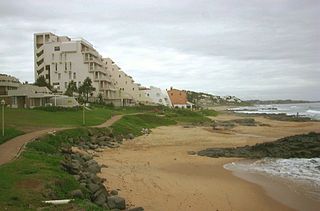
Warner Beach is a coastal village with a residential area and tourist, educational, and shopping facilities. Warner Beach still retains much of its quaint seaside character with little to no development and its main street, Kingsway which has no traffic lights whatsoever, is lined with the occasional book shop, hairdresser, petrol stations, bottle shops, real estate agents, hardware store and boutique stores amongst others. Furthermore it is unique in that for some part of Kingsway's length in Warner Beach, it is separated from the beach only by the railway line which runs parallel to the road.

Beaches

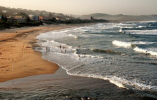
Surfing conditions are excellent at Warner Beach, which is why this coastal village has created some of the best surfers on a global scale. Close by lies the Aliwal Shoal, which is definitely one of the best dive sites in the area. Kit surfing, paddle skiing, canoeing, beach walks, scuba diving, jogging, and fishing are popular activities.

A name that is often used for Warner Beach is Baggies Beach, but contention exists as to the validity of the name. Investigations show that the name Baggies Beach was originally used for St Winifred's Beach, which is also known as Subway Beach. The beach known as Warner Beach was also called Crane Beach, due to the presence of a construction crane at a building site next to the beach.

An excellent short film of Warner Beach at sunrise, filmed by Dan Dedekind is available here.

Body boarding the shore-break at Baggies, Warner Beach Body-boarding at Baggies beach.jpg
Body boarding the shore-break at Baggies, Warner Beach
Scuba diving at a diving spot nearby Aliwal Shoal.jpg
Scuba diving at a diving spot nearby

Marine ecosystems

Whales and dolphins can at times be seen in the Indian Ocean adjacent to the area. The annual "Sardine Run" is a migration of huge schools of fish, attracting tourists and fishermen.

Developments

Developments in the area include:

In about 1946, Fred Mohnhaupt and Gus Brown finally sold both the Strelitzia and Strand Hotels and moved back to Durban, where they settled down to their retirements.

Transport

Warner Beach lies on the R102 named as Kingsway (Andrew Zondo Road) which runs parallel to the coast as its main thoroughfare from Doonside and Amanzimtoti in the north to Winklespruit and Umkomaas in the south.

The N2 highway between Durban and Port Shepstone intersects Warner Beach, but does not offer direct access to the coastal village and as a result access to Warner Beach from the freeway can only be obtained from the interchanges with Seadoone Road in Doonside or the R603 in Winklespruit.

The main commuter line between Durban and Kelso, the South Coast Line, passes through Warner Beach and its railway station currently operates commuter rail services offered by Metrorail. In some places of Warner Beach, the railway line is only metres from the water's edge. After the floods of 2021 the Rail transport link from Warner Beach to Durban was out of service for 24 months. Currently, (November 2023) the railway link only goes as far a Winklespruit as the railway bridge across the Illovo river is still not repaired.

Related Research Articles

<span class="mw-page-title-main">KwaZulu-Natal</span> Province in South Africa

KwaZulu-Natal is a province of South Africa that was created in 1994 when the government merged the Zulu bantustan of KwaZulu and Natal Province.

A seaside resort is a city, town, village, or hotel that serves as a vacation resort and is located on a coast. Sometimes the concept includes an aspect of official accreditation based on the satisfaction of certain requirements, such as in the German Seebad. Where a beach is the primary focus for tourists, it may be called a beach resort.

<span class="mw-page-title-main">Miranda, New South Wales</span> Suburb of Sydney, New South Wales, Australia

Miranda is a suburb in southern Sydney, in the state of New South Wales, Australia. The suburb is known as a commercial centre for the southern suburbs. Miranda is 24 kilometres south of the Sydney central business district, in the Sutherland Shire.

<span class="mw-page-title-main">Doonside, New South Wales</span> Suburb of Sydney, New South Wales, Australia

Doonside is a suburb in the metropolis of Sydney, in the state of New South Wales, Australia. Doonside is located 40 kilometres west of the Sydney central business district, in the local government area of the City of Blacktown and is part of the Greater Western Sydney region. Featherdale Wildlife Park and the Nurragingy Nature Reserve are popular local tourist attractions.

<span class="mw-page-title-main">Cronulla, New South Wales</span> Suburb of Sydney, New South Wales, Australia

Cronulla is a suburb of Sydney, in the state of New South Wales, Australia. Boasting numerous surf beaches and swimming spots, the suburb attracts both tourists and Greater Sydney residents. Cronulla is 26 kilometres south of the Sydney central business district, in the local government area of the Sutherland Shire.

<span class="mw-page-title-main">Brighton-Le-Sands, New South Wales</span> Suburb of Sydney, New South Wales, Australia

Brighton Le Sands, is a suburb in southern Sydney, in the state of New South Wales, Australia. Brighton Le Sands is located 13 kilometres south of the Sydney central business district, on the western shore of Botany Bay. Brighton Le Sands is in the local government area of the Bayside Council and is part of the St George area.
<span class="mw-page-title-main">Ballito</span> Place in KwaZulu-Natal, South Africa

Ballito is an affluent coastal town located in KwaZulu-Natal, South Africa. Ballito is about 40 kilometres (25 mi) north of Durban and 24 kilometres south of KwaDukuza. It forms part of the KwaDukuza Local Municipality, and iLembe District Municipality. Dolphins and Whales are common on this stretch of the North Coast shoreline, hence the nickname Dolphin Coast.
<span class="mw-page-title-main">Scottburgh</span> Place in KwaZulu-Natal, South Africa

Scottburgh is a coastal resort town located along the south coast of KwaZulu-Natal, South Africa. It situated south of the mouth of the Mpambanyoni River (confuser of birds).

<span class="mw-page-title-main">Umkomaas</span> Small coastal village in KwaZulu-Natal, South Africa

Umkomaas, also known by its official name eMkhomazi, is a small coastal village on the subtropical South Coast of KwaZulu-Natal, South Africa was formed when a harbour was built in 1861 to export sugar. The village rests beside the mouth of the navigable uMkhomazi River, also known as the Mkhomazi or Umkomaas. With the successful dredging of Durban harbour's sandbar and arrival of the railway, like Port Shepstone, the harbour fell into disuse, but the village came to life. It is administered as eMkhomazi Area, together with the nearby areas of Craigieburn, Clansthal, Crowder, Amahlongwa and Hull Valley as part Ward 99 in the eThekwini Metropolitan Municipality

<span class="mw-page-title-main">Amanzimtoti</span> Settlement in South Africa

Amanzimtoti, locally nicknamed Toti, and officially renamed to eManzimtoti, is a coastal town just south of Durban in KwaZulu-Natal, South Africa. Situated along the Sapphire Coast, the town is well known for its warm climate and numerous beaches, and is a popular tourist destination, particularly with surfers.

Doonside is a small beachside resort suburb in Kingsburgh, some 30 km south-west of Durban in KwaZulu-Natal, South Africa on the South Coast.

Isipingo is a town situated 19 kilometres (12 mi) south of Durban in KwaZulu-Natal, South Africa and currently forms part of eThekwini Metropolitan Municipality. The town is named after the Siphingo River, which in turn is thought to be named for the intertwining cat-thorn shrubs (Scutia myrtina) present in the area, or the river's winding course.

Kingsburgh is a coastal resort town along the South Coast of KwaZulu-Natal, South Africa, approximately 32 kilometres south-west of Durban.

Winklespruit is a small seaside resort on the South Coast of KwaZulu-Natal in South Africa and now forms part of the coastal town of Kingsburgh and the eThekwini Metropolitan Municipality, the Greater Durban metropolitan area.

<span class="mw-page-title-main">Kloof</span> Town in KwaZulu-Natal, South Africa

Kloof is a town that includes a smaller area called Everton, located approximately 26 km north-west of Durban in KwaZulu-Natal, South Africa. Once an independent municipality, it now forms part of greater Durban area of the eThekwini Metropolitan Municipality.

Hemsby is a village, seaside resort and civil parish in the county of Norfolk, England. It is situated some 8 mi (13 km) north of the town of Great Yarmouth. In the 2001 census Hemsby had a population of 2,973 in 1,221 households; by the 2011 census it had increased to 3,275. Hemsby borders the villages of Winterton-on-Sea and Scratby. For the purpose of local government, the parish is in the district of Great Yarmouth.

uMhlanga, KwaZulu-Natal Place in KwaZulu-Natal, South Africa

uMhlanga, alternatively rendered Umhlanga, is a residential, commercial and resort town north of Durban on the coast of KwaZulu-Natal, South Africa. It is part of the eThekwini Metropolitan Municipality, which was created in 2000 and includes the greater Durban area. The name means "place of reeds" in the Zulu language, and the correct pronunciation of "hl" in uMhlanga is similar to the Welsh "ll".

<span class="mw-page-title-main">Salt Rock</span> Place in KwaZulu-Natal, South Africa

Salt Rock is a small coastal village just north of Ballito and Shaka's Rock situated along the Dolphin Coast of KwaZulu-Natal, South Africa. It is a favorite holiday destination for many local South Africans. It is approximately located 52 kilometres north-east of Durban and 19 km south-east of KwaDukuza. Salt Rock owes much of its history to Basil Hulett and his wife Gwen who started not only the Salt Rock Hotel but went on to develop the town of Salt Rock as found today.

Umbogintwini is a suburb located approximately 23 km south-west of Durban, in the KwaZulu-Natal province of South Africa and it forms part of the eThekwini Metropolitan Municipality.

<span class="mw-page-title-main">Dalyston</span> Town in Victoria, Australia

Dalyston is a seaside town located 125 kilometres (78 mi) south east of Melbourne via the South Gippsland and Bass Highways, in the Bass Coast Shire of Gippsland, Victoria, Australia. Known originally as a train station at Powlett River near Wonthaggi, it is now the location of the Victorian Desalination Plant, and at the 2011 census, it had a population of 606. It's Bass Coast’s fastest-growing suburb, with the 2011 census showing Dalyston’s population more than doubled from 278 residents in 2006 to 606 in 2011.

References

  1. 1 2 3 4 "Sub Place Warner Beach". Census 2011.
  2. https://www.facebook.com/dandedekind/videos/736114106541996/ [ bare URL ]