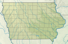
Southeast Iowa Regional Airport is a public airport located two miles southwest of Burlington, in Des Moines County, Iowa. It is owned by the Southeast Iowa Regional Airport Authority which includes representatives from the city of Burlington, the city of West Burlington, and Des Moines County. The airport is used for general aviation and sees one airline, a service subsidized by the federal government's Essential Air Service program at a cost of $1,917,566.

Mason City Municipal Airport is located six miles west of downtown Mason City, in Cerro Gordo County, Iowa, United States. It is in the northern part of Lake Township, just east of the city of Clear Lake. It is used for general aviation and has airline service subsidized through the Essential Air Service (EAS) program.
Clarion Municipal Airport is a city-owned public-use airport located one nautical mile (1.85 km) northwest of the central business district of Clarion, a city in Wright County, Iowa, United States. This airport is included in the FAA's National Plan of Integrated Airport Systems for 2009–2013, which categorized it as a general aviation facility.

Arlington Municipal Airport is a public airport located three miles (5 km) southwest of the central business district of Arlington, a city in Snohomish County, Washington, United States. It is owned and operated by the City of Arlington.

Renton Municipal Airport is a public use airport located in Renton, a city in King County, Washington, United States. The airport was renamed Clayton Scott Field in 2005 to celebrate the 100th birthday of Clayton Scott. The airport's northern boundary is Lake Washington and the Will Rogers–Wiley Post Memorial Seaplane Base. Renton Airport has a floating dock and a launching ramp for conversion from wheeled landings to water takeoffs and landings.
Iowa City Municipal Airport, is two miles southwest of downtown Iowa City, in Johnson County, Iowa. It is the oldest civil airport west of the Mississippi River still in its original location.

Davenport Municipal Airport is a general aviation airport located about 7 miles (11 km) north of downtown Davenport, a city in Scott County, Iowa, United States. The airport, which dates back to 1948, has been home to the Quad City Air Show since 1987.
Council Bluffs Municipal Airport is a public use airport located four nautical miles east of the central business district of Council Bluffs, a city in Pottawattamie County, Iowa, United States. It is owned by Council Bluffs Airport Authority. This airport is included in the National Plan of Integrated Airport Systems for 2011–2015, which categorized it as a general aviation facility.

Spencer Municipal Airport, also known as Northwest Iowa Regional Airport, is a public airport located three miles (5 km) northwest of the central business district of Spencer, a city in Clay County, Iowa, United States. It is owned by the City of Spencer.
Monticello Regional Airport, formerly known as Monticello Municipal Airport, is a public airport located two miles (3 km) southeast of the central business district of Monticello, a city in Jones County, Iowa, United States. It is owned by the City of Monticello.
Beaver County Airport or is a county-owned public airport three miles northwest of Beaver Falls, in Beaver County, Pennsylvania.
Northeast Iowa Regional Airport is a public airport located three miles (5 km) east of the central business district of Charles City, in Floyd County, Iowa, United States. It is owned by the North Cedar Aviation Authority and was formerly known as Charles City Municipal Airport.
Ames Municipal Airport is two miles (3 km) southeast of Ames, in Story County, Iowa.
Decorah Municipal Airport is a city-owned public-use airport located two nautical miles (3.7 km) southeast of the central business district of Decorah, in Winneshiek County, Iowa, United States.
Independence Municipal Airport is a city-owned public-use airport located three nautical miles (6 km) southwest of the central business district of Independence, a city in Buchanan County, Iowa, United States. As per the FAA's National Plan of Integrated Airport Systems for 2009-2013, it is classified as a general aviation airport.
Centerville Municipal Airport is a city-owned public-use airport located three nautical miles (6 km) southwest of the central business district of Centerville, a city in Appanoose County, Iowa, United States. According to the FAA's National Plan of Integrated Airport Systems for 2009–2013, it is categorized as a general aviation airport.
Rogers Executive Airport, also known as Carter Field, is a city-owned public-use airport located two nautical miles (3.7 km) north of the central business district of Rogers, a city in Benton County, Arkansas, United States. This airport is included in the FAA's National Plan of Integrated Airport Systems for 2021–2025, which categorized it as a general aviation facility.
Storm Lake Municipal Airport is a city-owned public-use airport located in Storm Lake, Iowa, United States. The airport is mostly used for general aviation.
Osceola Municipal Airport is a city-owned public-use airport located four nautical miles northeast of the central business district of Osceola, a city in Clarke County, Iowa, United States. It is included in the National Plan of Integrated Airport Systems for 2011–2015, which categorized it as a general aviation facility.
Winterset Municipal Airport is a public use airport located two nautical miles (4 km) north of the central business district of Winterset, a city in Madison County, Iowa, United States. Formerly known as Winterset-Madison County Airport, it is owned by the Winterset Airport Authority. This airport is included in the National Plan of Integrated Airport Systems for 2011–2015, which categorized it as a general aviation facility.


