Arthur N. Neu Airport

Last updated
Arthur N. Neu Airport
Summary
Airport typePublic
OwnerCity of Carroll
Serves Carroll, Iowa
Elevation  AMSL 1,204 ft / 367 m
Coordinates 42°02′46″N094°47′20″W / 42.04611°N 94.78889°W / 42.04611; -94.78889
Website cityofcarroll.com/...
Map
USA Iowa relief location map.svg
Airplane silhouette.svg
CIN
Usa edcp relief location map.png
Airplane silhouette.svg
CIN
Runways
Direction LengthSurface
ftm
13/315,5061,678 Concrete
3/213,3011,006Concrete
Statistics
Aircraft operations (2015)7,700
Based aircraft (2017)16

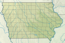
Arthur N. Neu Airport( IATA : CIN, ICAO : KCIN, FAA LID : CIN) is a public airport five miles southeast of Carroll, in Carroll County, Iowa. [1] Also known as Arthur N. Neu Municipal Airport, it was established at its current location in the 1940s. [2]
Contents

Facilities

Arthur N. Neu Airport covers 300 acres (120 ha) at an elevation of 1,204 feet (367 m). It has two lighted runways: Runway 13/31 is 5,506 by 100 feet (1,676 x 30 m) with an instrument approach and non-directional beacon. Runway 3/21 is 3,301 by 60 feet (1,006 x 18 m). [1] [2]

In the year ending August 20, 2017, the airport had 7,700 aircraft operations, average 21 per day: 91% general aviation, 8% air taxi and <1% military. In January 2017, 16 aircraft were based at the airport: 11 single-engine, 4 multi-engine and 1 ultralight. [1] The airport has hangar space for 24 aircraft. [2]

See also

Related Research Articles

Iowa City Municipal Airport, is two miles southwest of downtown Iowa City, in Johnson County, Iowa. It is the oldest civil airport west of the Mississippi River still in its original location.

Forest City Municipal Airport is a public use airport in Hancock County, Iowa, United States. It is located two nautical miles (4 km) south of the central business district of Forest City, a city in Hancock County and Winnebago County. The airport is owned by the City of Forest City. It serves general aviation for Forest City and the surrounding area. Winnebago Industries operates an IAI Astra for company use with the 5800 runway. There is no scheduled air service.

<span class="mw-page-title-main">Davenport Municipal Airport (Iowa)</span> Airport

Davenport Municipal Airport is a general aviation airport located about 7 miles (11 km) north of downtown Davenport, a city in Scott County, Iowa, United States. The airport, which dates back to 1948, has been home to the Quad City Air Show since 1987.

<span class="mw-page-title-main">Elkhart Municipal Airport</span> Airport in Elkhart County, Indiana, United States

Elkhart Municipal Airport is a city-owned public-use airport located three nautical miles (6 km) northwest of the central business district of Elkhart, a city in Elkhart County, Indiana, United States.

Council Bluffs Municipal Airport is a public use airport located four nautical miles east of the central business district of Council Bluffs, a city in Pottawattamie County, Iowa, United States. It is owned by Council Bluffs Airport Authority. This airport is included in the National Plan of Integrated Airport Systems for 2011–2015, which categorized it as a general aviation facility.

Keokuk Municipal Airport is five miles northwest of Keokuk, in Lee County, Iowa. The National Plan of Integrated Airport Systems for 2017–2021 categorized it as a general aviation facility.

Atlantic Municipal Airport, is a city-owned public-use airport located two miles (3 km) west of the central business district of Atlantic, a city in Cass County, Iowa, United States. The airport has a runway opened in 2006 capable of handling light business jets.

Northeast Iowa Regional Airport is a public airport located three miles (5 km) east of the central business district of Charles City, in Floyd County, Iowa, United States. It is owned by the North Cedar Aviation Authority and was formerly known as Charles City Municipal Airport.

Decorah Municipal Airport is a city-owned public-use airport located two nautical miles (3.7 km) southeast of the central business district of Decorah, in Winneshiek County, Iowa, United States.

<span class="mw-page-title-main">Clinton Municipal Airport (Iowa)</span> Airport

Clinton Municipal Airport is seven miles southwest of Clinton, in Clinton County, Iowa. The FAA's National Plan of Integrated Airport Systems (2017-2021) categorizes it as a general aviation airport.

Independence Municipal Airport is a city-owned public-use airport located three nautical miles (6 km) southwest of the central business district of Independence, a city in Buchanan County, Iowa, United States. As per the FAA's National Plan of Integrated Airport Systems for 2009-2013, it is classified as a general aviation airport.

Le Mars Municipal Airport is a city-owned public-use airport located 2 nautical miles southwest of the central business district of Le Mars, a city in Plymouth County, Iowa, United States.

Centerville Municipal Airport is a city-owned public-use airport located three nautical miles (6 km) southwest of the central business district of Centerville, a city in Appanoose County, Iowa, United States. According to the FAA's National Plan of Integrated Airport Systems for 2009–2013, it is categorized as a general aviation airport.

Red Oak Municipal Airport is a city-owned public-use airport located two nautical miles (3.7 km) west of the central business district of Red Oak, a city in Montgomery County, Iowa, United States. According to the FAA's National Plan of Integrated Airport Systems for 2009–2013, it is categorized as a general aviation facility.

Mount Pleasant Municipal Airport is a city-owned public-use airport located three nautical miles southeast of the central business district of Mount Pleasant, a city in Henry County, Iowa, United States. According to the FAA's National Plan of Integrated Airport Systems for 2009–2013, it is categorized as a general aviation facility.

Perry Municipal Airport is a city-owned public-use airport located three nautical miles west of the central business district of Perry, a city in Dallas County, Iowa, United States. This airport is included in the FAA's National Plan of Integrated Airport Systems for 2015–2019, which categorized it as a general aviation facility.

Boone Municipal Airport is a city-owned public-use airport located two nautical miles (4 km) southeast of the central business district of Boone, a city in Boone County, Iowa, United States. It is included in the National Plan of Integrated Airport Systems for 2011–2015, which categorized it as a general aviation facility.

Creston Municipal Airport is a city-owned public-use airport located three nautical miles (6 km) south of the central business district of Creston, a city in Union County, Iowa, United States. It is included in the National Plan of Integrated Airport Systems for 2011–2015, which categorized it as a general aviation facility.

Denison Municipal Airport is a city-owned, public-use airport located two nautical miles (4 km) southwest of the central business district of Denison, a city in Crawford County, Iowa, United States. It is included in the National Plan of Integrated Airport Systems for 2011–2015, which categorized it as a general aviation facility.

Webster City Municipal Airport is a city-owned public-use airport located three nautical miles (6 km) southwest of the central business district of Webster City, in Hamilton County, Iowa, United States. It is included in the National Plan of Integrated Airport Systems for 2015–2019, which categorized it as a general aviation facility.

References

  1. 1 2 3 4 FAA Airport Form 5010 for CIN PDF , effective Jan 5, 2017.
  2. 1 2 3 Arthur N. Neu Municipal Airport Archived May 24, 2009, at the Wayback Machine page at City of Carroll website