Clinton Municipal Airport (Iowa)

Last updated
Clinton Municipal Airport
Clinton Municipal Airport (Iowa) - USGS 19 May 1994.jpg
USGS aerial image, 1994 (north is to the right)
Summary
Airport typePublic
OwnerCity of Clinton
Serves Clinton, Iowa
Elevation  AMSL 708 ft / 216 m
Coordinates 41°49′52″N090°19′45″W / 41.83111°N 90.32917°W / 41.83111; -90.32917
Website www.clintonairport.us
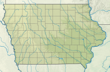
Map
USA Iowa relief location map.svg
Airplane silhouette.svg
CWI
Usa edcp relief location map.png
Airplane silhouette.svg
CWI
Runways
Direction LengthSurface
ftm
3/215,2041,586Asphalt
14/324,2011,280Asphalt
Statistics
Aircraft operations (2015)15,400
Based aircraft (2017)40

Clinton Municipal Airport( IATA : CWI, ICAO : KCWI, FAA LID : CWI) is seven miles southwest of Clinton, in Clinton County, Iowa. [1] The FAA's National Plan of Integrated Airport Systems (2017-2021) categorizes it as a general aviation airport. [2]

Contents

Clinton had scheduled airline flights from 1951-52 until 1975: Braniff until 1955, then Ozark. There was still commercial air service to Clinton into the mid-1980s. The Official Airline Guide in February 1985 showed a total of five weekday departures to O'Hare International in Chicago; Three via American Central and two via Great Lakes. Scheduled passenger service to Clinton was discontinued by the late 1980s.
Facilities

Clinton Municipal Airport, January 2011 Clinton Airport Iowa.JPG
Clinton Municipal Airport, January 2011

Clinton Municipal Airport covers 556 acres (225 ha) at an elevation of 708 feet (216 m). It has two asphalt runways: 3/21 is 5,204 by 100 feet (1,586 x 30 m) and 14/32 is 4,201 by 100 feet (1,280 x 30 m). [1]

In the year ending September 10, 2015 the airport had 15,400 aircraft operations, average 42 per day: 95% general aviation, 3% military and 2% air taxi. In April 2017, 40 aircraft were based at the airport: 30 single-engine, 3 multi-engine, 1 jet and 6 ultralight. [1]

Other uses

The airport is the site of the annual Cessna 150 and Cessna 152 fly-in, which began in 2001. The fly-in is open to owners, pilots and enthusiasts who share a common interest in those types of airplanes. [3]

See also

Related Research Articles

<span class="mw-page-title-main">Molokai Airport</span> Airport in Maui County, Hawaii

Molokai Airport, also known as Hoolehua Airport is a state-owned, public use airport located six nautical miles northwest of Kaunakakai, on the island of Molokai in Maui County, Hawaii, United States. It is the principal airport of the island. The largest plane to ever fly here regularly was a Boeing 737-200 jet, which seats 127 passengers.

<span class="mw-page-title-main">McNary Field</span> Airport

McNary Field is in Marion County, Oregon, United States, two miles southeast of downtown Salem, which owns it. The airport is named for U.S. Senator Charles L. McNary.

<span class="mw-page-title-main">Ogden-Hinckley Airport</span> Airport

Ogden-Hinckley Airport is a public airport four miles southwest of Ogden, in Weber County, Utah. The National Plan of Integrated Airport Systems for 2019–2023 categorized it as a commercial service–primary nonhub airport. Formerly Ogden Municipal Airport, it is billed as Utah's busiest municipal airport for private planes.

Taunton Municipal Airport, also known as King Field, is a public use airport located three nautical miles (6 km) east of the central business district of Taunton, a city in Bristol County, Massachusetts. It is located in the East Taunton neighborhood of the city. The city-owned airport is maintained and operated by the Taunton Airport Commission. According to the FAA's National Plan of Integrated Airport Systems for 2009–2013, it is categorized as a general aviation airport.

<span class="mw-page-title-main">Casa Grande Municipal Airport</span> Airport in Pinal County, Arizona

Casa Grande Municipal Airport is a city-owned public-use airport 6 miles north of Casa Grande in Pinal County, Arizona. The FAA's National Plan of Integrated Airport Systems for 2009–2013 categorizes it as a general aviation facility. The airport is not served by an airline.

<span class="mw-page-title-main">Kenai Municipal Airport</span> Airport

Kenai Municipal Airport is a city-owned, public-use airport located in Kenai, a city in the Kenai Peninsula Borough of the U.S. state of Alaska.

Tunica Municipal Airport is a public use airport located one nautical mile (2 km) east of the central business district of Tunica, in Tunica County, Mississippi, United States. It is owned by the Tunica County Airport Commission. Also known as Tunica Airport, it should not be confused with the 10 acre privately owned, public use Tunica Airport located 2 nautical miles (4 km) south of the center of town, which has been recently changed to Ralph M Sharpe Airport.

Taos Regional Airport is a public use airport eight nautical miles (15 km) northwest of the central business district of Taos, in Taos County, New Mexico, United States. It is owned by the Town of Taos. FAA's National Plan of Integrated Airport Systems for 2009–2013 classifies it as a general aviation airport.

Iowa City Municipal Airport, is two miles southwest of downtown Iowa City, in Johnson County, Iowa. It is the oldest civil airport west of the Mississippi River still in its original location.

<span class="mw-page-title-main">Zanesville Municipal Airport</span> Airport

Zanesville Municipal Airport is a city-owned airport six miles east of downtown Zanesville, in Muskingum County, Ohio. The National Plan of Integrated Airport Systems for 2011–2015 called it a general aviation facility.

Baker City Municipal Airport is three miles north of Baker City, in Baker County, Oregon, United States. The National Plan of Integrated Airport Systems for 2011–2015 categorized it as a general aviation facility.

<span class="mw-page-title-main">Newport Municipal Airport (Oregon)</span> Airport

Newport Municipal Airport is a city-owned, public-use airport located three nautical miles (6 km) south of the central business district of Newport, a city in Lincoln County, Oregon, United States. It is included in the National Plan of Integrated Airport Systems for 2011–2015, which categorized it as a general aviation facility.

Council Bluffs Municipal Airport is a public use airport located four nautical miles east of the central business district of Council Bluffs, a city in Pottawattamie County, Iowa, United States. It is owned by Council Bluffs Airport Authority. This airport is included in the National Plan of Integrated Airport Systems for 2011–2015, which categorized it as a general aviation facility.

Keokuk Municipal Airport is five miles northwest of Keokuk, in Lee County, Iowa. The National Plan of Integrated Airport Systems for 2017–2021 categorized it as a general aviation facility.

<span class="mw-page-title-main">Northeast Alabama Regional Airport</span> Airport

Northeast Alabama Regional Airport is five miles southwest of Gadsden, in Etowah County, Alabama. It is owned by Gadsden Airport Authority and it used to be Gadsden Municipal Airport. The FAA's National Plan of Integrated Airport Systems for 2009–2013 categorized as a general aviation facility.

<span class="mw-page-title-main">Clintonville Municipal Airport</span> Airport

Clintonville Municipal Airport is located two miles southeast of Clintonville, in Waupaca County, Wisconsin, United States. The Federal Aviation Administration (FAA) National Plan of Integrated Airport Systems for 2021–2025 categorized it as a local general aviation facility.

Guymon Municipal Airport is in Texas County, Oklahoma, two miles west of Guymon, which owns it. The FAA's National Plan of Integrated Airport Systems for 2021-2025 classifies it as a general aviation airport.

<span class="mw-page-title-main">University-Oxford Airport</span> Airport

University-Oxford Airport is a public use airport located two nautical miles (4 km) northwest of the central business district of Oxford, a city in Lafayette County, Mississippi, United States. The airport is owned by the University of Mississippi. It is included in the National Plan of Integrated Airport Systems for 2011–2015, which categorized it as a general aviation facility.

<span class="mw-page-title-main">Hastings Municipal Airport</span> Airport

Hastings Municipal Airport is two miles northwest of Hastings in Adams County, Nebraska. The National Plan of Integrated Airport Systems for 2011–2015 categorized it as a "general aviation" airport.

<span class="mw-page-title-main">Shawnee Regional Airport</span> Airport

Shawnee Regional Airport is two miles northwest of Shawnee, in Pottawatomie County, Oklahoma. It was formerly Shawnee Municipal Airport.

References

  1. 1 2 3 4 FAA Airport Form 5010 for CWI PDF , effective Apr 27, 2017.
  2. FAA National Plan of Integrated Airport Systems: 2009-2013. Federal Aviation Administration. Published 1 October 2008.
  3. "Home". cessna150152flyin.org.