Culpeper Regional Airport is a county-owned public-use airport located seven nautical miles (13 km) northeast of the of Culpeper, a city in Culpeper County, Virginia, United States. Located in Brandy Station, Virginia, the airport opened in 1968. The runway originally measured 3200 ft. by 75 ft. In 1983, the runway was lengthened to 4000 ft. In 2004, the runway was expanded to 5000 ft. by 100 ft. It can handle corporate-size jets and large twin-engine aircraft. The airport has an airfest every October since 1998, with performances such as aerobatics.

Valdosta Regional Airport is a public-use airport located three nautical miles (6 km) south of the central business district of Valdosta, a city in Lowndes County, Georgia, United States. It is owned by the Valdosta-Lowndes County Airport Authority. The Valdosta Regional airport is mostly used for general aviation, but is also served by Delta Air Lines, which offers service to Atlanta. The airport also offers free parking.

Anniston Regional Airport, formerly known as Anniston Metropolitan Airport, is a city-owned public-use airport located five nautical miles southwest of the central business district of Anniston, a city in Calhoun County, Alabama, United States. It is included in the National Plan of Integrated Airport Systems for 2011–2015, which categorized it as a general aviation airport.
Logan County Airport is a public use airport located 2.2 nautical miles northeast of the central business district of Lincoln, a city in Logan County, Illinois, United States. It is owned by the Logan County Board. The airport is also the site of the National Weather Service Central Illinois.
Vermilion Regional Airport is a public-use airport located five miles northeast of Danville, the largest city in Vermilion County, Illinois. It is publicly owned by the Vermilion Regional Airport Authority. The FAA's National Plan of Integrated Airport Systems for 2017–2021 categorized it as a general aviation basic facility.
Lawrence Municipal Airport is two miles east of Lawrence, in Essex County, Massachusetts, United States. It is owned by the City of Lawrence, though it is in North Andover.
Iowa City Municipal Airport, is two miles southwest of downtown Iowa City, in Johnson County, Iowa. It is the oldest civil airport west of the Mississippi River still in its original location.
Northwest Missouri Regional Airport is a city-owned public use airport located two nautical miles (3.7 km) west of the central business district of Maryville, a city in Nodaway County, Missouri, United States. The airport is used for general aviation with no commercial airlines.

Davenport Municipal Airport is a general aviation airport located about 7 miles (11 km) north of downtown Davenport, a city in Scott County, Iowa, United States. The airport, which dates back to 1948, has been home to the Quad City Air Show since 1987.
Fairfield Municipal Airport is a public airport located three miles (5 km) northwest of the central business district of Fairfield, a city in Jefferson County, Iowa, United States. It is owned by the City of Fairfield.

Spencer Municipal Airport, also known as Northwest Iowa Regional Airport, is a public airport located three miles (5 km) northwest of the central business district of Spencer, a city in Clay County, Iowa, United States. It is owned by the City of Spencer.

Leesburg International Airport, formerly known as Leesburg Regional Airport, is a public airport located three miles (5 km) northeast of the central business district of Leesburg, a city in Lake County, Florida, United States. It is owned by the City of Leesburg.

Kissimmee Gateway Airport, formerly known as Kissimmee Municipal Airport, is a public airport in Kissimmee, a city in Osceola County, Florida, United States. The airport is located 16 nautical miles (30 km) southwest of the central business district of Orlando. It is owned and operated by the City of Kissimmee.
Monticello Regional Airport, formerly known as Monticello Municipal Airport, is a public airport located two miles (3 km) southeast of the central business district of Monticello, a city in Jones County, Iowa, United States. It is owned by the City of Monticello.

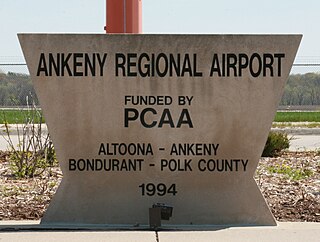
Ankeny Regional Airport is a mile (2 km) southeast of Ankeny, in Polk County, Iowa. It is owned by the Polk County Aviation Authority.
Newton Municipal Airport is a city-owned public-use airport located two miles (3 km) southeast of the central business district of Newton, a city in Jasper County, Iowa, United States. The airport is adjacent to Iowa Speedway.
Southwest Washington Regional Airport is a city-owned public-use airport located two nautical miles (3.7 km) southeast of the central business district of Kelso, in Cowlitz County, Washington, United States. The airport was renamed in 2009, prior to which it was known as the Kelso-Longview Regional Airport, or Molt Taylor Field, named after flying car designer Moulton Taylor.
Red Wing Regional Airport is a city-owned public-use airport located in Pierce County, Wisconsin, three nautical miles (6 km) northeast of the central business district of Red Wing, a city in Goodhue County, Minnesota, United States.
Independence Municipal Airport is a city-owned public-use airport located three nautical miles (6 km) southwest of the central business district of Independence, a city in Buchanan County, Iowa, United States. As per the FAA's National Plan of Integrated Airport Systems for 2009-2013, it is classified as a general aviation airport.
Centerville Municipal Airport is a city-owned public-use airport located three nautical miles (6 km) southwest of the central business district of Centerville, a city in Appanoose County, Iowa, United States. According to the FAA's National Plan of Integrated Airport Systems for 2009–2013, it is categorized as a general aviation airport.


