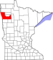
Beseman Township is a township in Carlton County, Minnesota, United States; located near Wright and Cromwell. The population was 149 as of the 2000 census. Beseman Township was named for Ernst Besemann, a local landowner.
Barnesville Township is a township in Clay County, Minnesota, United States. The population was 149 at the 2000 census. Barnesville Township was named after the city of Barnesville.
Nora Township is a township in Clearwater County, Minnesota, United States. The population was 408 at the 2000 census.
Rice Township is a township in Clearwater County, Minnesota, United States. The population was 134 at the 2000 census. Rice Township was named after the Wild Rice River.
Amo Township is a township in Cottonwood County, Minnesota, United States. The population was 132 at the 2010 census.
Canton Township is a township in Fillmore County, Minnesota, United States. The population was 684 at the 2000 census.
Carlston Township is a township in Freeborn County, Minnesota, United States. The population was 332 at the 2000 census.
London Township is a township in Freeborn County, Minnesota, United States. The population was 334 at the 2000 census.
Good Hope Township is a township in Itasca County, Minnesota, United States. The population was 99 at the 2010 census.
Wabana Township is a township in Itasca County, Minnesota, United States. The population was 537 at the 2010 census.
Harvey Township is a township in Meeker County, Minnesota, United States. The population was 445 at the 2000 census.
Nicollet Township is a township in Nicollet County, Minnesota, United States. The population was 511 at the 2000 census.
Dover Township is a township in Olmsted County, Minnesota, United States. The population was 440 at the 2000 census.
Homestead Township is a township in Otter Tail County, Minnesota, United States. The population was 371 at the 2000 census.
Dell Grove Township is a township in Pine County, Minnesota, United States. The population was 699 at the 2000 census.
Garfield Township is a township in Polk County, Minnesota, United States. It is part of the Grand Forks-ND-MN Metropolitan Statistical Area. The population was 391 at the 2000 census.
Hill River Township is a township in Polk County, Minnesota, United States. It is part of the Grand Forks-ND-MN Metropolitan Statistical Area. The population was 162 at the 2000 census.
Folsom Township is a township in Traverse County, Minnesota, United States. The population was 149 at the 2000 census.
Lake Township is a township in Wabasha County, Minnesota, United States. The population was 412 at the 2000 census.
Birch Lake is an unorganized territory in Saint Louis County, Minnesota, United States, located north of Babbitt, and south of Ely and Morse Township. The population was 648 at the 2000 census.


