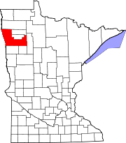
Jamestown Township is a township in Blue Earth County, Minnesota, United States. The population was 628 as of the 2000 census.

Home Township is a township in Brown County, Minnesota, United States. The population was 800 as of the 2000 census. Home Township was organized in 1866.

Oak Lawn Township is a township in Crow Wing County, Minnesota, United States. The population was 1,793 at the 2000 census.

Pilot Grove Township is a township in Faribault County, Minnesota, United States. The population was 182 at the 2000 census.

Arago Township is a township in Hubbard County, Minnesota, United States. The population was 586 at the 2000 census.

Gennessee Township is a township in Kandiyohi County, Minnesota, United States. The population was 458 at the 2000 census. The township includes the city of Atwater.

Kandiyohi Township is a township in Kandiyohi County, Minnesota, United States. The population was 600 at the 2000 census.

Acton Township is a township in Meeker County, Minnesota, United States. The population was 381 at the 2000 census. The township includes almost all of Grove City.

Des Moines River Township is a township in Murray County, Minnesota, United States. The population was 182 at the 2000 census.

Cascade Township is a township in Olmsted County, Minnesota, United States. The population was 3,183 at the 2000 census.

Erhards Grove Township is a township in Otter Tail County, Minnesota, United States. The population was 467 at the 2000 census.

Sverdrup Township is a township in Otter Tail County, Minnesota, United States. The population was 577 at the 2000 census.

Mission Creek Township is a township in Pine County, Minnesota, United States. The population was 590 at the 2000 census.

Grove Park-Tilden Township is a township in Polk County, Minnesota, United States which surrounds the city of Mentor. The unincorporated community of Dugdale, and the location of Tilden Junction are located within the township, and the unincorporated community of Marcoux Corner is located at the edge of the township. It is part of the Grand Forks-ND-MN Metropolitan Statistical Area. The population was 311 at the 2000 census.

Ault Township is a township in Saint Louis County, Minnesota, United States. The population was 109 at the 2010 census.

Fayal Township is an urban township in Saint Louis County, Minnesota, United States. The population was 1,809 at the 2010 census.

Farming Township is a township in Stearns County, Minnesota, United States. The population was 987 at the 2010 census.

Albion Township is a township in Wright County, Minnesota, United States. The population was 1,146 at the 2000 census.

Silverton Township is a township in Pennington County, Minnesota, United States. The population was 182 at the 2000 census.

Birch Lake is an unorganized territory in Saint Louis County, Minnesota, United States, located north of Babbitt, and south of Ely and Morse Township. The population was 648 at the 2000 census.


