
Civil engineering is a professional engineering discipline that deals with the design, construction, and maintenance of the physical and naturally built environment, including public works such as roads, bridges, canals, dams, airports, sewage systems, pipelines, structural components of buildings, and railways.
Gibraltar has a limited public transport system, due to the compact size of the territory.

Infrastructure is the set of facilities and systems that serve a country, city, or other area, and encompasses the services and facilities necessary for its economy, households and firms to function. Infrastructure is composed of public and private physical structures such as roads, railways, bridges, tunnels, water supply, sewers, electrical grids, and telecommunications. In general, infrastructure has been defined as "the physical components of interrelated systems providing commodities and services essential to enable, sustain, or enhance societal living conditions" and maintain the surrounding environment.

Stormwater, also written storm water, is water that originates from precipitation (storm), including heavy rain and meltwater from hail and snow. Stormwater can soak into the soil (infiltrate) and become groundwater, be stored on depressed land surface in ponds and puddles, evaporate back into the atmosphere, or contribute to surface runoff. Most runoff is conveyed directly as surface water to nearby streams, rivers or other large water bodies without treatment.

A combined sewer is a type of gravity sewer with a system of pipes, tunnels, pump stations etc. to transport sewage and urban runoff together to a sewage treatment plant or disposal site. This means that during rain events, the sewage gets diluted, resulting in higher flowrates at the treatment site. Uncontaminated stormwater simply dilutes sewage, but runoff may dissolve or suspend virtually anything it contacts on roofs, streets, and storage yards. As rainfall travels over roofs and the ground, it may pick up various contaminants including soil particles and other sediment, heavy metals, organic compounds, animal waste, and oil and grease. Combined sewers may also receive dry weather drainage from landscape irrigation, construction dewatering, and washing buildings and sidewalks.
Microbial corrosion, also called microbiologically influenced corrosion (MIC), microbially induced corrosion (MIC), or biocorrosion, is when microbes affect the electrochemical environment of the surface they are on. This usually involves building a biofilm, which can lead to either an increase in corrosion of the surface or, in a process called microbial corrosion inhibition, protect the surface from corrosion.
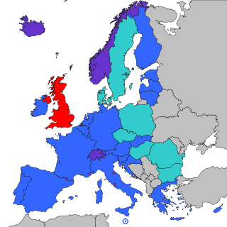
The Single Euro Payments Area (SEPA) is a payment integration initiative of the European Union for simplification of bank transfers denominated in euros. As of 2020, there were 36 members in SEPA, consisting of the 27 member states of the European Union, the four member states of the European Free Trade Association, and the United Kingdom. Some microstates participate in the technical schemes: Andorra, Monaco, San Marino, and Vatican City.

Gibraltar is a British Overseas Territory and city located at the southern tip of the Iberian Peninsula, on the Bay of Gibraltar, near the exit of the Mediterranean Sea into the Atlantic Ocean. It has an area of 6.8 km2 (2.6 sq mi) and is bordered to the north by Spain. The landscape is dominated by the Rock of Gibraltar, at the foot of which is a densely populated town area, home to some 34,003 people, primarily Gibraltarians.

Kosovo is a developing country with an economy that functions on the principles of the free market, with a large private sector. Kosovo is an upper-middle income economy according to the World Bank, and is a member of the World Bank and the International Monetary Fund. Its official currency is the euro.

Tourism in Gibraltar constitutes one of the British Overseas Territory's most important economic pillars, alongside financial services and shipping. Gibraltar's main attractions are the Rock of Gibraltar and its resident population of Barbary macaques, the territory's military heritage, duty-free shopping, casinos and marinas. Although the population of Gibraltar numbers only some 30,000 people, the territory recorded nearly 12 million visits in 2011, giving it one of the highest tourist-to-resident ratios in the world.

The Trafalgar Cemetery is a cemetery in the British Overseas Territory of Gibraltar. Formerly known as the Southport Ditch Cemetery, it occupies a small area of land just to the south of the city walls, in what had been a defensive ditch during the period of Spanish rule of Gibraltar. Although it is named for the Battle of Trafalgar of 21 October 1805, only two victims of the battle are buried there. The remainder of the interments are mostly of those killed in other sea battles or casualties of the yellow fever epidemics that swept Gibraltar between 1804 and 1814. In addition, tombstones were transferred to the Trafalgar Cemetery from St. Jago's Cemetery and Alameda Gardens.

The Gibraltar Artificial Reef, or simply the Gibraltar Reef, is the ongoing artificial reef project for the Mediterranean waters surrounding the British overseas territory of Gibraltar. The initiative was started in 1973 by Dr. Eric Shaw of the Helping Hand Trust.
Sulfur concrete, sometimes named thioconcrete or sulfurcrete, is a composite construction material, composed mainly of sulfur and aggregate. Cement and water, important compounds in normal concrete, are not part of sulfur concrete. The concrete is heated above the melting point of elemental sulfur at ca. 140 °C (284 °F) in a ratio of between 12% and 25% sulfur, the rest being aggregate.

The North Front Cemetery is a cemetery located in the British Overseas Territory of Gibraltar. Also known as the Gibraltar Cemetery and the Garrison Cemetery, it is the only graveyard still in use in Gibraltar. It is also the only Commonwealth War Graves Commission (CWGC) cemetery in Gibraltar. The two CWGC monuments, the Gibraltar Memorial and the Gibraltar Cross of Sacrifice, are positioned nearby at the junction of Winston Churchill Avenue and Devil's Tower Road.

Flat Bastion is a bastion which projects southward from the Charles V Wall in the British Overseas Territory of Gibraltar. Once known as the St. Jago's Bastion or the Baluarte de Santiago in Spanish, the fortification was built by the Spanish in the mid 16th century and formed part of the southern defences of the city of Gibraltar, together with Charles V Wall, Southport Gates, Southport Ditch, and South Bastion. In 1859, six guns, four 12-pounders and two 12-pound carronades, were installed on the bastion, and four years later, five 32-pounders were mounted on the fortification.

The Southport Gates are three city gates in the British Overseas Territory of Gibraltar. They are located in the Charles V Wall, one of the 16th century fortifications of Gibraltar. The gates are clustered together, with the South Bastion to the west, and the Trafalgar Cemetery to the east. The first and second Southport Gates were constructed at present day Trafalgar Road in 1552 and 1883, respectively. The third gate, Referendum Gate, is the widest of the three and was constructed in 1967 at Main Street, immediately west of the first two gates. The Southport Gates are listed with the Gibraltar Heritage Trust.

Nun's Well is an ancient underground water reservoir in the British Overseas Territory of Gibraltar. It is located at Europa Point, and is thought to be of the Moorish period. It represents some of the earliest evidence of an artificial water supply in Gibraltar. The name of the cistern is thought to be derived from the nuns associated with the Shrine of Our Lady of Europe. In the eighteenth century, Nun's Well supplied the military with water. In the early nineteenth century, it provided water for the brewery that was built next door. In 1988, the Royal Engineers constructed what is now the main building, which has a castle-like appearance. Nun's Well became the focus of controversy during the 2010-2011 restoration of the site.

Streets in the British Overseas Territory of Gibraltar are represented by road signs as in the United Kingdom. As of 2007, Gibraltar has a network of 29 kilometres (18 mi) of roads.

Keightley Way is a southwestern road and tunnel in the British Overseas Territory of Gibraltar. It connects Rosia Road at Little Bay to the Ibrahim-al-Ibrahim Mosque and Nun's Well at Europa Point. Dug in 1960, it was the last surface tunnel to be built in Gibraltar. The tunnel was designed to take a two lane road and space for pedestrians, although it now only carries one lane of traffic southbound. It was named after General Sir Charles Keightley who was the Governor of Gibraltar at the time.
The University of Gibraltar is a degree-awarding higher education institution established by the Government of Gibraltar through the University of Gibraltar Act 2015. The founding of the university was described by Gibraltar's Chief Minister Fabian Picardo as "a coming-of-age" for the British Overseas Territory.


