Main Street, Gibraltar

Last updated

Main Street
Calle Real
Main Street Gibraltar.JPG
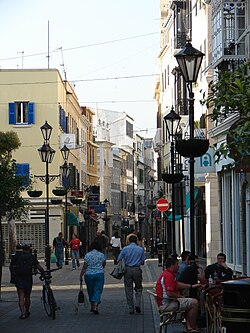
View from Main Street looking north.
Former name(s)Calle Real
Owner Government of Gibraltar
Length1 km (0.62 mi)
Location Gibraltar
Coordinates 36°08′23″N5°21′14″W / 36.139682°N 5.353794°W / 36.139682; -5.353794
Old photograph of Main Street taken in the early 1900s just outside the Cathedral of St. Mary the Crowned. Gibraltar-s-principal-street.jpg
Old photograph of Main Street taken in the early 1900s just outside the Cathedral of St. Mary the Crowned.

Main Street (Spanish : Calle Real) is the main arterial street in the British overseas territory of Gibraltar.

Contents

History

Main Street's route was established in the 14th century which was confirmed when the Puerta de África (now called the Southport Gates) were built in 1575, during the Spanish period.

Nearly every building in Main Street was damaged during the Great Siege of Gibraltar when from 1779 to 1783 the town was attacked by a combined French and Spanish fleet. Because Main Street was near the harbour it was easily bombarded by the ships in the harbour. Col. John Drinkwater wrote "that some few, near South-port, continued to be inhabited by soldiers families, but in general the floors and roofs were destroyed and the bare shell only was left standing." [1]

The street's route has only had minor adjustment when the front of the Cathedral of St. Mary the Crowned was re-modeled and downsized in 1801 in order to straighten the street on the orders of the British Governor, Charles O'Hara. [2] A branch of Marks & Spencer was established in Gibraltar on the street in 1968.

Description

Main Street is Gibraltar's main commercial and shopping district. [3] It runs northsouth through the old town which is pedestrianised and lined with buildings displaying a blend of Genoese, Portuguese, Andalusian, Moorish and British Regency styles, [3] most of which have shops on the ground floor. Upper floors provide residential accommodation or offices. Tourists and visitors will find a wide variety of shops, many of which will be familiar from British high streets.

Irish Town is a street name and one of Main Street's sub-districts and was named in the early 19th century when Gibraltar was split into differing quarters. [3]

Gibraltar's city centre is largely protected by the Gibraltar Heritage Trust and is part of a continual restoration programme. [3]

Grand Casemates Square

Grand Casemates Square at the northern end of Main Street, once the centre of public executions, is the hub of Gibraltar's nightlife, and is filled with numerous restaurants, pubs and bars.

Notable buildings on Main Street

Gibraltar Governor's Residence, The Convent Gibraltar - 11.jpg
Gibraltar Governor's Residence, The Convent

Related Research Articles

<span class="mw-page-title-main">Walsall</span> Market town in West Midlands County, England

Walsall is a market town and administrative centre in the West Midlands County, England. Historically part of Staffordshire, it is located 9 miles (14 km) north-west of Birmingham, 7 miles (11 km) east of Wolverhampton and 9 miles (14 km) from Lichfield.

<span class="mw-page-title-main">Brading</span> Town on the Isle of Wight, United Kingdom

The ancient 'Kynges Towne' of Brading is the main town of the civil parish of the same name. The ecclesiastical parish of Brading used to cover about a tenth of the Isle of Wight. The civil parish now includes the town itself and Adgestone, Morton, Nunwell and other outlying areas between Ryde, St Helens, Bembridge, Sandown and Arreton. Alverstone was transferred to the Newchurch parish some thirty years ago.

<span class="mw-page-title-main">Cathedral of St. Mary the Crowned</span> Church in Main Street, Gibraltar

The Cathedral of Saint Mary the Crowned is a Roman Catholic cathedral in Gibraltar. It is the primary centre of Catholic worship in the Diocese of Gibraltar.

<span class="mw-page-title-main">Great Siege of Gibraltar</span> Failed Franco-Spanish attempt to capture Gibraltar (1779–1783)

The Great Siege of Gibraltar was an unsuccessful attempt by Spain and France to capture Gibraltar from the British during the War of the American Revolution. It was the largest battle in the war by number of combatants.

<span class="mw-page-title-main">John Drinkwater Bethune</span> British Army officer and military historian (1762–1844)

Colonel John Drinkwater Bethune was an British Army officer and military historian best known for his account of the Great Siege of Gibraltar that came out in 1785.

The history of Poole, a town in Dorset, England, can be traced back to the founding of a settlement around Poole Harbour during the Iron Age. The town now known as Poole was founded on a small peninsula to the north of the harbour. Poole experienced rapid growth as it became an important port following the Norman Conquest of England.

<span class="mw-page-title-main">Our Lady of Europe</span> The Virgin Mary, as patron of Gibraltar

Our Lady of Europe is a title given to the Blessed Virgin Mary patroness of Gibraltar and protectress of Europe. The entire European continent was consecrated under the protection of Our Lady of Europe in the early 14th century from the Shrine in Gibraltar where devotion continues to this day, over 700 years on.

<span class="mw-page-title-main">John Mackintosh Square</span> Square in Gibraltar

John Mackintosh Square is a main square in the British overseas territory of Gibraltar. It has been the centre of city life since the 14th century and takes its name from John Mackintosh, a local philanthropist. Notable buildings on John Mackintosh Square include the Parliament Building and the City Hall.

<span class="mw-page-title-main">History of Gibraltar</span> History of a peninsula on the Iberian coast

The history of Gibraltar, a small peninsula on the southern Iberian coast near the entrance of the Mediterranean Sea, spans over 2,900 years. The peninsula has evolved from a place of reverence in ancient times into "one of the most densely fortified and fought-over places in Europe", as one historian has put it. Gibraltar's location has given it an outsized significance in the history of Europe and its fortified town, established in the Middle Ages, has hosted garrisons that sustained numerous sieges and battles over the centuries.

<span class="mw-page-title-main">Rosia Bay</span> Natural harbour in Gibraltar

Rosia Bay is the only natural harbour in Gibraltar, the British Overseas Territory at the southern end of the Iberian Peninsula. Formerly referred to as Rosia Harbour, it is located on the southwest side of Gibraltar. Rosia Bay was the site of the Royal Navy Victualling Yard complex which was constructed in the early 19th century, allowing vessels to anchor and obtain provisions, including food and water. Vice Admiral Horatio Nelson obtained supplies for his Mediterranean Fleet at Rosia Bay. It was to that same anchorage that his vessel HMS Victory was towed after Nelson's death in the 1805 Battle of Trafalgar. The area is also the location of gun batteries, including Parson's Lodge Battery at the south end of the bay and Napier of Magdala Battery at the north end. In the 21st century, Rosia Bay was the focus of controversy following the government's demolition of the historic Rosia Water Tanks and construction of the affordable housing development Nelson's View, which necessitated the relocation of the owners of the adjacent 19th century Rosia Cottages.

<span class="mw-page-title-main">Line Wall Curtain</span>

The Line Wall Curtain is a defensive curtain wall that forms part of the fortifications of the British Overseas Territory of Gibraltar.

<span class="mw-page-title-main">Streets in Gibraltar</span>

Streets in the British Overseas Territory of Gibraltar are represented by road signs as in the United Kingdom. As of 2007, Gibraltar has a network of 29 kilometres (18 mi) of roads.

<span class="mw-page-title-main">King's Chapel, Gibraltar</span> Church in Main Street, Gibraltar

King's Chapel is a small chapel in the British Overseas Territory of Gibraltar. It is located at the southern end of Main Street and adjoins the Governor of Gibraltar's residence, The Convent. What nowadays is King's Chapel was the first purpose-built church to be constructed in Gibraltar. Originally part of a Franciscan friary, the chapel was built in the 1530s but was given to the Church of England by the British after the capture of Gibraltar in 1704. It was badly damaged in the late 18th century during the Great Siege of Gibraltar and in the explosion of an ammunition ship in Gibraltar harbour in 1951, but was restored on both occasions. From 1844 to 1990 it served as the principal church of the British Army in Gibraltar; since then it has been used by all three services of the British Armed Forces.

<span class="mw-page-title-main">Grand Casemates Gates</span>

Grand Casemates Gates, formerly Waterport Gate, provide an entrance from the northwest to the old, fortified portion of the city of the British Overseas Territory of Gibraltar, at Grand Casemates Square.

<span class="mw-page-title-main">North Bastion, Gibraltar</span>

The North Bastion, formerly the Baluarte San Pablo was part of the fortifications of Gibraltar, in the north of the peninsula, protecting the town against attack from the mainland of Spain. The bastion was based on the older Giralda tower, built in 1309. The bastion, with a mole that extended into the Bay of Gibraltar to the west and a curtain wall stretching to the Rock of Gibraltar on its east, was a key element in the defenses of the peninsula. After the British took Gibraltar in 1704 they further strengthened these fortifications, flooding the land in front and turning the curtain wall into the Grand Battery.

<span class="mw-page-title-main">Grand Casemates Square</span> Square in Gibraltar

Grand Casemates Square is the larger of the two main squares within the city centre of Gibraltar. The square takes its name from the British-built Grand Casemates, a casemate and bombproof barracks at the northern end of the square completed in 1817.

<span class="mw-page-title-main">Irish Town, Gibraltar</span> Street in Gibraltar

Irish Town is a pedestrianised street in the British Overseas Territory of Gibraltar. It is one of Main Street's sub-districts running parallel to it, from Cooperage Lane in the north to John Mackintosh Square in the south.

<span class="mw-page-title-main">Hardy Town, Gibraltar</span> Shanty town in Gibraltar, 1779 to 1783

Hardy Town was a temporary civilian settlement established near the south end of the Gibraltar peninsula during the Great Siege of Gibraltar (1779–83). The intensive Spanish and French bombardment reduced the town of Gibraltar to ruins and prompted many of its inhabitants, and eventually the off-duty members of the British garrison, to relocate to a spot out of range of the enemy's land-based guns. After it became known for its appalling conditions, a British quartermaster named Hardy was put in charge of the settlement and it acquired his name. Hardy Town was eventually abandoned and torn down after the siege ended and the population moved back to Gibraltar's main town within the city walls.

<span class="mw-page-title-main">Windmill Hill (Gibraltar)</span> A pair of plateaux

Windmill Hill or Windmill Hill Flats is one of a pair of plateaux, known collectively as the Southern Plateaux, at the southern end of the British Overseas Territory of Gibraltar. It is located just to the south of the Rock of Gibraltar, which descends steeply to the plateau. Windmill Hill slopes down gently to the south with a height varying from 120 metres (390 ft) at the north end to 90 metres (300 ft) at the south end. It covers an area of about 19 hectares, though about 6 hectares at the north end is built over. The plateau is ringed to the south and east with a line of cliffs which descend to the second of the Southern Plateaux, Europa Flats, which is itself ringed by sea cliffs. Both plateaux are the product of marine erosion during the Quaternary period and subsequent tectonic uplift. Windmill Hill was originally on the shoreline and its cliffs were cut by the action of waves, before the ground was uplifted and the shoreline moved further out to the edge of what is now Europa Flats.

<span class="mw-page-title-main">Kirkwall Town Hall</span> Municipal building in Kirkwall, Scotland

Kirkwall Town Hall is a municipal building in Broad Street, Kirkwall, Orkney, Scotland. The structure, which is currently used as a community events venue, is a Category B listed building.

References

  1. Bethune, John Drinkwater (1786). A history of the late siege of Gibraltar, by John Drinkwater. p. 156.
  2. Benady, Tito (1996). The streets of Gibraltar : a short history. Grendon: Gibraltar Books. pp. 11–17. ISBN   0948466375.
  3. 1 2 3 4 "What to do". Gibraltar London. Archived from the original on 1 December 2012. Retrieved 21 December 2012.