European Climate Assessment and Dataset

Last updated
ECA&D project logo Logo eca d 2.png
ECA&D project logo

The European Climate Assessment and Dataset (ECA&D) is a database of daily meteorological station observations across Europe and is gradually being extended to countries in the Middle East and North Africa. ECA&D has attained the status of Regional Climate Centre for high-resolution observation data in World Meteorological Organization Region VI (Europe and the Middle East).

Contents

The objective of ECA&D is to monitor and analyze climate and changes in climate with a focus on climate extremes while making the data publicly available to download. Included in the database is a collection of daily series observations obtained from climatological divisions of National Meteorological and Hydrological Services (NMHSs), observatories and research centres throughout Europe and the Mediterranean. The daily series of observations is combined with quality control and analysis of extremes via climate change indices. [1]

The ECA&D project is initiated by the European Climate Support Network (ECSN) and is coordinated at the Royal Netherlands Meteorological Institute (Dutch: Koninklijk Nederlands Meteorologisch Instituut or KNMI) which now funds the project after it was initially funded by EUMETNET, the network of European national meteorological services.

Participants

Participating countries. ParticipatingCountries.png
Participating countries.

As of June 2010, the European Climate Assessment and Dataset contains 13472 series of observations at 3314 meteorological stations provided by 56 participants from 61 different countries and is constantly expanding. These participants contribute daily, quality controlled data from (a subset) of their national meteorological station networks. In order to ensure that each station's time series are as complete as possible, the database contains an automated update procedure that relies on daily data from SYNOP (surface synoptic observations) messages that are distributed in near real-time over the Global Telecommunication System (GTS). Any gaps in data are infilled with observations from nearby stations, provided they are within a 25 kilometres (16 mi) distance radius and within a height range of less than 50 metres (160 ft). These series are referred to as blended series and are used for calculating the ECA&D indices of extremes (see below) and are also used in the E–OBS daily gridded observational dataset (see below).

Participation in ECA&D is open to anyone maintaining daily station data.

Data availability

ECA&D data availability for precipitation. Green dots: data freely available; red dots: in database but ECA&D is not at liberty to distribute. Data availability precip update.png
ECA&D data availability for precipitation. Green dots: data freely available; red dots: in database but ECA&D is not at liberty to distribute.
ECA&D data availability for snow depth. Green dots: data freely available; red dots: in database but ECA&D is not at liberty to distribute. Data availability snow depth update.png
ECA&D data availability for snow depth. Green dots: data freely available; red dots: in database but ECA&D is not at liberty to distribute.

Data is available for the following elements:

As of June 2010, the number of stations providing data involving temperature is on the order of 1500, and nearly 3000 stations contribute precipitation data. In contrast, the number of stations currently providing data for the other elements ranges from approximately 150 (wind direction) to 900 (snow depth). Data collection for the elements other than temperature and precipitation began later so the data availability is lower; however the number of stations contributing these data is rapidly increasing. In measuring these elements, nearly all countries follow the climatological practices guidelines outlined by the World Meteorological Organization. Element identification is given for all series including those provided by countries which do not follow these guidelines.

Metadata

Station De Bilt, The Netherlands De bilt photo.jpg
Station De Bilt, The Netherlands

In order to achieve the most correct interpretation of observations, metadata is collected for each station in the ECA&D database. Apart from the standard longitude, latitude and elevation, ECA&D collects other metadata as well. This includes the World Meteorological Organization station identifiers and whether or not the station is part of the Global Climate Observing System. Other examples of metadata are the land use around the observing area, soil type, surface coverage, station relocations and/or instrument changes. A photograph of the observing site may be included as well.

Indices of extremes

Using the daily data, a total of 48 indices are calculated for every ECA&D station. Each index describes a particular characteristic of climate change for both changes in the mean and changes in the extremes. A core set of 26 indices follows the definitions recommended by the Expert Team on Climate Change Detection and Indices and are calculated in similar ways as in other regions of the world. An additional set of 22 indices highlights particular characteristics of climate change in Europe. [2]

The calculated indices fall into the following categories:

Some indices are expressed via a fixed threshold and others are based on percentiles. Fixed threshold indices describe a particular criteria such as the number of frost days that the minimum temperature is below 0 °C, or as another example, the number of heavy precipitation days that the precipitation sum exceeds 10 millimetres (0.39 in). Percentile indices describe the case in which a value of a variable falls above a certain percentage, such as the number of days that the precipitation sum exceeds the 75th, 95th or 99th percentile.

The station series used for index calculations are blended series (see above). They are made by utilizing the most recent data from synoptical messages distributed over the Global Telecommunication System (GTS). Any gaps in data are infilled with observations from nearby stations, provided they are within a 25 kilometres (16 mi) distance radius and within a height range of less than 50 metres (160 ft). Information on the underlying series that are used in the blending process is provided for each blended series. The blended series for temperature and precipitation have also been tested for homogeneity (see below). Additional information regarding the blending process can be found in the ECA&D Algorithm Theoretical Basis Document. [2]

Quality control and homogeneity

Series of the best possible quality are provided for ECA&D by the participating institutions. However, even with careful data validation, it can never be excluded that some errors remain undetected. The risk of such errors is greatest in the recent data that stem from synoptical messages. Thus, all series in ECA&D (both non-blended and blended) are quality controlled, and all blended temperature and precipitation series are checked for inhomogeneities.

The quality control procedures lead to each data being flagged as either "OK", "suspect" or "missing" and homogeneity testing results in the classification of series as "useful", "doubtful" or "suspect". It is recommended to use the results of the homogeneity tests for selecting appropriate series and time intervals since the "useful", "doubtful" and "suspect" categories only hold for the particular time interval for which the tests are applied. Information on the specifics of quality control and homogeneity procedures can be found in the Algorithm Theoretical Basis Document [2] and elsewhere. [3]

There is, however, no well-established testing procedure for daily climatological data as well as no accepted method to apply the homogeneity results. There is a clear need for additional research on techniques for homogenisation of daily data in order to create high quality, daily datasets for the assessment of extremes without abandoning entire series or tossing out real extremes. This is of particular importance for areas that have a low density of stations with long, daily data series. [4]

Types of data display

Annual time series of the mean temperature at station De Bilt, The Netherlands. TG 162 ANNUAL June.png
Annual time series of the mean temperature at station De Bilt, The Netherlands.
Trend in the June maximum temperature from 1950-2009. Trend June max temp 1950 2009.png
Trend in the June maximum temperature from 1950–2009.
Anomaly in the number of wet days (precipitation sum greater than 1mm) for June, 2010 with respect to the normal period 1961-1990. Anom June wet days 1961-1990.png
Anomaly in the number of wet days (precipitation sum greater than 1mm) for June, 2010 with respect to the normal period 1961–1990.
Climatology of mean temperature for the normal period 1961-1990. Climatology mean temp.png
Climatology of mean temperature for the normal period 1961–1990.
E-OBS mean temperature for June, 2010. EOBS TG June.png
E–OBS mean temperature for June, 2010.

The data in the ECA&D database is accessible in many different ways. One can view Time series plots for each index and station, maps of trends over Europe for each index, maps of index anomalies (with respect to the normal period 1961-1990) for a particular year or season, as well as climatology maps depicting index behavior for two periods in the past: 1961–1990 and 1971–2000. One can also request daily data (minimum, mean and maximum temperature as well as precipitation amount) via a custom query in ASCII format, by downloading predefined ASCII subsets, or by accessing the E–OBS daily gridded dataset through the ENSEMBLES project (see below). Both the ASCII custom queries and the predefined ASCII subsets are available for both blended and non-blended data.

In order to better evaluate the intensity and frequency of rare events, the website also offers the option to view maps of return values for events that occur once in two, five, ten and fifty years. To determine the return values, a Gumbel distribution is fit to the seasonal maxima for the chosen period and season for several temperature and precipitation extremes over Europe. [5]

In addition to calculating return values, the website allows users to investigate particular extreme events that have occurred in the past. Included is a brief description of the event plus figures from the ECA&D database that describe the significance of the event placed in the context of climate change. However, single events cannot simply and directly be attributed to anthropogenic climate change as there is always a finite chance that the event in question may have occurred within natural variability; but, according to the latest report from the Intergovernmental Panel on Climate Change (IPCC), "Confidence has increased that some extremes will become more frequent, widespread and/or more intense during the 21st century." [6]

E–OBS daily gridded dataset

The E–OBS daily gridded dataset is a European land-only, high-resolution gridded observational dataset produced using the ECA&D blended daily station data. The dataset covers the area 25–75N x 40W–75E and comes in two grid flavours with two resolutions: a 0.22° and 0.44° rotated grid (North Pole at 39.25N, 162W) and a 0.25° and 0.50° regular grid. The current version 3.0 was released in April, 2010 and covers 1950–2009. Monthly updates for the current year are available.

The dataset is freely available for non-commercial research and non-commercial education projects only through the ENSEMBLES project. The number of current users is now in excess of 800. [7]

The station observations in the ECA&D project are used in several other related activities.

ENSEMBLES

The E–OBS daily gridded dataset covering Europe, the Middle East and Northern Africa has been developed as part of the ENSEMBLES project and is available from 1950 onwards.

European Reanalysis and Observations for Monitoring (EURO4M)

EURO4M is a European Union-funded project which will run between April 2010 and March 2014, [8] and it is hoped to be Europe's primary source of timely and reliable information about the state of the European climate. With its enhanced climate monitoring capability – combining observations from ground-based stations, satellites and model-based reanalysis – climate change can be better understood and predicted. Near real-time updates for the E–OBS daily gridded dataset will be used for the monitoring of extreme events in EURO4M.

Related Research Articles

<span class="mw-page-title-main">Climate</span> Statistics of weather conditions in a given region over long periods

Climate is the long-term weather pattern in a region, typically averaged over 30 years. More rigorously, it is the mean and variability of meteorological variables over a time spanning from months to millions of years. Some of the meteorological variables that are commonly measured are temperature, humidity, atmospheric pressure, wind, and precipitation. In a broader sense, climate is the state of the components of the climate system, including the atmosphere, hydrosphere, cryosphere, lithosphere and biosphere and the interactions between them. The climate of a location is affected by its latitude, longitude, terrain, altitude, land use and nearby water bodies and their currents.

<span class="mw-page-title-main">Climatology</span> Scientific study of climate, defined as weather conditions averaged over a period of time

Climatology or climate science is the scientific study of Earth's climate, typically defined as weather conditions averaged over a period of at least 30 years. Climate concerns the atmospheric condition during an extended to indefinite period of time; weather is the condition of the atmosphere during a relative brief period of time. The main topics of research are the study of climate variability, mechanisms of climate changes and modern climate change. This topic of study is regarded as part of the atmospheric sciences and a subdivision of physical geography, which is one of the Earth sciences. Climatology includes some aspects of oceanography and biogeochemistry.

<span class="mw-page-title-main">Instrumental temperature record</span> In situ measurements that provide the temperature of Earths climate system

The instrumental temperature record is a record of temperatures within Earth's climate based on direct, instrument-based measurements of air temperature and ocean temperature. Instrumental temperature records are distinguished from indirect reconstructions using climate proxy data such as from tree rings and ocean sediments. Instrument-based data are collected from thousands of meteorological stations, buoys and ships around the globe. Whilst many heavily-populated areas have a high density of measurements, observations are more widely spread in sparsely populated areas such as polar regions and deserts, as well as over many parts of Africa and South America. Measurements were historically made using mercury or alcohol thermometers which were read manually, but are increasingly made using electronic sensors which transmit data automatically. The longest-running temperature record is the Central England temperature data series, which starts in 1659. The longest-running quasi-global records start in 1850.

The Palmer drought index, sometimes called the Palmer drought severity index (PDSI), is a regional drought index commonly used for monitoring drought events and studying areal extent and severity of drought episodes. The index uses precipitation and temperature data to study moisture supply and demand using a simple water balance model. It was developed by meteorologist Wayne Palmer, who first published his method in the 1965 paper Meteorological Drought for the Office of Climatology of the U.S. Weather Bureau.

<span class="mw-page-title-main">Precipitation</span> Product of the condensation of atmospheric water vapor that falls under gravity

In meteorology, precipitation is any product of the condensation of atmospheric water vapor that falls from clouds due to gravitational pull. The main forms of precipitation include drizzle, rain, sleet, snow, ice pellets, graupel and hail. Precipitation occurs when a portion of the atmosphere becomes saturated with water vapor, so that the water condenses and "precipitates" or falls. Thus, fog and mist are not precipitation but colloids, because the water vapor does not condense sufficiently to precipitate. Two processes, possibly acting together, can lead to air becoming saturated: cooling the air or adding water vapor to the air. Precipitation forms as smaller droplets coalesce via collision with other rain drops or ice crystals within a cloud. Short, intense periods of rain in scattered locations are called showers.

<span class="mw-page-title-main">Climatic Research Unit</span> UK Climate Change research body

The Climatic Research Unit (CRU) is a component of the University of East Anglia and is one of the leading institutions concerned with the study of natural and anthropogenic climate change.

<span class="mw-page-title-main">Climate of London</span> Overview about Londons climate

London features a temperate oceanic climate (Cfb). This gives the city cool winters, warm summers with precipitation fairly evenly distributed all year round. London has a very rich history of meteorological observations, with precipitation records beginning as early as January 1697 at Kew Gardens. Irregular observations were made at multiple locations in the ensuing years. An observing station has been located at Greenwich since 1841, giving London its longest continuous reliable temperature series. Other stations include Heathrow, beginning in 1948, Hampstead, beginning in 1910, Northolt, beginning in 1948, and St James's Park, beginning in 1910.

The Winkler Index, sometimes known as the Winkler Scale or WinklerRegions, is a technique for classifying the climate of wine growing regions based on heat summation or growing degree-days. In the system, geographical areas are divided into five climate regions based on temperature converted to growing degree-days, and is commonly known as Regions I–V. The system was developed at the University of California, Davis by A. J. Winkler and Maynard Amerine.

The Global Historical Climatology Network (GHCN) is a data set of temperature, precipitation and pressure records managed by the National Climatic Data Center (NDCC), Arizona State University and the Carbon Dioxide Information Analysis Center.

<span class="mw-page-title-main">Atmospheric chemistry observational databases</span> Aspect of atmospheric sciences

Over the last two centuries many environmental chemical observations have been made from a variety of ground-based, airborne, and orbital platforms and deposited in databases. Many of these databases are publicly available. All of the instruments mentioned in this article give online public access to their data. These observations are critical in developing our understanding of the Earth's atmosphere and issues such as climate change, ozone depletion and air quality. Some of the external links provide repositories of many of these datasets in one place. For example, the Cambridge Atmospheric Chemical Database, is a large database in a uniform ASCII format. Each observation is augmented with the meteorological conditions such as the temperature, potential temperature, geopotential height, and equivalent PV latitude.

<span class="mw-page-title-main">Climate of the Arctic</span>

The climate of the Arctic is characterized by long, cold winters and short, cool summers. There is a large amount of variability in climate across the Arctic, but all regions experience extremes of solar radiation in both summer and winter. Some parts of the Arctic are covered by ice year-round, and nearly all parts of the Arctic experience long periods with some form of ice on the surface.

<span class="mw-page-title-main">Surface weather observation</span> Fundamental data used for weather forecasts

Surface weather observations are the fundamental data used for safety as well as climatological reasons to forecast weather and issue warnings worldwide. They can be taken manually, by a weather observer, by computer through the use of automated weather stations, or in a hybrid scheme using weather observers to augment the otherwise automated weather station. The ICAO defines the International Standard Atmosphere (ISA), which is the model of the standard variation of pressure, temperature, density, and viscosity with altitude in the Earth's atmosphere, and is used to reduce a station pressure to sea level pressure. Airport observations can be transmitted worldwide through the use of the METAR observing code. Personal weather stations taking automated observations can transmit their data to the United States mesonet through the Citizen Weather Observer Program (CWOP), the UK Met Office through their Weather Observations Website (WOW), or internationally through the Weather Underground Internet site. A thirty-year average of a location's weather observations is traditionally used to determine the station's climate. In the US a network of Cooperative Observers make a daily record of summary weather and sometimes water level information.

<span class="mw-page-title-main">Climate of Ireland</span> Climate of Ireland

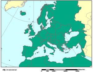
The climate of Ireland is mild, humid and changeable with abundant rainfall and a lack of temperature extremes. Ireland's climate is defined as a temperate oceanic climate, or Cfb on the Köppen climate classification system, a classification it shares with most of northwest Europe. The island receives generally warm summers and cool winters.

CLIMAT is a code for reporting monthly climatological data assembled at land-based meteorological surface observation sites to data centres. CLIMAT-coded messages contain information on several meteorological variables that are important to monitor characteristics, changes, and variability of climate. Usually these messages are sent and exchanged via the Global Telecommunication System (GTS) of the World Meteorological Organisation (WMO). Modifications of the CLIMAT code are the CLIMAT SHIP and CLIMAT TEMP / CLIMAT TEMP SHIP codes which serve to report monthly climatological data assembled at ocean-based meteorological surface observation sites and at land-/ocean-based meteorological upper-air observation sites, respectively. The monthly values included usually are obtained by averaging observational values of one or several daily observations over the respective month.

ʽAziziya, sometimes spelled El Azizia, is a small town and it was the capital of the Jafara district in northwestern Libya, 41 kilometres (25 mi) southwest of the capital Tripoli. From 1918 to 1922 it was the capital of the Tripolitanian Republic, the first formal republic in the Arab world. Before 2001 it was in the ʽAziziya District and its capital. ʽAziziya is a major trade centre of the Sahel Jeffare plateau, being on a trade route from the coast to the Nafusa Mountains and the Fezzan region to the south. As of 2006, the town's population has been estimated at over 23,399.

An atmospheric reanalysis is a meteorological and climate data assimilation project which aims to assimilate historical atmospheric observational data spanning an extended period, using a single consistent assimilation scheme throughout.

Homogenization in climate research means the removal of non-climatic changes. Next to changes in the climate itself, raw climate records also contain non-climatic jumps and changes, for example due to relocations or changes in instrumentation. The most used principle to remove these inhomogeneities is the relative homogenization approach in which a candidate station is compared to a reference time series based on one or more neighboring stations. The candidate and reference station(s) experience about the same climate, non-climatic changes that happen only in one station can thus be identified and removed.

The National Centers for Environmental Information (NCEI), an agency of the United States government, manages one of the world's largest archives of atmospheric, coastal, geophysical, and oceanic data, containing information that ranges from the surface of the sun to Earth's core, and from ancient tree ring and ice core records to near-real-time satellite images.

Ingeborg Auer is an Austrian climatologist, known for her work on Project HISTALP.

Lisa Victoria Alexander is an international expert on heatwaves. She received the Dorothy Hill Medal for her research on climate extremes, the frequency and intensity of heatwaves, and has provided evidence that the frequency and intensity of heatwaves will be influenced by the quantity of anthropogenic greenhouse gas emissions, in particular carbon dioxide. She was a contributing author to the Intergovernmental Panel on Climate Change (IPCC) reports, including the fifth assessment report.

References

  1. Klein–Tank et al.,"Daily dataset of 20th-century surface air temperature and precipitation series for the European climate assessment", Int. J. Climatol., 22: 1441–1453 (2002). Retrieved on 2010-01-29. Archived October 18, 2006, at the Wayback Machine
  2. 1 2 3 Albert Klein Tank, [ permanent dead link ] European Climate Assessment and Dataset (ECA&D) Algorithm Theoretical Basis Document (ATBD) [ permanent dead link ]. Retrieved on 2010-01-29.
  3. Wijngaard et al.,Homogeneity of 20th century European daily temperature and precipitation series, Int. J. Climatol., 23: 679–692 (2003). Retrieved on 2010-01-29. Archived June 4, 2011, at the Wayback Machine
  4. Advances in homogenisation methods of climate series: an integrated approach (HOME) Retrieved on 2010-02-04.
  5. =Guidelines on Analysis of extremes in a changing climate in support of informed decisions for adaptation Retrieved on 2010-02-04. Archived October 27, 2011, at the Wayback Machine
  6. IPCC Fourth Assessment Report: Working Group I Report "The Physical Science Basis" Retrieved on 2010-02-04. Archived January 19, 2010, at the Wayback Machine
  7. Hofstra et al., Testing E–OBS European high-resolution gridded dataset of daily precipitation and surface temperature, J. Geophys. Res., 114, D21101, ] doi : 10.1029/2009JD011799. Retrieved on 2010-01-29.
  8. European Reanalysis And Observations For Monitoring (EURO4M)