Evanston Gardens, South Australia

Last updated

Evanston Gardens
Adelaide,  South Australia
Tambelin.jpg
Tambelin Railway Station in Evanston Gardens
Australia South Australia Town of Gawler location map.svg
Red pog.svg
Evanston Gardens
Coordinates 34°37′26″S138°43′19″E / 34.624°S 138.722°E / -34.624; 138.722 Coordinates: 34°37′26″S138°43′19″E / 34.624°S 138.722°E / -34.624; 138.722
Population770 (2006 census) [1]
787 (2001 Census) [2]
Postcode(s) 5116 [3]
Location35 km (22 mi) NE of Adelaide city centre [3]
LGA(s) Town of Gawler
State electorate(s) Light (2011) [4]
Federal division(s) Spence
Suburbs around Evanston Gardens:
Hillier Hillier Evanston
Hillier Evanston Gardens Evanston, Evanston South
Kudla Kudla, Evanston South Evanston South

Evanston Gardens is an outer northern suburb of Adelaide, South Australia. It is located in the Town of Gawler.

Contents

Geography

The suburb lies astride Angle Vale Road and is bounded on the east by the Sturt Highway (Gawler Bypass). [5]

Demographics

The 2006 Census by the Australian Bureau of Statistics counted 770 persons in Evanston Gardens on census night. Of these, 50.6% were male and 49.4% were female. [1]

The majority of residents (78.3%) are of Australian birth, with an additional 8.4% identifying England as their country of birth. [1]

The age distribution of Evanston Gardens residents is similar to that of the greater Australian population. 62.6% of residents were over 25 years in 2006, compared to the Australian average of 66.5%; and 37.4% were younger than 25 years, compared to the Australian average of 33.5%. [1]

Community

Local newspapers include the News Review Messenger and The Bunyip. Other regional and national newspapers such as The Plains Producer, The Advertiser and The Australian are also available. [6]

Schools

Evanston Gardens Primary School is located on Angle Vale Road. [7]

Facilities and attractions

Parks

Karbeethon Reserve lies on Angle Vale Road. There are parks elsewhere in the suburb, particularly on Hindmarsh Boulevard. [5]

Transportation

Roads

Evanston Gardens is serviced by Angle Vale Road, indirectly connecting the suburb to both Port Wakefield Road and the Sturt Highway. [5]

Public transport

Evanston Gardens is serviced by public transport run by the Adelaide Metro. [8]

Trains

The Gawler railway line passes through the suburb. The closest station is Tambelin. [8]

See also

Related Research Articles

Grange, South Australia Suburb of Adelaide, South Australia

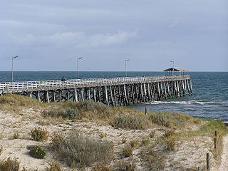
Grange is a coastal suburb of the City of Charles Sturt, in Adelaide, South Australia, located 11 kilometres from the Adelaide city centre. The suburb is named after Captain Charles Sturt's cottage, built in 1840–41, which still stands and is now a museum. In addition to Grange Beach, the suburb has several parks and reserves, as well as the Grange Hotel, which was originally licensed in 1881.

Parkside, South Australia Suburb of Adelaide, South Australia

Parkside is an inner southern suburb of Adelaide, South Australia. It is located in the City of Unley.

Flinders Park, South Australia Suburb of Adelaide, South Australia

Flinders Park is a western suburb of Adelaide, South Australia. It is located in the City of Charles Sturt.

Athol Park, South Australia Suburb of Adelaide, South Australia

Athol Park is a north-western suburb of Adelaide, South Australia. It is located in the City of Charles Sturt.

Cheltenham, South Australia Suburb of Adelaide, South Australia

Cheltenham is a suburb of Adelaide, South Australia. It is located on Kaurna Land in the City of Charles Sturt.

Brompton, South Australia Suburb of Adelaide, South Australia

Brompton is an inner-northern suburb of Adelaide, South Australia in the City of Charles Sturt.

Bowden, South Australia Suburb of Adelaide, South Australia

Bowden is an inner northern suburb of Adelaide, South Australia. It is located in the City of Charles Sturt.

Ovingham, South Australia Suburb of Adelaide, South Australia

Ovingham is an inner northern suburb of Adelaide, South Australia. It is located in the cities of Charles Sturt and Prospect.

Ridleyton, South Australia Suburb of Adelaide, South Australia

Ridleyton is an inner northern suburb of Adelaide, South Australia. It is located in the City of Charles Sturt.

Renown Park, South Australia Suburb of Adelaide, South Australia

Renown Park is an inner northern suburb of Adelaide, South Australia. It is located in the City of Charles Sturt.

Fulham Gardens is a western suburb of Adelaide, South Australia in the City of Charles Sturt.

Kidman Park is a western suburb of Adelaide, South Australia. It is located in the City of Charles Sturt.

Albert Park is a suburb of Adelaide, South Australia. It is located in the City of Charles Sturt.

Kilkenny, South Australia Suburb of Adelaide, South Australia

Kilkenny is an inner north-western suburb of Adelaide, South Australia. It is located in the City of Charles Sturt. It is named after Kilkenny, Ireland.

Devon Park is an inner northern suburb of Adelaide, South Australia. It is located in the cities of Port Adelaide Enfield and Charles Sturt beside the Gawler railway line near, but not meeting, the intersection of Torrens Road and Churchill Road.

Henley Beach South, South Australia Suburb of Adelaide, South Australia

Henley Beach South is a coastal suburb of Adelaide, South Australia. It is located in the City of Charles Sturt.

Beverley, South Australia Suburb of Adelaide, South Australia

Beverley is a western suburb of Adelaide, South Australia. It is located in the City of Charles Sturt.

Hendon is a north-western suburb of Adelaide, South Australia, 9.8 km from the Adelaide city centre. It is located in the City of Charles Sturt.

Andrews Farm is a northern suburb of Adelaide, South Australia. It is located in the City of Playford.

Hillier is a northern suburb of Adelaide, South Australia. It is located in the Town of Gawler.

References

  1. 1 2 3 4 Australian Bureau of Statistics (25 October 2007). "Evanston Gardens (State Suburb)". 2006 Census QuickStats. Retrieved 26 April 2011.
  2. Australian Bureau of Statistics (9 March 2006). "Evanston Gardens (State Suburb)". 2001 Census QuickStats. Retrieved 26 April 2011.
  3. 1 2 "Evanston Gardens, South Australia (Adelaide)". Postcodes-Australia. Postcodes-Australia.com. Retrieved 26 April 2011.
  4. "Electoral Districts – Electoral District for the 2010 Election". Electoral Commission SA. Archived from the original on 22 August 2011. Retrieved 26 April 2011.
  5. 1 2 3 Adelaide and surrounds street directory (47th ed.). UBD. 2009. ISBN   978-0-7319-2336-6.
  6. "South Australian Newspapers". Newspapers.com.au. Australia G'day. Archived from the original on 29 April 2011. Retrieved 26 April 2011.
  7. "Australian Schools Directory". Australian Schools Directory. Retrieved 26 April 2011.
  8. 1 2 "Public Transport in Adelaide". Adelaide Metro official website. Dept. for Transport, Energy and Infrastructure, Public Transport Division. 12 January 2011. Archived from the original on 26 April 2011. Retrieved 26 April 2011.