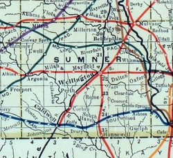
Ewell is a ghost town in Sumner County, Kansas, United States. [1] It is located about 3.5 miles southwest of Conway Springs at 0.25 mile southeast of the intersection of N Bluff Rd and W 60th Ave N, next to an abandoned railroad. [2]
Ewell was located next to a former railroad between Conway Springs and Argonia.
Ewell had a post office between 1885 and 1906. [3]
This community no longer exists, though a modern home and its buildings exist on the site.
The rural area around the former community is currently served by Conway Springs USD 356 public school district.
Sumner County is a county located in the U.S. state of Kansas. Its county seat is Wellington. As of the 2020 census, the population was 22,382. The county is named after Charles Sumner, a U.S. Senator from Massachusetts who was a leader of Reconstruction politics.
McPherson County is a county located in the U.S. state of Kansas. Its county seat and largest city is McPherson. As of the 2020 census, the county population was 30,223. The county was named for James McPherson, a general in the American Civil War.
Sumner is a city in Chariton County, Missouri, United States. The population was 78 at the 2020 census. It was named in honor of U.S. Senator Charles Sumner.
Corbin is an unincorporated community in Sumner County, Kansas, United States. It is located about 6.5 miles northeast of Caldwell near the intersection of S Mayfield Rd and W 110th St S, next to the railroad.
Octagon City is a ghost town in Allen County, Kansas, United States. It was a failed intentional community that was founded in 1856 about six miles (10 km) south of Humboldt, Kansas near the Neosho River. It was created by the Vegetarian Kansas Emigration Company, headed by prominent vegetarian Henry S. Clubb and entrepreneurs Charles DeWolfe and John McLaurin. The original intent was to build a vegetarian commune on the south side of the Neosho River, but investor interest in a non-vegetarian moral community was much higher and the decision was made to build Octagon City on the north side of the Neosho River to make the entire project sustainable. Members of Octagon City were under oath to educate their children and uphold a moral life.
Milton is an unincorporated community in Sumner County, Kansas, United States. As of the 2020 census, the population of the community and nearby areas was 155. It is located 4.5 miles (7.2 km) southeast of Norwich at the intersection of N Argonia Rd and W 120th Ave N, next to the railroad.
Aulne is an unincorporated community in Marion County, Kansas, United States. The Aulne name was suggested by officials of the railroad when it was built through Aulne during the 19th century. It is located southwest of Marion at the intersection of Pawnee Road and 140th Street next to the Union Pacific Railroad.
Ashton is an unincorporated community in Walton Township, Sumner County, Kansas, United States. It is located about halfway between South Haven and Arkansas City at 1.75 miles north of the intersection of S Rock Rd and U.S. Route 166, which is 5.5 miles east of I-35, next to an abandoned railroad.
Bayneville is an unincorporated community in Ohio Township, Sedgwick County, Kansas, United States. It is located on S 87th W between W 71st S and W 79st S.
Oursler is a ghost town in Marion County, Kansas, United States. It is currently a ghost town that was located approximately 3.5 miles southeast of Marion next to a former railroad. No buildings remain of this former community.
Waldeck is a ghost town in Marion County, Kansas, United States. It is currently a ghost town that was located approximately 3.5 miles north of Lehigh next to a railroad. No buildings remain of this former community.
Vine Creek is a ghost town in Ottawa County, Kansas, United States.
Adamsville is an unincorporated community in Sumner County, Kansas, United States. It is located about 4 miles north of Geuda Springs at 0.5 mile west of the intersection of S Oxford Rd and E 80th St, next to an abandoned railroad.
Anson is an unincorporated community in Sumner County, Kansas, United States. It is located about 6 miles east of Conway Springs at 1.5 miles south of the intersection of N Anson Rd and W 90th St N, next to an abandoned railroad. It currently contains a small number of homes, but no businesses or services.
Cicero is an unincorporated community in Sumner County, Kansas, United States. It is located about 4 miles northeast of Wellington at about 2.5 miles east of the intersection of U.S. Route 81 and E 50th Ave N, next to the railroad.
Millerton is an unincorporated community in Sumner County, Kansas, United States. It is located about 5 miles northeast of Conway Springs at the intersection of N Maple Rd and W 123rd Ave N, next to the railroad.
Portland is an unincorporated community in Sumner County, Kansas, United States. It is located about 5 miles northeast of South Haven at 1.5 miles north of the intersection of S Hydraulic Rd and U.S. Route 166, next to an abandoned railroad. It is 1.5 miles east of I-35.
Riverdale is an unincorporated community in Sumner County, Kansas, United States. It is located about 6 miles southwest of Belle Plaine at the intersection of N Sand Plum Rd and 77th Ave N, or west of U.S. Route 81 next to the railroad.
Plum Grove is a ghost town in Butler County, Kansas, United States. It was located in a rural area north of modern-day Potwin. No buildings remain at this former community site.
Comiskey is a ghost town in Morris County, Kansas, United States. It was located approximately 6 miles (9.7 km) east of Council Grove, next to the county line.