Farkha

Last updated • 4 min readFrom Wikipedia, The Free Encyclopedia

Farkha
Arabic transcription(s)
   Arabic فرخة
Farkha7763.JPG
Farkha, 2016
Palestine location map wide.png
Red pog.svg
Farkha
Location of Farkha within Palestine
Coordinates: 32°04′11″N35°8′56″E / 32.06972°N 35.14889°E / 32.06972; 35.14889
Palestine grid 164/164
State State of Palestine
Governorate Salfit
Government
  Type Village council
Elevation
[1]
587 m (1,926 ft)
Population
 (2017) [2]
  Total
1,650
Name meaningFurkhah, from personal name [3]

Farkha (Arabic : فرخة) is a Palestinian village in the Salfit Governorate in the northern West Bank, 30 kilometers south of Nablus. According to the Palestinian Central Bureau of Statistics, it had a population of 1,650 in 2017. [2]

Contents

Location

Farkha is located 3.2 kilometers (2.0 mi) west of Salfit. It is bordered by Salfit to the east and north, Qarawat Bani Zaid and Bani Zaid ash Sharqiya to the south, and Bruqin village to the west. [1]

History

Pottery sherds from the Middle Bronze Age, Iron Age I and IA II, Persian, Hellenistic, Roman, Byzantine and Crusader/Ayyubid have been found here. [4]

It was populated by Samaritans up until the Arab conquest, and probably later into the Umayyad period. [5]

An Ayyubid text in the village mosque, first noted in situ by D.C. Bamraki, dates it to 1210 CE. [6] [7]

Pottery sherds from the Mamluk era have also been found here. [4] The village is seem to be the birthplace of the Muslim scholar Abdullah al-Farkhawi (d. 1415). [8]

Ottoman era

In 1517 the village was included in the Ottoman empire with the rest of Palestine, and in the 1596 tax-records it appeared as Farha, located in the Nahiya of Jabal Quba, part of Nablus Sanjak. The population was 17 households, all Muslim. They paid a fixed tax rate of 33.3% on agricultural products, such as wheat, barley, summer crops, olive trees, goats and beehives, in addition to occasional revenues and a fixed tax for people of Nablus area; a total of 2,800 akçe. [9] Pottery sherds from the early Ottoman era has also been found here. [4]

In the 18th and 19th centuries the village formed part of the highland region known as Jūrat ‘Amra or Bilād Jammā‘īn. Situated between Dayr Ghassāna in the south and the present Route 5 in the north, and between Majdal Yābā in the west and Jammā‘īn, Mardā and Kifl Ḥāris in the east, this area served, according to historian Roy Marom, "as a buffer zone between the political-economic-social units of the Jerusalem and the Nablus regions. On the political level, it suffered from instability due to the migration of the Bedouin tribes and the constant competition among local clans for the right to collect taxes on behalf of the Ottoman authorities." [10]

In 1838 Furkha was noted as village in the Jurat Merda area, south of Nablus. [11]

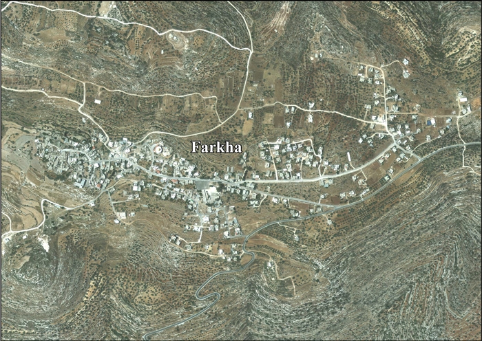
In 1870 Victor Guérin on his travels noted Farkha as a "considerable" village, located on a mountain peak. [12]

In 1870/1871 (1288 AH) an Ottoman census listed the village with a population of 36 households in the nahiya (sub-district) of Jamma'in al-Awwal, subordinate to Nablus. [13]

In 1882 the PEF's Survey of Western Palestine described Furkhah as: "An ancient village in a very strong position on a steep hill-top. The houses are of stone, and there are three sacred tombs, including Haram en Neby Shit, on the south. The fountain of Ain Yambua, in the valley, gives a supply of fine water, and there are two other springs east of the village. The place is evidently an ancient site. The hills around it are very steep and rocky." [14]

British Mandate era

In the 1922 census of Palestine conducted by the British Mandate authorities, Farkha had a population of 210 Muslims, [15] increasing in the 1931 census to 304 Muslims in 54 occupied houses. [16]

Tawfiq Canaan mention the custom of Mafazeh at the top of the ascent of Farkah; "a traveller after climbing a high mountain raises a heap of stones, or throw a stone on an existing heap, saying at the same time prayer as a mark of thanks to God that he has overcome a difficulty." [17]

In the 1945 statistics the population was 380 Muslims [18] while the total land area was 5,675 dunams, according to an official land and population survey. [19] Of this, 1,753 were allocated for plantations and irrigable land, 1,301 for cereals, [20] while 14 dunams were classified as built-up areas. [21]

Jordanian era

In the wake of the 1948 Arab–Israeli War and after the 1949 Armistice Agreements, Farkha came under Jordanian rule.

The Jordanian census of 1961 found 564 inhabitants. [22]

Post-1967

Since the Six-Day War in 1967, Farkha has been under Israeli occupation.

After the 1995 accords, Israel and Israeli settlements got 80% of the water from the Western Aquifer, leading often to severe shortages of water in Farkha. [23] [24]

After 1995, 48% of village land is defined as Area A land, 21.6% is Area B, while the remaining 30.4% is defined as Area C land. As of 2013, the plans for the Segregation Wall would isolate the village from much of its land behind the wall. [25]

Related Research Articles

<span class="mw-page-title-main">Salfit</span> Palestinian city in the West Bank

Salfit is a Palestinian city in the central West Bank, and the capital of the Salfit Governorate of the State of Palestine. Salfit is located at an altitude of 570 meters (1,870 ft), adjacent to the Israeli settlement of Ariel. According to the Palestinian Central Bureau of Statistics (PCBS), Salfit had a population of 10,911 in 2017. Since the 1995 Interim Agreement on the West Bank and the Gaza Strip, Salfit, located in Area A, has been administered by the Palestinian National Authority, while continuing under Israeli military occupation.

<span class="mw-page-title-main">Kifl Haris</span> Municipality type D in Salfit, Palestine

Kifl Haris is a Palestinian village in the northern West Bank, located six kilometers west of Salfit and 18 kilometers south of Nablus, in the Salfit Governorate of the State of Palestine; it is located northwest of the Israeli settlement of Ariel.

<span class="mw-page-title-main">Deir Ballut</span> Municipality type D in Salfit, State of Palestine

Deir Ballut is a Palestinian town in the Salfit Governorate in the northern West Bank, 41 kilometers (25 mi) south west of Nablus. According to the Palestinian Central Bureau of Statistics, it had a population of 3,873 in 2017.

<span class="mw-page-title-main">Jamma'in</span> Municipality type C in Nablus, State of Palestine

Jamma'in is a Palestinian town in the Nablus Governorate of the State of Palestine, in the northern West Bank, located 16 kilometers (9.9 mi) southwest of Nablus, 6 kilometers (3.7 mi) northwest of Salfit and 40 kilometers (25 mi) north of Ramallah. According to the Palestinian Central Bureau of Statistics, the town had a population of 7,436 in 2017.

<span class="mw-page-title-main">Bruqin</span> Municipality type D in Salfit, State of Palestine

Bruqin is a Palestinian town 13 kilometers west of Salfit in the Salfit Governorate of the State of Palestine, in the northern West Bank, adjacent to the Israeli settlement of Brukhin, which was built over lands confiscated from the Palestinian town. According to the Palestinian Central Bureau of Statistics, Bruqin had a population of 4,047 in 2017. The town used to be on a camel-trading route. There is evidence of Roman rule in the city due to the presence of three ancient pools and a tomb.

<span class="mw-page-title-main">Biddya</span> Municipality type C in Salfit, State of Palestine

Biddya is a Palestinian city in the Salfit Governorate, located 32 kilometers southwest of Nablus and half that distance from Salfit in the northern West Bank. According to the Palestinian Central Bureau of Statistics (PCBS), Biddya had a population of 10,451 in 2017. The town is governed by a municipal council of eleven members who each represent the prominent families of Biddya and select a mayor.

<span class="mw-page-title-main">Az-Zawiya, Salfit</span> Municipality type C in Salfit, State of Palestine

Az-Zawiya is a Palestinian town in the Salfit Governorate of the State of Palestine, in the northern West Bank, located west of Salfit and south of Qalqilya. According to the Palestinian Central Bureau of Statistics, az-Zawiya had a population of 6,033 in 2017. The town's population is made up of primarily three families: Shuqeir (45%), Muqadi (30%) and Raddad (20%), while the remaining 5% consists of Palestinian refugee families such as Shamlawi, Rabi and Yusif.

<span class="mw-page-title-main">Einabus</span> Municipality type D in Nablus, State of Palestine

Einabus is a Palestinian village in the northern West Bank, located 12 kilometers south of Nablus and a part of the Nablus Governorate. Nearby towns include Huwara and Beita to the east and Jammain to the south.

<span class="mw-page-title-main">Haris, Salfit</span> Municipality type D in Salfit, State of Palestine

Haris is a Palestinian town in the Salfit Governorate of the State of Palestine, in the northern West Bank, 24 kilometers Southwest of Nablus. According to the Palestinian Central Bureau of Statistics, it had a population of 4,137 in 2017.

<span class="mw-page-title-main">Marda, Salfit</span> Municipality type D in Salfit, State of Palestine

Marda is a Palestinian town in the Salfit Governorate of the State of Palestine, in the northern West Bank, 18 kilometers southwest of Nablus. According to the Palestinian Central Bureau of Statistics, it had a population of 2,375 in 2017.

<span class="mw-page-title-main">Iskaka</span> Municipality type D in Salfit, State of Palestine

Iskaka is a Palestinian town in the Salfit Governorate of the State of Palestine, in the northern West Bank, 27 kilometers southwest of Nablus. According to the Palestinian Central Bureau of Statistics, it had a population of 1,198 in 2017.

<span class="mw-page-title-main">Qira, Salfit</span> Municipality type D in Salfit, State of Palestine

Qira is a Palestinian town in the Salfit Governorate in the northern West Bank, 19 kilometers southwest of Nablus. According to the Palestinian Central Bureau of Statistics, it had a population of approximately 1,278 in 2017.

<span class="mw-page-title-main">Rafat, Salfit</span> Town in Salfit Governorate, West Bank

Rafat is a Palestinian town in the Salfit Governorate of the State of Palestine, in the northern West Bank, 38 kilometers southwest of Nablus. According to the Palestinian Central Bureau of Statistics, it had a population of 2,522 in 2017.

<span class="mw-page-title-main">Sarta</span> Municipality type D in Salfit, State of Palestine

Sarta is a Palestinian town in the Salfit Governorate in the northern West Bank, 22 kilometers southwest of Nablus. According to the Palestinian Central Bureau of Statistics, it had a population of approximately 3,382 in 2017.

<span class="mw-page-title-main">Mas-ha</span> Municipality type D in Salfit, State of Palestine

Mas-ha is a Palestinian village in the Salfit Governorate in the northern West Bank, 24 kilometers southwest of Nablus. According to the Palestinian Central Bureau of Statistics, it had a population of 2,370 in 2017.

<span class="mw-page-title-main">Deir Istiya</span> Municipality type D in Salfit, State of Palestine

Deir Istiya is a Palestinian town of 3,696 in the Salfit Governorate of the State of Palestine, in the northern West Bank, 15 kilometers (9.3 mi) southwest of Nablus. The built-up area of Deir Istiya is 74 dunams, and its old city has about thirty families.

<span class="mw-page-title-main">Yatma</span> Municipality type D in Nablus, State of Palestine

Yatma is a Palestinian town in the Nablus Governorate in northern West Bank, located 15 kilometers south of Nablus. According to the Palestinian Central Bureau of Statistics (PCBS), the town had a population of 3,363 inhabitants in 2017.

<span class="mw-page-title-main">Zeita Jamma'in</span> Municipality type C in Nablus, State of Palestine

Zeita Jamma'in is a Palestinian village in the Nablus Governorate in northern West Bank, located 16 kilometers southwest of Nablus. The village is located just north of Jamma'in, from which the village receives its name. According to the Palestinian Central Bureau of Statistics (PCBS), Zeita Jamma'in had a population of 2,740 inhabitants in 2017.

<span class="mw-page-title-main">Ammuriya, Nablus</span> Local Development Committee in Nablus, State of Palestine

Ammuriya is a Palestinian village in the Nablus Governorate of the State of Palestine in the northern West Bank, located south of Nablus. According to the Palestinian Central Bureau of Statistics (PCBS) census, Ammuriya had a population of 371 in 2017. There were 48 households and five business establishments in the village.

<span class="mw-page-title-main">Khirbet Qeis</span> Municipality type D in Salfit, State of Palestine

Khirbat Qais is a Palestinian village in the Salfit Governorate in the northern West Bank. In 2010 it became a suburb of Salfit, about 4 km south of Salfit.

References

  1. 1 2 Farkha village profile, ARIJ, p. 4
  2. 1 2 Preliminary Results of the Population, Housing and Establishments Census, 2017 (PDF). Palestinian Central Bureau of Statistics (PCBS) (Report). State of Palestine. February 2018. pp. 64–82. Retrieved 2023-10-24.
  3. Palmer, 1881, p. 229
  4. 1 2 3 Finkelstein et al, 1997, p. 456
  5. Sharon, Corpus Inscriptionum Arabicarum Palaestinae, 2004. Brill. Leiden/Boston. p. 242 "A small village built on a steep hilltop, 500m. above sea level, in the heart of Samaria, Southwest of the small town of Salfit. Samaritans populated it until the Arab conquest, and probably throughout the Umayyad period. Under the Crusaders its name is not mentioned, but its location suggests that it was included in the Royal Domain of the Latin Kingdom of Jerusalem. (Riley-Smith, Atlas, 1991: 36–37) In 1187, after the battle of Hittin, it came under Ayyubid rule. In Islamic literature its name appears connected with the name of a Muslim scholar, Abdallah b. Abu Abdallah al-Farkhawi (d. 818/1415). In his biography, as-Sakhawi remarked that the nisbah al-Farkhawi refers to the village of Farkha, which he spells with a long “a" (also Guerin, Samarie, 2, 1875:159) adding that it was a village in the district of Nabulus. (Sakhawi, I)aw\ 5:29) Except for this remark I found no other mention of the village in the literary sources. This fact grants the present Ayyubid inscription, found in the village and mentioning its name, particular significance."
  6. The full text of the inscription is: "Basmalah. They only shall manage (visit, perform the umrah to) Allah's places of worship who have believed in Allah and the Last Day. (Q, 9:18; trans. Bell) This blessed mosque was renewed particularly by the funds of the inhabitants of the village known (by the name of) Farkhah that belongs to the sub district of the divinely protected town of Nābulus, as a pious deed for the sake of Allah—the exalted—and seeking His approval. Those who assumed charge of the work were Mansūr b. Abū al-Fawāris and Kāmil b. Sinān (or Sayyār) and Nāsir b. Muhammad who are all in need for Allah's compassion. And the most exalted the great Amīr Bahā' ad-Dīn Alūdākh(?) b. 'Abd Allah has endowed for it from the (income of the) fasal of the aforementioned village every year three Tyrian dinars seeking the approval of Allah and (hoping to) gain the abode of the world to come. And this took place on the full moon of the month of Shawwāl the year 606 (=12.4.1210) and may Allah bless Muhammad." Sharon, 2004, pp. 188 −200
  7. Sharon, 2005, pp. 127–140
  8. Sharon, 2004, p. 188
  9. Hütteroth and Abdulfattah, 1977, p. 134
  10. Marom, Roy (2022-11-01). "Jindās: A History of Lydda's Rural Hinterland in the 15th to the 20th Centuries CE". Lod, Lydda, Diospolis. 1: 17.
  11. Robinson and Smith, 1841, vol 3, pp. 82-83, Appendix 2, p. 127
  12. Guérin, 1875, p. 159
  13. Grossman, David (2004). Arab Demography and Early Jewish Settlement in Palestine. Jerusalem: Magnes Press. p. 252.
  14. Conder and Kitchener, 1882, SWP II, p. 284
  15. Barron, 1923, Table IX, Sub-district of Nablus, p. 25
  16. Mills, 1932, p. 61
  17. Canaan, 1927, p. 76 and note 4. Cited in Sharon, 2004, p. 189
  18. Government of Palestine, Department of Statistics, 1945, p. 18
  19. Government of Palestine, Department of Statistics. Village Statistics, April, 1945. Quoted in Hadawi, 1970, p. 59
  20. Government of Palestine, Department of Statistics. Village Statistics, April, 1945. Quoted in Hadawi, 1970, p. 106
  21. Government of Palestine, Department of Statistics. Village Statistics, April, 1945. Quoted in Hadawi, 1970, p. 156
  22. Government of Jordan, Department of Statistics, 1964, p. 26
  23. Farkha village profile, ARIJ, p. 15
  24. Israel incapable of telling truth about water it steals from Palestinians, by Amira Hass, Jun. 22, 2016, Haaretz (Archived)
  25. Farkha village profile, ARIJ, p. 17

Bibliography