Farrar, Iowa | |
|---|---|
 Farrar Bible Fellowship, a church in Farrar | |
 Farrar, Iowa | |
| Coordinates: 41°48′21″N93°22′12″W / 41.80583°N 93.37000°W | |
| Country | |
| State | |
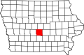
| County | Polk |
| Township | Washington |
| Elevation | 297 m (974 ft) |
| Time zone | UTC-6 (Central (CST)) |
| • Summer (DST) | UTC-5 (CDT) |
| Area code | 515 |
| GNIS feature ID | 456558 [1] |
Farrar is an unincorporated community in Washington Township, Polk County, Iowa, United States. [1] A formerly abandoned elementary school building, now owned by paranormal investigative Youtubers Sam and Colby, and one church are located in Farrar, as well as 13 houses. As a result of unincorporation all residents of Farrar now have a Maxwell, Iowa address.