
Ang Mo Kio is a planning area and residential town situated in the North-East region of Singapore. Located approximately 11 km north of the Downtown Core district, Ang Mo Kio is the 3rd most populated planning area in the North-East region and ranks 8th in terms of population in the country overall. The planning area is located at the south-western corner of the North-East region, bordered by the planning areas of Yishun to the north, Sengkang to the north-east, Serangoon to the east, Bishan to the south and the Central Water Catchment to the west.

Yishun, formerly known as Nee Soon, is a residential town located in the northeastern corner of the North Region of Singapore, bordering Simpang and Sembawang to the north, Mandai to the west, the Central Water Catchment to its southwest, Ang Mo Kio to its south, as well as Seletar and Sengkang to its east and southeast respectively.

Serangoon is a planning area and residential town located in the North-East Region of Singapore.
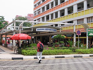
Hougang is a planning area and mature residential town located in the North-East Region of Singapore. It is the largest housing estate in Singapore based on land area, and is home to 247,528 residents as of 2018. Hougang planning area is bordered by Sengkang to the north, Geylang to the south, Bedok to the southeast, Toa Payoh to the southwest, Serangoon to the west and Paya Lebar to the east.
Seletar is an area located in the north-east of Singapore. Its name can also refer to the Seletar Planning Area, situated in the North-East Region of Singapore. The place name was derived from the Malay subgroup who were indigenous to the area, the Orang Seletar. It shares boundaries with the planning areas of Sengkang to the south, Punggol to the east, Yishun and Simpang to the west, as well as the Straits of Johor to the north.
Jalan Kayu is a road situated in Sengkang, Singapore. It is located in the northwestern part of Fernvale, near the Seletar–Sengkang boundary.

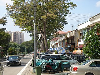
Yio Chu Kang, alternatively spelt as Yeo Chu Kang, is a sub-urban area in the northeast of Singapore, with proximity to the Ang Mo Kio, Lentor, Seletar and Sengkang areas. Deriving its name from the Yio Chu Kang Village, it is still known for lush greenery and low-density housing with high-rise public housing in its southern fringes.

SMRT Buses is the second largest bus operator in Singapore. A subsidiary of SMRT Corporation, it traded as Trans Island Bus Services until 10 May 2004.
The Ang Mo Kio Police Division is one of the seven land divisions of the Singapore Police Force. It was first established in 1965. It was previously located in Paya Lebar. In 1987, the division HQ moved to its present location to better serve the public and meet its operational needs. Ang Mo Kio Division serves a residential population of over 1.1 million residents. Ang Mo Kio Division’s area of coverage includes mature housing estates such as Ang Mo Kio, Hougang and Serangoon. It also oversees young but rapidly-developing residential estates like Sengkang and Punggol.
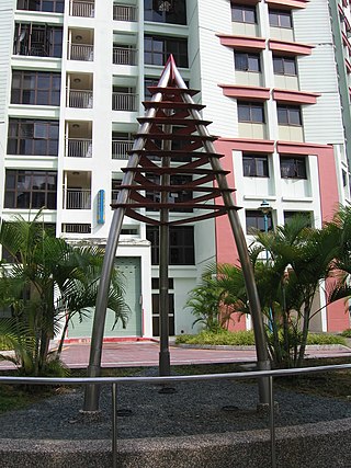
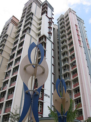
Anchorvale is a neighbourhood of Sengkang New Town in Singapore between Sungei Punggol and Compassvale. House numbers of its public apartment blocks begin with the number '3' (3xx). These housing estates were fully completed by the Housing and Development Board (HDB) in 2001.
Compassvale is a neighbourhood of Sengkang New Town, and is located between Rivervale and Anchorvale. Compassvale encompasses the Sengkang Town Centre.
Rivervale is a neighbourhood of Sengkang New Town located between Sungei Serangoon and Compassvale. The block numbers of the public apartment blocks in Rivervale begin with the number '1' (1xx). Rivervale was the first neighbourhood of Sengkang New Town to be built, and many of the existing housing estates in Rivervale were completed by the Housing and Development Board (HDB) as early as 1997.

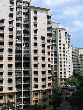
Sengkang is a planning area and residential town located in the North-East Region of Singapore. The town is the second most populous in the region, being home to 249,370 residents in 2020. Sengkang shares boundaries with Seletar and Punggol in the north, Pasir Ris and Paya Lebar in the east, Hougang and Serangoon to the south, as well as Yishun and Ang Mo Kio to the west.

The Ang Mo Kio Group Representation Constituency is a five-member Group Representation Constituency (GRC) in the north eastern region of Singapore. The constituency encompasses the majority of Ang Mo Kio, Seletar Hills, the northern half of Serangoon North, a portion of northern Hougang and a portion of Fernvale. The western portion consists of parts of the Central Catchment Nature Reserve, while in the northeastern corner, it borders the Straits of Johor with two reclaimed islands, Pulau Punggol Barat and Pulau Punggol Timor. The northeast also includes the Sengkang Floating Wetland. This GRC has 5 wards: Teck Ghee, Cheng San- Seletar, Fernvale, Jalan Kayu and Ang Mo Kio-Hougang by Ang Mo Kio Town Council. The current Members of Parliament are Darryl David, Nadia Ahmad Samdin, Ng Ling Ling, Gan Thiam Poh and Lee Hsien Loong from the People's Action Party (PAP).
Buangkok is a neighbourhood located in north eastern Singapore. The neighbourhood roughly encompasses the Trafalgar and Compassvale subzones of the Hougang and Sengkang Planning Areas respectively, as designated by the URA.
Cheng San Group Representation Constituency was a Group Representation Constituency (GRC) in the North-eastern region in Singapore. The GRC consisted of the eastern part of Ang Mo Kio, Jalan Kayu, Seletar Hills, part of Serangoon North, a large part of Hougang, Buangkok, and the whole of Sengkang New Town and Punggol New Town.

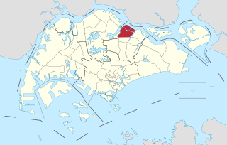
The North-East Region of Singapore is one of the five regions in the country. The region is the most densely populated and has the highest population among the five, with Sengkang being its most populous town as of 2020 and Seletar as the regional centre. Comprising 13,810 hectares, it includes seven planning areas and is largely a residential region with 217,120 homes. Housing largely consists of high-density HDB public housing estates, however private housing is also present in the region. As its name implies, it is located in the north-eastern part of Singapore.

Sengkang Sports Centre, formerly known as Sengkang Sports and Recreation Centre, is a sports complex in Anchorvale of Sengkang New Town, Singapore, near Farmway LRT station. It was scheduled to open in end 2007, but its inauguration was delayed until mid-late 2008.

Sengkang MRT/LRT station is a Mass Rapid Transit (MRT) and Light Rail Transit (LRT) interchange station in Sengkang, Singapore. It is an interchange between the North East line (NEL) and Sengkang LRT (SKLRT). Along with Buangkok station, it is located within the Sengkang planning area.


