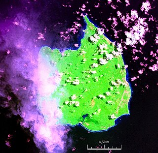
Car Nicobar is the northernmost of the Nicobar Islands. It is also one of three local administrative divisions of the Indian district of Nicobar, part of the Indian union territory of Andaman and Nicobar Islands. Annual rainfall is 2800 millimetres.

South Andaman Island is the southernmost island of the Great Andaman and is home to the majority of the population of the Andaman Islands. It belongs to the South Andaman administrative district, part of the Indian union territory of Andaman and Nicobar Islands. It is the location of Sri Vijaya Puram, capital of the Andaman and Nicobar Islands.
Little Andaman Island is the fourth largest of the Andaman Islands of India with an area of 707 km2, lying at the southern end of the archipelago. It belongs to the South Andaman administrative district, part of the Indian union territory of Andaman and Nicobar Islands. It lies 88 km (55 mi) south of Port Blair, the capital of Andaman and Nicobar Islands.

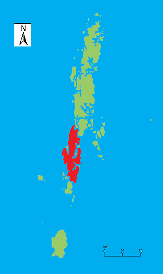
Middle Andaman Island is an island of the Andaman Islands. It belongs to the North and Middle Andaman administrative district, part of the Indian union territory of Andaman and Nicobar Islands.
Nicobar district is one of three districts in the Indian union territory of the Andaman and Nicobar Islands. The district's administrative territory encompasses all of the Nicobar Islands, which are located in the Indian Ocean, between the Bay of Bengal and the Andaman Sea. The headquarters of the district is the village of Malacca, located on the island of Car Nicobar.
Port Blair tehsil is one of 5 local administrative divisions of the Indian district of South Andaman, part of the Indian union territory of Andaman and Nicobar Islands.
Mayabunder is a town and a tehsil in the northern part of Middle Andaman Island, Andaman Archipelago, India. The name is also spelled Maya Bunder or Maya Bandar. As of 2001, the county had 23,912 inhabitants, of which 3182 were in the town. It was settled in the British colonial period by immigrants from Myanmar and ex-convicts from Mainland India.
Rangat is a town on the Middle Andaman Island, Andaman Archipelago. It is also one of the three counties (tehsils) administrative divisions of the North and Middle Andaman district, in the Andaman and Nicobar Islands union territory of India. Its population, according to the 2001 Census of India, was 38,824 people, mainly of Bengalis and Tamils.
Nancowry Taluk is one of 7 local administrative divisions of the Indian district of Nicobar, part of the Indian union territory of Andaman and Nicobar Islands.
South Andaman district is one of the 3 districts of the Indian Union Territory of Andaman and Nicobar Islands located in the Bay of Bengal. Sri Vijaya Puram, the capital of the Union Territory is the district headquarters. The area covered by this district is 2,640 km2.
North and Middle Andaman district is one of the 3 districts of the Indian Union Territory of Andaman and Nicobar Islands located in the Bay of Bengal. Mayabunder town is the district headquarters. The area covered by this district is 3251.85 km2.
Trinket Bay is a village in the Nicobar district of Andaman and Nicobar Islands, India. It is located in the Great Nicobar tehsil. It is located between Lawful and Afra on Great Nicobar island.
Bengali is a village on Teressa Island in the Nicobar district of Andaman and Nicobar Islands, India. It is located in the Nancowry tehsil.
Pulomilo is an island in the Nicobar district of Andaman and Nicobar Islands, India, and is home to a village of the same name. It is located just north of Little Nicobar Island.
Car Nicobar Tehsil is one of three local administrative divisions of the Indian district of Nicobar, part of the Indian union territory of Andaman and Nicobar Islands. It is a subdivision and also a tehsil, roughly equivalent to a county in its range of administrative powers. It is located in the Northern Nicobar Islands.
Nancowry Subdivision is one of three local administrative divisions of the Indian district of Nicobar, part of the Indian union territory of Andaman and Nicobar Islands.
Great Nicobar Subdivision is one of three local administrative divisions of the Indian district of Nicobar, part of the Indian union territory of Andaman and Nicobar Islands. It is located in the Southern Nicobar Islands.
James Island is an island of the Andaman Islands. It belongs to the South Andaman administrative district, part of the Indian union territory of Andaman and Nicobar Islands. The island is 30 km (19 mi) north of Port Blair.
Defence Island is an island of the Andaman Islands. It belongs to the South Andaman administrative district, part of the Indian union territory of Andaman and Nicobar Islands. The island is 33.5 km (21 mi) north of Port Blair.
Defence Islands are an island group of the Andaman Islands. It belongs to the South Andaman administrative district, part of the Indian union territory of Andaman and Nicobar Islands. The islands are situated 33.5 km (21 mi) north from Port Blair.


