Garacharma

Last updated

Garacharma
Town
India Andaman and Nicobar Islands location map.svg
Red pog.svg
Garacharma
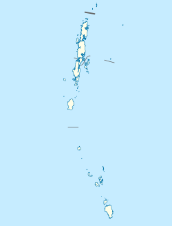
Location in the Andaman and Nicobar Islands
India location map.svg
Red pog.svg
Garacharma
Garacharma (India)
Coordinates: 11°37′N92°43′E / 11.617°N 92.717°E / 11.617; 92.717
Country Flag of India.svg  India
Union Territory Andaman and Nicobar Islands
District South Andaman
Population
 (2001)
  Total
9,431
Time zone UTC+5.30 (IST)
Climate Am

Garacharma is a census town in Andaman district just outside Sri Vijaya Puram in the Andaman and Nicobar Islands, a union territory of India.
Demographics

As of 2001 India census, [1] Garacharma had a population of 9,431. Males constitute 53% of the population and females 47%. Garacharma has an average literacy rate of 74%, higher than the national average of 59.5%: male literacy is 78%, and female literacy is 69%. In Garacharma, 12% of the population is under 6 years of age.

References

  1. "Census of India 2001: Data from the 2001 Census, including cities, villages and towns (Provisional)". Census Commission of India. Archived from the original on 16 June 2004. Retrieved 1 November 2008.