
Westminster is an area in central London within the City of Westminster, part of the West End, on the north bank of the River Thames. Westminster's concentration of visitor attractions and historic landmarks, one of the highest in London, includes the Palace of Westminster, Buckingham Palace, Westminster Abbey and Westminster Cathedral.

A village is a clustered human settlement or community, larger than a hamlet but smaller than a town, with a population ranging from a few hundred to a few thousand. Though villages are often located in rural areas, the term urban village is also applied to certain urban neighborhoods. Villages are normally permanent, with fixed dwellings; however, transient villages can occur. Further, the dwellings of a village are fairly close to one another, not scattered broadly over the landscape, as a dispersed settlement.

Guiseley is a small town in metropolitan borough of the City of Leeds, West Yorkshire, England. Historically part of the West Riding of Yorkshire, it is situated south of Otley and Menston and is now a north-western suburb of Leeds.

Edale is a village and civil parish in the Peak District, Derbyshire, England, whose population was 353 at the 2011 Census. Edale, with an area of 7,030 acres (2,840 ha), is in the Borough of High Peak.
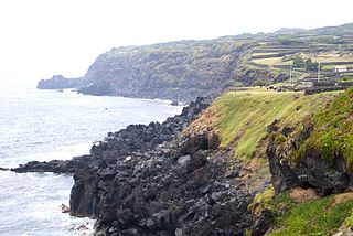
Cinco Ribeiras is a civil parish in the municipality of Angra do Heroísmo on the island of Terceira in the Portuguese archipelago of the Azores. The population in 2011 was 704, in an area of 12.80 km².

Craven Arms is a small town and civil parish in Shropshire, England, on the A49 road and the Welsh Marches railway line, which link it north and south to the larger towns of Shrewsbury and Ludlow respectively. The Heart of Wales railway line joins the Welsh Marches line at Craven Arms and the town is served by Craven Arms railway station. The town is enclosed to the north by the Shropshire Hills Area of Outstanding Natural Beauty, and to the south is the fortified manor house of Stokesay Castle.

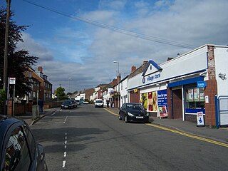
Sprowston is a small suburban town (population 14,691 bordering Norwich in Norfolk, England. It is bounded by Heartsease to the east, Mousehold Heath and the suburb of New Sprowston to the south, Old Catton to the west, and by the open farmland of Beeston St Andrew to the north.

Borrowdale is a valley and civil parish in the English Lake District in the Borough of Allerdale in Cumbria, England. It lies within the historic county boundaries of Cumberland. It is sometimes referred to as Cumberland Borrowdale to distinguish it from another Borrowdale in the historic county of Westmorland.

Birstall is a large village and civil parish within the Charnwood borough of Leicestershire, England. It is three miles north of Leicester city centre and is part of the wider Leicester Urban Area.
Markfield is a commuter village in both the National Forest and Charnwood Forest and in the Hinckley and Bosworth district of Leicestershire, England. The settlement dates back to at least the time of the Norman conquest and is mentioned in the Domesday Book under the name Merchenefeld. A variant of this is still used as the name for the village primary school, Mercenfeld. It is to the south-east of Junction 22 of the M1, and to the south of the A50. The highest point in Markfield is shown on OS sheet 129 at 222 metres above sea level. Nearby places are Newtown Linford, Groby, Field Head, and Stanton under Bardon. In the 1841 census its population was recorded at 1,203. In the 2011 census the parish had a population of 5681. Markfield is within the LE67 postcode district. In 2012 Hinckley & Bosworth Borough Council published an overview of Markfield conservation area.
Ravenstone is a small rural cluster village with a population of 2149, situated just off the A511 road between Coalville and Ashby-de-la-Zouch, in North West Leicestershire, and within the National Forest, England. From the 2011 census the population was included in the civil parish of Ravenstone with Snibston.

Boxted is a village and civil parish in Essex, England. It is located approximately 5 miles (8.0 km) north of Colchester and 24 miles (39 km) northeast of the county town of Chelmsford. The village is in the borough of Colchester and in the parliamentary constituency of North Essex. There is a Parish council. The village was the site of a series of skirmishes between Parliamentary and Royalist troops in July 1648, known as the Battle of Boxted Heath.

Hambrook is a village in South Gloucestershire, England, situated on the north-eastern outskirts of the city of Bristol. It lies between the larger communities of Winterbourne and Frenchay and is part of the Civil Parish of Winterbourne.

Woolsington is a village in and also a civil parish of the City of Newcastle upon Tyne, England. It is north-west of the city centre, and covers a large geographical area. It is one of the city's 26 electoral wards, although the ward is slightly larger than the civil parish, extending slightly further south. The parish also includes Newbiggin Hall, Woolsington village and Newcastle Airport. It has a population of 11,160 as of the 2011 Census.

Fleet is a small, scattered village and civil parish in south Dorset, England, situated in the West Dorset administrative district approximately 2.5 miles (4.0 km) west of Weymouth. It consists of the small settlements of East Fleet, West Fleet, Fleet House, and Fleet Common, all of which are close to the shore of The Fleet, a brackish lagoon behind Chesil Beach. The name "Fleet" is derived from fleot, Old English for an inlet or estuary. Dorset County Council estimate that the population of the civil parish was 60 in 2013.

Praia da Luz, officially Luz, is a civil parish located about 6 kilometres (3.7 mi) from the municipality of Lagos in the Algarve, Portugal. The population in 2011 was 3,545, in an area of 21.78 km². Also known as Luz de Lagos or Vila da Luz, "Praia da Luz" is used to refer to both the urbanized village and the beach. The parish had its origins in a small fishing village, but was transformed by several holiday-villa complexes into a tourist area.

Sutton is a village and civil parish near Dover in Kent, England. In 1935 this village became a parish when the small settlements of Studdal, Sutton, Ashley, Little Mongeham and Maydensole joined to become the Parish of Sutton-by-Dover. Prior to this Sutton has had a vast history of agricultural practices, which has helped sustain the village into the parish it is today. The quoted population includes the villages of East and West Studdal plus Swingate and the hamlet of Little Mongeham.

Charleton is a civil parish in the English county of Devon. In 2001 its population was 511. The parish forms part of the Saltstone electoral ward. At the 2011 census the ward had a population of 1,529.
Nutbourne is a hamlet running north-south situated 1.5 miles (2.4 km) east of Pulborough in the Horsham District of West Sussex and is in Pulborough civil parish. It is in the civil parish of West Chiltington.


