Flesberg

Last updated

Flesberg Municipality
Flesberg kommune
Flesberg kommunehus.jpg
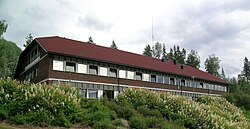
Flesberg Council Offices at Lampeland
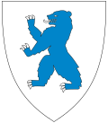
Norway Counties Buskerud Position.svg
Buskerud within Norway
NO 3334 Flesberg.svg
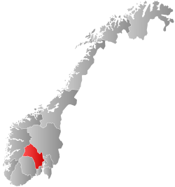
Flesberg within Buskerud
Coordinates: 59°50′52″N9°28′56″E / 59.84778°N 9.48222°E / 59.84778; 9.48222
Country Norway
County Buskerud
District Numedal
Administrative centre Lampeland
Government
  Mayor (2003)Egil Langgård (Ap)
Area
  Total
562 km2 (217 sq mi)
  Land538 km2 (208 sq mi)
  Rank#190 in Norway
Population
 (2004)
  Total
2,512
  Rank#302 in Norway
  Density5/km2 (13/sq mi)
  Change (10 years)
Increase2.svg +0.2%
Demonym Flesberging [1]
Official language
[2]
   Norwegian form Bokmål
Time zone UTC+01:00 (CET)
  Summer (DST) UTC+02:00 (CEST)
ISO 3166 code NO-3334 [3]
Website Official website

Flesberg is a municipality in Buskerud county, Norway. It is part of the traditional region of Numedal. The administrative centre of the municipality is the village of Lampeland.

Contents

The economy of Flesberg is dominated by forestry and agriculture, as well as the cluster of high-tech industries in neighbouring Kongsberg.

General information

Etymology

The municipality (originally the parish) is named after the old Flesberg farm (Old Norse: Flesberg), since the first church was built here. The first element is fles which means "rock" and the last element is berg which means "mountain". [4]

Coat-of-arms

The coat-of-arms is from modern times. They were granted on 10 March 1989. The arms show two tømmerklaver to represent forestry – and also the letter F. [5]

History

Flesberg Stave Church Flesberg stave church.jpg
Flesberg Stave Church

Flesberg Stave Church was built around the year 1250. After reconstruction in 1735, the church conformed with cruciform plan. The municipality of Flesberg was established on 1 January 1838 (see formannskapsdistrikt). The area of Jondalen was transferred from Flesberg to the neighboring municipality of Kongsberg on 1 January 1964. [6]

Geography

The municipality is divided into the parishes Flesberg, Lyngdal, and Svene. Most of the population lives in the four villages of Svene, Lampeland, Flesberg, and Lyngdal. The municipal area is 560 square kilometres (220 mi2). In the western part of Flesberg, the landscape rises steeply to the mountain area of Blefjell, a popular tourist destination.

Demographics

Number of minorities (1st and 2nd generation) in Flesberg by country of origin in 2017 [7]
AncestryNumber
Flag of Lithuania.svg Lithuania 49
Flag of Somalia.svg Somalia 46
Flag of Poland.svg Poland 35
Flag of Eritrea.svg Eritrea 34
Flag of Latvia.svg Latvia 16

Notable people

Sister cities

The following cities are twinned with Flesberg: [8]

References

  1. "Navn på steder og personer: Innbyggjarnamn" (in Norwegian). Språkrådet.
  2. "Forskrift om målvedtak i kommunar og fylkeskommunar" (in Norwegian). Lovdata.no.
  3. Bolstad, Erik; Thorsnæs, Geir, eds. (9 January 2024). "Kommunenummer". Store norske leksikon (in Norwegian). Foreningen Store norske leksikon.
  4. Haugen, Einar (1967) Norwegian-English Dictionary (University of Wisconsin Press) ISBN   978-0-299-03874-8
  5. "Aktuelt" (in Norwegian). Flesberg kommune. Archived from the original on 1 May 2010. Retrieved 6 January 2009.
  6. "Flesberg stavkirke". Kunsthistorie. Retrieved 1 October 2017.
  7. "Immigrants and Norwegian-born to immigrant parents, by immigration category, country background and percentages of the population". ssb.no. Archived from the original on 2 July 2015. Retrieved 29 July 2017.
  8. "Flesbergs vennskapskommuner" (in Norwegian). Flesberg kommune. Retrieved 6 January 2009.[ permanent dead link ]