Flooding in Jakarta

Last updated
Flood in Central Jakarta, 2013 VOA A car tries to drive through Jakarta's flooded streets.jpg
Flood in Central Jakarta, 2013

Flooding in Jakarta occurs on the northwest coast of Java, at the mouth of the Ciliwung River on Jakarta Bay, which is an inlet of the Java Sea and has happened recently in 1996, 2002, 2007, 2013, and 2020. Sections of Jakarta are constantly flooded now. [1]

Contents

Jakarta geography

Population density and height above sea level in Jakarta (2010). Urban-Rural Population and Land Area Estimates, v2, 2010 Jakarta, Indonesia (13873745385).jpg
Population density and height above sea level in Jakarta (2010).

The area of the Jakarta Special District is 662 km2 of land area and 6,977 km2 of sea area. [2]

Jakarta lies in a low, flat basin, averaging 7 metres (23 ft) above sea level;[ citation needed ] 40% of Jakarta, particularly the northern areas, is below sea level, [3] while the southern parts are comparatively hilly.

Rivers flow from the Puncak highlands to the south of the city, across the city northwards towards the Java Sea; the Ciliwung River, divides the city into the western and eastern principalities. Other rivers include the Pesanggrahan, and Sunter high sea tides.

Other contributing factors include clogged sewage pipes and waterways that service an increasing population, in addition to deforestation near rapidly urbanizing Bogor and Depok in Jakarta's hinterland.

Jakarta is an urban area with complex socio-economic problems that indirectly contribute to triggering a flood event. [4]

1960 floods

In February 1960, flooding occurred in the new suburb of Grogol. Despite the flood-proof planning of Grogol suburb, the area was flooded to knee and waist height. This was the first crisis for Governor Soemarno who was installed only days before the floods began. [5]

1996 floods

Major floods occurred in 1996 [6] [7] when 5,000 hectares of land were flooded. [8]

2007 floods

See also 2007 Jakarta flood

Major floods also occurred in 2007. [9] Losses from infrastructure damage and state revenue were at least 5.2 trillion rupiah (572 million US dollars) and at least 190,000 people have fallen ill due flood related illnesses. Approximately 70% of Jakarta's total area was flooded with water up to four meters deep in parts of the city. [10] [11] 80 people were killed in the floods.

2013 floods

A car tries to drive through Jakarta's flooded streets, Indonesia, January 17, 2013. VOA A car tries to drive through Jakarta's flooded streets.jpg
A car tries to drive through Jakarta's flooded streets, Indonesia, January 17, 2013.

On January 15, 2013, a serious flood affected downtown Jakarta, as well as several other areas surrounding the city, such as West Java and Banten, as a result of heavy rain and waterways clogged with garbage and other kinds of debris. A 30-meter-long section of Jakarta's West Flood Canal dike on Jalan Johannes Latuharhary in Menteng collapsed, which quickly caused flooding in nearby areas. Military personnel, the Jakarta public works agency, and public order officers joined forces to quickly replace the collapsed dike section with a temporary retaining wall made of rocks and sandbags. Workers finished rebuilding a section of a canal dike. [12] Flooding was reported at the presidential palace, forcing the postponement of a meeting between President Susilo Bambang Yudhoyono and his visiting Argentine counterpart, Cristina Fernandez. [13] There were 47 deaths being reported. [14] Evacuations were carried out in parts of Jakarta. An estimated 20,000 people were evacuated as of 17 January 2013 [15] [16]

2020 floods

See also 2020 Jakarta floods

Floods occurred throughout Jakarta, Bogor, Tangerang, and Bekasi on the early hours of January 1, 2020, due to the overnight rain which dumped nearly 15 inches of rainwater — more than 3 times the average amount. [17] The massive downpour caused the Ciliwung and Cisadane river to overflow. [18] Multiple floodgates were assigned emergency status due to the high water levels after the rainfall. [19]

At least 48 deaths had been reported, due to landslides, hypothermia, drowning, and electrocution. [20] [21] Many parts of the city had been left without power, as the power was switched off for safety reasons. [22] [23]

Multiple transportation networks were disrupted including light rail transit, [24] taxis, [25] [26] trains, [27] toll roads, [28] and an airport. [29] Sukarno-Hatta Airport and the Mass Rapid Transit lines were operating as per normal. [30] [31]

Halim Perdanakusuma Airport was closed early in the morning due to the airport runways being submerged. Air traffic was temporarily redirected to Sukarno-Hatta Airport. [29] Halim Perdanakusuma was reopened a couple of hours later.

From 6pm on January 1 until 12pm on January 2, 2020, the government temporarily waived all toll road fees in Jakarta. [32]

At many parts of the city, water levels reached 30 to 200 cm. At some places, such as Cipinang Melayu, East Jakarta, water levels peaked at 4 meters. [33] More than 19,000 residents had been evacuated to higher grounds. The government had designated schools and government buildings as temporary shelters. [34] In several areas, evacuation efforts were hampered by rushing waters and blackouts. [35] [36]

On 25 February 2020, Jakarta witnessed another flood. [37]

Pollution issues

In May 2011, the Jakarta Environmental Management Agency categorized all rivers in Jakarta as polluted; 71% of them were heavily polluted, 20% were partly polluted and 9% were lightly polluted. [38]

Remedies

Flood canals

East Flood Canal (Banjir Kanal Timur, BKT) in eastern Jakarta was a national project which began in 2003 and late 2009 reached the Java sea and will be accomplished in 2011. It was 23.5 kilometers length which linking five rivers: Cipinang, Sunter, Buaran, Jati Kramat and Cakung. It will reduce flood and hope as a 2 kilometers rowing sport venue too. [39] To ease from flood, Jakarta Emergency Dredging Initiative (JEDI) phase-2 will make underground canal (siphon) from Ciliwung river to Cipinang river and then go through to East Flood Canal. It will lower floods at Cawang, Kampung Melayu, Bukit Duri and Kebun Baru. The length is one kilometer and is finished in 2016. [40]

Using participatory mapping for disaster preparedness in Jakarta

For managing risk effectively, it needs extensive data for making decisions on investments in preparedness, mitigation, and response. Until recently, detailed information on disaster situation (flooding) was hardly available at local level. A pilot project in Jakarta, led by the Province of Jakarta's Disaster Management Agency collected high-resolution data to inform flood preparedness and contingency. Later, the data, which was accessible by the community and the general public, was used in 2011/2012 Jakarta contingency emergency planning exercise. The risk information it produced was very useful for decision makers in preparedness, development and investment planning. [41] Petabencana.id can now be consulted and it contains a flood map. [42] [43] Some additional info may be found at OpenStreetMap. It is an online, open-source platform, which relies on participatory mapping conducted by local communities, private and public actors who collect the detailed information about a given area and share it, meet the needs in disaster situation.

Continuing issues

Jakarta sinking

Alongside flooding from rivers, Jakarta is also sinking about 5 to 10 centimeters each year and up to 20 centimeters in northern Jakarta mainland. From 2000 to 2050, the potential coastal flood extent is estimated to increase by 110.5 km2 due to both land subsidence and sea level rise. [44] Land subsidence in Jakarta is mainly caused by the overuse of groundwater. [45] At the same time, the groundwater has lost its capacity to recharge due to the lack of watershed areas and overpopulation in the capital. Without any groundwater regulation in place, buildings in Jakarta are drawing water from the ground at an unprecedented rate. For households, especially those at the bottom of the economic pyramid, access to piped water is considered a luxury. Not only must the customer pay for the tariff, which is higher than other Indonesian cities, [46] the installment fees often burden the poor households to connect to the tap.

In addition, residents consider piped water (and to some extent groundwater) quality in Jakarta to be of poor quality, thus explaining why only 28 percent of Jakarta households drink piped water and groundwater compared to 95 percent in 2000. [47] It is important to note that apart from drinking, people in Jakarta still use groundwater, and to some extent piped water and wended water. [48] Such hydrological behaviour has led to the overuse of groundwater, thus contributing to the land subsidence.

In an effort to solve the problem, the Netherlands will give $4 million for a feasibility study to build a dike on Jakarta Bay. The ring dike will be provided with pumping system and retention area, would regulate and control seawater and would also be used as an additional toll road. The project will be built by 2025. [49] Construction of an 8 km sea wall along the coast was officially launched on October 9, 2014. [50]

See also

Related Research Articles

Ciliwung river in Indonesia

Ci Liwung is a 119 km long river in the northwestern region of Java where it flows through two provinces, West Java and the special region of Jakarta. The natural estuary of the Ciliwung river, known as the Kali Besar, was an important strategic point for trade in the precolonial and colonial periods and was instrumental in the founding of the port city of Jakarta, but has been lost from reorganization of the watercourse of the rivers around the area into canals.

Gambir, Jakarta kelurahan of Indonesia

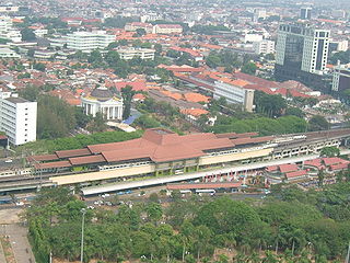
Gambir is a district of Central Jakarta, Indonesia. It is characterized by many historic buildings from the colonial era. Gambir District is the location of many political and administrative center of Jakarta and Indonesia. The Merdeka Palace, the National Museum, the headquarters of the Indonesian Scout Movement and the Merdeka Square are located in Gambir.

Kelapa Gading District in Special Capital City District of Jakarta, Indonesia

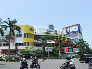
Kelapa Gading or also known as KG, Gading', is a district of North Jakarta, Jakarta, Indonesia. Kelapa Gading neighborhood is known to the local populates as a city within a city, due to the integrated residential-commercial planning, and the supporting facilities.

2013 Jakarta flood

The 2013 Jakarta flood was a flood in Jakarta, the capital of Indonesia, which, in addition to areas in downtown Jakarta, also affected several other areas surrounding the city, such as West Java and Banten.

Jakarta Flood Canal

The Jakarta Flood Canal refers to two canals that divert floods from rivers around Jakarta instead of going through the city. This first flood control channel was designed by Hendrik van Breen, engineer at the Burgelijke Openbare Werken or BOW, after a big flood hit the city on 13 February 1918.

Batavia Castle VOC fort in Jakarta

Batavia Castle was a fort located at the mouth of Ciliwung River in Jakarta. Batavia Castle was the administrative center of Dutch East India Company in Asia.

2017 Jakarta gubernatorial election

Two rounds of a gubernatorial election were held in Jakarta as part of the 2017 simultaneous elections on 15 February and 19 April 2017 to elect the Governor of Jakarta to a five-year term. Incumbent governor Basuki Tjahaja Purnama, popularly referred to as "Ahok", and his deputy Djarot Saiful Hidayat were running for re-election to a second term. Basuki, who inherited his current position from his running mate Joko Widodo when he won the 2014 Indonesian presidential election, would have become the first elected Chinese-Christian governor of Jakarta had he won.

Mookervaart River

Mookervaart River is a canal connecting the Cisadane River in Tangerang and Kali Angke in Jakarta. Constructed from 1678 to 1689, this 25-30 meter wide channel is one of the important flood control water channels in Jakarta.

Pesanggrahan River river in Indonesia

Pesanggrahan River is a river with the upstream in the Bogor Regency, flowing through the cities of Depok, Jakarta and Tangerang, Banten. The river passes the districts of Tanah Sereal, Bojong Gede, Sawangan, Limo, Kebayoran Lama, Pesanggrahan, Kembangan, and Kebun Jeruk before flowing into the Cengkareng Drain. Based on the 2005 data, 55 percent watershed area of Pesanggrahan River is occupied by housing, only 7 percent is still forests, 20 percent rice fields, and 13 percent other agriculture fields.

Krukut River river in Indonesia

Krukut River is a river flowing in Jakarta originating in Bogor Regency. In the past the river was clean and one of the tourist attractions during the Dutch East Indies administration, but due to denser housing on the banks and lack of maintenance, the water turned dark and filled with trash, causing routine flooding in rainy seasons.

Jatikramat River river in Indonesia

Jatikramat River is a river in the Bekasi, West Java and eastern part of the Special Capital Region of Jakarta, Indonesia. The lower portions of the original river have been channelized and directed into the eastern flood canal, "Banjir Kanal Timur", which continues to flow to the Java Sea in the district of Marunda, Cilincing, North Jakarta. The river regularly causes flooding in the city of Bekasi and Jakarta.

Cakung River river in Indonesia

Cakung River is a river in the Bekasi, West Java and eastern part of the Special Capital Region of Jakarta, Indonesia. The lower portions of the original river have been channelized and directed into the eastern flood canal, "Banjir Kanal Timur", which continues to flow to the Java Sea in the district of Marunda, Cilincing, North Jakarta. The river regularly causes flooding in the city of Bekasi and Jakarta.

Buaran River river in Indonesia

Buaran River is a river flowing in the Bekasi, West Java and eastern part of the Special Capital Region of Jakarta, Indonesia. The lower portions of the original river have been channelized and directed into the eastern flood canal, "Banjir Kanal Timur", which continues to flow to the Java Sea in the district of Marunda, Cilincing, North Jakarta. The river regularly causes flooding in the city of Bekasi and Jakarta.

Cipinang River river in Indonesia

The Cipinang River is a river flowing in the Special Capital Region of Jakarta, Indonesia. Cipinang river is a tributary of Sunter River, conjoining near I Gusti Ngurah Rai Street and Cipinang Muara Ilir Street, Jakarta, but in the middle it is cut by the beginning of Banjir Kanal Timur, near Cipinang Besar Selatan Street dan IPN Street, Jakarta. The river flows mainly in the district of Makassar, East Jakarta, with many houses built on both banks.

Baru Timur River river in Jakarta, Indonesia - Geonames ID = 1649957

Baru Timur River is a man-made canal flowing from Ci Liwung in Bogor Regency to Jakarta, Indonesia. It was one of two canals built in the 18th century under the order of the Governor-General Gustaaf Willem van Imhoff originally to transport agriculture harvest from Bogor to Batavia. Currently both canals, now known as Kali Baru Timur and Kali Baru Barat, are among the main rivers in Jakarta, and part of the Ciliwung Cisadane flood control project. Baru Timur River flows from Katulampa flood gate, built at the same time as the canal, along the major road Bogor Highway, passing Cimanggis, Depok, Cilangkap, until reaching Java Sea in Kali Besar, Tanjung Priok, North Jakarta.

Baru Barat River river in Jakarta, Indonesia

Baru Barat River is a man-made canal flowing from Cisadane River in Bogor Regency to Jakarta, Indonesia. It was one of two canals built in the 18th century under the order of the Governor-General Gustaaf Willem van Imhoff originally to transport agriculture harvest from Bogor to Batavia. Currently both canals, now known as Kali Baru Timur and Kali Baru Barat, are among the main rivers in Jakarta, and part of the Ciliwung Cisadane flood control project. Flowing through the areas of Pancoran and Tebet, South Jakarta, among others, Baru Barat River is one of the drainages that flow the water into Banjir Kanal Barat.

2019 South Sulawesi floods

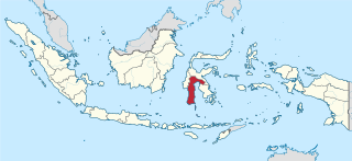
On 22 January 2019, floods caused by heavy rainfall struck the Indonesian province of South Sulawesi. At least 68 people were killed and thousands were displaced. Gowa Regency was particularly hard-hit, experiencing the majority of the fatalities.

Cyclone Savannah A strong tropical cyclone which affected Java, Bali, Christmas Island and the Cocos (Keeling) Islands during March 2019.

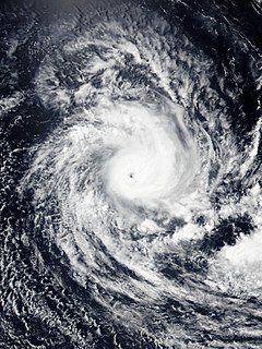
Cyclone Savannah was a strong tropical cyclone that brought significant impacts to Java and Bali and minor impacts to Christmas Island and the Cocos (Keeling) Islands during March 2019. It was the sixteenth tropical low, sixth tropical cyclone and third severe tropical cyclone of the 2018–19 Australian region cyclone season. Savannah developed from a tropical low that formed well to the east of Christmas Island on 8 March. The system was slow to develop initially, but reached tropical cyclone intensity on 13 March after adopting a southwesterly track. Savannah underwent rapid intensification and reached peak intensity on 17 March as a Category 4 severe tropical cyclone on the Australian scale. Ten-minute sustained winds were estimated as 175 km/h (110 mph), with a central barometric pressure of 951 hPa (28.08 inHg). One-minute sustained winds reached 185 km/h (115 mph) at this time, equivalent to a Category 3 major hurricane on the Saffir-Simpson hurricane wind scale. Weakening commenced soon afterwards, and responsibility for the system passed from the Australian Bureau of Meteorology to Météo-France. As it moved into the new region, Savannah became the eighth of a record-breaking ten intense tropical cyclones in the 2018–19 South-West Indian Ocean cyclone season. Savannah was downgraded to a tropical depression on 20 March, and its remnants dissipated in the central Indian Ocean on 24 March.

2020 Jakarta floods 2020 flash flooding in Jakarta

Flash floods occurred throughout the Indonesian capital of Jakarta and its metropolitan area on the early hours of 1 January 2020, due to the overnight rain which dumped nearly 400 millimetres (15 in) of rainwater, causing the Ciliwung and Cisadane rivers to overflow. At least 66 people have been killed, and 60,000 displaced in the worst flooding in the area since 2007.

References

  1. See petabencana flood maps
  2. Based on Governor Decree in 2007, No. 171. taken from Statistics DKI Jakarta Provincial Office, Jakarta in Figures, 2008, BPS, Province of DKI Jakarta
  3. "The Tides: Efforts Never End to Repel an Invading Sea". Jakarta Globe. Archived from the original on 17 November 2015. Retrieved 15 November 2015.
  4. "Key to Jakarta's floods: Basin flood management". The Jakarta Post. 22 March 2008. Retrieved 14 March 2011.
  5. Merrillees 2015, p. 17.
  6. "Asian News". Asiaviews. Archived from the original on 1 February 2013. Retrieved 27 April 2010.
  7. "Floods in DKI Jakarta Province, updated 19 February 2007 Emergency Situation Report No. 6". ReliefWeb. 19 February 2007.
  8. "1996 Global Register of Major Flood Events". Dartmouth Flood Observatory. Dartmouth College.
  9. "Asia". Bloomberg. 4 February 2007. Retrieved 27 April 2010.
  10. Jakarta Flood Feb 2007 « (Geo) Information for All
  11. 2007 Global Register of Major Flood Events, Dartmouth Flood Observatory, 1 May 2008
  12. Siregar, Hotman (19 January 2013). "Floods Recede in Central Jakarta, as Damaged Dike Repaired". Jakarta Globe. Archived from the original on 16 February 2013. Retrieved 19 January 2013.
  13. Jensen, Fergus; Rieka Rahadiana (2013-01-17). "Floods paralyze Indonesian capital, heavy rains continue". Reuters. Retrieved 2013-01-17.
  14. "Daftar Korban Meninggal Banjir 2013". BPBD Jakarta. Archived from the original on 3 May 2013. Retrieved 1 April 2013.
  15. "Evacuations as Jakarta floods". The Sydney Morning Herald.
  16. "Thousands evacuated amid Jakarta floods - Asia-Pacific". Al Jazeera English. Retrieved 2014-01-20.
  17. "New Year's Eve flooding kills nine, displaces thousands in Jakarta". UPI. Retrieved 2020-01-01.
  18. "9 dead, thousands caught in flooding in Indonesia's capital". ABC News. Retrieved 2020-01-01.
  19. Afifa, Laila (2020-01-01). "New Year; Jakarta Braces for Flood as Rain Pours since Evening". Tempo. Retrieved 2020-01-01.
  20. Post, The Jakarta. "[UPDATED] Multiple deaths reported as floods, landslides strike Greater Jakarta". The Jakarta Post. Retrieved 2020-01-01.
  21. "9 dead after Indonesian capital hit by New Year flooding". CNA. Retrieved 2020-01-01.
  22. "9 dead, thousands caught in flooding in Indonesia's capital". AP NEWS. 2020-01-01. Retrieved 2020-01-01.
  23. Afifa, Laila (2020-01-01). "Jakarta Flooding; PLN Turns Off Electricity in 700 Areas". Tempo. Retrieved 2020-01-01.
  24. detikcom, Tim. "Banjir, Sejumlah Perjalanan KRL Terganggu". detiknews. Retrieved 2020-01-01.
  25. Liputan6.com (2020-01-01). "Pul Taksi Terendam Banjir, Manajemen Blue Bird Fokus Evakuasi dan Data Kerusakan". liputan6.com (in Indonesian). Retrieved 2020-01-01.
  26. Media, Kompas Cyber. "Banjir di Pool Taksi Bluebird Kramat Jati dan Puri Indah, Mobil Terendam Sampai Atap". KOMPAS.com (in Indonesian). Retrieved 2020-01-01.
  27. Media, Kompas Cyber. "Berikut Perincian Kereta Jarak Jauh yang Terganggu akibat Banjir Jakarta". KOMPAS.com (in Indonesian). Retrieved 2020-01-01.
  28. Media, Kompas Cyber. "5 Tol yang Sempat Tergenang Banjir di Awal Tahun 2020". KOMPAS.com (in Indonesian). Retrieved 2020-01-01.
  29. 1 2 Afifa, Laila (2020-01-01). "Flooding; Halim Perdanakusuma Airport Runway Closed". Tempo. Retrieved 2020-01-01.
  30. Liputan6.com (2020-01-01). "MRT Beroperasi Normal, LRT Setop Sementara Gara-gara Banjir di Jakarta". liputan6.com (in Indonesian). Retrieved 2020-01-01.
  31. "Banjir Jakarta, Bandara Soekarno Hatta Beroperasi Normal". nasional. Retrieved 2020-01-01.
  32. Media, Kompas Cyber. "Banjir di Jakarta, Jalan Tol Dalam Kota Gratis Selama 18 Jam". KOMPAS.com (in Indonesian). Retrieved 2020-01-01.
  33. "Banjir Jakarta dan sekitarnya: Sembilan meninggal, lebih dari 19.000 warga ibu kota mengungsi". 2020-01-01. Retrieved 2020-01-01.
  34. "Bloomberg – Are you a robot?". www.bloomberg.com. Retrieved 2020-01-01.
  35. Media, Kompas Cyber. "Arus Deras Jadi Kendala Evakuasi di Cipinang Melayu". KOMPAS.com (in Indonesian). Retrieved 2020-01-01.
  36. Media, Kompas Cyber. "Listrik Mati Total di Jatimulya Bekasi, Sulitkan Proses Evakuasi". KOMPAS.com (in Indonesian). Retrieved 2020-01-01.
  37. Orecchio-Egresitz, Haven. "Flooding in Jakarta is so bad the government is planning to move the city 100 miles away. Here are photos of the devastation". Insider. Retrieved 2020-02-26.
  38. Jakartans lament the sorry state of the capital’s rivers. The Jakarta Post, Jakarta. May 20, 2011
  39. Minister: Jakarta East Flood Canal accomplished in 2011. Waspada.co.id (30 November 2010). Retrieved 12 June 2011.
  40. :: Wartakotalive.com | Berita : Kali Ciliwung Disodet Archived 2012-03-26 at the Wayback Machine . Wartakota.co.id (14 April 2010). Retrieved 12 June 2011.
  41. (PDF) https://www.gfdrr.org/sites/gfdrr/files/publication/Pillar_1_Using_Participatory_Mapping_for_Disaster_Preparedness_in_Jakarta_OSM.pdf.Missing or empty |title= (help)
  42. Petabencana.id
  43. Riskmap
  44. Takagi, Hiroshi; Esteban, Miguel; Mikami, Takahito; Fujii, Daisuke (2016-09-27). "Projection of coastal floods in 2050 Jakarta". Urban Climate. Elsevier. 17: 135–145. doi:10.1016/j.uclim.2016.05.003.
  45. Onodera, S., Saito, M., Sawano, M., Hosono, T., Taniguchi, M., Shimada, J., Umezawa, Y., Lubis, R.F., Buapeng, S., Delinom, R.2008. “Effects of intensive urbanization on the intrusion of shallow groundwater into deep groundwater: Examples from Bangkok and Jakarta”. Science of the Total Environment. 404(2-3). 401-410. https://doi.org/10.1016/j.scitotenv.2008.08.003
  46. Zamzami, Irfan, and Nila Ardhianie. “An End to the Struggle? Jakarta Residents Reclaim Their Water System.” In Our Public Water Future: The Global Experience with Remunicipalisation, 40–49. Amsterdam: Transnational Institute (TNI), 2015. https://www.ft.dk/samling/20151/almdel/efk/nilag/408/1667841.pdf.
  47. Indonesia Statistical Agency. “Water Supply Statistics DKI Jakarta 2013–2015.” Indonesia Statistical Agency, July 25, 2017. https://jakarta.bps.go.id/publication/2017/07/25/afe14bedf87387ac239cebb8/statistik-air-bersih-dki-jakarta-2013-2015.
  48. Ismowati, M. “Profile of Pam Jaya and Private Partners in Clean Water Supply Jakartan (Case Study Year 1998–2012).” KnE Social Sciences, August 29, 2018, 481–93. https://doi.org/10.18502/kss.v3i10.2928.
  49. "Dutch to study new dike for Jakarta Bay". The Jakarta Post. 2011-07-27. Retrieved 2014-01-20.
  50. Kusuma, Adriana Nina (9 October 2014). "Indonesia Holds Groundbreaking Ceremony for Giant Sea Wall". The Jakarta Globe. Archived from the original on 10 October 2014. Retrieved 10 October 2014.

Cited works