"},"established":{"wt":"[[1945 Florida State Road renumbering|1945 renumbering]] ([[wikisource:1945 Florida State Road renumbering|definition]])"},"direction_a":{"wt":"South"},"terminus_a":{"wt":"{{jct|state=FL|US|92}}in [[Lakeland,FL|Lakeland]]"},"junction":{"wt":"{{jct|state=FL|I|4}}in Lakeland
{{jct|state=FL|SR|559}}in [[Polk City,FL|Polk City]]"},"direction_b":{"wt":"North"},"terminus_b":{"wt":"{{jct|state=FL|SR|50}}in [[Mascotte,FL|Mascotte]]"},"counties":{"wt":"[[Polk County,Florida|Polk]],[[Lake County,Florida|Lake]]"},"previous_type":{"wt":"SR"},"previous_route":{"wt":"31"},"next_type":{"wt":"SR"},"next_route":{"wt":"35"}},"i":0}}]}" id="mwBA">.mw-parser-output .hlist dl,.mw-parser-output .hlist ol,.mw-parser-output .hlist ul{margin:0;padding:0}.mw-parser-output .hlist dd,.mw-parser-output .hlist dt,.mw-parser-output .hlist li{margin:0;display:inline}.mw-parser-output .hlist.inline,.mw-parser-output .hlist.inline dl,.mw-parser-output .hlist.inline ol,.mw-parser-output .hlist.inline ul,.mw-parser-output .hlist dl dl,.mw-parser-output .hlist dl ol,.mw-parser-output .hlist dl ul,.mw-parser-output .hlist ol dl,.mw-parser-output .hlist ol ol,.mw-parser-output .hlist ol ul,.mw-parser-output .hlist ul dl,.mw-parser-output .hlist ul ol,.mw-parser-output .hlist ul ul{display:inline}.mw-parser-output .hlist .mw-empty-li{display:none}.mw-parser-output .hlist dt::after{content:":"}.mw-parser-output .hlist dd::after,.mw-parser-output .hlist li::after{content:" ·";font-weight:bold}.mw-parser-output .hlist dd:last-child::after,.mw-parser-output .hlist dt:last-child::after,.mw-parser-output .hlist li:last-child::after{content:none}.mw-parser-output .hlist dd dd:first-child::before,.mw-parser-output .hlist dd dt:first-child::before,.mw-parser-output .hlist dd li:first-child::before,.mw-parser-output .hlist dt dd:first-child::before,.mw-parser-output .hlist dt dt:first-child::before,.mw-parser-output .hlist dt li:first-child::before,.mw-parser-output .hlist li dd:first-child::before,.mw-parser-output .hlist li dt:first-child::before,.mw-parser-output .hlist li li:first-child::before{content:" (";font-weight:normal}.mw-parser-output .hlist dd dd:last-child::after,.mw-parser-output .hlist dd dt:last-child::after,.mw-parser-output .hlist dd li:last-child::after,.mw-parser-output .hlist dt dd:last-child::after,.mw-parser-output .hlist dt dt:last-child::after,.mw-parser-output .hlist dt li:last-child::after,.mw-parser-output .hlist li dd:last-child::after,.mw-parser-output .hlist li dt:last-child::after,.mw-parser-output .hlist li li:last-child::after{content:")";font-weight:normal}.mw-parser-output .hlist ol{counter-reset:listitem}.mw-parser-output .hlist ol>li{counter-increment:listitem}.mw-parser-output .hlist ol>li::before{content:" "counter(listitem)"\a0 "}.mw-parser-output .hlist dd ol>li:first-child::before,.mw-parser-output .hlist dt ol>li:first-child::before,.mw-parser-output .hlist li ol>li:first-child::before{content:" ("counter(listitem)"\a0 "}
SR 33 in red, CR 33 in blue | ||||
Route information | ||||
Maintained by FDOT | ||||
Length | 42.687 mi [1] (68.698 km) | |||
Existed | 1945 renumbering (definition)–present | |||
Major junctions | ||||
South end | ![]() | |||
![]() ![]() | ||||
North end | ![]() | |||
Location | ||||
Country | United States | |||
State | Florida | |||
Counties | Polk, Lake | |||
Highway system | ||||
|
State Road 33 (SR 33) is a state highway running through Lake and Polk counties in the U.S. state of Florida.
State Road 33 begins in Lakeland off U.S. Route 92 (US 92) east of the intersection with US 98 and heads north along the vicinity of the west bank of Lake Parker. North of there it curves to the northeast and has one of two interchanges with Interstate 4 (I-4). The first interchange (Exit 33) provides westbound access via North Socrum Loop Road (CR 582), and eastbound access directly to SR 33. The route turns more to the east away from I-4, until it curves north at the northern terminus of Florida State Road 659. It has an encounter at the second interchange with I-4 (Exit 38) where it actually crosses under the interstate. The road continues northeast to Polk City where it curves back towards the north at a bridge over a former Seaboard Air Line Railroad line (now the Auburndale TECO Trail and General James A. Van Fleet State Trail) just at the northwestern coast of Lake Agnes. From there, it traverses through mostly rural farmland into Lake County and Groveland. In Groveland, it intersects and begins a 3 miles (4.8 km) concurrency with SR 50, up to Mascotte. Now a county road, CR 33 continues through another 10 miles (16 km) or so of rural farmland, passes over Florida's Turnpike, then has a brief overlap with Lake County Road 48 in Okahumpka, which terminates at the eastern terminus of CR 470, while CR 48 head to Howey-in-the-Hills. Lake CR 33 itself ends on US 27 just south of the bridge over Helena Run, a waterway between Lake Denham and Lake Harris.
The current Florida State Road 33 was established during the great renumbering of 1945, after the original SR 33 was replaced by Florida State Road 85 between Fort Walton Beach and Crestview in Okaloosa County. The route originally began at began at U.S. Route 92 (later U.S. Business Route 92, and currently unmarked State Road 600) in Lakeland, Florida and ended at Florida State Road 44 west of the merge with U.S. Route 441 in Leesburg, Florida. It was rerouted in Lakeland from Iowa Avenue one block west to Massachusetts Avenue in the 1970's, with a connecting road between East First Street and north of Bon Aire Street. Some Google Street View images still mistakenly show Iowa Avenue as being part of SR 33. [2] [3] South of the current US 92, SR 33 became a city street within Lakeland, though some traces of Massachusetts Avenue's status as part of SR 33 can still be found in the city, mainly on railroad signal boxes at the crossing of the CSX Carters Subdivision. [4]
North of SR 50 in Mascotte, the road was downgraded to a county road.[ when? ] North of U.S. Route 27 in Okahumpka, the route was extended in a hidden overlap with US 27 and hidden SR 25 until it branched off at Dixie Avenue in Leesburg. The US 27/SRs 25-33 bridge over Lake Harris contained a roadside park, which was later converted into the Leesburg Fishing Area. [5] [6] This segment was eliminated as part of the realignment of SR 44 in Leesburg during the mid-1980's, and the county portion has been truncated at US 27 in Okahumpka ever since.
County | Location | mi [1] | km | Destinations | Notes |
---|---|---|---|---|---|
Polk | Lakeland | 0.000 | 0.000 | ![]() | |
2.931 | 4.717 | ![]() ![]() ![]() ![]() ![]() | |||
3.572 | 5.749 | ![]() ![]() | I-4 exit 33 | ||
6.046 | 9.730 | ![]() ![]() | Former SR 33A, and CR 33A | ||
7.69 | 12.38 | ![]() | I-4 exit 38 | ||
Polk City | 13.503 | 21.731 | ![]() ![]() | Former SR 655 | |
13.702 | 22.051 | ![]() ![]() ![]() ![]() | |||
Polk–Lake county line | | Bridge over Withlacoochee River | |||
Lake | | 27.460 | 44.193 | ![]() ![]() | |
| 29.803 | 47.963 | ![]() ![]() | ||
| 36.547 | 58.817 | ![]() ![]() | ||
Groveland | 40.216 | 64.721 | ![]() ![]() | south end of SR 50 overlap; signage changes northbound from SR 33 to CR 33 | |
40.541 | 65.244 | ![]() ![]() ![]() ![]() ![]() | Southern terminus of SR 19 | ||
41.312 | 66.485 | ![]() ![]() | |||
Mascotte | 42.687 | 68.698 | ![]() ![]() | north end of SR 50 overlap and state maintenance | |
Leesburg | 54.1 [7] | 87.1 | ![]() ![]() | south end of CR 48 overlap | |
Okahumpka | 54.7 [7] | 88.0 | ![]() ![]() ![]() ![]() ![]() ![]() | north end of CR 48 overlap | |
| 56.049 | 90.202 | ![]() | ||
1.000 mi = 1.609 km; 1.000 km = 0.621 mi
|
Location | Eaton Park-Lakeland, Florida |
---|---|
Length | 7.625 mi (12.271 km) |
State Road 33A served as a suffixed alternate route for SR 33 from Eaton Park, Florida to the northern reaches of Lakeland, Florida. It began at US 98 in Eaton Park, ran north through Crystal Lake and Combee Settlement at US 92, and finally terminated at SR 33 south of Interstate 4. It is mainly known as South Combee Road south of Polk County Road 542 and North Combee Road north of CR 542. At some point in the 1980's, the route was downgraded into County Road 33A. Today it is designated as Florida State Road 659, though the old route number still shows up in many street name signs and on Google maps.
Lake County is a county in the central portion of the U.S. state of Florida. As of the 2020 census, the population was 383,956. Its county seat is Tavares, and its largest city is Clermont. Lake County is included in the Orlando–Kissimmee–Sanford Metropolitan Statistical Area.
U.S. Route 92 or U.S. Highway 92 is a 181-mile (291 km.) U.S. Route entirely in the U.S. state of Florida. The western terminus is at US 19 Alt. and SR 687 in downtown St. Petersburg. The eastern terminus is at SR A1A in Daytona Beach.
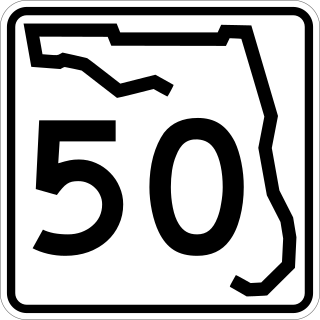
State Road 50 runs across the center of the U.S. state of Florida through Orlando, with its termini at SR 55 at Weeki Wachee and SR 5 in Titusville.
State Road 570 (SR 570), also known as the Polk Parkway, is a 24-mile (39 km) controlled-access toll road which runs through Polk County, Florida. It is operated as part of Florida's Turnpike Enterprise system of tolled freeways. The Polk Parkway mainly serves as a beltway around Lakeland forming a semicircle, which along with I-4 circumscribes most of the city limits of Lakeland.
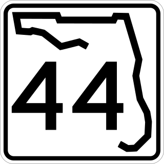
State Road 44 is an east–west state highway in the U.S. state of Florida. It runs from Crystal River on the Gulf of Mexico east to New Smyrna Beach on the Atlantic Ocean, passing through Inverness, Wildwood, Leesburg and DeLand.
State Road 48 (SR 48) was an east–west state highway that ran from U.S. Highway 41 in Floral City, Florida, to Florida State Road 19 in Howey-in-the-Hills, Florida. In the last years of the route's existence, it was a 2.167 miles (3.487 km) state road in Bushnell, Florida, which ran from Interstate 75 (I-75) at exit 314 to U.S. Highway 301 (US 301). Today, all segments are designated County Road 48 (CR 48), where they are under county maintenance. Segments in Sumter County are part of the Scenic Sumter Heritage Byway.
State Road 19 is a Florida State Road in Putnam, Marion, and Lake counties. It runs from Groveland to Palatka through Ocala National Forest. Along with SR 33, SR 19 provides a mostly rural north-south corridor through central Florida from Lakeland to Palatka.
U.S. Highway 17 (US 17) in Florida is a north–south United States Numbered Highway that runs 317 miles (510 km) from the Punta Gorda, Florida Metropolitan Statistical Area northeast to the Jacksonville metropolitan area.
U.S. Highway 27 (US 27) in Florida is a north–south United States Numbered Highway. It runs 496.352 miles (798.801 km) from the Miami metropolitan area northwest to the Tallahassee metropolitan area. Throughout the state, US 27 has been designated the Claude Pepper Memorial Highway by the Florida Legislature. It was named after long-time Florida statesperson Claude Pepper, who served in both the U.S. Senate and House of Representatives. The stretch running from Miami to South Bay was originally designated the Thomas E. Will Memorial Highway by the Florida Legislature in 1937 when that portion was known as State Road 26 (SR 26). Thomas E. Will, the founder of Okeelanta, had worked for almost 20 years to get the state to build a road from Miami to the area south of Lake Okeechobee. For most of its length in the state, US 27 is a divided highway.
U.S. Route 98 is a major east-west thoroughfare through the U.S. state of Florida. Spanning 670.959 miles (1,079.804 km), it connects Pensacola and the Alabama/Florida state line to the west with Palm Beach and the Atlantic coast in the east. It is the longest US road in Florida, as well as the longest US road in any state east of the Mississippi River.
U.S. Route 441 (US 441) in Florida is a north–south United States Highway. It runs 433 miles (697 km) from Miami in South Florida northwest to the Georgia state line, with the overall route continuing to Tennessee in the Rocky Top area.
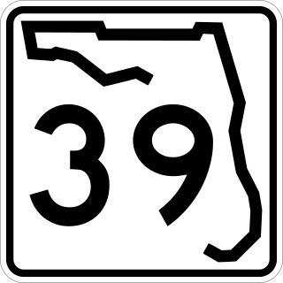
State Road 39 is a north–south state highway in eastern Pasco and Hillsborough County, Florida, United States. Between Plant City and Zephyrhills, the road is named Paul S. Buchman Highway. North of Zephyrhills, Florida the road is a secret state designation for U.S. Route 301 until the southern terminus of the concurrency with U.S. Route 98 south of Dade City, Florida.
State Road 540 (SR 540) is a west–east route in Central Florida, serving Polk County. It runs 19.2 miles (30.9 km) from the south side of the city of Lakeland to U.S. Route 27. SR 540 also runs along the entrance to Legoland Florida. It is a major route along the south side of Winter Haven, where it is known as Cypress Gardens Boulevard, and an important link between Winter Haven and Lakeland, the Polk Parkway, and subsequently Interstate 4 (I-4) and the Tampa Bay area.
State Road 539 is a 2.5-mile-long (4.0 km) northwest–southeast route in Lakeland. SR 539 is also known as Kathleen Road, and is one of the main routes connecting downtown Lakeland with Interstate 4 (I-4).
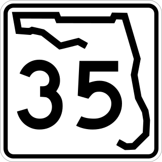
State Road 35 is a north–south state highway in the western counties of the U.S. state of Florida.
State Road 546 (SR 546) is a 5.837-mile-long (9.394 km) state highway in Lakeland, Polk County, Florida, that runs from Interstate 4 (I-4) to U.S. Route 92 (US 92) and SR 600. SR 546 is only signed for the first 1.731 miles (2.786 km), after which it is concurrent with US 92.
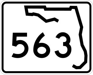
State Road 563 (SR 563) is a 4.912-mile-long (7.905 km) state highway in Lakeland, Polk County, Florida, that runs from 0.162 miles (0.261 km) south of Beaker Road to U.S. Route 92 and Martin Luther King Jr. Avenue.
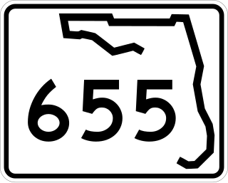
State Road 655 (SR 655) is a 7.125-mile-long (11.467 km) state highway in Polk County, Florida, that runs from U.S. Route 17 and County Road 655 at Eloise just south of Winter Haven city limits to U.S. Route 92 in western Auburndale.
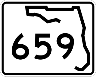
State Road 659 (SR 659) is a 7.625-mile-long (12.271 km) state highway in Polk County, Florida, that runs from U.S. Route 98 (US 98) and South Combee Road at Eaton Park to SR 33 and Village Lakes Boulevard in far northeast Lakeland via Crystal Lake and Combee Settlement.