"},"established":{"wt":""},"direction_a":{"wt":"South"},"terminus_a":{"wt":"{{jct|state=FL|US|41}}in [[Punta Gorda,Florida|Punta Gorda]]"},"junction":{"wt":""},"direction_b":{"wt":"North"},"terminus_b":{"wt":"{{Jct|state=FL|SR|40|CR|35|county2=Marion}}in [[Silver Springs,Florida|Silver Springs]]"},"counties":{"wt":"[[Charlotte County,Florida|Charlotte]],[[DeSoto County,Florida|DeSoto]],[[Hardee County,Florida|Hardee]],[[Polk County,Florida|Polk]],[[Pasco County,Florida|Pasco]],[[Hernando County,Florida|Hernando]],[[Sumter County,Florida|Sumter]],[[Marion County,Florida|Marion]]"},"previous_type":{"wt":"SR"},"previous_route":{"wt":"33"},"next_type":{"wt":"SR"},"next_route":{"wt":"37"}},"i":0}}]}" id="mwBA">.mw-parser-output .hlist dl,.mw-parser-output .hlist ol,.mw-parser-output .hlist ul{margin:0;padding:0}.mw-parser-output .hlist dd,.mw-parser-output .hlist dt,.mw-parser-output .hlist li{margin:0;display:inline}.mw-parser-output .hlist.inline,.mw-parser-output .hlist.inline dl,.mw-parser-output .hlist.inline ol,.mw-parser-output .hlist.inline ul,.mw-parser-output .hlist dl dl,.mw-parser-output .hlist dl ol,.mw-parser-output .hlist dl ul,.mw-parser-output .hlist ol dl,.mw-parser-output .hlist ol ol,.mw-parser-output .hlist ol ul,.mw-parser-output .hlist ul dl,.mw-parser-output .hlist ul ol,.mw-parser-output .hlist ul ul{display:inline}.mw-parser-output .hlist .mw-empty-li{display:none}.mw-parser-output .hlist dt::after{content:":"}.mw-parser-output .hlist dd::after,.mw-parser-output .hlist li::after{content:" ·";font-weight:bold}.mw-parser-output .hlist dd:last-child::after,.mw-parser-output .hlist dt:last-child::after,.mw-parser-output .hlist li:last-child::after{content:none}.mw-parser-output .hlist dd dd:first-child::before,.mw-parser-output .hlist dd dt:first-child::before,.mw-parser-output .hlist dd li:first-child::before,.mw-parser-output .hlist dt dd:first-child::before,.mw-parser-output .hlist dt dt:first-child::before,.mw-parser-output .hlist dt li:first-child::before,.mw-parser-output .hlist li dd:first-child::before,.mw-parser-output .hlist li dt:first-child::before,.mw-parser-output .hlist li li:first-child::before{content:" (";font-weight:normal}.mw-parser-output .hlist dd dd:last-child::after,.mw-parser-output .hlist dd dt:last-child::after,.mw-parser-output .hlist dd li:last-child::after,.mw-parser-output .hlist dt dd:last-child::after,.mw-parser-output .hlist dt dt:last-child::after,.mw-parser-output .hlist dt li:last-child::after,.mw-parser-output .hlist li dd:last-child::after,.mw-parser-output .hlist li dt:last-child::after,.mw-parser-output .hlist li li:last-child::after{content:")";font-weight:normal}.mw-parser-output .hlist ol{counter-reset:listitem}.mw-parser-output .hlist ol>li{counter-increment:listitem}.mw-parser-output .hlist ol>li::before{content:" "counter(listitem)"\a0 "}.mw-parser-output .hlist dd ol>li:first-child::before,.mw-parser-output .hlist dt ol>li:first-child::before,.mw-parser-output .hlist li ol>li:first-child::before{content:" ("counter(listitem)"\a0 "}
Route information | ||||
---|---|---|---|---|
Maintained by FDOT | ||||
Length | 179.218 mi [1] (288.423 km) | |||
Major junctions | ||||
South end | ![]() | |||
North end | ![]() ![]() | |||
Location | ||||
Country | United States | |||
State | Florida | |||
Counties | Charlotte, DeSoto, Hardee, Polk, Pasco, Hernando, Sumter, Marion | |||
Highway system | ||||
|
State Road 35 (SR 35) is a north–south state highway in the western counties of the U.S. state of Florida.
It is mainly signed as a hidden route along U.S. Highways:
In Bartow, SR 35 turns west and follows East Main Street, before turning north again on North Broadway Avenue, and rejoining US 98 again at SR 60 (Van Fleet Drive).
Evidence of SR 35's existence can be found in Hardee County, Florida along County Roads 35A & 35B in Coker, Wauchula, and Zolfo Springs. Polk County's evidence of SR 35's existence can be found with County Road 35A between Lakeland and Providence, and in Pasco County, Florida, evidence of SR 35's existence can be found with County Road 35 Alternate between Branchborough and Dade City. According to some maps, County Road 41 Alternate (Spring Valley Road) was previously known as CR 35B, and was extended to US 98-301 north of Dade City along Frazee Hill Road.
Within Belleview, the road is briefly co-signed with US 27-441 (SR 25-500) then turns right at the eastern terminus of CR 484, where it is signed independently along Southeast Hames Road, and then turns left again at Baseline Road, where it curves north as it leaves the city. While State Road 35 terminates at State Road 40 near the site of the former Wild Waters water park in Silver Springs, the road continues northward as County Road 35 through the intersection with State Road 326, passing through Indian Lake State Forest where it finally terminates at Northeast 90th Street Road and Northeast 97th Street Road.
County | Location | mi [1] | km | Destinations | Notes | ||
---|---|---|---|---|---|---|---|
Charlotte | Punta Gorda | 0.000 | 0.000 | ![]() ![]() | |||
0.184 | 0.296 | ![]() ![]() | |||||
see US 17 (mile 0.000-73.861) | |||||||
Polk | Bartow | 73.861 | 118.868 | ![]() ![]() ![]() ![]() ![]() ![]() ![]() | south end of US 17 / US 98 / SR 700 overlap; north end of state maintenance; former SR 60 Bus. east | ||
74.760 [2] | 120.315 | West Main Street - Mulberry | former SR 60 Bus. west | ||||
75.281 | 121.153 | ![]() ![]() ![]() ![]() ![]() | south end of US 98 / SR 700 overlap; south end of state maintenance | ||||
see US 98 (mile 490.421-478.720) | |||||||
Lakeland | 86.982 | 139.984 | ![]() ![]() ![]() ![]() | north end of US 98 overlap; north end of state maintenance; south end of SR 600 overlap | |||
87.777 [3] | 141.263 | ![]() ![]() ![]() ![]() | north end of SR 600 overlap; south end of state maintenance | ||||
88.159 | 141.878 | ![]() ![]() ![]() | south end of US 98 overlap | ||||
see US 98 (mile 477.900-452.349), US 301 (mile 83.074-85.208) | |||||||
Pasco | Dade City | 115.844 | 186.433 | ![]() ![]() ![]() ![]() | north end of US 98 / US 301 overlap; no left turn southbound | ||
115.918 | 186.552 | north end of state maintenance | |||||
116.5 [3] | 187.5 | ![]() ![]() ![]() | |||||
116.978 | 188.258 | south end of state maintenance | |||||
117.155 | 188.543 | ![]() ![]() ![]() ![]() | south end of US 98 / US 301 overlap | ||||
see US 301 (mile 86.810-138.030) | |||||||
Marion | Belleview | 168.375 | 270.973 | ![]() ![]() ![]() ![]() | |||
Gap in route | |||||||
0.000 | 0.000 | ![]() ![]() ![]() ![]() | |||||
| 5.450 | 8.771 | ![]() ![]() ![]() ![]() | ||||
| 9.176 | 14.767 | ![]() ![]() | ||||
Silver Springs | 10.843 | 17.450 | ![]() ![]() ![]() | ||||
1.000 mi = 1.609 km; 1.000 km = 0.621 mi
|
Location | Silver Springs |
---|
County Road 35 is a northern extension of SR 35. It begins at SR 35 & 40 in Silver Springs and continues north to make a reverse turn before the intersection with SR 326. From there it returns to its previous trajectory then winds through Indian Lake State Forest where it reaches its northern terminus at Northeast 90th Street Road and Northeast 97th Street Road.
Location | Zolfo Springs-Coker |
---|
County Road 35A is a suffixed alternate of SR 35. The route runs along Florida Avenue from Florida State Road 64 just west of the Peace River Bridge and Zolfo Springs to US 17 in Coker north of Wauchula.
![]() | This section needs expansion. You can help by adding to it. (August 2012) |
Location | Wauchula-Coker |
---|
County Road 35B is another suffixed alternate of SR 35. The roads have included Terrell Road and Louisiana Street in Wauchula and Metheny Road in Coker.
![]() | This section needs expansion. You can help by adding to it. (August 2012) |
Location | Lakeland-Providence |
---|
County Road 35A is a spur of SR 35 in the northwestern Lakeland area. It begins at Interstate 4 and State Road 539 at Exit 31. The route runs along the east side of the CSX Vitis Subdivision until it reaches Kathleen, where it turns straight north. From there it eventually reunites with SR 35.
The entire route is in Polk County.
Location | mi | km | Destinations | Notes | |
---|---|---|---|---|---|
| 0.0 | 0.0 | ![]() ![]() ![]() | Exit 31 (I-4); northern terminus of SR 539 | |
Griffin | ![]() | ||||
Galloway | ![]() | ||||
Kathleen | Duff Road | Unmarked connecting road to US 98 | |||
| Old Dade City Road | ||||
Providence | ![]() | ||||
1.000 mi = 1.609 km; 1.000 km = 0.621 mi |
Location | Branchborough-Dade City |
---|
County Road 35 Alternate is the bannered route of SR 35 in the southeastern Pasco County. The route begins on Berry Boulevard at County Road 54 in Branchborough just west of the Hillsborough River, and curves to the west onto Melrose Avenue where it approaches Vitis, where CSX's Yeoman Subdivision and Vitis Subdivision merge into the Wildwood Subdivision. The route then turns right onto the Zephyrhills Bypass(CR 535). From there it is named Old Lakeland Highway and follows the west side of the Wildwood Subdivision past an unnumbered interchange with US 98 near Ellerslie, and eventually terminates at US 98/301 in Dade City. Since turns are restricted at this north end, Dick Jarrett Way provides several movements.
The entire route is in Pasco County.
Location | mi | km | Destinations | Notes | |
---|---|---|---|---|---|
Branchborough | 0.0 | 0.0 | ![]() ![]() | ||
Lumberton | ![]() ![]() | ||||
Richland | ![]() ![]() ![]() ![]() | CR 35 ALT turns north onto Old Lakeland Highway | |||
![]() | Interchange with single two-lane on and off-ramp on southwest corner | ||||
| ![]() ![]() ![]() ![]() | ||||
Dade City | ![]() ![]() ![]() ![]() | ||||
![]() ![]() ![]() ![]() | |||||
1.000 mi = 1.609 km; 1.000 km = 0.621 mi |
Location | Dade City-Blanton |
---|
Former County Road 35B was shown on some maps as Spring Valley Road between both ends of County Road 41 from north of Dade City to Blanton, and US 98-301 north of Dade City along Payne Road, Fourteenth Street and Frazee Hill Road. Today, Frazee Hill Road, 14th Street, and Payne Road are strictly local streets, and Spring Valley Road is County Road Alternate 41.
Pasco County is a county located on the west central coast of the U.S. state of Florida. According to the 2020 census, the population was 561,691. Its county seat is Dade City, and its largest city is Zephyrhills. The county is named after Samuel Pasco.
Dade City is a city in and the county seat of Pasco County, Florida, United States. It is located in the Tampa Bay Area, north east of Tampa and west south west of Orlando. The population was 7,275 as of the 2020 census.
Zephyrhills is a city in Pasco County, Florida, United States. The population was counted at 17,194 in the 2020 census. The city is the headquarters of the Zephyrhills bottled water company. The current mayor is Melonie Monson.
U.S. Route 92 or U.S. Highway 92 is a 181-mile (291 km.) U.S. Route entirely in the U.S. state of Florida. The western terminus is at US 19 Alt. and SR 687 in downtown St. Petersburg. The eastern terminus is at SR A1A in Daytona Beach.
State Road 52 (SR 52) is the major east–west road through northern Pasco County, Florida. The road begins in Bayonet Point at US 19 (SR 55), passes south of San Antonio and St. Leo, and terminates on the south side of Dade City at US 98 and US 301.
State Road 54 is located in the Tampa Bay Area, north of Tampa itself, and runs from US 19 in Elfers in the west to US 301 in Zephyrhills, in the east. In between it passes through Wesley Chapel, Land o' Lakes, and Elfers.
State Road 471 is a two-lane rural highway primarily in Sumter County in the state of Florida. It runs north and south from U.S. Route 98 (US 98) in northwestern Polk County to US 301 near Sumterville in Sumter County.
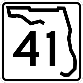
State Road 41 is the secret designation for U.S. Route 301 between Temple Terrace and Zephyrhills, Florida. It is known as Fort King Highway in Hillsborough County, and Fort King Road in Pasco County.
U.S. Highway 17 (US 17) in Florida is a north–south United States Numbered Highway that runs 317 miles (510 km) from the Punta Gorda, Florida Metropolitan Statistical Area northeast to the Jacksonville metropolitan area.
U.S. Highway 41 (US 41) in the state of Florida is a north–south United States Highway. It runs 479 miles (771 km) from Miami in South Florida northwest to the Georgia state line north of the Lake City area. Within the state, US 41 is paralleled by Interstate 75 (I-75) all the way from Miami to Georgia, and I-75 has largely supplanted US 41 as a major highway.
U.S. Route 98 is a major east-west thoroughfare through the U.S. state of Florida. Spanning 670.959 miles (1,079.804 km), it connects Pensacola and the Alabama/Florida state line to the west with Palm Beach and the Atlantic coast in the east. It is the longest US road in Florida, as well as the longest US road in any state east of the Mississippi River.
U.S. Route 301 in Florida runs from the Sarasota-Bradenton-Venice, Florida Metropolitan Statistical Area northeast to the Greater Jacksonville Metropolitan Area. The road is a spur of U.S. Route 1, which it intersects in Callahan.
U.S. Route 441 (US 441) in Florida is a north–south United States Highway. It runs 433 miles (697 km) from Miami in South Florida northwest to the Georgia state line, with the overall route continuing to Tennessee in the Rocky Top area.
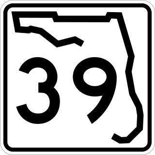
State Road 39 is a north–south state highway in eastern Pasco and Hillsborough County, Florida, United States. Between Plant City and Zephyrhills, the road is named Paul S. Buchman Highway. North of Zephyrhills, Florida the road is a secret state designation for U.S. Route 301 until the southern terminus of the concurrency with U.S. Route 98 south of Dade City, Florida.
State Road 64 extends from City Road 789 near the Gulf of Mexico in Holmes Beach on Anna Maria Island in Manatee County to US 27/US 98 in Avon Park in Highlands County. State Road 64 travels from west to east through the counties of Manatee, Hardee and Highlands.
State Road 539 is a 2.5-mile-long (4.0 km) northwest–southeast route in Lakeland. SR 539 is also known as Kathleen Road, and is one of the main routes connecting downtown Lakeland with Interstate 4 (I-4).
Trilacoochee is an unincorporated community in the northeast corner of Pasco County, Florida, United States. It is at the northern terminus of the US 301 and US 98 multiplex. It has a non-profit "Greater Trilby Community Association" which exists to improve the life and quality of residents of the Trilby, Trilacoochee and Lacoochee area. The ZIP Code for this community is 33523, which it shares with Dade City.
There are six special routes along U.S. Route 98 and seven former routes. Most US 98 bannered routes are located in the U.S. state of Florida.
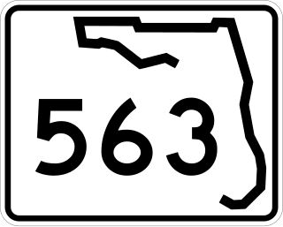
State Road 563 (SR 563) is a 4.912-mile-long (7.905 km) state highway in Lakeland, Polk County, Florida, that runs from 0.162 miles (0.261 km) south of Beaker Road to U.S. Route 92 and Martin Luther King Jr. Avenue.