
Pasco County is located on the west central coast of the U.S. state of Florida. According to the 2020 census, the population was 561,691. Its county seat is Dade City, and its largest city is New Port Richey. The county is named after Samuel Pasco.

The Seminole Gulf Railway is a short line freight and passenger excursion railroad headquartered in Fort Myers, Florida, that operates two former CSX Transportation railroad lines in Southwest Florida. The company's Fort Myers Division, which was previously the southernmost segment of CSX's Fort Myers Subdivision, runs from Arcadia south to North Naples via Punta Gorda, Fort Myers, Estero, and Bonita Springs. The company's other line, the Sarasota Division, runs from Oneco south through Sarasota. Seminole Gulf acquired the lines in November 1987 and operates its own equipment.

State Road 52 is the major east–west road through northern Pasco County, Florida. The road begins in Bayonet Point at US 19, passes through San Antonio, runs past Saint Leo University, in Saint Leo, and terminates in Dade City at US 98 / US 301.

State Road 54 is located in the Tampa Bay Area, north of Tampa itself, and runs from US 19 in Elfers in the west to US 301 in Zephyrhills, in the east. In between it passes through Wesley Chapel, Land o' Lakes, and Elfers.

Trilby is a census-designated place (CDP) in the northeast corner of Pasco County, Florida, United States. The population was 419 at the 2010 census.

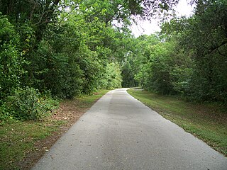
Withlacoochee State Trail is a 46-mile (74 km) long paved, multi-use, non-motorized rail trail in Florida located in Citrus, Hernando and Pasco counties. It follows along the Withlacoochee River and passes through the Withlacoochee State Forest. It is the longest paved rail trail in Florida.

The Ocala Union Station is a historic site in Ocala, Florida, United States. It is located at 531 Northeast First Avenue, and was built in 1917 by both the Atlantic Coast Line and Seaboard Air Line Railroad. Prior to this, ACL and SAL had separate depots in Ocala. The former ACL station was originally built by the Florida Southern Railroad, while the former SAL station was built by the Florida Transit and Peninsular Railroad. On December 22, 1997, it was added to the U.S. National Register of Historic Places.

State Road 575 is a short state road in and near Lacoochee, Florida. At both ends it continues as a county road.
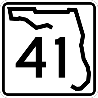
State Road 41 is the secret designation for U.S. Route 301 between Temple Terrace and Zephyrhills, Florida. It is known as Fort King Highway in Hillsborough County, and Fort King Road in Pasco County.

U.S. Highway 41 (US 41) in the state of Florida is a north–south United States Highway. It runs 479 miles (771 km) from Miami in South Florida northwest to the Georgia state line north of the Lake City area. Within the state, US 41 is paralleled by Interstate 75 (I-75) all the way from Miami to Georgia, and I-75 has largely supplanted US 41 as a major highway.

U.S. Route 98 is a major east-west thoroughfare through the U.S. state of Florida. Spanning 670.959 miles (1,079.804 km), it connects Pensacola and the Alabama/Florida state line to the west with Palm Beach and the Atlantic coast in the east. It is the longest US road in Florida, as well as the longest US road in any state east of the Mississippi River.

U.S. Route 301 in Florida runs from the Sarasota-Bradenton-Venice, Florida Metropolitan Statistical Area northeast to the Greater Jacksonville Metropolitan Area. The road is a spur of U.S. Route 1, which it intersects in Callahan.
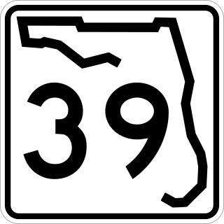
State Road 39 is a north–south state highway in eastern Pasco and Hillsborough County, Florida, United States. Between Plant City and Zephyrhills, the road is named Paul S. Buchman Highway. North of Zephyrhills, Florida the road is a secret state designation for U.S. Route 301 until the southern terminus of the concurrency with U.S. Route 98 south of Dade City, Florida.
The Atlantic Coast Line Railroad was a US Class I railroad from 1900 until 1967. The following former and active train stations were previously used by the Atlantic Coast Line Railroad. Many of them are listed on the National Register of Historic Places.

Wildwood station is a bus station, and former train station, in Wildwood, Florida. It serves Amtrak's Thruway Motorcoach bus system and formerly served trains for Amtrak and other rail companies. The station is located on 601 North Main Street in Wildwood, Florida. Along with the northern terminus of Florida's Turnpike, the station gave Wildwood a reason to refer to itself as "The Crossroads of Florida."

Mabel is an unincorporated community in central Sumter County, Florida, United States. The postal codes are 33597, which is shared by Webster to the northwest and 33514, which is shared by Center Hill to the north.
There are six special routes along U.S. Route 98 and seven former routes. Most US 98 bannered routes are located in the U.S. state of Florida.
The Orange Belt Railway was a 3 ft narrow gauge railroad established in 1885 by Russian exile Peter Demens in Florida. It was one of the longest narrow gauge railroads in the United States at the time of its completion in 1888, with a mainline 152 miles (245 km) in length between Sanford and St. Petersburg. It carried citrus, vegetables, and passengers; and it interchanged with two standard gauge lines: the Jacksonville, Tampa and Key West Railway at Lake Monroe, and the Florida Central and Peninsular Railroad at Lacoochee.
The Wildwood Subdivision is a railroad line owned by CSX Transportation in Florida. It runs along CSX's S Line from Baldwin south to Zephyrhills via Ocala and Wildwood for a total of 155.7 miles. The S Line is CSX's designation for the line that was the Seaboard Air Line Railroad main line from 1903 to 1967.
The Hardy Trail is a paved multi-use recreational trail in Dade City, Florida. It is one mile (1.6 km) long and 12 feet (3.7 m) wide. It follows the path of a segment of the Seaboard Air Line Railroad line where it ran through Dade City. This line was originally built between Zephyrhills and Lacoochee by the Florida Central and Peninsular Railroad, but was abandoned after SAL merged with the Atlantic Coast Line Railroad to form the Seaboard Coast Line Railroad. It was named after former residents Roy and Martha Hardy, and is used primarily by local residents seeking exercise and recreation. The southern half of the trail is nearly always shaded by the woods through which it runs. A visitor information center is now under construction at the northern end where the trail meets Church Street.


