Bayonet Point, Florida

Last updated

Bayonet Point, Florida
CDP
Pasco County Florida Incorporated and Unincorporated areas Bayonet Point Highlighted 1204162.svg
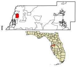
Location of Bayonet Point in Pasco County, Florida.
Coordinates: 28°19′22″N82°41′2″W / 28.32278°N 82.68389°W / 28.32278; -82.68389
Country United States
State Florida
County Pasco
Area
[1]
  Total5.73 sq mi (14.83 km2)
  Land5.68 sq mi (14.71 km2)
  Water0.05 sq mi (0.12 km2)
Elevation
30 ft (9 m)
Population
 (2020)
  Total26,713
  Density4,702.17/sq mi (1,815.64/km2)
Time zone UTC-5 (Eastern (EST))
  Summer (DST) UTC-4 (EDT)
ZIP code
34667
Area code 727
FIPS code 12-04162 [2]
GNIS feature ID1867113 [3]

Bayonet Point is a census-designated place (CDP) in Pasco County, Florida, United States. As of the 2010 Census, the population was 23,467. [4]

Contents

Geography

Bayonet Point is located at 28°19′22″N82°41′2″W / 28.32278°N 82.68389°W / 28.32278; -82.68389 (28.322903, -82.683957). [5]

According to the United States Census Bureau, the CDP has a total area of 5.7 square miles (15 km2), of which 5.6 square miles (15 km2) is land and 0.1 square miles (0.26 km2) (1.41%) is water.

Demographics

Historical population
CensusPop.Note
1980 16,455
1990 21,86032.8%
2000 23,5777.9%
2020 26,713
source: [6]

As of the census of 2010, there were 23,467 people, 10,727 total households, and 6,214 families residing in the CDP. The population density was 4,136 inhabitants per square mile (1,597/km2). The racial makeup of the CDP was 92.3% White, 1.9% African American, 0.3% Native American, 1.2% Asian, 0.1% Pacific Islander, 1.9% from other races, and 2.3% from two or more races. Hispanic or Latino of any race were 9% of the population.

Of the 6,214 family households, 19.5% had children under the age of 18 living with them. 40.1% were married couples living together, 12.9% had a female householder with no husband present, 5% had a male householder with no wife present. Of the 10,727 total households, 42.1% were non-families. 35.1% of all households were made up of individuals, and 22.5% had someone living alone who was 65 years of age or older.

In the CDP, the population was spread out, with 18.4% under the age of 18. The median age was 48.9 years.

Related Research Articles

<span class="mw-page-title-main">Istachatta, Florida</span> Census-designated place in Florida, United States

Istachatta is an unincorporated community and census-designated place (CDP) in Hernando County, Florida, United States. The population was 116 at the 2010 census, up from 65 at the 2000 census. The name "Istachatta" is derived from a Seminole word meaning "man snake".

<span class="mw-page-title-main">Ridge Manor, Florida</span> Census-designated place in Florida, United States

Ridge Manor is a census-designated place (CDP) in Hernando County, Florida, United States. The population was 4,513 at the 2010 census.

<span class="mw-page-title-main">Cheval, Florida</span> Census-designated place in Florida, United States

Cheval is a census-designated place in Hillsborough County, Florida, United States. The population was 10,702 at the 2010 census, up from 7,602 at the 2000 census.

<span class="mw-page-title-main">Pebble Creek, Florida</span> Census-designated place in Florida, United States

Pebble Creek is a census-designated place (CDP) in Hillsborough County, Florida, United States. The population was 9,624 at the 2020 census, up from 7,622 at the 2010 census. Pebble Creek is located in the unincorporated portion of New Tampa, and is primarily a residential zone.

<span class="mw-page-title-main">Beacon Square, Florida</span> CDP in Florida, United States

Beacon Square is a census-designated place (CDP) in Pasco County, Florida, United States. The population was 7,263 at the 2000 census.

<span class="mw-page-title-main">Crystal Springs, Florida</span> CDP in Florida, United States

Crystal Springs is a hydrological spring and a census-designated place (CDP) in Pasco County, Florida, United States. The population was 1,175 at the 2000 census.

<span class="mw-page-title-main">Dade City North, Florida</span> CDP in Florida, United States

Dade City North is a census-designated place (CDP) in eastern Pasco County, Florida, United States. The population was 3,319 at the 2000 census.

<span class="mw-page-title-main">Elfers, Florida</span> CDP in Florida, United States

Elfers is a census-designated place (CDP) in Pasco County, Florida, United States. The population was 13,161 at the 2000 census.

<span class="mw-page-title-main">Lacoochee, Florida</span> CDP in Florida, United States

Lacoochee is a census-designated place (CDP) in Pasco County, Florida, United States. The population was 1,345 at the 2000 census.

<span class="mw-page-title-main">Odessa, Florida</span> CDP in Florida, United States

Odessa is a census-designated place (CDP) in Pasco County, Florida, United States. The population was 3,173 at the 2000 census and more than doubled to 7,267 in 2010. Northwest of Tampa, Odessa had been an area of open spaces, ranching, and horse properties. More recently it has seen many suburban property developments as Tampa's population expands.

<span class="mw-page-title-main">Shady Hills, Florida</span> CDP in Florida, United States

Shady Hills is a census-designated place (CDP) in Pasco County, Florida, United States. The population was 7,798 at the 2000 census. It is in the Tampa-St. Petersburg-Clearwater, Florida Metropolitan Statistical Area and home to a pigeon racing group.

<span class="mw-page-title-main">Trinity, Florida</span> CDP in Florida, United States

Trinity is a census-designated place (CDP) in Pasco County, Florida, United States. The population was 10,907 in 2010, according to the most recent census. The Trinity Community is named after Trinity College of Florida, a Bible college founded in 1932, when it relocated to the first occupied site in the communities developed by James Gills in the late 1980s. The main plaza is found near the high school, known as Mitchell Ranch Plaza. Trinity is located at the junction where Pasco, Hillsborough and Pinellas Counties meet. The community of Longleaf is located in Trinity and it is believed that the “Welcome Plank” originated in Longleaf.

<span class="mw-page-title-main">Zephyrhills North, Florida</span> CDP in Florida, United States

Zephyrhills North is a census-designated place (CDP) in Pasco County, Florida, United States. The population was 2,544 at the 2000 census.

<span class="mw-page-title-main">Zephyrhills South, Florida</span> CDP in Florida, United States

Zephyrhills South is a census-designated place (CDP) in Pasco County, Florida, United States. The population was 4,435 at the 2000 census.

<span class="mw-page-title-main">Zephyrhills West, Florida</span> CDP in Florida, United States

Zephyrhills West is a census-designated place (CDP) in Pasco County, Florida, United States. The population was 5,242 at the 2000 census.

<span class="mw-page-title-main">Wesley Chapel South, Florida</span> Unincorporated community in Florida, United States

Wesley Chapel South is an unincorporated community in Pasco County, Florida, United States. The population was 3,245 at the 2000 census.

West Wyomissing is a census-designated place (CDP) in Spring Township, Berks County, Pennsylvania, United States. The population was 3,407 at the 2010 census.

<span class="mw-page-title-main">West Pasco, Washington</span> Census-designated place in Washington, United States

West Pasco is a census-designated place (CDP) in Franklin County, Washington, United States. The population was 1,747 at the 2020 census, a significant decrease from 3,739 at the 2010 census.

<span class="mw-page-title-main">Burbank, Washington</span> CDP in Washington, United States

Burbank is a census-designated place (CDP) in Walla Walla County, Washington, United States, where the Snake River meets the Columbia. The population was 3,291 at the 2010 census. Named for Luther Burbank, the city is located just east of Pasco and Kennewick, across the Snake and Columbia Rivers, respectively. Burbank is part of the Tri-Cities, WA urban area, despite being located in the Walla Walla metropolitan area.

<span class="mw-page-title-main">Hooverson Heights, West Virginia</span> Census-designated place in West Virginia, United States

Hooverson Heights is a census-designated place (CDP) in Brooke County, West Virginia, United States. It is part of the Weirton–Steubenville metropolitan area. The population was 2,590 at the 2010 census.

References

  1. "2020 U.S. Gazetteer Files". United States Census Bureau. Retrieved October 31, 2021.
  2. "U.S. Census website". United States Census Bureau . Retrieved January 31, 2008.
  3. "US Board on Geographic Names". United States Geological Survey. October 25, 2007. Retrieved January 31, 2008.
  4. Bureau, U. S. Census. "U.S. Census website". United States Census Bureau . Retrieved September 30, 2019.
  5. "US Gazetteer files: 2010, 2000, and 1990". United States Census Bureau. February 12, 2011. Retrieved April 23, 2011.
  6. "CENSUS OF POPULATION AND HOUSING (1790-2000)". U.S. Census Bureau . Retrieved July 18, 2010.