Zolfo Springs, Florida

Last updated

Zolfo Springs, Florida
Town of Zolfo Springs
Zolfo Springs FL city hall01.jpg
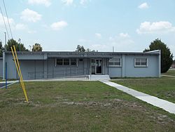
Zolfo Springs Town Hall
Hardee County Florida Incorporated and Unincorporated areas Zolfo Springs Highlighted.svg
Location in Hardee County and the state of Florida
Coordinates: 27°29′46″N81°47′49″W / 27.49611°N 81.79694°W / 27.49611; -81.79694
Country Flag of the United States.svg  United States
State Flag of Florida.svg  Florida
County   Hardee
Settled (Zolfo) c. 1877–1886 [1]
Incorporated
(Town of Zolfo)
October 18, 1904 [1]
Incorporated
(Town of Zolfo Springs)
September 13, 1909 [1]
Government
  Type Commission–Manager
   Mayor Rodney "Rod" Cannon
   Vice Mayor Dierdre "Didi" White
   Commissioners Martina Zuniga,
Sara Schofield, and
Guadalupe "Lupe" DeLeon
   Town Manager Linda Roberson
   Town Clerk Susan Williamson
Area
[2]
  Total1.74 sq mi (4.50 km2)
  Land1.74 sq mi (4.50 km2)
  Water0.00 sq mi (0.00 km2)
Elevation
66 ft (20 m)
Population
 (2020)
  Total1,737
  Density998.85/sq mi (385.60/km2)
Time zone UTC-5 (Eastern (EST))
  Summer (DST) UTC-4 (EDT)
ZIP code
33890
Area code 863
FIPS code 12-79250 [3]
GNIS feature ID0293628 [4]
Website www.townofzolfo.com

Zolfo Springs is a town in Hardee County, Florida, United States. It is part of the Florida Heartland region. The population was 1,737 at the 2020 census.

Contents

Etymology

The name of the town got its name in the early 1800s, when a crew of miners from Spain and Italy looking for phosphate were sailing along the Peace River and came upon the spring, noting it had a strong sulfuric smell. Because of this, the Italians decided to call the area "zolfo", which means " sulfur " in the Italian language. [1] [5] [6] [7]

History

Early prosperity in the area (where the settlement was known as "Zolfo") was due to its location along the Florida Cracker Trail, a cattle trail from Bradenton to Fort Pierce. Cattle herded from this area and the Florida Heartland was run to the coasts along this route as early as 1850. The Florida Cracker Trail today includes parts of State Road 64 and State Road 66 through Zolfo Springs. [1] [8]

In 1886, transportation improved through Zolfo when the Florida Southern Railway (later the Atlantic Coast Line Railroad) was built through the town on its way from Bartow to Punta Gorda. [9] The railroad built a depot in the town and a post office was established the same year. The railroad was removed in the early 1980s. Today US 17 runs along the former railroad right of way (with Main Street being the original alignment of US 17). [1] [8]

It was officially incorporated as a municipality on October 18, 1904, as the "Town of Zolfo", but was officially renamed as the "Town of Zolfo Springs" on September 13, 1909. [1]

Geography

The approximate coordinates for the Town of Zolfo Springs is located at the geographic center of Hardee County, at 27°29′46″N81°47′49″W / 27.49611°N 81.79694°W / 27.49611; -81.79694 (27.496211, –81.796878). [10]

U.S. Route 17 runs through the center of town, leading north 4 miles (6 km) to Wauchula, the county seat, and south 20 miles (32 km) to Arcadia. Florida State Road 64 crosses the northern side of town, leading northeast 18 miles (29 km) to Avon Park and west 50 miles (80 km) to Bradenton. SR 66 leaves US 17 at the center of Zolfo Springs and leads east 25 miles (40 km) to U.S. Route 27 at the south end of Sebring.

According to the United States Census Bureau, Zolfo Springs has a total area of 1.7 square miles (4.5 km2), all of it land.

The Peace River, which flows south to Punta Gorda, forms part of the northern town boundary. Pioneer Park Lake and Pioneer Park are also inside the town's boundaries.

Climate

The climate in this area is characterized by hot, humid summers and generally mild winters. According to the Köppen climate classification, the Town of Zolfo Springs has a humid subtropical climate zone (Cfa).

Demographics

Historical population
CensusPop.Note
1910 171
1920 25649.7%
1930 2726.3%
1940 223−18.0%
1950 33449.8%
1960 838150.9%
1970 1,11733.3%
1980 1,49533.8%
1990 1,219−18.5%
2000 1,64134.6%
2010 1,82711.3%
2020 1,737−4.9%
U.S. Decennial Census [11]

2010 and 2020 census

Zolfo Springs racial composition
(Hispanics excluded from racial categories)
(NH = Non-Hispanic)
RacePop 2010 [12] Pop 2020 [13] % 2010% 2020
White (NH)54749829.94%28.67%
Black or African American (NH)74514.05%2.94%
Native American or Alaska Native (NH)250.11%0.29%
Asian (NH)1180.60%0.46%
Pacific Islander or Native Hawaiian (NH)400.22%0.00%
Some other race (NH)010.00%0.06%
Two or more races/Multiracial (NH)12390.66%2.25%
Hispanic or Latino (any race)1,1771,13564.42%65.34%
Total1,8271,737

As of the 2020 United States census, there were 1,737 people, 597 households, and 513 families residing in the town. [14]

As of the 2010 United States census, there were 1,827 people, 648 households, and 552 families residing in the town. [15]

Zolfo Springs Pioneer Park Museum Zolfo Springs Pioneer Park museum01.jpg
Zolfo Springs Pioneer Park Museum

2000 census

As of the census [3] of 2000, there were 1,641 people, 497 households, and 399 families residing in the town. The population density was 1,086.5 inhabitants per square mile (419.5/km2). There were 634 housing units at an average density of 419.8 per square mile (162.1/km2). The racial makeup of the town was 65.69% White, 3.35% African American, 0.18% Native American, 0.12% Asian, 0.12% Pacific Islander, 29.07% from other races, and 1.46% from two or more races. Hispanic or Latino of any race were 53.63% of the population.

In 2000, there were 497 households, out of which 39.4% had children under the age of 18 living with them, 60.2% were married couples living together, 15.1% had a female householder with no husband present, and 19.7% were non-families. 14.9% of all households were made up of individuals, and 9.5% had someone living alone who was 65 years of age or older. The average household size was 3.26 and the average family size was 3.55.

In 2000, in the town, the population was spread out, with 32.3% under the age of 18, 11.2% from 18 to 24, 25.3% from 25 to 44, 16.4% from 45 to 64, and 14.9% who were 65 years of age or older. The median age was 30 years. For every 100 females, there were 102.3 males. For every 100 females age 18 and over, there were 100.2 males.

In 2000, the median income for a household in the town was $25,972, and the median income for a family was $27,188. Males had a median income of $18,603 versus $17,292 for females. The per capita income for the town was $11,397. About 18.7% of families and 27.3% of the population were below the poverty line, including 33.2% of those under age 18 and 18.9% of those age 65 or over.

Media

Related Research Articles

<span class="mw-page-title-main">Archer, Florida</span> City in Florida, United States

Archer is a city in Alachua County, Florida, United States. It is part of the Gainesville, Florida Metropolitan Statistical Area. As of the 2020 census, the city had a population of 1,140, up from 1,118 at the 2010 census.

<span class="mw-page-title-main">High Springs, Florida</span> City in Florida, United States of America

High Springs is a city in Alachua County, Florida, United States. It is the fourth-largest city in Alachua County and seventh-largest in North Central Florida. The population was 6,215 at the 2020 census, up from 5,350 at the 2010 census. It is part of the Gainesville, Florida Metropolitan Statistical Area.

<span class="mw-page-title-main">Palm Shores, Florida</span> Town in the state of Florida, United States

Palm Shores is a town in Brevard County, Florida. It is part of the Palm Bay–Melbourne–Titusville, Florida Metropolitan Statistical Area. The population was 1,200 at the 2020 US Census, up from 900 at the 2010 census.

<span class="mw-page-title-main">Fort White, Florida</span> Town in the state of Florida, United States

Fort White is a town in Columbia County, Florida, United States, named after a military fort built in the 1830s. It is the closest town to Ichetucknee Springs State Park. Fort White High School and the Fort White Public School Historic District are located within the town's borders. The original school building was constructed in 1915. As of the 2020 census, the population of Fort White was 618, up from 567 at the 2010 census. It is part of the Lake City, Florida Micropolitan Statistical Area.

<span class="mw-page-title-main">Beverly Beach, Florida</span> Town in Florida, United States

Beverly Beach is a town in Flagler County, Florida, United States. The Town of Beverly Beach is part of the Deltona–Daytona Beach–Ormond Beach, FL metropolitan statistical area. The population was 474 at the 2020 census, up from 338 in the 2010 census.

<span class="mw-page-title-main">Fanning Springs, Florida</span> City in Florida, United States

Fanning Springs is a city in Gilchrist and Levy counties in the U.S. state of Florida. It is part of the Gainesville, Florida Metropolitan Statistical Area. The population was 1,182 at the 2020 census, up from 764 at the 2010 census.

<span class="mw-page-title-main">Wauchula, Florida</span> City in Florida, United States of America

Wauchula is a city and the county seat of Hardee County, Florida, United States. As of the 2020 census, it had a population of 4,900.

<span class="mw-page-title-main">Bonifay, Florida</span> City in Florida, United States

Bonifay is a city in Holmes County, Florida, United States. As of the 2020 census, the population was 2,759. It is the county seat of Holmes County.

<span class="mw-page-title-main">Cottondale, Florida</span> City in Florida, United States

Cottondale is a city in Jackson County, Florida, United States. It is part of the Florida Panhandle and North Florida. The population was 848 at the 2020 census, down from 933 at the 2010 census.

<span class="mw-page-title-main">Astatula, Florida</span> Town in the state of Florida, United States

Astatula is a town in Lake County, Florida, United States. The population was 1,889 at the 2020 census. It is part of the Orlando–Kissimmee–Sanford Metropolitan Statistical Area.

<span class="mw-page-title-main">Montverde, Florida</span> Town in Florida, United States

Montverde is a town in Lake County, Florida, United States. The population was 1,655 at the 2020 census. It is part of the Orlando–Kissimmee–Sanford Metropolitan Statistical Area.

<span class="mw-page-title-main">Umatilla, Florida</span> City in Florida

Umatilla is a city in Lake County, Florida, United States. The population was 3,685 at the 2020 census. Umatilla is known as the Gateway to the Ocala National Forest, located in northern Lake County.

<span class="mw-page-title-main">Greenville, Florida</span> Town in the state of Florida, United States

Greenville is a town in Madison County, Florida, United States. The population was 746 at the 2020 census, down from 843 at the 2010 census.

<span class="mw-page-title-main">Lee, Florida</span> Town in the state of Florida, United States

Lee is a town in Madison County, Florida, United States. The Town of Lee is part of the Florida Panhandle in North Florida. The population was 375 at the 2020 census.

<span class="mw-page-title-main">Callahan, Florida</span> Town in Florida, United States

Callahan is a town in Nassau County, Florida, United States, adjacent to Duval County. The population was 1,526 at the 2020 census, up from 1,123 at the 2010 census. It is part of the Jacksonville, Florida Metropolitan Statistical Area. It is one location of the Northeast Florida Fair.

<span class="mw-page-title-main">Kenneth City, Florida</span> Town in the state of Florida, United States

Kenneth City is a town in southern Pinellas County, Florida, between St. Petersburg and Pinellas Park, United States. It is part of the Tampa–St. Petersburg–Clearwater Metropolitan statistical area (MSA), much more commonly known as the Tampa Bay area. The population was 5,047 at the 2020 US census.

<span class="mw-page-title-main">Davenport, Florida</span> City in Florida, United States

Davenport is a city in Polk County, Florida, United States. It is part of the Lakeland–Winter Haven Metropolitan Statistical Area. The population was 9,043 at the 2020 Census. The city's population has increased dramatically since the 2010 Census, when the population was 2,888.

<span class="mw-page-title-main">Pomona Park, Florida</span> Town in the state of Florida, United States

Pomona Park is a town in Putnam County, Florida, United States. The Town of Pomona Park is part of the Palatka, Florida Micropolitan Statistical Area. The population was 784 at the 2020 census, down from 912 at the 2010 census.

<span class="mw-page-title-main">Milton, Florida</span> City in Florida, United States

Milton is a city and the county seat of Santa Rosa County, Florida. It is located within the Pensacola—Ferry Pass—Brent, Florida Metropolitan Statistical Area. Milton is located in the geographic center of Santa Rosa County, and it is bordered by Pace to the west and Navarre to the south. As of 2020, the population of the city of Milton was 10,197, up from 8,826 at the 2010 census.

<span class="mw-page-title-main">St. Lucie Village, Florida</span> Town in the state of Florida, United States

St. Lucie Village is a town in St. Lucie County, Florida, United States. It is part of the Port St. Lucie Metropolitan Statistical Area. The population was 613 at the 2020 census.

References

  1. 1 2 3 4 5 6 7 "History: Where We've Come From..." www.townofzolfo.com.
  2. "2020 U.S. Gazetteer Files". United States Census Bureau. Retrieved December 2, 2021.
  3. 1 2 "U.S. Census website". United States Census Bureau . Retrieved January 31, 2008.
  4. "US Board on Geographic Names". United States Geological Survey. October 25, 2007. Retrieved January 31, 2008.
  5. "Cash-Strapped Zolfo Springs Finds Services Hard to Provide". The Ledger .
  6. "Why do they call it that? Zolfo Springs and Port Tampa City". www.wtsp.com.
  7. "The Unique History of Zolfo Springs Florida". wanderflorida.net.
  8. 1 2 "Zolfo Springs Downtown Vision Plan" (PDF). Central Florida Regional Planning Council. Retrieved May 6, 2018.
  9. Turner, Gregg M. (December 1, 1999). Railroads of Southwest Florida. Images of America. Arcadia Publishing.
  10. "US Gazetteer files: 2010, 2000, and 1990". United States Census Bureau. February 12, 2011. Retrieved April 23, 2011.
  11. "Census of Population and Housing". Census.gov. Retrieved June 4, 2015.
  12. "P2 HISPANIC OR LATINO, AND NOT HISPANIC OR LATINO BY RACE - 2010: DEC Redistricting Data (PL 94-171) - Zolfo Springs town, Florida". United States Census Bureau .
  13. "P2 HISPANIC OR LATINO, AND NOT HISPANIC OR LATINO BY RACE - 2020: DEC Redistricting Data (PL 94-171) - Zolfo Springs town, Florida". United States Census Bureau .
  14. "S1101 HOUSEHOLDS AND FAMILIES - 2020: Zolfo Springs town, Florida". United States Census Bureau .
  15. "S1101 HOUSEHOLDS AND FAMILIES - 2010: Zolfo Springs town, Florida". United States Census Bureau .