
Tooele County is a county in the U.S. state of Utah. As of the 2010 United States Census, the population was 58,218. Its county seat and largest city is Tooele. The county was created in 1850 and organized the following year.
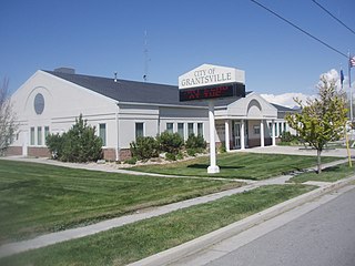
Grantsville is the second most populous city in Tooele County, Utah, United States. It is part of the Salt Lake City, Utah Metropolitan Statistical Area. The population was 8,893 at the 2010 census. The city has grown slowly and steadily throughout most of its existence, but rapid increases in growth occurred during the 1970s and 1990s. Recent rapid growth has been attributed to the nearby Deseret Peak recreational center, the Utah Motorsports Campus raceway and to the newly built Wal-Mart Distribution Center located just outside the city. It is quickly becoming a bedroom community for commuters into the Salt Lake valley.

Stansbury Park is a census-designated place (CDP) in Tooele County, Utah, United States. The population was 5,145 at the 2010 Census; it was 2,385 at the 2000 census; the 1990 census population was 1,049.

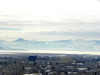
Tooele is a city in Tooele County in the U.S. state of Utah. The population was 22,502 at the 2000 census, and 32,115 at the 2010 census. It is the county seat of Tooele County. About 30 minutes southwest of Salt Lake City, Tooele is known for Tooele Army Depot, for its views of the nearby Oquirrh Mountains and the Great Salt Lake.
Rush Valley is a 30-mile (48 km) long north-trending valley in the southeast of Tooele County, Utah. It lies adjacent and attached at the south of Tooele Valley; the separation point is the lowpoint of the valley at Rush Lake, and lies at the southeast of the small mountain massif causing the separation, South Mountain at 6,541 feet (1,994 m). The region of Rush Lake is a marsh region, fed by various streams from the mountain regions east and west.
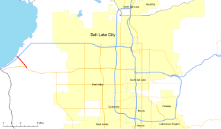
State Route 202 (SR-202) is a 1.683-mile (2.709 km) long state highway in the U.S. state of Utah that serves as a connector, linking SR-201 to Interstate 80 (I-80) in rural Salt Lake County. The road has existed since at least 1937, when it connected U.S. Route 40 (US-40) and US-50 via the Garfield Cut-Off Road. It also serves as the eastbound on-ramp for I-80.

Delle is a small unincorporated community on the northern end of the Skull Valley in northeast Tooele County, Utah, United States, along Interstate 80 near the Bonneville Salt Flats. The town has never had more than a few residents and has served primarily as a filling station along the I-80 corridor. Since the completion of the freeway, the town has essentially become a ghost town.
State Route 138 is a highway, completely within Tooele County in northern Utah that connects Grantsville to Erda and Stansbury Park. The route runs twenty miles (32 km) and is the old routing of U.S. Route 50 Alternate and U.S. Route 40.
Interstate 80 (I-80) is a part of the Interstate Highway System that runs from San Francisco, California, to Teaneck, New Jersey. The portion of the highway in the U.S. state of Utah is 196.35-mile-long (315.99 km), through the northern part of the state. From west to east, I-80 crosses the state line from Nevada in Tooele County and traverses the Bonneville Salt Flats—which are a part of the larger Great Salt Lake Desert. It continues alongside the Wendover Cut-off—the corridor of the former Victory Highway—U.S. Route 40 (US-40) and the Western Pacific Railroad Feather River Route. After passing the Oquirrh Mountains, I-80 enters the Salt Lake Valley and Salt Lake County. A short portion of the freeway is concurrent with I-15 through Downtown Salt Lake City. At the Spaghetti Bowl, I-80 turns east again into the mouth of Parley's Canyon and Summit County, travels through the mountain range and intersects the eastern end of I-84 near Echo Reservoir before turning northeast towards the Wyoming border near Evanston. I-80 was built along the corridor of the Lincoln Highway and the Mormon Trail through the Wasatch Range. The easternmost section also follows the historical routes of the First Transcontinental Railroad and US-30S.

Gold Hill is an unincorporated community in far western Tooele County, Utah, United States, located near the Nevada state line.

Burmester is an unincorporated community in northeastern Tooele County, Utah, United States.
Lake Point is an unincorporated community on the eastern edge of northern Tooele County, Utah, United States.
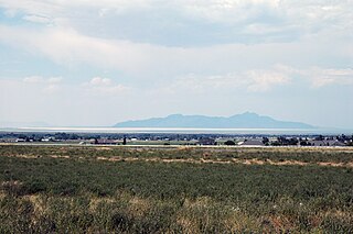
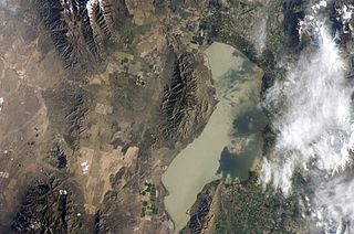
Stansbury Island is the second largest island within the Great Salt Lake in the U.S. state of Utah. Located in Tooele County, it is considered an island even though a dirt causeway connects it to the mainland. Stansbury Island was named after Howard Stansbury, the leader of a government expedition that surveyed the lake in 1849.
The East Tintic Mountains are a mountain range in central Juab, Utah, and Tooele counties in Utah, United States on the east margin of the Great Basin just west of the Wasatch Front about 50 miles (80 km) south-southeast of Salt Lake City. The community of Eureka is an old mining town near the center of the range. U.S. Route 6 Passes through the central part of the range and through Eureka.
The Juab Valley is a 40-mile (64 km) long valley located on the eastern edge of Juab County, Utah, United States.
The Stansbury Mountains are a 28-mile (45 km) long mountain range located in eastern Tooele County, Utah. It is named for U.S. Army Major Howard Stansbury, a topographical engineer, who led an expedition that surveyed the region.
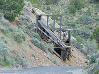
The Eureka Lilly Headframe is the surviving headframe at the Eureka Lilly mine in the Tintic Mining District in Dividend, Utah, United States, and is listed on the National Register of Historic Places.
Knolls is an unincorporated community in north-central Tooele County, Utah, United States.
Aragonite is a ghost town in Tooele County, Utah, United States, located in the western portion of the state. The Utah Test and Training Range lies to the west and the Dugway Proving Grounds lie to the southwest. Interstate 80, exit 56 provides access to Aragonite. The site lies northwest of the Cedar Mountains. The low Grassy Mountains lie to the north.

Tintic School District is a school district located in western Juab County, Utah, United States.


