Forney, Alabama | |
---|---|
Unincorporated community | |
Coordinates: 34°05′10″N85°27′43″W / 34.08611°N 85.46194°W Coordinates: 34°05′10″N85°27′43″W / 34.08611°N 85.46194°W | |
Country | United States |
State | Alabama |
County | Cherokee |
Elevation | 702 ft (214 m) |
Time zone | Central (CST) (UTC-6) |
• Summer (DST) | CDT (UTC-5) |
Area code(s) | 256 & 938 |
GNIS feature ID | 118508 [1] |
Forney is an unincorporated community in Cherokee County, Alabama, United States. Forney is located on U.S. Route 411, 13.2 miles (21.2 km) east-southeast of Centre.
In law, an unincorporated area is a region of land that is not governed by a local municipal corporation; similarly an unincorporated community is a settlement that is not governed by its own local municipal corporation, but rather is administered as part of larger administrative divisions, such as a township, parish, borough, county, city, canton, state, province or country. Occasionally, municipalities dissolve or disincorporate, which may happen if they become fiscally insolvent, and services become the responsibility of a higher administration. Widespread unincorporated communities and areas are a distinguishing feature of the United States and Canada. In most other countries of the world, there are either no unincorporated areas at all, or these are very rare; typically remote, outlying, sparsely populated or uninhabited areas.
Cherokee County, Alabama is a county of the U.S. state of Alabama. As of the 2010 census, the population was 25,989. Its county seat is Centre,. The county is named for the Cherokee tribe.
Alabama is a state in the southeastern region of the United States. It is bordered by Tennessee to the north, Georgia to the east, Florida and the Gulf of Mexico to the south, and Mississippi to the west. Alabama is the 30th largest by area and the 24th-most populous of the U.S. states. With a total of 1,500 miles (2,400 km) of inland waterways, Alabama has among the most of any state.
A post office called Forney was established in 1878, and remained in operation until 1936. [2] The community was named for P. Forney, who kept a store there. [3]
Swain County is a county located in the western portion of the U.S. state of North Carolina. As of the 2010 census, the population was 13,981. Its county seat is Bryson City.
Graham County is a county located in the U.S. state of North Carolina. As of the 2010 census, the population was 8,861, making it the third-least populous county in North Carolina. Its county seat is Robbinsville. The county was formed January 30, 1872, from the northeastern part of Cherokee County. It was named for William A. Graham, United States Senator from North Carolina (1840–1843) and Governor of North Carolina (1845–1849).
Cherokee County is the westernmost county in the U.S. state of North Carolina. As of the 2010 census, the population was 27,444. Its county seat is Murphy.
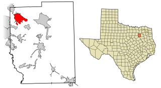
Forney is a city in Kaufman County, Texas, United States and has been named by the Texas legislature as the "Antique Capital of Texas". It is part of the Dallas–Fort Worth metroplex. Its population was 14,661 at the 2010 census.
Rock Run is an unincorporated community in Cherokee County, Alabama, United States. Rock Run is located on County Route 29, 13.6 miles (21.9 km) southeast of Centre.
Congo is an unincorporated community in Cherokee County, Alabama, United States.
Adams Crossroads is an unincorporated community in Cherokee County, Alabama, United States.
Alexis is an unincorporated community in Cherokee County, in the U.S. state of Alabama.
Blue Pond, also spelled Bluepond, is an unincorporated community in Cherokee County, Alabama, United States.
Bomar, also known as Jordan, is an unincorporated community in Cherokee County, Alabama, United States.
Ellisville, also known as Coloma, is an unincorporated community in Cherokee County, Alabama, United States.
Elrath is an unincorporated community in Cherokee County, Alabama, United States.
Hurley is an unincorporated community in Cherokee County, Alabama, United States.
Key is an unincorporated community in Cherokee County, Alabama, United States.
McGhee is an unincorporated community in Cherokee County, Alabama, United States.
Moshat is an unincorporated community in Cherokee County, Alabama, United States.
Newberry Crossroads, also known as Bid, is an unincorporated community in Cherokee County, Alabama, United States.
Pleasant Gap, also known as Pleasantsgap and Stocks Mills, is an unincorporated community in Cherokee County, in the U.S. state of Alabama.
Turkey Town is a ghost town in Cherokee County, in the U.S. state of Alabama.
This Alabama state location article is a stub. You can help Wikipedia by expanding it. |