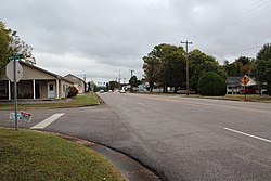
Cedar Bluff, Alabama | |
---|---|
Motto: "You can stop looking for the good life. We found it." | |
Coordinates: 34°13′14″N85°35′45″W / 34.22056°N 85.59583°W | |
Country | United States |
State | Alabama |
County | Cherokee |
Area | |
• Total | 4.82 sq mi (12.49 km2) |
• Land | 4.81 sq mi (12.46 km2) |
• Water | 0.01 sq mi (0.04 km2) |
Elevation | 591 ft (180 m) |
Population (2020) | |
• Total | 1,845 |
• Density | 383.66/sq mi (148.13/km2) |
Time zone | UTC-6 (Central (CST)) |
• Summer (DST) | UTC-5 (CDT) |
ZIP code | 35959 |
Area code | 256 |
FIPS code | 01-12760 |
GNIS feature ID | 0155014 |
Website | www |
Cedar Bluff is a town in Cherokee County, Alabama, United States. At the 2020 census, the population was 1,845. Unlike the rest of the county, Cedar Bluff is a wet town. Cedar Bluff is located on the north shore of Weiss Lake, noted for its crappie fishing. [2]
A post office called Cedar Bluff has been in operation since 1837. [3] Once the county seat from about 1836 to 1844 before being removed to Centre, the city was named for groves of cedar trees above the bluffs of the nearby river. [4]
The Cornwall Furnace near Cedar Bluff is listed on the National Register of Historic Places. [5]
Cedar Bluff is located northeast of the center of Cherokee County at 34°13'14.182" North, 85°35'45.596" West (34.220606, -85.595999). [6]
According to the U.S. Census Bureau, the town has a total area of 5.1 square miles (13.3 km2), of which 5.1 square miles (13.1 km2) is land and 0.08 square miles (0.2 km2), or 1.15%, is water. [7] The town is bordered on the north, west, and south by Weiss Lake.
Census | Pop. | Note | %± |
---|---|---|---|
1880 | 85 | — | |
1890 | 194 | 128.2% | |
1920 | 418 | — | |
1950 | 563 | — | |
1960 | 687 | 22.0% | |
1970 | 956 | 39.2% | |
1980 | 1,129 | 18.1% | |
1990 | 1,174 | 4.0% | |
2000 | 1,467 | 25.0% | |
2010 | 1,820 | 24.1% | |
2020 | 1,845 | 1.4% | |
U.S. Decennial Census [8] 2013 Estimate [9] |
Race | Num. | Perc. |
---|---|---|
White (non-Hispanic) | 1,577 | 85.47% |
Black or African American (non-Hispanic) | 140 | 7.59% |
Native American | 18 | 0.98% |
Asian | 9 | 0.49% |
Other/Mixed | 71 | 3.85% |
Hispanic or Latino | 30 | 1.63% |
As of the 2020 United States census, there were 1,845 people, 876 households, and 507 families residing in the town.
As of the census [11] of 2010, there were 1,820 people, 766 households, and 521 families residing in the town. The population density was 359 inhabitants per square mile (139/km2). There were 1,302 housing units at an average density of 255 per square mile (98/km2). The racial makeup of the town was 86.2% White, 9.9% Black or African American, 0.7% Native American, 0.3% Asian, 0.5% from other races, and 2.4% from two or more races. 1.2% of the population were Hispanic or Latino of any race.
There were 766 households, out of which 21.9% had children under the age of 18 living with them, 49.0% were married couples living together, 14.4% had a female householder with no husband present, and 32.0% were non-families. 28.6% of all households were made up of individuals, and 12.8% had someone living alone who was 65 years of age or older. The average household size was 2.38 and the average family size was 2.87.
In the town, the population was spread out, with 21.4% under the age of 18, 8.6% from 18 to 24, 20.0% from 25 to 44, 30.9% from 45 to 64, and 19.0% who were 65 years of age or older. The median age was 45 years. For every 100 females, there were 93.6 males. For every 100 females age 18 and over, there were 92.9 males.
The median income for a household in the town was $35,143, and the median income for a family was $37,500. Males had a median income of $31,016 versus $26,583 for females. The per capita income for the town was $19,469. About 22.8% of families and 25.7% of the population were below the poverty line, including 41.0% of those under age 18 and 8.5% of those age 65 or over.
Cedar Bluff Public Schools are part of the Cherokee County School District. Schools in the district include Cedar Bluff School, Centre Elementary School, Gaylesville School, Sand Rock School, Centre Middle School, Cherokee County High School, Spring Garden High School and Cherokee County Career & Technology Center. Cedar Bluff School is located in Cedar Bluff.
Mike Welch is the Superintendent of Schools. [12]
Cherokee County, Alabama is a county located in the northeastern part of the U.S. state of Alabama. As of the 2020 census, the population was 24,971. Its county seat is Centre. The county is named for the Cherokee tribe.
Tallapoosa County is located in the east-central portion of the U.S. state of Alabama. As of the 2020 census, the population was 41,311. Its county seat is Dadeville. Its largest city is Alexander City.
Caldwell County is a county located in the U.S. state of Kentucky. As of the 2020 census, the population was 12,649. Its county seat is Princeton. The county was formed in 1809 from Livingston County, Kentucky and named for John Caldwell, who participated in the George Rogers Clark Indian Campaign of 1786 and was the second lieutenant governor of Kentucky. Caldwell was a prohibition or dry county until 2013, when the citizens voted to lift the ban.
Gordon County is a county located in the northwestern part of the U.S. state of Georgia. As of the 2020 census, the population was 57,544. The county seat is Calhoun. Gordon County comprises the Calhoun, GA Micropolitan Statistical Area, which is included in the Atlanta–Athens-Clarke County–Sandy Springs, GA-AL CSA.
Centre is a city in Cherokee County, Alabama, United States. At the 2020 census, the population was 3,587. The city is the county seat of Cherokee County.
Gaylesville is a town in Cherokee County, Alabama, United States. The population was 144 at the 2010 census.
Leesburg is a town in Cherokee County, Alabama, United States. At the 2020 census, the population was 911.
Sand Rock is a town in Cherokee and DeKalb counties in the U.S. state of Alabama. It incorporated in 1988. At the 2020 census, the population was 591.
Kinston is a town in Coffee County, Alabama, United States. At the 2020 census, the population was 580. It is part of the Enterprise Micropolitan Statistical Area.
Sylvania is a town in DeKalb County, Alabama, United States. It incorporated in October 1967. At the 2010 census the population was 1,837, up from 1,186 in 2000. Sylvania is located atop Sand Mountain. Sylvania was incorporated in 1967. The post office /town hall was built in 1977.
Hokes Bluff is a city in Etowah County, Alabama, United States. It is part of the Gadsden Metropolitan Statistical Area. At the 2020 census, the population was 4,446.
Section is a town in Jackson County, Alabama, United States and is included in the Chattanooga-Cleveland-Dalton, TN-GA-AL Combined Statistical Area. As of the 2010 census, the population of the town was 770, an increase of one person (769) from 2000. Section is located on top of Sand Mountain.
Morrison Bluff is a town in Logan County, Arkansas, United States. The population was 64 at the 2010 census and an estimated 81 in 2017.
Cedar Lake is a town in Hanover and Center townships, Lake County, Indiana, United States. It is near the Illinois state line. Its population was 11,560 at the 2010 census. The town is notable for its location on Cedar Lake, the Lake of the Red Cedars museum.
Cherokee is a city in Crawford County, Kansas, United States. As of the 2020 census, the population of the city was 590.
Washburn is a town in Aroostook County, Maine, United States. It was incorporated on February 25, 1861, and named after Israel Washburn, the governor of Maine at the time. The population was 1,527 at the 2020 census. Benjamin C. Wilder House, which was built in 1852, is located on Main Street in Washburn and predates the town's incorporation by nine years.
Cedar Bluff is a town in Tazewell County, Virginia, United States. The population was 1,139 at the 2010 census. It is part of the Bluefield, WV-VA micropolitan area, which has a population of 107,578.
Cedar Grove is a town in Kanawha County, West Virginia, United States. The population was 714 at the 2020 census. Cedar Grove was incorporated in 1902. Its name is derived from the time the town was established, when a large juniper forest, misidentified as cedars by early settlers, was growing at that location. Cedar Grove is the site of Fort Kelley and the oldest settlement in the Kanawha Valley, dating from 1773. Landmarks located here include the Tompkins Home (1844) and the Old Brick Church (1853). The current mayor is as of July 1, 2023 is Melissa (Missy) Young.
Pine Bluffs is a town in eastern Laramie County, Wyoming, United States. It is located on the county's border with Nebraska. Pine Bluffs is part of the Cheyenne, Wyoming, Metropolitan Statistical Area. The population was 1,129 at the 2010 census. It was first known as Rock Ranch, but the name was changed by railroad officials for the pines on the nearby bluffs.
Crowder is a town in Panola and Quitman counties in the state of Mississippi. The population was 712 at the 2010 census.