Rock Run, Alabama

Last updated
Rock Run, Alabama
Unincorporated community
USA Alabama location map.svg
Red pog.svg
Rock Run, Alabama
Usa edcp location map.svg
Red pog.svg
Rock Run, Alabama
Coordinates: 34°01′40″N85°29′43″W / 34.02778°N 85.49528°W / 34.02778; -85.49528 Coordinates: 34°01′40″N85°29′43″W / 34.02778°N 85.49528°W / 34.02778; -85.49528
Country United States
State Alabama
County Cherokee
Elevation 732 ft (223 m)
Time zone Central (CST) (UTC-6)
  Summer (DST) CDT (UTC-5)
Area code(s) 256 & 938
GNIS feature ID 155218 [1]

Rock Run is an unincorporated community in Cherokee County, Alabama, United States. Rock Run is located on County Route 29, 13.6 miles (21.9 km) southeast of Centre.

Unincorporated area Region of land not governed by own local government

In law, an unincorporated area is a region of land that is not governed by a local municipal corporation; similarly an unincorporated community is a settlement that is not governed by its own local municipal corporation, but rather is administered as part of larger administrative divisions, such as a township, parish, borough, county, city, canton, state, province or country. Occasionally, municipalities dissolve or disincorporate, which may happen if they become fiscally insolvent, and services become the responsibility of a higher administration. Widespread unincorporated communities and areas are a distinguishing feature of the United States and Canada. In most other countries of the world, there are either no unincorporated areas at all, or these are very rare; typically remote, outlying, sparsely populated or uninhabited areas.

Cherokee County, Alabama county in Alabama, United States

Cherokee County, Alabama is a county of the U.S. state of Alabama. As of the 2010 census, the population was 25,989. Its county seat is Centre,. The county is named for the Cherokee tribe.

Alabama State of the United States of America

Alabama is a state in the southeastern region of the United States. It is bordered by Tennessee to the north, Georgia to the east, Florida and the Gulf of Mexico to the south, and Mississippi to the west. Alabama is the 30th largest by area and the 24th-most populous of the U.S. states. With a total of 1,500 miles (2,400 km) of inland waterways, Alabama has among the most of any state.

Contents

History

Rock Run had its start as a mining community, and may have been named from a run on the rocks containing iron ore. [2] According to another story, a settler climbing a hill dislodged a rock, and watching it roll down the hill, said "Look at that rock run!" [3] A post office operated under the name Rock Run from 1883 to 1957. [4]

Mining community community that houses miners

A mining community, also known as a mining town or a mining camp, is a community that houses miners. Mining communities are usually created around a mine or a quarry.

Iron ore ore rich in iron or the element Fe

Iron ores are rocks and minerals from which metallic iron can be economically extracted. The ores are usually rich in iron oxides and vary in colour from dark grey, bright yellow, or deep purple to rusty red. The iron is usually found in the form of magnetite (Fe
3
O
4
, 72.4% Fe), hematite (Fe
2
O
3
, 69.9% Fe), goethite (FeO(OH), 62.9% Fe), limonite (FeO(OH)·n(H2O), 55% Fe) or siderite (FeCO3, 48.2% Fe).

Demographics

In 1890, it was listed on the U.S. Census as having 360 residents, making it the largest incorporated community in Cherokee County, narrowly ahead of Centre, the county seat.

Centre, Alabama City in Alabama, United States

Centre is a city in Cherokee County, Alabama, United States. At the 2010 census the population was 3,489. The city is the county seat of Cherokee County and is part of the Gadsden, Alabama Metropolitan Statistical Area.

Historical population
Census Pop.
1890 360
U.S. Decennial Census [5]

Below are photographs recorded in Rock Run during the Historic American Buildings Survey:

Related Research Articles

Oconee County, South Carolina county in South Carolina, United States

Oconee County is the westernmost county in the U.S. state of South Carolina. As of the 2010 census, the population was 74,273. Its county seat is Walhalla.

Noble County, Oklahoma county in Oklahoma

Noble County is located in the north central part of Oklahoma. As of the 2010 census, the population was 11,561. Its county seat is Perry. It was part of the Cherokee Outlet in Indian Territory until Oklahoma Territory was created in 1890, and the present county land was designated as County P. After the U. S. government opened the area to non-Indian settlement in 1893, it was renamed Noble County for John Willock Noble, then the United States Secretary of the Interior.

Hardin County, Illinois county in Illinois, United States of America

Hardin County is a county located in the U.S. state of Illinois. According to the 2010 census, it has a population of 4,320, making it the least populous county in Illinois. Its county seat is Elizabethtown. Hardin County is located in the part of the state known as Little Egypt. Hardin County was named for Hardin County, Kentucky, which was named in honor of Colonel John Hardin, an officer in the American Revolutionary War and the Northwest Indian War.

Pickens County, Georgia county in Georgia, United States

Pickens County is a county located in the north central portion of the U.S. state of Georgia. As of the 2010 census, the population was 29,431. The county seat is Jasper.

Gordon County, Georgia county in Georgia, United States

Gordon County is a county located in the northwestern part of the U.S. state of Georgia. As of the 2010 census, the population was 55,186. The county seat is Calhoun.

Cherokee County, Georgia county in Georgia, United States

Cherokee County is a county located in the US state of Georgia. As of the 2010 census, the population was 214,346. According to the local newspaper, the Cherokee Ledger-News on August 29, 2018, with an estimated population of 254,500, Cherokee is currently the fastest growing county in the metro Atlanta, Georgia area. The county seat is Canton. The county Board of Commissioners is the governing body, with members elected to office.

Prairie County, Arkansas county in Arkansas, United States

Prairie County is located in the Central Arkansas region of the U.S. state of Arkansas. The county is named for the Grand Prairie, a subregion of the Arkansas Delta known for rice cultivation and aquaculture which runs through the county. Created as Arkansas's 54th county in 1846, Prairie County is home to four incorporated towns, including DeValls Bluff, the southern district county seat, and two incorporated cities, including Des Arc, the northern district county seat. The county is also the site of numerous unincorporated communities and ghost towns. Occupying 676 square miles (175,000 ha), Prairie County is the median-sized county in Arkansas. As of the 2010 Census, the county's population is 8,715 people in 4,503 households. Based on population, the county is the ninth-smallest county of the 75 in Arkansas.

Cedar Bluff, Alabama Town in Alabama, United States

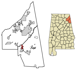
Cedar Bluff is a town in Cherokee County, Alabama, United States. At the 2010 census the population was 1,820. Unlike the rest of the county, Cedar Bluff is a wet town. Cedar Bluff is located on the north shore of Weiss Lake, noted for its crappie fishing.

Gaylesville, Alabama Town in Alabama, United States

Gaylesville is a town in Cherokee County, Alabama, United States. The population was 144 at the 2010 census.

Sand Rock, Alabama Town in Alabama, United States

Sand Rock is a town in Cherokee and DeKalb counties in the U.S. state of Alabama. It incorporated in 1988. At the 2010 census the population was 560.

Dahlonega, Georgia City in Georgia, United States

The city of Dahlonega is the county seat of Lumpkin County, Georgia, United States. As of the 2010 census, the city had a population of 5,242.

Hulbert, Oklahoma Town in Oklahoma, United States

Hulbert is a town in Cherokee County, Oklahoma, United States, named after Ben H. Hulbert, a prominent Cherokee man. The population was 590 at the 2010 census, an increase of 8.7 percent from 543 at the 2000 census. Our Lady of the Annunciation of Clear Creek Monastery is a Benedictine monastery located in Hulbert. The Clear Creek Monastery, recently elevated to the status of an abbey, is a foundation abbey of France's Notre Dame de Fontgombault, which is itself a foundation abbey of Saint Pierre de Solesmes, also in France.

Park Hill, Oklahoma Census-designated place in Oklahoma, United States

Park Hill is an unincorporated community and census-designated place (CDP) in southwestern Cherokee County, Oklahoma in the United States. The population was 3,909 at the 2010 census. It lies near Tahlequah, east of the junction of U.S. Route 62 and State Highway 82.

Cherokee, California Unincorporated community in California, United States

Cherokee is an unincorporated community and census-designated place in Butte County, California. It is an area inhabited by Maidu Indians prior to the gold rush, but that takes its name from a band of Cherokee prospectors who perfected a mining claim on the site. The population was 69 at the 2010 census. It lies at an elevation of 1306 feet.

Spring Garden, Alabama Census-designated place in Alabama, United States

Spring Garden is a census-designated place and unincorporated community in Cherokee County, Alabama, United States. Its population was 238 as of the 2010 census. The area was also known as Amberson or Ambersonville in the 19th century. It was erroneously called "Aubersonville" in the 1880 U.S. Census.

Bluffton, Alabama Unincorporated community in Alabama, United States

Bluffton is an unincorporated community in Cherokee County, Alabama, United States.

Pleasant Gap, Alabama Unincorporated community in Alabama, United States

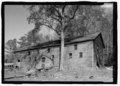
Pleasant Gap, also known as Pleasantsgap and Stocks Mills, is an unincorporated community in Cherokee County, in the U.S. state of Alabama.

Round Mountain, Alabama Unincorporated community in Alabama, United States

Round Mountain is an unincorporated community in Cherokee County, Alabama, United States. For a short period, it was an incorporated community beginning in 1908, and was listed in the 1910 U.S. Census as having 210 residents. That technically and briefly made it the largest town in Cherokee County, as neither the county seat of Centre nor Cedar Bluff returned census figures.

Tecumseh Furnace, Alabama Unincorporated community in Alabama, United States

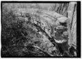
Tecumseh Furnace is an unincorporated community in Cherokee County, Alabama, United States.

References

  1. "Rock Run". Geographic Names Information System . United States Geological Survey.
  2. "Cherokee County, Ala". Calhoun Times. September 1, 2004. p. 46. Retrieved 24 April 2015.
  3. Smith Katie (Jun 17, 1984). "Names often lend special air to places". Gadsden Times. pp. B1. Retrieved 20 May 2015.
  4. "Cherokee County". Jim Forte Postal History. Retrieved 3 January 2015.
  5. "U.S. Decennial Census". Census.gov. Retrieved June 6, 2013.