Leesburg, Alabama

Last updated

Leesburg, Alabama
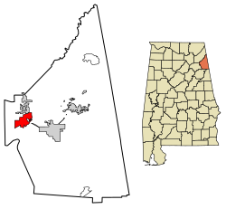
Cherokee County Alabama Incorporated and Unincorporated areas Leesburg Highlighted 0142016.svg
Location of Leesburg in Cherokee County, Alabama.
Coordinates: 34°10′57″N85°46′8″W / 34.18250°N 85.76889°W / 34.18250; -85.76889
Country United States
State Alabama
County Cherokee
Area
[1]
  Total6.28 sq mi (16.27 km2)
  Land6.27 sq mi (16.24 km2)
  Water0.01 sq mi (0.03 km2)
Elevation
610 ft (186 m)
Population
 (2020)
  Total911
  Density145.30/sq mi (56.10/km2)
Time zone UTC-6 (Central (CST))
  Summer (DST) UTC-5 (CDT)
ZIP code
35983
Area code 256
FIPS code 01-42016
GNIS feature ID0152019
Website www.leesburgal.com

Leesburg is a town in Cherokee County, Alabama, United States. At the 2020 census, the population was 911.

Contents

History

Leesburg was originally called Hamptonville; it was named for Joseph Hampton and the Henslee family respectively. [2] A post office was established as Hamptonville in 1836, and in 1839 the name was changed to Leesburg. [3]

Geography

Leesburg is located in western Cherokee County at 34°10'57.446" North, 85°46'8.350" West (34.182624, -85.768986). [4] It is bordered by Lookout Mountain and the town of Sand Rock to the north and Weiss Lake on the Coosa River to the south. Weiss Dam, forming the lake, is located just south of the town limits.

U.S. Route 411 runs through the town from west to east, leading southeast 5 mi (8 km) to Centre, the county seat of Cherokee County, and southwest 19 mi (31 km) to Gadsden. Alabama State Route 68 meets US-411 in town, leading north 5 mi (8 km) to Sand Rock, and following US-411 east to Centre.

According to the U.S. Census Bureau, Leesburg has a total area of 6.4 square miles (16.7 km2), of which 0.019 square miles (0.05 km2), or 0.29%, is water. [5]

Demographics

Historical population
CensusPop.Note
1970 98
1980 11618.4%
1990 21887.9%
2000 799266.5%
2010 1,02728.5%
2020 911−11.3%
U.S. Decennial Census [6]
2013 Estimate [7]

2020 census

Leesburg racial composition [8]
RaceNum.Perc.
White (non-Hispanic)83791.88%
Black or African American (non-Hispanic)111.21%
Native American 90.99%
Asian 20.22%
Other/Mixed 424.61%
Hispanic or Latino 101.1%

As of the 2020 United States census, there were 911 people, 381 households, and 292 families residing in the town.

2010 census

As of the census [9] of 2010, there were 1,027 people, 409 households, and 298 families residing in the town. The population density was 160 inhabitants per square mile (62/km2). There were 663 housing units at an average density of 103.6 per square mile (40.0/km2). The racial makeup of the town was 96.5% White, 0.0% Native American, 0.0% Asian, 0.5% from other races, and 1.9% from two or more races. 1.3% of the population were Hispanic or Latino of any race.

There were 409 households, out of which 29.1% had children under the age of 18 living with them, 55.3% were married couples living together, 11.0% had a female householder with no husband present, and 27.1% were non-families. 22.0% of all households were made up of individuals, and 9.3% had someone living alone who was 65 years of age or older. The average household size was 2.51 and the average family size was 2.90.

In the town, the population was spread out, with 23.5% under the age of 18, 8.9% from 18 to 24, 25.1% from 25 to 44, 29.4% from 45 to 64, and 13.1% who were 65 years of age or older. The median age was 40.4 years. For every 100 females, there were 103.4 males. For every 100 females age 18 and over, there were 102.8 males.

The median income for a household in the town was $36,806, and the median income for a family was $45,714. Males had a median income of $32,075 versus $26,793 for females. The per capita income for the town was $18,392. About 12.5% of families and 15.6% of the population were below the poverty line, including 18.2% of those under age 18 and 12.2% of those age 65 or over.
Government

The town of Leesburg operates a Mayor–council government, composed of Mayor Brandy Pierce and 5 town council members. Place #1 is held by Councilman Frankie Brewster, Place #2 is held by Councilman Joe Sonaty, Place #3 is held by Councilman Jimmy Tillery, Place #4 is held by Councilman Wayne Byram, and Place #5 is held by Councilwoman Melissa Rodriguez. [10]

Climate

Climate is characterized by relatively high temperatures and evenly distributed precipitation throughout the year. The Köppen Climate Classification subtype for this climate is "Cfa" (Humid Subtropical Climate). [11]

Notable person

Related Research Articles

<span class="mw-page-title-main">Cherokee County, Alabama</span> County in Alabama, United States

Cherokee County, Alabama is a county located in the northeastern part of the U.S. state of Alabama. As of the 2020 census, the population was 24,971. Its county seat is Centre. The county is named for the Cherokee tribe.

<span class="mw-page-title-main">Etowah County, Alabama</span> County in Alabama, United States

Etowah County is a county located in the northeastern part of the U.S. state of Alabama. As of the 2020 census the population was 103,436. Its county seat is Gadsden. Its name is from a Cherokee word meaning "edible tree". In total area, it is the smallest county in Alabama, but one of the most densely populated. Etowah County comprises the Gadsden Metropolitan Statistical Area.

<span class="mw-page-title-main">Lawrence County, Alabama</span> County in Alabama, United States

Lawrence County is a county in the northern part of the U.S. state of Alabama. As of the 2020 census, the population was 33,073. The county seat is Moulton. The county was named after James Lawrence, a captain in the United States Navy from New Jersey.

<span class="mw-page-title-main">Garden City, Alabama</span> Town in Alabama, United States

Garden City is a town in Cullman and Blount counties in the U.S. state of Alabama. At the 2020 census, the population was 528. Garden City was founded by Johann Cullmann, namesake of Cullman County in 1873 after founding Cullman, Alabama. It was located in Blount County and was incorporated in 1878. Cullman County was created in 1877. Garden City was annexed by Cullman County with a shift in county borders until 1901. After a lapse in its incorporation, it was re-incorporated in 1950.

<span class="mw-page-title-main">Cedar Bluff, Alabama</span> Town in Alabama, United States

Cedar Bluff is a town in Cherokee County, Alabama, United States. At the 2020 census, the population was 1,845. Unlike the rest of the county, Cedar Bluff is a wet town. Cedar Bluff is located on the north shore of Weiss Lake, noted for its crappie fishing.

<span class="mw-page-title-main">Centre, Alabama</span> City in and county seat of Cherokee County, Alabama

Centre is a city in Cherokee County, Alabama, United States. At the 2020 census, the population was 3,587. The city is the county seat of Cherokee County.

<span class="mw-page-title-main">Collinsville, Alabama</span> Town in Alabama, United States

Collinsville is a town in DeKalb and Cherokee counties in the U.S. state of Alabama. It was incorporated in 1887. As of the 2010 census, the population was 1,983.

<span class="mw-page-title-main">Gaylesville, Alabama</span> Town in Alabama, United States

Gaylesville is a town in Cherokee County, Alabama, United States. The population was 144 at the 2010 census.

<span class="mw-page-title-main">Sand Rock, Alabama</span> Town in Alabama, United States

Sand Rock is a town in Cherokee and DeKalb counties in the U.S. state of Alabama. It incorporated in 1988. At the 2020 census, the population was 591.

<span class="mw-page-title-main">Crossville, Alabama</span> Town in Alabama, United States

Crossville is a town in DeKalb County, Alabama, United States. At the 2010 census the population was 1,862, up from 1,431 in 2000. Crossville is located atop Sand Mountain, a southern extension of the Cumberland Plateau.

<span class="mw-page-title-main">Valley Head, Alabama</span> Town in Alabama, United States

Valley Head is a town in DeKalb County, Alabama, United States. Although the town incorporated in 1921, it was also listed as being incorporated on the 1890 U.S. Census. At the 2020 census, the population was 577.

<span class="mw-page-title-main">Section, Alabama</span> Town in Alabama, United States

Section is a town in Jackson County, Alabama, United States and is included in the Chattanooga-Cleveland-Dalton, TN-GA-AL Combined Statistical Area. As of the 2010 census, the population of the town was 770, an increase of one person (769) from 2000. Section is located on top of Sand Mountain.

<span class="mw-page-title-main">Lexington, Alabama</span> Town in Alabama, United States

Lexington is a town in Lauderdale County, Alabama, United States. It is part of the Florence–Muscle Shoals Metropolitan Statistical Area known as "The Shoals". It incorporated in 1959. As of the 2010 census, the population of the town is 735, down from 840 in 2000. The current mayor of Lexington is Sandra Killen-Burroughs.

<span class="mw-page-title-main">Hayneville, Alabama</span> Town in Alabama, US

Hayneville is a town in Lowndes County, Alabama, United States and its county seat. At the 2010 census the population was 932, down from its record high of 1,177 in 2000. It is also part of the Montgomery Metropolitan Statistical Area. It initially incorporated in 1831, but lapsed, finally reincorporating in 1967. Before 1970, the town appeared only twice on the U.S. Census: in 1850 and 1890. The 1850 estimate of 800 residents ranked it as the largest town in the county at the time.

<span class="mw-page-title-main">Frisco City, Alabama</span> Town in Alabama, United States

Frisco City is a town in Monroe County, Alabama, United States. The population was 1,170 at the 2020 census.

<span class="mw-page-title-main">Wadley, Alabama</span> Town in Alabama, United States

Wadley is a town in Randolph County, Alabama, United States. It is home to the Wadley campus of Southern Union State Community College. As of the 2010 census, the population of the town was 751, up from 640 in 2000. According to the 1910 U.S. Census, the town was incorporated in 1908.

<span class="mw-page-title-main">Camp Hill, Alabama</span> Town in Alabama, United States

Camp Hill is a town in Tallapoosa County, Alabama, United States. It was incorporated in 1895. At the 2010 census the population was 1,014, down from 1,273 in 2000. Camp Hill is the home to Southern Preparatory Academy.

<span class="mw-page-title-main">Friant, California</span> Census-designated place in California, United States

Friant is a census-designated place (CDP) in Fresno County, California, United States. The population was 549 at the 2010 census, down from 778 at the 2000 census. Friant is located 11.5 miles (19 km) north of Clovis, at an elevation of 344 feet.

<span class="mw-page-title-main">Adairsville, Georgia</span> City in Georgia, United States

Adairsville is a city in Bartow County, Georgia, United States. As of the 2020 census, the city had a population of 4,878. Adairsville is approximately halfway between Atlanta and Chattanooga on Interstate 75. It is 12 miles (19 km) south of Calhoun, 18 miles (29 km) northeast of Rome and 61 miles (98 km) north of Atlanta.

<span class="mw-page-title-main">New Martinsville, West Virginia</span> City in West Virginia, United States

New Martinsville is a city in and the county seat of Wetzel County, West Virginia, United States, along the Ohio River. The population was 5,186 at the 2020 census.

References

  1. "2020 U.S. Gazetteer Files". United States Census Bureau. Retrieved October 29, 2021.
  2. "Cherokee County, Ala". Calhoun Times. September 1, 2004. p. 45. Retrieved April 24, 2015.
  3. "Cherokee County". Jim Forte Postal History. Retrieved April 25, 2015.
  4. "US Gazetteer files: 2010, 2000, and 1990". United States Census Bureau. February 12, 2011. Retrieved April 23, 2011.
  5. "Geographic Identifiers: 2010 Demographic Profile Data (G001): Leesburg town, Alabama". U.S. Census Bureau, American Factfinder. Archived from the original on February 12, 2020. Retrieved June 3, 2014.
  6. "U.S. Decennial Census". Census.gov. Retrieved June 6, 2013.
  7. "Annual Estimates of the Resident Population: April 1, 2010 to July 1, 2013". Archived from the original on May 22, 2014. Retrieved June 3, 2014.
  8. "Explore Census Data". data.census.gov. Retrieved December 11, 2021.
  9. "U.S. Census website". United States Census Bureau . Retrieved July 11, 2015.
  10. "Cherokee County Municipalities Swear In New Council Members/Mayors". Award-Winning WEISRadio.com | The Voice of Cherokee County | Local & Area News, Sports, & Weather. November 3, 2020. Retrieved December 16, 2020.
  11. Climate Summary for Leesburg, Alabama

34°10′57″N85°46′08″W / 34.182624°N 85.768986°W / 34.182624; -85.768986