Fort Braden, Florida

Last updated
Fort Braden, Florida
Fort Braden General Store n034128.jpg
Fort Braden store, date unknown
USA Florida location map.svg
Red pog.svg
Fort Braden
Usa edcp location map.svg
Red pog.svg
Fort Braden
Coordinates: 30°25′39″N84°31′59″W / 30.42750°N 84.53306°W / 30.42750; -84.53306 Coordinates: 30°25′39″N84°31′59″W / 30.42750°N 84.53306°W / 30.42750; -84.53306
Country Flag of the United States.svg  United States
State Florida
County Leon
Area
[1]
  Total5.17 sq mi (13.39 km2)
  Land4.35 sq mi (11.26 km2)
  Water0.82 sq mi (2.14 km2)
Elevation
[2]
125 ft (38 m)
Population
 (2020)
  Total1,045
  Density240.45/sq mi (92.84/km2)
Time zone UTC-5 (Eastern (EST))
  Summer (DST) UTC-4 (EDT)
ZIP Code
32310 (Tallahassee)
Area code(s) 850/448
FIPS code 12-23680
GNIS feature ID2805176 [2]

Fort Braden is a historic location and census-designated place (CDP) in western Leon County, Florida, United States. It was first listed as a CDP in the 2020 census with a population of 1,045. [3]

Contents

Demographics

Historical population
CensusPop.
2020 1,045
U.S. Decennial Census [4]
2020 [5]

2020 census

Fort Braden CDP, Florida – Demographic Profile
(NH = Non-Hispanic)
Race / EthnicityPop 2020 [5] % 2020
White alone (NH)90386.41%
Black or African American alone (NH)232.20%
Native American or Alaska Native alone (NH)70.67%
Asian alone (NH)40.38%
Pacific Islander alone (NH)00.00%
Some Other Race alone (NH)40.38%
Mixed Race/Multi-Racial (NH)545.17%
Hispanic or Latino (any race)504.78%
Total1,045100.00%

Note: the US Census treats Hispanic/Latino as an ethnic category. This table excludes Latinos from the racial categories and assigns them to a separate category. Hispanics/Latinos can be of any race.

History

On December 3, 1839, Fort Braden was established as a military fort during the Second Seminole War, 1st Lieutenant Seth B. Thornton of Company G, 2nd U.S. Dragoons built the fort and was its first Commanding Officer. The list of Commanding Officers were as follows:

January 1840 – February 1840 – Lt. Seth Barton Thornton Company G, Second (Howes) Dragoons

February 1840 – March 1840 – Capt. S Eastman First Infantry (Temporary Assignment until C.A. May arrived)

March 4, 1840 – July 1840 – Lt. C.A. May Company G, Second Dragoons

August 1840 – November 1840 – Capt. Arthur Burney Mounted Militia, General Leigh Reed Territorial Militia (Unit was Mustered Out)

December 1840 – March 1841 Capt. Mew Mounted Militia, General Reed, Territorial Militia (Mustered at Fort Braden and Mustered Out)

July 31, 1842 -- June 7, 1842, Deserted/Occupied as necessary by Federals/Militia

April 7, 1842 -- June 7, 1842, Capt. S.B. Thornton Company F, Second Dragoons

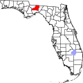
It was near the Ochlockonee River on the 126 feet contour just south of the then "Pork Creek" (now known as Polk Creek) eighteen miles southwest of Tallahassee. Fort Braden was named for Virginia Braden, formerly Virginia Ward. She married Dr. Joseph Braden, a prominent citizen of Tallahassee. Joseph Braden's brother, Hector, was director of Tallahassee's Union Bank.

Virginia was the daughter of Leon County plantation owner George T. Ward, of Southwood Plantation and Waverly Plantation.

On July 12, 1840, a fight with Indians by two soldiers of Company B of the 2nd Infantry stationed at Fort Braden resulted in their deaths, The two soldiers were traveling from Fort White, Florida back to Fort Braden (mistakenly reported in some newspaper accounts of the incident as “Fort Brady”) and were attacked in Cow Creek Hammock about 4 miles from Fort White.  Cow Creek is a creek that runs into the Santa Fe River close by Fort White.

The incident was reported in the Daily Chronicle & Sentinel (Augusta, Ga.) on July 31, 1840:

“A daring murder was committed on the 12th ins. [July] at the hammock of Cow Creek, near Fort White.  Sgt. Ziegler and Cpl Sweatman of Company B, 2nd Inf. were returning from Fort White to Fort Brady [Braden], the Sgt mounted and the Corp’l on foot.  At the place before mentioned, they were fired upon by a party of 21 Indians.  The Corporal was undoubtedly immediately killed, but the sergeant, it would appear, tho’ badly wounded, fought until knocked down by superior numbers.  The bodies of both soldiers were horribly mutilated in a manner too revolting for publication.  After the murder, the Indians blazed a tree where they painted a figure of an Indian under which they made 21 marks indicative of their number.  Against the tree they placed an iron pointed arrow dipped in the blood of their victims.  The next day they were pursued by a party of 23 men under Captain J.R, Smith, but to no purpose.”

The soldiers, Sergeant William Ziegler and Corporal Daniel Sweatman were initially interred in Cow Creek hammock community near Fort White.  Their military records indicate they were reinterred in the Saint Augustine National Cemetery in 1907 under the pyramids there that identify soldiers killed during this period.

Fort Braden was abandoned on June 7, 1842, at the conclusion of the Second Seminole War. The historical site is on a 94 acre parcel of privately held land of the Herold family at approximate GPS 30.25.50 -84.32.00. For years the actual site of Fort Braden, or Fort Virginia Braden, has been speculated to be one of several places known as Jackson Bluffs between the original channel of the Oclocknee River (now flooded by Lake Talquin) and Highway 20 in SW Leon County. Several were close, but none documented the actual location, but it was hidden in "plain sight" being documented in a legal historical Platt Book and Survey for a large north Florida land purchase known as the Forbes' Purchase, <1852-1856> that contained printed forms and maps, some of which were completed in manuscript by surveyors Randolph and Hunter; McIver and Galbraith, James D. Galbraith; Hodgson, Randolph and Hunter; M.A. Williams, and McIver and Louis.  The documents are available in the FSU Strozier Library Special Collections and Archives Florida (Oversize) F314 .P56 1852a, and showed the Fort location, surrounding fields, and path of the old Fort Braden Road that led right up to the front gates of the Fort.

The survey shows the Fort is located south of “Pork Creek" (now known as Polk Creek), a tributary to the Oclocknee River, built at the 120 feet elevation. It is located on private property, owned currently by the Herold Family Trust, but was also owned in 1999 by the Herold Family that farmed the land, and later planted it as a tree farm, which is the current state of the property.  No visible signs remain of the Fort structure that is located at approximately 30 degrees 25 minutes 50 seconds North, 84 degrees 32 minutes West, but an exhibit from a 1999 Masters Thesis written by FSU student Wendy Richard shows the location of the Fort and surrounding fields. Wendy’s Thesis shows the archeological work that was done by her team at the site in 1999. The details of the artifacts discovered at the site are cataloged in detail of the Thesis available at the FSU Strozier Library, General Collections E83.835 .R53 1999  titled "Looking for Fort Braden: A Second Seminole War Fort 1839-1842."

Like other forts around the nation, a small community had grown near this fort. In 1843 an E.M. Garnett attending the Leon County Convention in Tallahassee came from the area. In 1847 collection of taxes took place at the Fort Braden School House. In 1856 and 1872 Fort Braden was one of the voting precincts in Leon County.

Cotton planters

Though Fort Braden was south of the cotton rich Red Hills Region, it had successful planters Hugh Black, H.H. Black, P.B. Chanlers, John Gray, Joseph Haines, C. Gray, John Grissette, R.L. Harvey, and J. E. Williams.

Early churches

It is reported that in Florida State Gazetteer of 1886-1887 that Fort Braden had one Methodist church and one Baptist church.

Other buildings

Fort Braden is reported to have had a school house, a blacksmith shop, a grist mill, and a cotton gin.

See also

Related Research Articles

<span class="mw-page-title-main">Tallahassee, Florida</span> Capital city of Florida, United States

Tallahassee is the capital city of the U.S. state of Florida. It is the county seat and only incorporated municipality in Leon County. Tallahassee became the capital of Florida, then the Florida Territory, in 1824. In 2020, the population was 196,169, making it the 8th-largest city in the U.S state of Florida, and the 126th-largest city in the United States. The population of the Tallahassee metropolitan area was 385,145 as of 2018. Tallahassee is the largest city in the Florida Big Bend and Florida Panhandle region, and the main center for trade and agriculture in the Florida Big Bend and Southwest Georgia regions.

<span class="mw-page-title-main">Leon County, Florida</span> County in Florida, United States

Leon County is a county in the Panhandle of the U.S. state of Florida. It was named after the Spanish explorer Juan Ponce de León. As of the 2020 census, the population was 292,198.

<span class="mw-page-title-main">Manatee County, Florida</span> County in Florida, United States

Manatee County is a county in the U.S. state of Florida. As of the 2020 US Census, the population was 399,710. Manatee County is part of the Bradenton-Sarasota-Venice, Florida Metropolitan Statistical Area. Its county seat and largest city is Bradenton. The county was created in 1855 and named for the Florida manatee, Florida's official marine mammal. Features of Manatee County include access to the southern part of the Tampa Bay estuary, the Sunshine Skyway Bridge, and the Manatee River.

<span class="mw-page-title-main">Wakulla County, Florida</span> County in Florida, United States

Wakulla County is a county located in the Big Bend region in the northern portion of the U.S. state of Florida. As of the 2020 census, the population was 33,764. Its county seat is Crawfordville.

<span class="mw-page-title-main">Seminole Wars</span> Conflicts in Florida between the US govt. and Seminole Nation (1816–58)

The Seminole Wars were a series of three military conflicts between the United States and the Seminoles that took place in Florida between about 1816 and 1858. The Seminoles are a Native American nation which coalesced in northern Florida during the early 1700s, when the territory was still a Spanish colonial possession. Tensions grew between the Seminoles and settlers in the newly independent United States in the early 1800s, mainly because enslaved people regularly fled from Georgia into Spanish Florida, prompting slaveowners to conduct slave raids across the border. A series of cross-border skirmishes escalated into the First Seminole War in 1817, when General Andrew Jackson led an incursion into the territory over Spanish objections. Jackson's forces destroyed several Seminole and Black Seminole towns and briefly occupied Pensacola before withdrawing in 1818. The U.S. and Spain soon negotiated the transfer of the territory with the Adams-Onis Treaty of 1819.

<span class="mw-page-title-main">Middleburg, Florida</span> Census-designated place in Florida, United States

Middleburg is an unincorporated area and census-designated place (CDP) within Clay County in the U.S. state of Florida, located 26 miles (42 km) southwest of downtown Jacksonville and 16 miles (26 km) northwest of Green Cove Springs, the county seat of Clay County. As of the 2020 census,the population of Middleburg was 12,881.

<span class="mw-page-title-main">Second Seminole War</span> 1835–42 war in Florida

The Second Seminole War, also known as the Florida War, was a conflict from 1835 to 1842 in Florida between the United States and groups collectively known as Seminoles, consisting of Native Americans and Black Indians. It was part of a series of conflicts called the Seminole Wars. The Second Seminole War, often referred to as the Seminole War, is regarded as "the longest and most costly of the Indian conflicts of the United States". After the Treaty of Payne's Landing in 1832 that called for the Seminole's removal from Florida, tensions rose until open hostilities started with Dade battle. For the next four years, the Seminole and the U.S. forces engaged in small engagements and by 1842 only a few hundred native peoples remained in Florida. The war was declared over on August 14, 1842.

Halleck Tustenuggee was a 19th-century Seminole war chief. He fought against the United States government in the Second Seminole War and for the government in the American Civil War.

<span class="mw-page-title-main">Battle of Wahoo Swamp</span> Extended military engagement of the Second Seminole War

The Battle of Wahoo Swamp was an extended military engagement of the Second Seminole War fought in November 1836 in the Wahoo Swamp, approximately 50 miles northeast of Fort Brooke in Tampa and 35 miles south of Fort King in Ocala in modern Sumter County, Florida. General Richard K. Call, the territorial governor of Florida, led a mixed force consisting of Florida militia, Tennessee volunteers, Creek mercenaries, and some troops of the US Army and Marines against Seminole forces led by chiefs Osuchee and Yaholooche.

<span class="mw-page-title-main">Miccosukee, Florida</span> Unincorporated community in Florida, United States

Miccosukee is a small unincorporated community in northeastern Leon County, Florida, United States. It is located at the junction of County Road 59 and County Road 151. Miccosukee was a major center of the Miccosukee tribe, one of the tribes of the developing Seminole nation, during the 18th century.

<span class="mw-page-title-main">Southwood Plantation</span>

Southwood Plantation was a large cotton plantation of 5,000 acres (20 km2) located in southern Leon County, Florida, United States and owned by George Taliafero Ward.

<span class="mw-page-title-main">Francis W. Eppes</span> American politician and planter

Francis Wayles Eppes was a planter and slave owner from Virginia who became a cotton planter in the Florida Territory and later civic leader in Tallahassee and surrounding Leon County, Florida. After reaching legal age and marrying, Eppes operated the Poplar Forest plantation which his grandfather President Thomas Jefferson had established in Bedford County, Virginia, which he inherited. However, in 1829 he moved with his family to near Tallahassee, Florida. Long interested in education, in 1856 Eppes donated land and money to designate a school in Tallahassee as one of the first two state-supported seminaries, now known as Florida State University. He served as president of its board of trustees for eight years.

The history of Leon County, Florida, much like the History of Tallahassee, dates back to the settlement of the Americas. Beginning in the 16th century, the region was colonized by Europeans, becoming part of Spanish Florida. In 1819, the Adams–Onís Treaty ceded Spanish Florida, including modern-day Leon County, to the United States. Named for Spanish explorer Juan Ponce de León, Leon County became an official U.S. county in 1824; the American takeover led to the county's rapid expansion as growing numbers of cotton plantations began to spring up nearby, increasing Leon County's population significantly.

<span class="mw-page-title-main">Waverly Plantation (Leon County, Florida)</span>

Waverly Plantation was a large cotton plantation of unknown size, located in southern Leon County, Florida, United States, owned by George Taliaferro Ward.

The history of Tallahassee, Florida, much like the history of Leon County, dates back to the settlement of the Americas. Beginning in the 16th century, the region was colonized by Europeans, becoming part of Spanish Florida. In 1819, the Adams–Onís Treaty ceded Spanish Florida, including modern-day Tallahassee, to the United States. Tallahassee became a city and the state capital of Florida in 1821; the American takeover led to the settlements' rapid expansion as growing numbers of cotton plantations began to spring up nearby, increasing Tallahassees' population significantly.

<span class="mw-page-title-main">History of Florida State University</span>

The history of Florida State University dates to the 19th century and is deeply intertwined with the history of education in the state of Florida and in the city of Tallahassee. Florida State University, known colloquially as Florida State and FSU, is one of the oldest and largest of the institutions in the State University System of Florida. It traces its origins to the West Florida Seminary, one of two state-funded seminaries the Florida Legislature voted to establish in 1851.

<span class="mw-page-title-main">Theodore W. Brevard Jr.</span> American politician

Theodore Washington Brevard Jr. was best known for having served as a military officer in the Confederate States Army. During his tenure with the Confederate army, he eventually reached the rank of Brigadier-General. Brevard was captured by the forces of General George Custer and imprisoned at Johnson's Island. He later died in 1882.

Louise Jones Gopher is the second Seminole and the first woman from the Seminole tribe of Florida to earn a bachelor's degree. Gopher, a former director of education for the Seminole Tribe of Florida, was the first female Seminole to earn a bachelor's degree when she graduated from Florida Atlantic University in 1970. Born May 25, 1945, in a chickee at a tribal camp in Fort Pierce, Jones spoke no English when she entered school at age 6. Because they were considered neither black nor white, none of the segregated schools of the day would willingly take her as a student, but at the pleading of her father, Lucie County Schools Superintendent Ben L. Bryan chose to allow her to enroll in the Fairlawn School. In 2014, she was granted an honorary Doctorate of Humane Letters from Florida State University. She is the third Seminole to receive an honorary degree from FSU, after Betty Mae Tiger Jumper and Jim Shore. The Palm Beach Post named her one of the most 100 influential people in Florida in the 20th century.

<span class="mw-page-title-main">Fort Fulton</span> Former fort in Florida, USA

Fort Fulton was established on February 21, 1840, between Old Kings Road and Pellicer Creek in present-day Flagler County, Florida. A January 17, 1840 article in the Florida Herald of St. Augustine stated, "Can anyone inform us why the Mounted Volunteer Company, raised in this city, and now stationed at Hewlett’s [Hewitt’s] Mill, is weakened by a detail of ten men subject to the order of the city council, and kept in town idle." This article suggests that Fort Fulton was most likely manned with militia volunteers since it was the only military post in the general area of Hewitt's Mill. Hewitt's Mill was a sawmill built in 1768 by John Hewitt on his 1,000-acre plot of land in St. Johns County. This sawmill is known to have supplied many wooden building materials to the St. Augustine area and surrounding plantations.

<span class="mw-page-title-main">Benjamin Chaires</span> Wealthy Florida planter and slave owner

Benjamin Chaires Sr. (1786–1838) was an American planter, land owner, banker and investor in Territorial Florida, and may have been the richest man in Florida in the 1830s. He was involved in the creation of the first railroads in Florida.

References

  1. "2020 U.S. Gazetteer Files". United States Census Bureau. Retrieved October 31, 2021.
  2. 1 2 "Fort Braden Census Designated Place". Geographic Names Information System . United States Geological Survey, United States Department of the Interior.
  3. "Fort Braden CDP, Florida". United States Census Bureau . Retrieved April 30, 2022.
  4. "Decennial Census of Population and Housing by Decades". US Census Bureau.
  5. 1 2 "P2 HISPANIC OR LATINO, AND NOT HISPANIC OR LATINO BY RACE – 2020: DEC Redistricting Data (PL 94-171) – Fort Braden CDP, Florida". United States Census Bureau .