
Crow Agency is a census-designated place (CDP) in Big Horn County, Montana, United States and is near the actual location for the Little Bighorn National Monument and re-enactment produced by the Real Bird family known as Battle of the Little Bighorn Reenactment. The population was 1,616 at the 2010 census. It is the governmental headquarters of the Crow Native Americans. It is also the location of the "agency offices" where the federal Superintendent of the Crow Indian Reservation and his staff interacts with the Crow Tribe, pursuant to federal treaties and statutes.

Laramie is a city in and the county seat of Albany County, Wyoming, United States. The population was estimated 32,711 in 2019, making it the third-most populous city in Wyoming after Cheyenne and Casper. Located on the Laramie River in southeastern Wyoming, the city is north west of Cheyenne, at the junction of Interstate 80 and U.S. Route 287.

The North Platte River is a major tributary of the Platte River and is approximately 716 miles (1,152 km) long, counting its many curves. In a straight line, it travels about 550 miles (890 km), along its course through the U.S. states of Colorado, Wyoming, and Nebraska.

The Treaty of Fort Laramie is an agreement between the United States and the Oglala, Miniconjou, and Brulé bands of Lakota people, Yanktonai Dakota, and Arapaho Nation, following the failure of the first Fort Laramie treaty, signed in 1851.

Fort Laramie was a significant 19th-century trading post, diplomatic site, and military installation located at the confluence of the Laramie and the North Platte Rivers. They joined in the upper Platte River Valley in the eastern part of the present-day U.S. state of Wyoming. The fort was founded as a private trading-post in the 1830s to service the overland fur trade; in 1849, it was purchased by the United States Army. The site was located east of the long climb leading to the best and lowest crossing-point over the Rocky Mountains at South Pass and became a popular stopping-point for migrants on the Oregon Trail. Along with Bent's Fort on the Arkansas River, the trading post and its supporting industries and businesses were the most significant economic hub of commerce in the region.

The Bozeman Trail was an overland route in the Western United States, connecting the gold rush territory of southern Montana to the Oregon Trail in eastern Wyoming. Its most important period was from 1863 to 1868. Despite the fact that the major part of the route in Wyoming used by all Bozeman Trail travelers in 1864 was pioneered by Allen Hurlbut, it was named after John Bozeman. Many miles of the Bozeman Trail in present Montana followed the tracks of Bridger Trail, opened by Jim Bridger in 1864.

Fort Phil Kearny was an outpost of the United States Army that existed in the late 1860s in present-day northeastern Wyoming along the Bozeman Trail. Construction began in 1866 on Friday, July 13, by Companies A, C, E, and H of the 2nd Battalion, 18th Infantry, under the direction of the regimental commander and Mountain District commander Colonel Henry B. Carrington.

The Laramie Plains is an arid highland at an elevation of approx. 8,000 feet (2,400 m) in south central Wyoming in the United States. The plains extend along the upper basin of the Laramie River on the east side of the Medicine Bow Range. The city of Laramie is the largest community in the valley. The plains are separated from the Great Plains to the east by the Laramie Mountains, a spur of the Front Range that extends northward from Larimer County, Colorado west of Cheyenne. The high altitude of the region makes for a cold climate and a relatively short growing season. Unsuitable to most cultivation, the plains have historically been used for livestock raising, primarily of sheep and cattle.

Fort Fetterman was constructed in 1867 by the United States Army on the Great Plains frontier in Dakota Territory, approximately 11 miles northwest of present-day Douglas, Wyoming. Located high on the bluffs south of the North Platte River, it served as a major base for the start of several United States military expeditions against warring Native American tribes. The fort is listed on the National Register of Historic Places.

Fort Reno also known as Fort Connor or Old Fort Reno, was a wooden fort established on August 15, 1865 by the United States Army in Dakota Territory in present-day Johnson County, Wyoming. The fort was built to protect travelers on the Bozeman Trail from Native American tribes.
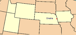
The Department of the Platte was a military administrative district established by the U.S. Army on March 5, 1866, with boundaries encompassing Iowa, Nebraska, Dakota Territory, Utah Territory and a small portion of Idaho. With headquarters in Omaha, the district commander oversaw the army's role initially along the Overland route to Salt Lake City, then later the construction route of the Union Pacific Railroad. The district also included the Montana road through eastern Wyoming. The district was discontinued when the Army's command was reorganized in 1898.

There is evidence of prehistoric human habitation in the region known today as the U.S. state of Wyoming stretching back roughly 13,000 years. Stone projectile points associated with the Clovis, Folsom and Plano cultures have been discovered throughout Wyoming. Evidence from what is now Yellowstone National Park indicates the presence of vast continental trading networks since around 1,000 years ago.

The Emigrant Trail in Wyoming, which is the path followed by Western pioneers using the Oregon, California, and Mormon Trails, spans 400 miles (640 km) through the U.S. state of Wyoming. The trail entered from Nebraska on the eastern border of the state near the present day town of Torrington and exited on the western border near the towns of Cokeville and Afton. An estimated 350,000 to 400,000 settlers traveled on the trail through Wyoming between 1841 and 1868. All three trails follow the same path through most of the state. The Mormon Trail splits at Fort Bridger and enters Utah, while the Oregon and California Trails continue to Idaho.
The Overland Trail was a stagecoach and wagon trail in the American West during the 19th century. While portions of the route had been used by explorers and trappers since the 1820s, the Overland Trail was most heavily used in the 1860s as a route alternative to the Oregon, California, and Mormon trails through central Wyoming. The Overland Trail was famously used by the Overland Stage Company owned by Ben Holladay to run mail and passengers to Salt Lake City, Utah, via stagecoaches in the early 1860s. Starting from Atchison, Kansas, the trail descended into Colorado before looping back up to southern Wyoming and rejoining the Oregon Trail at Fort Bridger. The stage line operated until 1869 when the completion of the First transcontinental railroad eliminated the need for mail service via stagecoach.

Fort Halleck was a military outpost that existed in the 1860s along the Overland Trail and stage route in what was then the Territory of Idaho, now the U.S. state of Wyoming. The fort was established in 1862 to protect emigrant travelers and stages transporting mail between Kansas and Salt Lake City, Utah, and named for Major General Henry Wager Halleck, commander of the Department of the Missouri and later General-in-chief of the Union armies.

Fort Brady was a frontier fort established in Sault Sainte Marie, Michigan to guard against British incursions from Canada. The original location of the fort, known as Old Fort Brady, was along the Saint Mary's River. Fort Brady was located at this site from 1822 until 1893, when it was moved to a new location on higher ground, known as New Fort Brady. The fort was located at the new site from 1893 until its close in 1944. The site of Old Fort Brady was designated a Michigan State Historic Site in 1956 and listed on the National Register of Historic Places in 1971; New Fort Brady was designated a Michigan State Historic Site in 1970 and listed on the National Register of Historic Places in 1972.

The Sussex Post Office and Store, also known as Sussex Community Hall, is located on the north bank of the Powder River in southeast Johnson County about twenty miles east of Kaycee, Wyoming. The store was built in 1914, and was listed on the National Register of Historic Places in 1998.

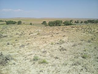
The Powder River Crossing, officially known as Powder River Station-Powder River Crossing , is an abandoned settlement located on the east bank of the Powder River in southeast Johnson County about twenty-four miles east of Kaycee, Wyoming. It developed after a wooden toll bridge was built across the Powder River in 1877, at a site that was originally used as a ford. With crossing secured, a settlement developed here in the late 19th century, incorporating a stage stop on the Bozeman Trail. The site is notable for having well-preserved wagon ruts from the pioneer era.
Crazy Woman Crossing is a historic place on the Bozeman Trail, in Johnson County, Wyoming, United States, about twenty miles southeast of Buffalo. Crazy Woman Crossing was one of three major fords used by travelers across creeks and rivers in this area. It is significant as the site of the Battle of Crazy Woman, a skirmish during Red Cloud's War in 1866. The United States pulled out of this territory after negotiation with the Lakota and allies of the Treaty of Fort Laramie of 1868.

Fort Steele, also known as Fort Fred Steele, was established to protect the newly built Union Pacific Railroad from attacks by Native Americans during construction of the transcontinental railroad in the United States. The fort was built in 1868 where the railroad crossed the North Platte River in Carbon County, Wyoming. Work on the fort was carried out by military and civilian labor. Fort Steele was one of three forts built on the line. Fort Sanders near Laramie and Fort D.A. Russell at Cheyenne were the other railroad forts. Fort Steele was named for the recently deceased General Frederick Steele.


