Fort Zeelandia (Guyana)

Last updated
Fort Zeelandia
Part of Essequibo
Vlaggeneiland-Fort-Zeelandia-Essequebo.jpg
Map of Fort Zeelandia on the Flag Island
Guyana location map.svg
Red pog.svg
Fort Zeelandia
Coordinates 6°47′00″N58°31′00″W / 6.783333°N 58.516667°W / 6.783333; -58.516667
Site history
Built1726 (1726)
Garrison information
Occupants Dutch Republic (1726-1795)
Batavian Republic/Commonwealth (1795-1806)
Kingdom of Holland (1806-1810)
First French Empire (1810-1813)
Sovereign Principality of the United Netherlands (1813-1815)

Fort Zeelandia is located on Fort Island, a fluvial island of the Essequibo River delta in the Essequibo Islands-West Demerara region of Guyana. Not to be confused with Fort Zeelandia in Paramaribo, Suriname, the current brick fort was built in 1743 for the Essequibo colony, replacing an earlier wooden fort built in 1726, and is among the oldest structures in Guyana. [1] The fort replaced Fort Kyk-Over-Al as the capital of Essequibo in 1739. [2]

Contents

Description

The small fort is a 15 x 20 m structure surrounded by four ramparts at each corner. [3] Constructed during the Dutch possession of the region, the fort was a vital defensive fortification strategically located at the mouth of the Essequibo River.

History

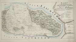
From the beginning of the 18th century, the commanders of Essequibo recommended that the location of the colony's administrative centre be removed as a result of the relocation of the Dutch settlers on the fertile banks of the Essequibo River.

In 1726, it was resolved that a fort should be constructed to protect the planters and the interest of the Dutch West India Company (DWIC). In 1726, Leslorant, an engineer, was sent from the Netherlands to construct a horn work with wooden redoubt and a strong palisade of the northern point of Vlaggeneiland (Flag Island). In August 1738, Laurens Storm van 's Gravesande, the Secretary to Commander Gleskerk, inspected the fort and reported that the structure was falling to pieces. He recommended to the Directors of the Netherlands that a new fort of brick be built to defend the interest of the DWIC.

Ruins of Fort Zeelandia 20191123 Guyana 0200 Fort Island sRGB (49295237188).jpg
Ruins of Fort Zeelandia

Construction of the fort commenced in 1740 and, with the labour of enslaved Africans, the structure was completed in 1743. Brick was baked on the spot and mortar and trass were imported from Barbados and the Netherlands. However, the entire complex was completed in 1749, since construction was delayed as a result of the shortage of building materials and labour. The completed structure was then christened Fort Zeelandia, after the County of Zeeland in the Netherlands, from which many of the original settlers had originated.

The Lozenge shaped design of the fort, submitted by Storm van 's Gravesande, is similar to other forts constructed in West Africa during that period. Fort Zeelandia consisted of a redoubt of fifty square feet, with walls thick enough to endure the heaviest ordnance. There were two stories; the lower served as a warehouse for provisions and a safe powder house whilst the upper floor housed the soldiers, with a room for the non commissioned officers. Twenty gunports, each holding a 2 or 3-pounder gun, were found on each storey.

By 1781, during the Fourth Anglo-Dutch War, the fort was no longer in a fit state to be of any use. When some six British privateers arrived in late February 1781, the Council at Essequibo instructed Captain Severyn, the commander of the fort, that if the British sailed towards the colony, he was to fire a blank shot. If that did not cause them to stop, he was to fire a pro-forma shot and surrender. The privateers captured 16 Dutch vessels and sailed away. A few days later, two British sloops-of-war, HMS Barbuda and HMS Surprize, that Admiral Lord Rodney had sent appeared at Demerara and Essequibo and accepted their surrender. [4]

The British takeover was short-lived, as the French occupied the island in the following year. The Dutch regained control of the fort two years later and, by 1796, the fort went into a long period of decline, as attention shifted towards the colony of Demerara. [5]

World Heritage status

Court of Policy building. 20191123 Guyana 0197 Fort Island sRGB.jpg
Court of Policy building.

This site, along with the Court of Policy Building, was added to the UNESCO World Heritage Site Tentative List on November 15, 1995, in the Cultural category. [6] The site has also been designated as a National Monument by the National Trust of Guyana. [7]

Notes

  1. Fort Zeelandia (including Court of Policy Building) - UNESCO World Heritage Centre
  2. Dutch National Archive - Fort Kykoveral [ permanent dead link ]
  3. Fort Zeelandia (including Court of Policy Building) - UNESCO World Heritage Centre
  4. Rodway (1891), Vol. 1, pp.275-283.
  5. McLean, Darren. "Fort Zeelandia". taste2travel. Retrieved 2019-07-24.
  6. Fort Zeelandia (including Court of Policy Building) - UNESCO World Heritage Centre
  7. "Guyana's National Monuments". Guyana Times International. Retrieved 26 August 2020.

Related Research Articles

<span class="mw-page-title-main">British Guiana</span> British colony from 1814 to 1966

British Guiana was a British colony, part of the mainland British West Indies, which resides on the northern coast of South America. Since 1966 it has been known as the independent nation of Guyana.

<span class="mw-page-title-main">Dutch colonisation of the Guianas</span> 1581–1975 colonisation in South America

The Dutch began their colonisation of the Guianas, the coastal region between the Orinoco and Amazon rivers in South America, in the late 16th century. The Dutch originally claimed all of Guiana but—following attempts to sell it first to Bavaria and then to Hanau and the loss of sections to Portugal, Britain, and France—the section actually settled and controlled by the Netherlands became known as Dutch Guiana.

<span class="mw-page-title-main">Fort Zeelandia (Paramaribo)</span>

Fort Zeelandia is a fortress in Paramaribo, Suriname. In 1640 the French built a wooden fort on the spot which, during British colonial period, was reinforced and became Fort Willoughby. It was taken by the Dutch in 1667 and renamed Fort Zeelandia.

<span class="mw-page-title-main">Demerara</span> 1745–1803 Dutch colony in South America

Demerara is a historical region in the Guianas, on the north coast of South America, now part of the country of Guyana. It was a colony of the Dutch West India Company between 1745 and 1792 and a colony of the Dutch state from 1792 until 1815. It was merged with Essequibo in 1812 by the British who took control. It formally became a British colony in 1815 until Demerara-Essequibo was merged with Berbice to form the colony of British Guiana in 1831. In 1838, it became a county of British Guiana until 1958. In 1966, British Guiana gained independence as Guyana and in 1970 it became a republic as the Co-operative Republic of Guyana. It was located around the lower course of the Demerara River, and its main settlement was Georgetown.

<span class="mw-page-title-main">The Guianas</span> Region in north-central South America

The Guianas, also spelled Guyanas or Guayanas, is a region in north-eastern South America. Strictly, the term refers to the three Guyanas: Guyana, Suriname and French Guiana, formerly British, Dutch and French Guyana. Broadly it refers to the South American coast from the mouth of the Oronoco to the mouth of the Amazon.

<span class="mw-page-title-main">Berbice</span> 1627–1815 Dutch colony in South America

Berbice is a region along the Berbice River in Guyana, which was between 1627 and 1792 a colony of the Dutch West India Company and between 1792 and 1815 a colony of the Dutch state. After having been ceded to the United Kingdom of Great Britain and Ireland in the latter year, it was merged with Demerara-Essequibo to form the colony of British Guiana in 1831. It became a county of British Guiana in 1838 till 1958. In 1966, British Guiana gained independence as Guyana and in 1970 it became a republic as the Co-operative Republic of Guyana.

<span class="mw-page-title-main">Fort Kyk-Over-Al</span>

Fort Kyk-Over-Al was a Dutch fort in the colony of Essequibo, in what is now Guyana. It was constructed in 1616 at the intersection of the Essequibo, Cuyuni and Mazaruni rivers. It once served as the centre for the Dutch administration of the county, but now only ruins are left. The name Kyk-Over-Al derives from the Dutch for "See over all", a reference to the commanding view of the river from the fort.

<span class="mw-page-title-main">Essequibo (colony)</span> 1616–1803 Dutch colony in South America

Essequibo was a Dutch colony in the Guianas and later a county on the Essequibo River in the Guiana region on the north coast of South America. It was a colony of the Dutch West India Company between 1616 and 1792 and a colony of the Dutch state from 1792 until 1815. It was merged with Demerara in 1812 by the British who took control. It formally became a British colony in 1815 until Demerara-Essequibo was merged with Berbice to form the colony of British Guiana in 1831. In 1838, it became a county of British Guiana till 1958. In 1966, British Guiana gained independence as Guyana and in 1970 it became a republic as the Co-operative Republic of Guyana. It was located around the lower course of the Essequibo River.

Stabroek was the old name of Georgetown, Guyana, between 1784 and 1812, and was the capital of Demerara. Stabroek is currently a ward in the centre of Georgetown.

<span class="mw-page-title-main">Demerara-Essequibo</span> Former British colony in South America

The Colony of Demerara-Essequibo was created on 28 April 1812, when the British combined the colonies of Demerara and Essequibo into the colony of Demerara-Essequibo. They were officially ceded to Britain on 13 August 1814. On 20 November 1815 the agreement was ratified by the Netherlands. On 21 July 1831 Demerara-Esequibo united with Berbice as British Guiana.

<span class="mw-page-title-main">Pomeroon (colony)</span> Dutch colony in Guyana

Pomeroon is the name of a former Dutch plantation colony on the Pomeroon River in the Guyana region on the north coast of South America. After early colonization attempts in the late 16th century were attacked by Spaniards and local Indians, the original inhabitants fled the interior of Guyana, founding the colony of Essequibo around Fort Kyk-Over-Al shortly after. A second, and more serious attempt at colonization started in 1650, but was ultimately unsuccessful, as French privateers destroyed the colony in 1689. In the late 18th century, a third attempt of colonization was started, this time under the jurisdiction of the Essequibo colony.

<span class="mw-page-title-main">Combined Court</span> Legislature of British Guiana

The Combined Court was the legislature of British Guiana until 1928. In its final form, it consisted of a sitting of the Court of Policy together with the elected Financial Representatives.

<span class="mw-page-title-main">Court of Policy</span>

The Court of Policy was a legislative body in Dutch and British Guiana until 1928. For most of its existence it formed the Combined Court together with the six Financial Representatives.

<span class="mw-page-title-main">College of Kiezers</span>

The College of Kiezers was an electoral college in the Dutch colonies of Essequibo and Demerara and their successor, British Guiana.

The raid on Demerara and Essequibo took place between 24 and 27 February 1781 in the context of the Fourth Anglo-Dutch War (1780–1784). Six British privateers entered the rivers and captured 15 Dutch vessels before withdrawing.

<span class="mw-page-title-main">Laurens Storm van 's Gravesande</span>

Laurens Storm van 's Gravesande was a Dutch governor of the colonies of Essequibo and Demerara from 1743 to 1772. He turned Demerara in a successful plantation colony, and the borders of Guyana are mainly based on his expeditions into the interior. He is also noted for his treatment of the Amerindians.

Borsselen is an island in the Demerara River of Guyana, and was the capital of Demerara between 1755 and 1782.

Guyanese nationality law is regulated by the 1980 Constitution of Guyana, as amended; the Citizenship Act of 1967, and its revisions; and various British Nationality laws. These laws determine who is, or is eligible to be, a national of Guyana. Guyanese nationality is typically obtained either on the principle of jus soli, i.e. by birth in Guyana; or under the rules of jus sanguinis, i.e. by birth abroad to parents with Guyanese nationality. It can also be granted to persons with an affiliation to the country, or to a permanent resident who has lived in the country for a given period of time through naturalisation. There is not currently a program in Guyana for persons to acquire nationality through investment in the country. Nationality establishes one's international identity as a member of a sovereign nation. Though it is not synonymous with citizenship, for rights granted under domestic law for domestic purposes, the United Kingdom, and thus the Commonwealth, have traditionally used the words interchangeably.

<span class="mw-page-title-main">Fort Island, Guyana</span> River island in Essequibo Islands-West Demerara, Guyana

Fort Island is an island in the Essequibo River located in the Essequibo Islands-West Demerara region of Guyana. It is about 16 kilometres (10 mi) from the mouth of the river, and to the east of Hogg Island. In 1687, a wooden fort was built on the island. In 1744, Fort Zeelandia was constructed and served as the capital of Essequibo, a Dutch colony which is nowadays part of Guyana. In 1752, the Court of Policy was built on the island as the legislative body for the colony.

References