
Fort Wayne is a city in and the county seat of Allen County, Indiana, United States. Located in northeastern Indiana, the city is 18 miles (29 km) west of the Ohio border and 50 miles (80 km) south of the Michigan border. The city's population was 263,886 as of the 2020 Census, making it the second-most populous city in Indiana after Indianapolis, and the 76th-most populous city in the United States. It is the principal city of the Fort Wayne metropolitan area, consisting of Allen, Wells, and Whitley counties, a combined population of 409,419 as of 2020. Fort Wayne is the cultural and economic center of northeastern Indiana. In addition to the three core counties, the combined statistical area (CSA) includes Adams, DeKalb, Huntington, Noble, and Steuben counties, with an estimated population of 615,077.

Allen County is a county in the U.S. state of Indiana. As of the 2020 Census, the population was 385,410, making it the third-most populous county in Indiana. The county seat and largest city is Fort Wayne, the second largest city in Indiana.

Monroeville is a town in Monroe Township, Allen County, Indiana, United States. The population was 1,235 as of the 2010 census.

New Haven is a city in Adams, Jefferson, and St. Joseph townships, Allen County, Indiana, United States. It sits to the east of the city of Fort Wayne, the second largest city in Indiana, and is situated mostly along the southern banks of the Maumee River. The population was 14,794 as of the 2010 census.
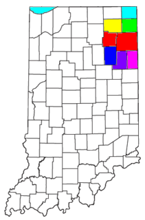
As of March 2020, the Fort Wayne–Huntington–Auburn Combined Statistical Area (CSA), or Fort Wayne Metropolitan Area, or Northeast Indiana is a federally designated metropolitan area consisting of eight counties in northeast Indiana, anchored by the city of Fort Wayne.
Arcola is an unincorporated community in Lake Township, Allen County, in the U.S. state of Indiana. The population of the community is only 33.

Benton Township is one of the twelve townships of Paulding County, Ohio, United States. The 2000 census found 1,035 people in the township, 694 of whom lived in the unincorporated portions of the township.

Milan Township is one of twenty townships in Allen County, Indiana, United States. Milan Township is located in east central Allen County, with the Maumee River meandering across the township. As of the 2010 census, its population was 3,749. The township is highly rural, with only 1,137 houses in the 2010 census. Many of the residents of Milan Township are Swiss Amish who mostly speak a Low Alemannic Alsatian dialect. Milan township is generally demarcated by Schwartz Road to the west, Notestine Road to the north, Sampson Road to the east, and Gar Creek Road to the south.
Aboite is an unincorporated community in Lafayette Township, Allen County, in the U.S. state of Indiana.

Hoagland is an unincorporated census-designated place (CDP) in Madison Township, Allen County, in the U.S. state of Indiana. As of the 2010 census, it had a population of 821.

Jackson Township is one of the twelve townships of Preble County, Ohio, United States. The 2000 census found 1,223 people within the township. The Jackson community is served by National Trail High School and the National Trail Local School District. Interstate 70 runs along the northern part of the township.

Jefferson Township is one of the twelve townships of Preble County, Ohio, United States. The 2010 census found 3,309 people in the township, 1,680 of whom lived in the unincorporated portions of the township. The Jefferson community is served by National Trail High School and the National Trail Local School district. Interstate 70 runs along the southern part of the township.

LaOtto is a small unincorporated community in Swan Township, Noble County, Indiana, in the U.S. state of Indiana. Located west of the current intersection of Indiana State Road 3 and Indiana State Road 205, it is 16 miles north of Fort Wayne and is also in proximity to Kendallville and Auburn. It is therefore considered a bedroom community to these cities.

Jefferson Township is one of twenty townships in Allen County, Indiana, United States. As of the 2010 census, its population was 2,109. Jefferson Township was organized in 1840.

Madison Township is one of twenty townships in Allen County, Indiana, United States. As of the 2010 census, its population was 1,771.

Monroe Township is one of twenty townships in Allen County, Indiana, United States. At the 2010 census, the population was 1,927.

Saint Joseph Township is one of twenty townships in Allen County, Indiana, United States. As of the 2010 census, its population was 72,245.
Poe is an unincorporated community in Marion Township, Allen County, in the U.S. state of Indiana.
Halls Corners is an unincorporated community in Springfield Township, Allen County, in the U.S. state of Indiana.
East Liberty is an unincorporated community in Monroe Township, Allen County, in the U.S. state of Indiana.


