Fox Chase, Kentucky

Last updated

Fox Chase, Kentucky
Bullitt County Kentucky Incorporated and Unincorporated areas Fox Chase Highlighted 2128785.svg
Location of Fox Chase in Bullitt County, Kentucky.
Coordinates: 38°02′45″N85°41′28″W / 38.04583°N 85.69111°W / 38.04583; -85.69111
Country United States
State Kentucky
County Bullitt
Area
[1]
  Total0.39 sq mi (1.01 km2)
  Land0.38 sq mi (0.99 km2)
  Water0.01 sq mi (0.02 km2)
Elevation
[2]
515 ft (157 m)
Population
 (2020)
  Total436
  Density1,141.36/sq mi (441.16/km2)
Time zone UTC-5 (Eastern (EST))
  Summer (DST) UTC-4 (EDT)
ZIP code
40165 [3]
Area code 502
FIPS code 21-28785
GNIS feature ID2403655 [2]
Website www.cityoffoxchase.org

Fox Chase is a home rule-class city in Bullitt County, Kentucky, in the United States. It was formally incorporated by the state assembly in 1983. [4] The population was 436 as of the 2020 census, down from 447 in the 2010 census. [5]

Contents

Geography

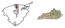
Fox Chase is located in northern Bullitt County 16 miles (26 km) south of downtown Louisville. It is bordered on its west side by Interstate 65, with the closest access from Exit 121 (John Harper Highway) 0.5 miles (0.80 km) north of Fox Chase. Surrounding communities include the city of Hillview, with land to the north, southeast, and west; the city of Hebron Estates to the east; and unincorporated Brooks to the west of I-65.

According to the United States Census Bureau, Fox Chase has a total area of 0.39 square miles (1.0 km2), of which 0.008 square miles (0.02 km2), or 1.72%, is water. [5]

Demographics

Historical population
CensusPop.Note
1990 528
2000 476−9.8%
2010 447−6.1%
2020 436−2.5%
U.S. Decennial Census [6]

As of the census [7] of 2000, there were 476 people, 176 households, and 162 families residing in the city. The population density was 1,416.8 inhabitants per square mile (547.0/km2). There were 176 housing units at an average density of 523.8 per square mile (202.2/km2). The racial makeup of the city was 99.79% White, and 0.21% from two or more races.

There were 176 households, out of which 27.8% had children under the age of 18 living with them, 87.5% were married couples living together, 2.8% had a female householder with no husband present, and 7.4% were non-families. 6.8% of all households were made up of individuals, and 2.3% had someone living alone who was 65 years of age or older. The average household size was 2.70 and the average family size was 2.81.

In the city the population was spread out, with 19.1% under the age of 18, 7.8% from 18 to 24, 19.5% from 25 to 44, 46.4% from 45 to 64, and 7.1% who were 65 years of age or older. The median age was 47 years. For every 100 females, there were 102.6 males. For every 100 females age 18 and over, there were 107.0 males.

The median income for a household in the city was $73,750, and the median income for a family was $75,790. Males had a median income of $50,781 versus $32,250 for females. The per capita income for the city was $30,371. None of the population or families were below the poverty line.

Related Research Articles

<span class="mw-page-title-main">Spencer County, Kentucky</span> County in Kentucky, United States

Spencer County is a county located in the U.S. state of Kentucky. As of the 2020 census, the total population was 19,490. Its county seat is Taylorsville. The county was founded in 1824 and named for Spier Spencer.

<span class="mw-page-title-main">Bullitt County, Kentucky</span> County in Kentucky, United States

Bullitt County is a county located in the north central portion of the U.S. state of Kentucky. As of the 2020 census, the population was 82,217. Its county seat is Shepherdsville. The county was founded in 1796. Located just south of the city of Louisville, Bullitt County is included in the Louisville/Jefferson County, KY-IN Metropolitan Statistical Area, commonly known as Kentuckiana. The western fifth of the county is part of the United States Army post of Fort Knox and is reserved for military training.

<span class="mw-page-title-main">Salt Lick, Kentucky</span> City in Kentucky, United States

Salt Lick is a home rule-class city in Bath County, Kentucky, in the United States. The population was 303 at the 2010 U.S. Census.

<span class="mw-page-title-main">Brooks, Kentucky</span> Census-designated place in Kentucky, United States

Brooks is a census-designated place (CDP) in Bullitt County, Kentucky, United States. The population was 2,469 as of the 2020 census, stagnant from 2,401 in the 2010 census. Brooks was struck by a tornado in 1996.

<span class="mw-page-title-main">Hebron Estates, Kentucky</span> City in Kentucky, United States

Hebron Estates is a home rule-class city in Bullitt County, Kentucky, in the United States. The population was 1014 as 0f the 2020 census, a small decrese from 1,087 in the 2010 census.

<span class="mw-page-title-main">Hillview, Kentucky</span> City in Kentucky, United States

Hillview is a home rule-class city in Bullitt County, Kentucky, in the United States. The population was 8,622 as of the 2020 census, up from 8,172 at the 2010 census. The primary road through the area is Kentucky Route 61, known as Preston Highway in both Jefferson and Bullitt counties.

<span class="mw-page-title-main">Hunters Hollow, Kentucky</span> City in Kentucky, United States

Hunters Hollow is a home rule-class city in Bullitt County, Kentucky, in the United States. The population was 324 as of the 2020 census, down from 386 at the time of the 2010 U.S. census.

<span class="mw-page-title-main">Lebanon Junction, Kentucky</span> City in Kentucky, United States

Lebanon Junction is a home rule-class city in Bullitt County, Kentucky, in the United States. The population was 1,746 as of the 2020 census, down from 1,813 as of the 2010 census.

<span class="mw-page-title-main">Mount Washington, Kentucky</span> City in Kentucky, United States

Mount Washington is a home rule-class city in northeast Bullitt County, Kentucky, in the United States. The population was 18,090 at the 2020 census. The city is one of several surrounding Louisville that have experienced a sharp rise in population in the past three decades, becoming a commuter town.

<span class="mw-page-title-main">Pioneer Village, Kentucky</span> City in Kentucky, United States

Pioneer Village is a home rule-class city in Bullitt County, Kentucky, in the United States. The population was 2,671 as of the 2020 census, up from 2,030 at the time of the 2010 census. Pioneer Village was struck by a tornado in 1996.

<span class="mw-page-title-main">Shepherdsville, Kentucky</span> City in Kentucky, United States

Shepherdsville is a home rule-class city on the Salt River in Bullitt County, Kentucky, in the United States. It is the second largest city and seat of its county, located just south of Louisville. The population was 14,201 during the 2020 U.S. Census.

<span class="mw-page-title-main">Berry, Kentucky</span> City in Kentucky, United States

Berry is a home rule-class city in Harrison County, Kentucky, in the United States. The city was formally incorporated by the state assembly in 1867 as "Berryville". It was renamed "Berry Station" two years later. The population was 264 at the 2010 census, down from 310 at the 2000 census.

<span class="mw-page-title-main">Lincolnshire, Kentucky</span> City in Kentucky, United States

Lincolnshire is a home rule-class city in Jefferson County, Kentucky, United States. The population was 148 at the 2010 census.

<span class="mw-page-title-main">Norbourne Estates, Kentucky</span> City in Kentucky, United States

Norbourne Estates is a home rule-class city in Jefferson County, Kentucky, United States. The population was 441 at the 2010 census.

<span class="mw-page-title-main">Strathmoor Village, Kentucky</span> City in Kentucky, United States

Strathmoor Village is a home rule-class city in Jefferson County, Kentucky, United States. The population was 648 at the 2010 census.

<span class="mw-page-title-main">Thornhill, Kentucky</span> City in Kentucky, United States

Thornhill is a home rule-class city in Jefferson County, Kentucky, United States. The population was 178 at the 2010 census.

<span class="mw-page-title-main">Woodland Hills, Kentucky</span> City in Kentucky, United States

Woodland Hills is a home rule-class city in Jefferson County, Kentucky, United States. The population was 696 at the 2010 census.

<span class="mw-page-title-main">Fort Mitchell, Kentucky</span> City in Kentucky, United States

Fort Mitchell is a home rule-class city in Kenton County, Kentucky, United States. The population was 8,702 at the 2020 census. It is part of the Cincinnati metropolitan area.

<span class="mw-page-title-main">Drakesboro, Kentucky</span> City in Kentucky, United States

Drakesboro is a home rule-class city in Muhlenberg County, Kentucky, United States. The population was 481 at the 2020 census. Incorporated in 1888, the city was named for early pioneer William Drake.

<span class="mw-page-title-main">Booneville, Kentucky</span> City in Kentucky, United States

Booneville is a home rule-class city in Owsley County, Kentucky, in the United States. The population was 81 at the 2010 census. It is the county seat of Owsley County. It is located at the junction of Kentucky Route 11 and Kentucky Route 30 on the South Fork of the Kentucky River.

References

  1. "2020 U.S. Gazetteer Files". United States Census Bureau. Retrieved March 18, 2022.
  2. 1 2 U.S. Geological Survey Geographic Names Information System: Fox Chase, Kentucky
  3. "Fox Chase KY ZIP Code". zipdatamaps.com. 2023. Retrieved June 16, 2023.
  4. Commonwealth of Kentucky. Office of the Secretary of State. Land Office. "Fox Chase, Kentucky". Accessed 26 July 2013.
  5. 1 2 "Geographic Identifiers: 2010 Demographic Profile Data (G001): Fox Chase city, Kentucky". U.S. Census Bureau, American Factfinder. Archived from the original on February 12, 2020. Retrieved November 25, 2013.
  6. "Census of Population and Housing". Census.gov. Retrieved June 4, 2015.
  7. "U.S. Census website". United States Census Bureau . Retrieved January 31, 2008.