
Hamakaze was one of 19 Kagerō-class destroyers built for the Imperial Japanese Navy during the 1930s.
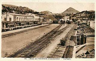
Ouenza is a town in Tébessa Province, in far eastern Algeria; near the border with Tunisia; 43 km south of Souk Ahras; and west of M'Daourouch.
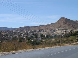
Aoubellil is a municipality in northwestern Algeria.

Beni Saf is a town in northwestern Algeria, about 80 kilometers southwest of Oran. The town was founded in 1876 as a shipping port for iron ore, which is mined just south of the town. Other products of the town include zinc, marble and onyx, and the fishing industry is extensive.

Aïn Djasser is a town in north-eastern Algeria.
Bitam, Algeria is a town in north-eastern Algeria.

Ichmoul is a town in north-eastern Algeria.

Nouader is a town in north-eastern Algeria.
Fornaka is a location in Algeria. Fornaka is located 27 km (17miles) from Mostaganem, the wilaya (province) capital, and 60 km (37 mi) from Oran, the country's second largest city. The city is located slightly west on the Greenwich meridian. As of 1998, the commune had a total population of 14,371.

Aïn Témouchent District is a district of Aïn Témouchent Province, Algeria.

Aïn Djasser District is a district of Batna Province, Algeria.

Ichmoul District is a district of Batna Province, Algeria.
El Hamel is a town and commune in M'Sila Province, Algeria. According to the 1998 census it has a population of 10,195.
Mamounia is a town and commune in Mascara Province, Algeria.
Khalouia is a town and commune in Mascara Province, Algeria. According to the 1998 census it has a population of 4,984.
Sidi Yacoub is a town and commune in Sidi Bel Abbès Province in north-western Algeria.

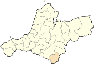
Oum Ali is a town and commune in Tébessa Province in north-eastern Algeria, near the border with Algeria.
Sidi Abdelli is a town and commune in Tlemcen Province in north-western Algeria.
Göllüalan is a village in the Vezirköprü, Samsun Province, Turkey.
In the Battle of Sig, French forces, assisted by the Douair and Smela tribes, fought the Algerian resistance led by Emir Abdelkader in the forest of Moulay-Ismaël near Sig for 2 days.


