Sedjerara | |
|---|---|
Commune and town | |
 | |
 | |
| Country | |
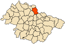
| Province | Mascara Province |
| Population (1998) | |
| • Total | 7,819 |
| Time zone | UTC+1 (CET) |
Sedjerara is a town and commune in Mascara Province, Algeria. According to the 1998 census it has a population of 7,819. [1]
Sedjerara | |
|---|---|
Commune and town | |
| | |
| | |
| Country | |
| Province | Mascara Province |
| Population (1998) | |
| • Total | 7,819 |
| Time zone | UTC+1 (CET) |
Sedjerara is a town and commune in Mascara Province, Algeria. According to the 1998 census it has a population of 7,819. [1]
Maxmo is a former municipality of Finland. It was located in the province of Western Finland and was part of the Ostrobothnia region. The municipality was consolidated with Vörå to form the new municipality of Vörå-Maxmo in 2007.
Çatalada, a.k.a.Çatal Ada, is a Turkish island located in the Aegean Sea, 3 miles off the town Turgutreis, west of Bodrum peninsula in southwestern Turkey. An island with three conical hills, its name means literally "fork island".
Assam Himalaya is a traditional designation for the portion of the Himalaya range between the eastern border of Bhutan, on the west, and the Great Bend of the Tsangpo River, on the east. The highest peak of this range is Namcha Barwa. Other high peaks include Gyala Peri, sister peak to Namcha Barwa; Kangto, and Nyegyi Kansang. The area is still poorly surveyed in general, and little visited by outsiders. It is located in the eastern side. The name "Assam Himalaya" is misleading, as some parts of this range are in southeastern Tibet, while other parts are in Bhutan and the Indian regions and states of northern Assam, Sikkim, and Arunachal Pradesh.
Gmina Nowe Miasto is a rural gmina in Płońsk County, Masovian Voivodeship, in east-central Poland. Its seat is the village of Nowe Miasto, which lies approximately 17 kilometres north-east of Płońsk and 54 km north-west of Warsaw.

Moczadła is a village in the administrative district of Gmina Brodnica, within Brodnica County, Kuyavian-Pomeranian Voivodeship, in north-central Poland. It lies approximately 5 kilometres (3 mi) south of Brodnica and 57 km (35 mi) east of Toruń.

Tama University is a private university in Tama, Tokyo, Japan, established in 1989.
Wolica is a village in the administrative district of Gmina Jędrzejów, within Jędrzejów County, Świętokrzyskie Voivodeship, in south-central Poland. It lies approximately 5 kilometres (3 mi) east of Jędrzejów and 34 km (21 mi) south-west of the regional capital Kielce.
Klęśnik is a settlement in the administrative district of Gmina Szydłowo, within Piła County, Greater Poland Voivodeship, in west-central Poland. It lies approximately 7 kilometres (4 mi) north of Szydłowo, 12 km (7 mi) north-west of Piła, and 93 km (58 mi) north of the regional capital Poznań.
Gacki is a village in the administrative district of Gmina Rudnik, within Racibórz County, Silesian Voivodeship, in southern Poland. It lies approximately 6 kilometres (4 mi) north-east of Rudnik, 10 km (6 mi) north of Racibórz, and 57 km (35 mi) west of the regional capital Katowice.
Owczary is a settlement in the administrative district of Gmina Trzebielino, within Bytów County, Pomeranian Voivodeship, in northern Poland. It lies approximately 6 kilometres (4 mi) east of Trzebielino, 23 km (14 mi) north-west of Bytów, and 97 km (60 mi) west of the regional capital Gdańsk.
Niedźwiada is a village in the administrative district of Gmina Małdyty, within Ostróda County, Warmian-Masurian Voivodeship, in northern Poland.
Kładno is a village in the administrative district of Gmina Będzino, within Koszalin County, West Pomeranian Voivodeship, in north-western Poland.
Krąg is a village in the administrative district of Gmina Polanów, within Koszalin County, West Pomeranian Voivodeship, in north-western Poland. It lies approximately 13 kilometres (8 mi) north of Polanów, 34 km (21 mi) east of Koszalin, and 165 km (103 mi) north-east of the regional capital Szczecin.
Dubočica is a village in the municipality of Višegrad, Bosnia and Herzegovina.

Škorpil Glacier is the 12 km long and 10 km wide glacier on Pernik Peninsula, Loubet Coast on the west side of Antarctic Peninsula, situated northeast of Stefan Ice Piedmont and W of Solun Glacier. It drains the north slopes of Protector Heights, and flows northwards into Darbel Bay east of Madell Point.

The Ésera, is a tributary of the Cinca in the High Aragon. It is part of the valley of the Ebro and its drainage basin. Its etymology is Celtic and it is cognate with several European rivers: Isar, Jizera, Isère, Isel, IJssel, and Eisack.

Hamars Ness is a headland on the island of Fetlar in Shetland, Scotland. The name is from the Old Norse Hamarsnes meaning "craggy headland". A ro-ro ferry is operated from here, which links Fetlar to the Shetland Mainland, and to the island of Unst. Hamars Ness is to the north of Fetlar's main village of Houbie.
The Lookout Rancheria is a federal Indian reservation belonging to the Pit River Tribe, a federally recognized tribe of indigenous people of California. The ranchería is located in Modoc County in northern California.

The Nationale SIGINT Organisatie (NSO) was the Dutch signals intelligence (SIGINT) organisation, which was part of the Ministry of Defence, but worked for both the military intelligence and security agency MIVD as for its civilian counterpart AIVD.
Schluersburg is an unincorporated hamlet in St. Charles County, in the U.S. state of Missouri.
Coordinates: 35°37′50″N0°12′50″E / 35.63056°N 0.21389°E
| | This article about a location in Mascara Province is a stub. You can help Wikipedia by expanding it. |
