Zahana زھانة | |
|---|---|
Commune and town | |
 | |
 | |
| Country | |
| Province | Mascara Province |
| Population (1998) | |
| • Total | 18,839 |
| Time zone | UTC+1 (CET) |
Zahana is a town and commune in Mascara Province, Algeria. According to the 1998 census it has a population of 18,839. [1]
Zahana زھانة | |
|---|---|
Commune and town | |
 | |
 | |
| Country | |
| Province | Mascara Province |
| Population (1998) | |
| • Total | 18,839 |
| Time zone | UTC+1 (CET) |
Zahana is a town and commune in Mascara Province, Algeria. According to the 1998 census it has a population of 18,839. [1]

The Pacific Remote Islands Marine National Monument is a group of unorganized, mostly unincorporated United States Pacific Island territories managed by the Fish and Wildlife Service of the United States Department of the Interior and the National Oceanic and Atmospheric Administration of the United States Department of Commerce. These remote refuges are "the most widespread collection of marine- and terrestrial-life protected areas on the planet under a single country's jurisdiction". They protect many endemic species including corals, fish, shellfish, marine mammals, seabirds, water birds, land birds, insects, and vegetation not found elsewhere.

Navezuelas is a municipality located in the province of Cáceres, Extremadura, Spain. According to the 2005 census (INE), the municipality has a population of 740 inhabitants.

Oliva de Plasencia is a municipality located in the province of Cáceres, Extremadura, Spain. According to the 2005 census (INE), the municipality has a population of 252 inhabitants.

Palomero is a municipality located in the province of Cáceres, Extremadura, Spain. According to the 2007 census (INE), the municipality has a population of 498 inhabitants.
Peribán is a municipality located in the western part of the Mexican state of Michoacán. The municipality has an area of 331.87 square kilometres and is bordered to the north by the municipality of Los Reyes, to the east by Uruapan, to the southeast by Tancítaro, to the south by Buenavista, and to the west by the state of Jalisco. The municipality had a population of 20,965 inhabitants according to the 2005 census. Its municipal seat is the city of Peribán de Ramos.

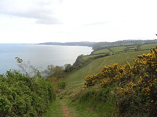
Babbacombe Bay is a shallow, wide, north-south indentation into the south coast of Devon, England, in the United Kingdom, opening eastward into the English Channel and about four to five statute miles across its mouth. It is bounded by Hope's Nose and Torquay to the south and roughly the River Teign and Teignmouth to the north.
Mohammedia District is a district located in Mascara Province, northwestern Algeria. It is located about 70 km from Oran and 420 km from Algiers. The seat of the district is the town of Mohammadia.
Tin-Hama is a small town and commune in the Cercle of Ansongo in the Gao Region of south-eastern Mali. In 1998 the commune had a population of 1902.
Lekhcheb is a village and rural commune in Mauritania.
Santo Antônio Grande River is a river of Alagoas state in eastern Brazil. It is a tributary of the Jacuipe River.
Resen is a village in the municipality of Bosilegrad, Serbia. According to the 2002 census, the town has a population of 81 people.

Ribarci is a village in the municipality of Bosilegrad, Serbia. According to the 2002 census, the village has a population of 39 people.

Sidi Elchahmi is a town and commune in Oran Province, Algeria. In 1998, it has a population of 58,857.

El Braya is a town and commune in Oran Province, Algeria. According to the 1998 census it has a population of 3879.

El Granado is a town and municipality located in the province of Huelva, Spain. According to the 2008 census, the municipality has a population of 598 inhabitants.

Dražiniće is a village in the municipality of Kraljevo, western-central Serbia. According to the 2002 census, the village has a population of 108 people.
Eikla is a village in Saaremaa Parish, Saare County in western Estonia.
Sirocco Glacier is a glacier about 3 nautical miles (6 km) long flowing north-northeast into West Bay, Fallières Coast, between Brindle Cliffs and Mount Edgell. Named by the United Kingdom Antarctic Place-Names Committee (UK-APC) in 1977 after the sirocco, the Italian name for the wind that blows from the Sahara. One of several features in the area named after winds.
Zerouala is a town and commune in Sidi Bel Abbès Province in north-western Algeria.
Coordinates: 35°31′N0°25′W / 35.517°N 0.417°W
| This article about a location in Mascara Province is a stub. You can help Wikipedia by expanding it. |