
Algeria, officially the People's Democratic Republic of Algeria, is a country in the Maghreb region of North Africa. It is bordered to the northeast by Tunisia; to the east by Libya; to the southeast by Niger; to the southwest by Mali, Mauritania, and Western Sahara; to the west by Morocco; and to the north by the Mediterranean Sea. The capital and largest city is Algiers, located in the far north on the Mediterranean coast.

The Atlas Mountains are a mountain range in the Maghreb in North Africa. It separates the Sahara Desert from the Mediterranean Sea and the Atlantic Ocean; the name "Atlantic" is derived from the mountain range, which stretches around 2,500 km (1,600 mi) through Morocco, Algeria and Tunisia. The range's highest peak is Toubkal, which is in central Morocco, with an elevation of 4,167 metres (13,671 ft). The Atlas Mountains are primarily inhabited by Berber populations.

Tunisia is a country in Northern Africa, bordering the Mediterranean Sea, having a western border with Algeria (965 km) and south-eastern border with Libya (459 km) where the width of land tapers to the south-west into the Sahara. The country has north, east and complex east-to-north coasts including the curved Gulf of Gabès, which forms the western part of Africa's Gulf of Sidra. Most of this greater gulf forms the main coast of Libya including the city of Sirte which shares its root name. The country's geographic coordinates are 34°00′N9°00′E. Tunisia occupies an area of 163,610 square kilometres, of which 8,250 are water. The principal and reliable rivers rise in the north of the country with a few notable exceptions from north-east Algeria and flow through the northern plain where sufficient rainfall supports diverse plant cover and irrigated agriculture.

Boumerdès is a province (wilaya) of northern Algeria, located in the Kabylia region, between Algiers and Tizi-Ouzou, with its capital at the coastal city of Boumerdès just east of Algiers.

Laghouat is one of the fifty-eight provinces (wilaya) of Algeria. It is located in the north central part of Algeria. The province borders Tiaret Province to the north, El Bayadh Province to the west, Ghardaia Province to the south and Djelfa Province to the east. The capital of the province is Laghouat City. The province is famous for palm trees and livestock.

The Medjerda River, the classical Bagrada, is a river in North Africa flowing from northeast Algeria through Tunisia before emptying into the Gulf of Tunis and Lake of Tunis. With a length of 450 km (280 mi), it is the longest river of Tunisia. It is also known as the Wadi Majardah or Mejerda.

Relizane or Ghilizan (Arabic: غلیزان; is a city in Algeria. It is the capital city of Relizane Province.
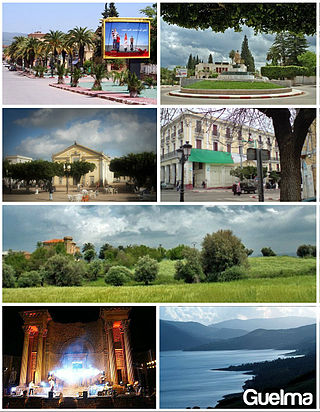
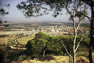
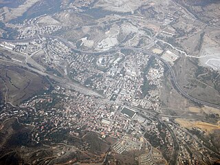
Guelma is the capital of Guelma Province and Guelma District, located in north-eastern Algeria, about 65 kilometers from the Mediterranean coast. Its location corresponds to that of ancient Calama.

Souk Ahras is a municipality in Algeria. It is the capital of Souk Ahras Province. The Numidian city of Thagaste, on whose ruins Souk Ahras was built, was the birthplace of Augustine of Hippo and a center of Berber culture.
Sig is a town in northwestern Algeria. Formerly located in Oran Province and now located in Mascara Province, north-western Algeria. Its population was 61,373 in 2008.

Thénia is a district in Boumerdès Province, Algeria. It was named after its capital, Thénia which, under French rule, was called Ménerville.
Thénia (الثنية), sometimes written as Thenia, with around 40,000 inhabitants, is the chief town in the daïra of the same name, in the wilaya of Boumerdès, in northern Algeria. Historically, the name is a contraction of "Theniet Beni Aicha", the Arabic translation of the Kabyle Berber toponym Tizi n At Ɛica. The steep-sided pass, which is only about 800 metres (2,600 ft) wide at its narrowest point, is sometimes taken to mark the transition between Mitidja and Grande Kabylie.

El Kseur is a commune in northern Algeria in the Béjaïa Province. The Béni Mansour-Bejaïa line serves this community with SNTF rail service.

Taourga is a town and commune in the Baghlia District of Boumerdès Province, Algeria. According to the 1998 census it has a population of 7,303.

Sidi Damed is a town and commune in Médéa Province, Algeria. According to the 1998 census, it has a population of 3,784.
Drinking water supply and sanitation in Algeria is characterized by achievements and challenges. Among the achievements is a substantial increase in the amount of drinking water supplied from reservoirs, long-distance water transfers and desalination at a low price to consumers, thanks to the country's substantial oil and gas revenues. These measures increased per capita water supply despite a rapidly increasing population. Another achievement is the transition from intermittent to continuous water supply in the capital Algiers in 2011, along with considerable improvements in wastewater treatment resulting in better water quality at beaches. These achievements were made possible through a public-private partnership with a private French water company. The number of wastewater treatment plants throughout the country increased rapidly from only 18 in 2000 to 113 in 2011, with 96 more under construction. However, there are also many challenges. One of them is poor service quality in many cities outside Algiers with 78% of urban residents suffering from intermittent water supply. Another challenge is the pollution of water resources. There has also been insufficient progress concerning reuse of treated water, a government priority in this dry country.
Bir Mcherga is a town and commune in the Zaghouan Governorate, Tunisia in the northwest of Tunisia, the site of former Roman North African city and bishopric Giufi, which only remains as Latin Catholic titular see.
Meraldene or Merabtene is a village in the Boumerdès Province in Kabylie, Algeria.

The Oued Meraldene or Oued Merabtene, also called Oued Bourdine, is a river of Algeria located in Kabylia within the framework of the Province of Boumerdès.
The Meraldene Dam, or Barrage Meraldene, is an embankment dam on the Meraldene River, located at 3 km (2 mi) southwest of Thénia in Boumerdès Province within Kabylia in Algeria.


