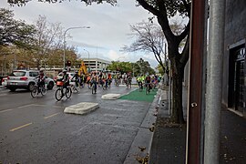
The O-Bahn Busway is a guided busway that is part of the bus rapid transit system servicing the northeastern suburbs of Adelaide, South Australia. The O-Bahn system was conceived by Daimler-Benz to enable buses to avoid traffic congestion by sharing tram tunnels in the German city of Essen.

North Terrace is one of the four terraces that bound the central business and residential district of Adelaide, the capital city of South Australia. It runs east–west, along the northern edge of "the square mile". The western end continues on to Port Road, and the eastern end continues across the Adelaide Parklands as Botanic Road.

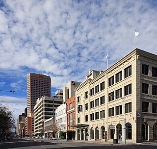
King William Street is the part of a major arterial road that traverses the CBD and centre of Adelaide, continuing as King William Road to the north of North Terrace and south of South Terrace. At approximately 40 metres (130 ft) wide, King William Street is the widest main street of all the Australian State capital cities. Named after King William IV in 1837, it is historically considered one of Adelaide's high streets, for its focal point of businesses, shops and other prominent establishments. The Glenelg tram line runs along the middle of the street through the city centre.

Wayville is an inner-southern suburb of Adelaide in the City of Unley. It is most notable for hosting of the Royal Adelaide Show at the Adelaide Showgrounds.

Rundle Street, often referred to as "Rundle Street East" as distinct from Rundle Mall, is a street in the East End of the city centre of Adelaide, the capital of South Australia. It runs from Pulteney Street to East Terrace, where it becomes Rundle Road through the East Park Lands.. Its former western extent, which ran to King William Street, was closed in 1972 to form the pedestrian street of Rundle Mall. The street is close to Adelaide Botanic Gardens, Rundle Park / Kadlitpina, Rymill Park, Hindmarsh Square and North Terrace.

The East End is a part of the Adelaide central business district, in the north-east corner of the Adelaide city centre. This area is a popular office and retail district and has an increasing residential interest from the building of high-density luxury apartments in the area.

Rymill Park / Murlawirrapurka, and numbered as Park 14, is a recreation park located in the East Park Lands of the South Australian capital of Adelaide. There is an artificial lake with rowboats for hire, a café, children's playground and rose garden, and the Adelaide Bowling Club is on the Dequetteville Terrace side. The Adelaide O-Bahn passes underneath it, to emerge at the western side opposite Grenfell Street.
Hindmarsh Square/Mukata is one of five public squares in the Adelaide city centre, South Australia. It is located in the centre of the north-eastern quarter of the city, and surrounds the intersection of Grenfell and Pulteney Streets, near the eastern end of the Rundle Mall. Pirie Street forms the southern boundary of the square.

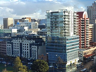
Adelaide city centre is the inner city locality of Greater Adelaide, the capital city of South Australia. It is known by locals simply as "the City" or "Town" to distinguish it from Greater Adelaide and from the City of Adelaide local government area. The population was 15,115 in the 2016 census.

The Manhattan Waterfront Greenway is a waterfront greenway for walking or cycling, 32 miles (51 km) long, around the island of Manhattan, in New York City. The largest portions are operated by the New York City Department of Parks and Recreation. It is separated from motor traffic, and many sections also separate pedestrians from cyclists. There are three principal parts — the East, Harlem and Hudson River Greenways.
Rundle Park / Kadlitpina, also known as Park 13, is a part of the Adelaide Park Lands in Adelaide, South Australia. It was known as Rundle Park until its Kaurna name was assigned as part of the dual naming initiative by Adelaide City Council in 2003. The park is bounded by East Terrace, Botanic Road (north), Dequetteville Terrace (east) and Rundle Road (south).

Frome Road is a connecting road in the South Australian capital city of Adelaide. It starts from North Terrace in the Adelaide city centre, running in a northerly direction past the University of South Australia, the site of the old Royal Adelaide Hospital, now known as Lot Fourteen, the Institute of Medical and Veterinary Science and the University of Adelaide, and then through the Adelaide Parklands to the Adelaide Zoo where it turns northeasterly, crosses the River Torrens via Albert Bridge, and continues through the parklands to the intersection with Melbourne Street and Brougham Place in North Adelaide. It is one of the three roads connecting the city centre to North Adelaide, the others being King William Road and Montefiore Road.

Grenfell Street is a major street in the north-east quarter of the Adelaide city centre, South Australia. The street runs west-east from King William Street to East Terrace. On the other side of King William Street, it continues as Currie Street. Its intersection with Pulteney Street is encircled by Hindmarsh Square.

East Terrace marks the eastern edge of the Adelaide city centre. It is one of the main north–south thoroughfares through the east side of the city. Although the terrace essentially runs north–south between North Terrace and South Terrace, unlike Adelaide's other three terraces, its path is far from a straight line; travelling the entire length of East Terrace requires turning at right angles at most intersections from Pirie Street onwards. These days however, the traffic flow, after a swerve to the east between Grenfell and Pirie Streets, continues southwards over the Pirie intersection into Hutt Street and on down to South Terrace.
Currie Street is a main street in the Adelaide city centre, South Australia. It runs east–to–west from King William Street, through Light Square, to West Terrace on the western edge of the city centre.

North Adelaide is a predominantly residential precinct and suburb of the City of Adelaide in South Australia, situated north of the River Torrens and within the Adelaide Park Lands.
The South Australian Vigneron and Gardeners' Manual was the first gardening book published in the newly founded colony of South Australia.
Gawler Place is a single-lane road in the city centre of Adelaide, the capital of South Australia. It runs north to south from North Terrace to Wakefield Street, parallel to and approximately midway between King William and Pulteney Streets.

The Rock Creek Trails are a series of trails through the Rock Creek valley and along the Potomac River in Washington, DC and Montgomery County, MD. The main route extends 22 miles from Lake Needwood in Maryland to the Inlet Bridge in Washington, DC, with a loop in the north part of Rock Creek Park and other trails through the Klingle Valley, Turkey Branch Valley and along the North Branch of Rock Creek. There are three separate trails that make up the main Rock Creek Trail route and others that connect to it. Along the Potomac River from Arlington Memorial Bridge to Rock Creek is a section sometimes called the Shoreline Trail.

Cycling infrastructure in the Canadian city of Halifax, Nova Scotia includes most regular streets and roads, bike lanes, protected cycle tracks, local street bikeways, and multi-use pathways.