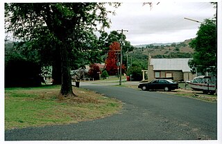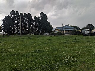
Forbes is a town in the Central West region of New South Wales, Australia, located on the Newell Highway between Parkes and West Wyalong. At the 2021 census, Forbes had a population of 9,319. Forbes is probably named after Sir Francis Forbes, first Chief Justice of NSW.

The Lachlan River is an intermittent river that is part of the Murrumbidgee catchment within the Murray–Darling basin, located in the Southern Tablelands, Central West, and Riverina regions of New South Wales, Australia.

Cowra is a small town in the Central West region of New South Wales, Australia. It is the largest population centre and the council seat for the Cowra Shire, with a population of 9,863.

Hornsby Shire is a local government area situated on the Upper North Shore as well as parts of the Hills District, of Sydney in the state of New South Wales, Australia. The shire stretches from the M2 Hills Motorway in the south to the Hawkesbury River town of Wisemans Ferry, some 53 kilometres (33 mi) to the north, making it the largest local government council in the Greater Sydney Metropolitan region by total area. As of the 2016 census the shire had an estimated population of 142,667.

Carcoar is a small town in the Central West region of New South Wales, Australia, in Blayney Shire. In 2021, the town had a population of 271 people. It is situated just off the Mid-Western Highway 258 km west of Sydney and 52 km south-west of Bathurst and is 720 m above sea level. It is located in a small green valley, with the township and buildings on both banks of the Belubula River. It is the third oldest settlement west of the Blue Mountains. Carcoar is a Gundungurra word meaning either 'frog' or 'kookaburra'. Nearby towns are Blayney, Millthorpe, Mandurama, Neville, Lyndhurst and Barry

Bigga is a village in the Southern Tablelands of New South Wales, Australia, in Upper Lachlan Shire. It is in the Parish of Bigga, County of Georgiana. The name Bigga is thought to originate as a shortened version of the Biggs Grant. Bigga is on the western side of the Abercrombie Mountains. It is 91 km northwest of Goulburn and 52 km southeast of Cowra. Nearby towns are: Abercrombie River, Binda, Greenmantle, Grabine, Reids Flat, and Tuena. Nearby places are: Blanket Flat and Crooked Corner. These places were once towns.

Abercrombie River, a perennial river that is part of the Murray–Darling basin, is located in the central west of New South Wales, Australia.

Karuah is a locality in both the Port Stephens and Mid-Coast Councils, the Port Stephens lga side is part the Hunter Region while the Mid-Coast lga is in the Mid North Coast region of New South Wales, Australia. It is thought that the name means 'native plum tree' in the local Aboriginal dialect.

Goulburn-Oberon Road is a New South Wales country road linking Goulburn near Hume Highway to Oberon. This name is not widely known to most drivers, as the entire allocation is still best known as by the names of its constituent parts: Taralga Road and Abercrombie Road.

Tomago is a combined industrial/semi-rural suburb of the Port Stephens local government area in the Hunter Region of New South Wales, Australia. It is located just north of the Hunter River and west of the body of water known as Fullerton Cove. Tomago means "sweet water" in the local Aboriginal language. In 2016 277 lived in Tomago with a median age of 55, 72.7% born in Australia and 80.4% only speaking English at home.

O’Connell is a village in New South Wales, Australia. The village, classified by the National Trust of Australia, is 23 kilometres from Oberon on the O'Connell Road. At the 2006 census, O'Connell and the surrounding area had a population of 355.
Bolong River, a watercourse that is part of the Lachlan catchment within the Murray–Darling basin, is located in the central–western region of New South Wales, Australia.
The Retreat River, a perennial stream that is part of the Lachlan catchment within the Murray–Darling basin, is located in the central western region of New South Wales, in eastern Australia.

Wyangala is a small village in the Lachlan Valley, near the junction of the Abercrombie and Lachlan Rivers, just below the Wyangala Dam wall. It is in the South West Slopes of New South Wales, Australia, and about 320 km (200 mi) west of the state capital, Sydney. The name is also used for the surrounding rural locality, which includes the site of the former mining village of Mount McDonald.

Gurrundah is a locality in the Upper Lachlan Shire, New South Wales, Australia. It lies on the eastern side of the Crookwell–Gunning road about 22 south of Crookwell and 26 km north of Gunning. At the 2016 census, it had a population of 55. The Gullen Range Wind Farm lies in the east of the locality above the upper Wollondilly River.

Black Springs, New South Wales is a village on the Great Dividing Range at an elevation of 1,210 metres (3,970 ft) and situated 138 km west of Sydney as the crow flies. It is located at 33 51.0493 °S, 149 44.41956 °E The post Code of the village is 2787. It is famous for its fossicking. It is midway between Taralga, New South Wales and Oberon, New South Wales. Black Springs, 24 kilometres from Oberon on the Abercrombie Road, is a tidy village with good facilities. The tennis courts, recreation ground and community hall are located opposite the Forestry Reserve camping area, which has toilets and fireplaces. The historic stone Avoca Catholic Church and Shrine is in a lovely setting south of the village. There is also an historic cemetery. Fossicking is popular at Sapphire Bend, off Riverview Road in Vulcan State Forest.

Richlands is a locality in the Upper Lachlan Shire, New South Wales, Australia. It lies about 5 km north of Taralga and about 95 km south of Oberon on the road from Goulburn to Oberon and Bathurst. At the 2016 census, it had a population of 34. It had a school from June 1868 to August 1879, which was designated as a "provisional school" for eight months and then as a "half-time" school. It also had a school from 1884 to 1915 and from 1918 to 1953, classified most commonly as a "provisional school", but for periods as a "house to house", "half-time" or "public" school. It was called Abercrombie school until 1894.

Bolong is a locality in the City of Shoalhaven in New South Wales, Australia. It lies to the north of the Shoalhaven River and to the west of Broughton Creek. It is northeast of Nowra. At the 2016 census, it had a population of 104.
Bumbalong is a rural locality in the Snowy Monaro Region, New South Wales, Australia. Although it lies in the valley of the Murrumbidgee River, it is sometimes referred to by its residents as Bumbalong Valley. At the 2016 census, it had a population of 24.
Kangiara is a locality, in the Yass Valley Council local government area, within the Southern Tablelands of New South Wales, Australia. There was once a mining village of the same name.


