Lost River is a locality, in the Upper Lachlan Shire, within the Southern Tablelands of New South Wales, Australia. It lies on either side of the main road between Crookwell and Boorawa, which are the nearest towns to it.
The area now known as Lost River lies within the traditional lands of Gundungurra people. These people spoke a similar if not identical language to the neighbouring Ngunnawal people to their south.[2] After settler colonisation, the area became part of the County of King,[3] one of the Nineteen Counties, in which land could be taken up by the colonial settlers.
There is a watercourse by the name of Lost River—a tributary of Wheeo Creek, in the Lachlan River catchment—that bisects the locality,[4] and forms a part of the boundary between the parishes.[3] The naming of the watercourse is unusual, being a 'river' that is a tributary of a creek. It may have been called Lost River, because it flowed "at the bottom of a rocky gorge, about 14 miles from one swamp into another," or it at least seemed to do so, in summer when its flow was low,[5] like a losing stream. The name of the watercourse seems to date from the early 1840s, at latest,[6][7] and probably earlier. However, the locality name, Lost River, also may have referred to an ancient watercourse, now in an elevated position as a result of geological processes. The ancient sediments of the 'lost river' contained gemstones.[8]
The presence of diamonds and gold in the area was well known by the early 1920s.[9]Diamonds were mined at the Lost River Diamond Mine, from around late 1924, with full scale mining commencing in mid-1927. Operations appear to have ended by late 1928, when the company—set up in 1925-1926 to take over from the earlier mining syndicate—started the process of voluntary liquidation. The first directors of the company were business people from the region, including three jewellers, and a sapphire mine owner from near Inverell.[10][11][12][13] One of the members of the earlier mining syndicate was a former Prime Minister of Australia, Chris Watson.[14]
Some sources state explicitly that the mine was on a bank of the Lost River, with the paydirt being ancient sediments lying under a basalt capping (a 'deep lead' deposit)[13][15][16][17] The owner of the land, upon which the mining leases were taken out, was T.J. McCormack.[18][16] He had land on the right bank of Lost River, in the Parish of Romner.[19]
Another source states that 'Lost River' mine was not on, or even very near, the watercourse known as Lost River, but that the mine was located, further north in the locality, on a bank of Wheeo Creek. Alternative names given for this mine (Spring Creek Mine, Potten Creek Mine and Wheeo Creek Mine)[20] suggest that it lay between the confluences of the other two watercourses with Wheeo Creek. However, it is possibly referring to another mine, as the evidence is stronger that the Lost River Diamond Mine indeed lay on Lost River.[18][16][19][21]
Ancient sediments were mined by shaft and open-cut methods and then processed by sluicing, using water from the creek at the base of the hill, and then by gravity separation on two shaking screens. As well as diamonds, some gold was recovered, and the deposit was also said to contain sapphire, olivine, and ruby.[8][22][13][15][17]
There was a school there, over most of the period from August 1873 to September 1936. The school was no longer called Lost River, from June 1931, when it became known as Wheeo North.[23]
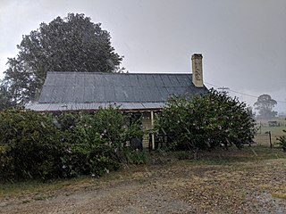
The area has been a predominantly agricultural area, from the 1840s, and the main industry of the locality remains grazing of livestock.
↑ Australian Institute of Aboriginal and Torres Strait Islander Studies (6 September 2021). "Map of Indigenous Australia". aiatsis.gov.au. Retrieved 12 June 2021.
1 2 3 "LOST RIVER". Daily Telegraph (Sydney, NSW: 1883 - 1930). 6 May 1927. p.29. Retrieved 12 June 2021.
↑ "ALL ABOUT PEOPLE". Gundagai Independent and Pastoral, Agricultural and Mining Advocate (NSW: 1898 - 1928). 24 September 1925. p.2. Retrieved 12 June 2021.
Boorowa is a farming village in the Hilltops Region in the south west slopes of New South Wales, Australia. It is located in a valley 340 kilometres (210 mi) southwest of Sydney around 490 metres (1,610 ft) above sea-level. The town is in Hilltops Council local government area.
Inverell is a large town in northern New South Wales, Australia, situated on the Macintyre River, close to the Queensland border. It is also the centre of Inverell Shire. Inverell is located on the Gwydir Highway on the western slopes of the Northern Tablelands. It has a temperate climate. In the 2021 census, the population of Inverell was 12,057 and the Inverell Shire population was 17,853.
Upper Lachlan Shire is a local government area in the Southern Tablelands region of New South Wales, Australia. The Shire was formed in February 2004 from Crookwell Shire and parts of Mulwaree, Gunning and Yass Shires.
Binda is a village in the Southern Tablelands region of New South Wales, Australia in Upper Lachlan Shire.
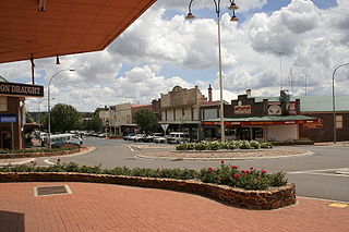
Crookwell is a small town located in the Southern Tablelands of New South Wales, Australia, in the Upper Lachlan Shire. At the 2016 census, Crookwell had a population of 2,641. The town is at a relatively high altitude of 887 metres and there are several snowfalls during the cooler months. The nearest major centre is the city of Goulburn which is about a half-hour drive to the south-east of the town. Crookwell is easily accessible to the state capital of Sydney and also the federal capital of Canberra.
Mongarlowe is a village in the Southern Tablelands of New South Wales, Australia in Queanbeyan-Palerang Regional Council. In former times, it was also known, in various contexts, as Little River, Monga, and Sergeants Point. The name, Mongarlowe, also applies to the surrounding area, for postal and statistical purposes.
Murringo is a small village in the southwestern slopes of New South Wales, Australia in Hilltops Council. It was once better known as Marengo. The name is also applied to the surrounding area, for postal and statistical purposes.
Araluen is a small town near Braidwood in the Southern Tablelands of New South Wales, Australia, in Queanbeyan-Palerang Regional Council. It lies in the valley of Araluen Creek, that joins the Deua River at roughly the midpoint in its course. At the 2021 census, Araluen had a population of 209 people.
Yalwal is the site of a former gold mining town of the same name situated 29 km (18 mi) west of Nowra at the confluence of the Danjera and Yarramunmun Creeks which then forms Yalwal Creek which flows into the Shoalhaven River in New South Wales, Australia.
Jembaicumbene is a locality in the Southern Tablelands of New South Wales, Australia, located 8 km (5 miles) out along the Braidwood–Majors Creek Road. Once a thriving goldfield, it is now a peaceful valley on the way to Majors Creek. The mining village of the same name is now virtually a ghost town.
Majors Creek is a small village in the Southern Tablelands region of New South Wales, Australia. The nearest major town is Braidwood, 16 km (9.9 mi) to the north. At the 2021 census, the population of Majors Creek was 290. A former gold mining town, the settlement is today associated with the operational Dargues Reef gold mine. The name, Majors Creek is also applied to the surrounding area, for postal and statistical purposes.
The Argyle Liberal and District Recorder was an English language newspaper published two times per week, on Tuesdays and Fridays, in Crookwell, New South Wales, Australia.
Frogmore is a village in the Southern Tablelands of New South Wales, Australia. It was previously a mining town.
Colinton is a locality in the Snowy Monaro Region, New South Wales, Australia. At the 2016 census, it had a population of 127. There was once a village and railway station of the same name.
Monga is a locality in the Queanbeyan-Palerang Region, Southern Tablelands, New South Wales, Australia. It lies on the Kings Highway at the top of the Clyde Mountain, about 110 km east of Canberra and 22 km southeast of Braidwood. A large part of the locality forms part of the Monga National Park. At the 2016 census, it had a population of 14.
Cadia is a locality in the Cabonne Council of New South Wales, Australia. It was formerly a private township established c. 1860s by the Cadiangullong Consolidated Copper company. It is now part of the Cadia-Ridgeway Mine lease, operated by Newcrest. It had a population of zero as of the 2016 census.
Caloola is a locality in the Central West region of New South Wales. There once was a small village of the same name but it is a ghost town today. At the 2016 census, the locality had a population of 88.
Currowan is a locality in the Eurobodalla Shire, on the South Coast of New South Wales, Australia. At the 2016 census, it had a population of 53.
Dalmorton is a locality in the Northern Rivers region of New South Wales, Australia. There once was a village of the same name, which was associated with gold mining. Much of the area of the locality is now reserved as National Parks or State Forests. At the 2016 census, the population of Dalmorton was four.
Kangiara is a locality, in the Yass Valley Council local government area, within the Southern Tablelands of New South Wales, Australia. There was once a mining village of the same name.
This page is based on this Wikipedia article Text is available under the CC BY-SA 4.0 license; additional terms may apply. Images, videos and audio are available under their respective licenses.