Fyodorovsky District, Republic of Bashkortostan

Last updated
Fyodorovsky District
Фёдоровский район(Russian)
Фёдоровка районы (Bashkir)
Location of Fedorovskiy rayon (Bashkortostan).svg
Location of Fyodorovsky District in the Republic of Bashkortostan
Coordinates: 54°41′N56°08′E / 54.683°N 56.133°E / 54.683; 56.133 Coordinates: 54°41′N56°08′E / 54.683°N 56.133°E / 54.683; 56.133
Pokrovsky monastery in Dedovo 2012 11.jpg
Pokrovsky monastery in Dedovo, Fyodorovsky District
Coat of Arms of Fedorovskiy rayon (Bashkortostan).png
Flag of Fedorovsky rayon (Bashkortostan).png
Coat of arms
Flag
Location
Country Russia
Federal subject Republic of Bashkortostan [1]
Administrative structure (as of February 2013)
Administrative center selo of  Fyodorovka [2]
Administrative divisions: [3]
Selsoviets 14
Inhabited localities: [3]
Rural localities 68
Municipal structure (as of July 2012)
Municipally incorporated asFyodorovsky Municipal District [4]
Municipal divisions: [4]
Urban settlements0
Rural settlements14
Statistics
Area 1,693.24 km2 (653.76 sq mi)[ citation needed ]
Population (2010 Census) 18,650 inhabitants [5]
 Urban0%
 Rural100%
Density 11.01/km2 (28.5/sq mi) [6]
Time zone YEKT (UTC+05:00) [7]
Established1935 [8]
Official website
Fyodorovsky District on WikiCommons
Population of Fyodorovsky District
2010 Census 18,650 [5]
2002 Census 19,675 [9]
1989 Census 19,819 [10]
1979 Census 23,197 [11]

Fyodorovsky District (Russian : Фёдоровский райо́н; Bashkir : Фёдоровка районы) is an administrative [1] and municipal [4] district (raion), one of the fifty-four in the Republic of Bashkortostan, Russia. It is located in the southwest of the republic and borders with Sterlibashevsky District in the north, Meleuzovsky District in the east, Kuyurgazinsky District in the south, and with Orenburg Oblast in the west. The area of the district is 1,693.24 square kilometers (653.76 sq mi).[ citation needed ] Its administrative center is the rural locality (a selo ) of Fyodorovka. [2] As of the 2010 Census, the total population of the district was 18,650, with the population of Fyodorovka accounting for 23.1% of that number. [5]

Russian language East Slavic language

Russian is an East Slavic language, which is official in the Russian Federation, Belarus, Kazakhstan and Kyrgyzstan, as well as being widely used throughout Eastern Europe, the Baltic states, the Caucasus and Central Asia. It was the de facto language of the Soviet Union until its dissolution on 25 December 1991. Although, nowadays, nearly three decades after the breakup of the Soviet Union, Russian is used in official capacity or in public life in all the post-Soviet nation-states, as well as in Israel and Mongolia, the rise of state-specific varieties of this language tends to be strongly denied in Russia, in line with the Russian World ideology.

Bashkir language Turkic language in Russia

The Bashkir language is a Turkic language belonging to the Kipchak branch. It is co-official with Russian in the Republic of Bashkortostan, European Russia and has approximately 1.2 million speakers in Russia. Bashkir has three dialects: Southern, Eastern and Northwestern.

A raion is a type of administrative unit of several post-Soviet states. The term is from the French "rayon", which is both a type of a subnational entity and a division of a city, and is commonly translated in English as "district".

Contents

History

The district was established in 1935. [8]

Administrative and municipal status

Within the framework of administrative divisions, Fyodorovsky District is one of the fifty-four in the Republic of Bashkortostan. [1] The district is divided into fourteen selsoviets, comprising sixty-eight rural localities. [3] As a municipal division, the district is incorporated as Fyodorovsky Municipal District. [4] Its fourteen selsoviets are incorporated as fourteen rural settlements within the municipal district. [4] The selo of Fyodorovka serves as the administrative center of both the administrative [2] and municipal [4] district.

Selsoviet is a shortened name for a rural council and for the area governed by such a council (soviet). The full names for the term are, in Belarusian: се́льскi Саве́т, Russian: се́льский Сове́т, Ukrainian: сільська́ ра́да. Selsoviets were the lowest level of administrative division in rural areas in the Soviet Union. After the dissolution of the Soviet Union, they were preserved as a third tier of administrative-territorial division throughout Ukraine, Belarus, and some of the federal subjects of Russia.

The classification system of the types of inhabited localities in Russia, the former Soviet Union, and some other post-Soviet states has certain peculiarities compared with the classification systems in other countries.

Fyodorovka, Fyodorovsky District, Republic of Bashkortostan Selo in Bashkortostan, Russia

Fyodorovka is a rural locality and the administrative center of Fyodorovsky District in the Republic of Bashkortostan, Russia. Population: 4,306 (2010 Census); 4,128 (2002 Census); 3,923 (1989 Census).

Related Research Articles

Birsk Town in Bashkortostan, Russia

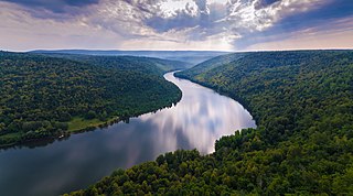
Birsk is a town in the Republic of Bashkortostan, Russia, located on the right bank of the Belaya River, 102 kilometers (63 mi) from Ufa, the capital of the republic. Population: 41,635 (2010 Census); 39,992 (2002 Census); 34,881 (1989 Census).

Bakalinsky District District in Republic of Bashkortostan, Russia

Bakalinsky District is an administrative and municipal district (raion), one of the fifty-four in the Republic of Bashkortostan, Russia. It is located in the west of the republic and borders with Ilishevsky District in the northeast, Chekmagushevsky District in the east, Sharansky District in the south, and with the Republic of Tatarstan in the west and northwest. The area of the district is 1,951 square kilometers (753 sq mi). Its administrative center is the rural locality of Bakaly. As of the 2010 Census, the total population of the district was 28,776, with the population of Bakaly accounting for 33.3% of that number.

Belokataysky District District in Republic of Bashkortostan, Russia

Belokataysky District is an administrative and municipal district (raion), one of the fifty-four in the Republic of Bashkortostan, Russia. It is located in the northeast of the republic and borders with Sverdlovsk Oblast in the north, Chelyabinsk Oblast in the east, Kiginsky District in the south, and with Mechetlinsky District in the west. The area of the district is 3,037 square kilometers (1,173 sq mi). Its administrative center is the rural locality of Novobelokatay. As of the 2010 Census, the total population of the district was 20,169, with the population of Novobelokatay accounting for 29.6% of that number.

Burzyansky District District in Republic of Bashkortostan, Russia

Burzyansky District is an administrative and municipal district (raion), one of the fifty-four in the Republic of Bashkortostan, Russia. It is located in the south of the republic and borders with Beloretsky District in the north, Abzelilovsky District in the east, Baymaksky District in the southeast, Zilairsky District in the south, Kugarchinsky District in the southwest, Meleuzovsky District in the west, and with Ishimbaysky District in the west and northwest. The area of the district is 4,444 square kilometers (1,716 sq mi). Its administrative center is the rural locality of Starosubkhangulovo. As of the 2010 Census, the total population of the district was 16,698, with the population of Starosubkhangulovo accounting for 27.6% of that number.

Kaltasinsky District District in Republic of Bashkortostan, Russia

Kaltasinsky District is an administrative and municipal district (raion), one of the fifty-four in the Republic of Bashkortostan, Russia. It is located in the northwest of the republic and borders with Yanaulsky District in the north, Burayevsky District in the east and southeast, Dyurtyulinsky District in the south, and with Krasnokamsky District in the west. The area of the district is 1,548.35 square kilometers (597.82 sq mi). Its administrative center is the rural locality of Kaltasy. As of the 2010 Census, the total population of the district was 26,268, with the population of Kaltasy accounting for 16.8% of that number.

Karmaskalinsky District District in Republic of Bashkortostan, Russia

Karmaskalinsky District is an administrative and municipal district (raion), one of the fifty-four in the Republic of Bashkortostan, Russia. It is located in the center of the republic and borders with Ufimsky and Iglinsky Districts in the north, Arkhangelsky District in the east, Gafuriysky District in the southeast, Aurgazinsky District in the south, Alsheyevsky District in the southwest, and with Chishminsky District in the west. The area of the district is 1,750 square kilometers (680 sq mi). Its administrative center is the rural locality of Karmaskaly. As of the 2010 Census, the total population of the district was 51,504, with the population of Karmaskaly accounting for 16.6% of that number.

Krasnokamsky District District in Republic of Bashkortostan, Russia

Krasnokamsky District is an administrative and municipal district (raion), one of the fifty-four in the Republic of Bashkortostan, Russia. It is located in the northwest of the republic and borders with the territory of the city of republic significance of Neftekamsk in the north, Yanaulsky District in the northeast, Kaltasinsky District in the east, Ilishevsky District in the south, the Republic of Tatarstan in the south and southwest, and with the Udmurt Republic in the west and northwest. The area of the district is 1,594.92 square kilometers (615.80 sq mi). Its administrative center is the rural locality of Nikolo-Beryozovka. As of the 2010 Census, the total population of the district was 27,986, with the population of Nikolo-Beryozovka accounting for 21.8% of that number.

Kushnarenkovsky District District in Republic of Bashkortostan, Russia

Kushnarenkovsky District is an administrative and municipal district (raion), one of the fifty-four in the Republic of Bashkortostan, Russia. It is located in the northern central part of the republic and borders with Birsky District in the north, Blagoveshchensky District in the northeast and east, Ufimsky District in the east and southeast, Chishminsky District in the south, Blagovarsky District in the south and southwest, Chekmagushevsky District in the west, and with Dyurtyulinsky District in the northwest. The area of the district is 1,717.77 square kilometers (663.23 sq mi). Its administrative center is the rural locality of Kushnarenkovo. As of the 2010 Census, the total population of the district was 27,491, with the population of Kushnarenkovo accounting for 35.9% of that number.

Kuyurgazinsky District District in Republic of Bashkortostan, Russia

Kuyurgazinsky District is an administrative and municipal district (raion), one of the fifty-four in the Republic of Bashkortostan, Russia. It is located in the southwest of the republic and borders with Fyodorovsky and Meleuzovsky Districts in the north, Kugarchinsky District in the east, and with Orenburg Oblast in the east, south, and west. The area of the district is 2,235 square kilometers (863 sq mi). Its administrative center is the rural locality of Yermolayevo. As of the 2010 Census, the total population of the district was 25,125, with the population of Yermolayevo accounting for 25.5% of that number.

Mechetlinsky District District in Republic of Bashkortostan, Russia

Mechetlinsky District is an administrative and municipal district (raion), one of the fifty-four in the Republic of Bashkortostan, Russia. It is located in the northeast of the republic and borders with Sverdlovsk Oblast in the north, Belokataysky District in the east, Kiginsky District in the southeast, and with Duvansky District in the south and west. The area of the district is 1,556.67 square kilometers (601.03 sq mi). Its administrative center is the rural locality of Bolsheustyikinskoye. As of the 2010 Census, the total population of the district was 25,032, with the population of Bolsheustyikinskoye accounting for 31.3% of that number.

Meleuzovsky District District in Republic of Bashkortostan, Russia

Meleuzovsky District is an administrative and municipal district (raion), one of the fifty-four in the Republic of Bashkortostan, Russia. It is located in the southwest of the republic and borders with Sterlitamaksky and Ishimbaysky Districts in the north, Burzyansky District in the east, Kugarchinsky and Kuyurgazinsky Districts in the south, Fyodorovsky District in the west, and with Sterlibashevsky District in the northwest. The area of the district is 3,234 square kilometers (1,249 sq mi). Its administrative center is the town of Meleuz. As of the 2010 Census, the total population of the district was 27,159.

Mishkinsky District, Bashkortostan District in Republic of Bashkortostan, Russia

Mishkinsky District is an administrative and municipal district (raion), one of the fifty-four in the Republic of Bashkortostan, Russia. It is located in the north of the republic and borders with Burayevsky District in the west and north, Baltachevsky District in the north, Karaidelsky District in the east, Blagoveshchensky District in the southeast, and with Birsky District in the south and southwest. The area of the district is 1,689.11 square kilometers (652.17 sq mi). Its administrative center is the rural locality of Mishkino. As of the 2010 Census, the total population of the district was 25,318, with the population of Mishkino accounting for 23.8% of that number.

Sterlibashevsky District District in Republic of Bashkortostan, Russia

Sterlibashevsky District is an administrative and municipal district (raion), one of the fifty-four in the Republic of Bashkortostan, Russia. It is located in the west of the republic and borders with Miyakinsky District in the north, Sterlitamaksky District in the northeast and east, Meleuzovsky District in the southeast, Fyodorovsky District in the south, and with Orenburg Oblast in the west. The area of the district is 1,609 square kilometers (621 sq mi). Its administrative center is the rural locality of Sterlibashevo. As of the 2010 Census, the total population of the district was 20,217, with the population of Sterlibashevo accounting for 29.3% of that number.

Karmaskaly, Karmaskalinsky District, Republic of Bashkortostan Selo in Bashkortostan, Russia

Karmaskaly is a rural locality and the administrative center of Karmaskalinsky District in the Republic of Bashkortostan, Russia. As of the 2010 Census, its population was 8,540.

Priyutovo, Republic of Bashkortostan Work settlement in Bashkortostan, Russia

Priyutovo is an urban locality in Belebeyevsky District of the Republic of Bashkortostan, Russia. As of the 2010 Census, its population was 20,891.

Askino, Askinsky District, Republic of Bashkortostan Selo in Bashkortostan, Russia

Askino is a rural locality and the administrative center of Askinsky District of the Republic of Bashkortostan, Russia. Population: 6,918 (2010 Census); 6,853 (2002 Census); 5,800 (1989 Census).

Rayevsky (rural locality) Selo in Bashkortostan, Russia

Rayevsky is a rural locality and the administrative center of Alsheyevsky District of the Republic of Bashkortostan, Russia. Population: 19,557 (2010 Census); 20,022 (2002 Census); 17,750 (1989 Census).

Bizhbulyak Selo in Bashkortostan, Russia

Bizhbulyak is a rural locality and the administrative center of Bizhbulyaksky District of the Republic of Bashkortostan, Russia. Population: 6,446 (2010 Census); 6,373 (2002 Census); 5,926 (1989 Census).

Burayevo Selo in Bashkortostan, Russia

Burayevo is arural locality and the administrative center of Burayevsky District of the Republic of Bashkortostan, Russia. Population: 9,522 (2010 Census); 8,946 (2002 Census); 7,879 (1989 Census).

References

Notes

  1. 1 2 3 Constitution of the Republic of Bashkortostan, Article 64
  2. 1 2 3 Государственный комитет Российской Федерации по статистике. Комитет Российской Федерации по стандартизации, метрологии и сертификации. №ОК 019-95 1 января 1997 г. «Общероссийский классификатор объектов административно-территориального деления. Код 80 254», в ред. изменения №278/2015 от 1 января 2016 г.. (State Statistics Committee of the Russian Federation. Committee of the Russian Federation on Standardization, Metrology, and Certification. #OK 019-95 January 1, 1997 Russian Classification of Objects of Administrative Division . Code 80 254, as amended by the Amendment #278/2015 of January 1, 2016. ).
  3. 1 2 3 Resolution #391
  4. 1 2 3 4 5 6 Law #126-z
  5. 1 2 3 Russian Federal State Statistics Service (2011). "Всероссийская перепись населения 2010 года. Том 1" [2010 All-Russian Population Census, vol. 1]. Всероссийская перепись населения 2010 года (2010 All-Russia Population Census) (in Russian). Federal State Statistics Service . Retrieved June 29, 2012.
  6. The value of density was calculated automatically by dividing the 2010 Census population by the area specified in the infobox. Please note that this value is only approximate as the area specified in the infobox does not necessarily correspond to the area of the entity proper or is reported for the same year as the population.
  7. Правительство Российской Федерации. Федеральный закон №107-ФЗ от 3 июня 2011 г. «Об исчислении времени», в ред. Федерального закона №271-ФЗ от 03 июля 2016 г. «О внесении изменений в Федеральный закон "Об исчислении времени"». Вступил в силу по истечении шестидесяти дней после дня официального опубликования (6 августа 2011 г.). Опубликован: "Российская газета", №120, 6 июня 2011 г. (Government of the Russian Federation. Federal Law #107-FZ of June 31, 2011 On Calculating Time , as amended by the Federal Law #271-FZ of July 03, 2016 On Amending Federal Law "On Calculating Time". Effective as of after sixty days following the day of the official publication.).
  8. 1 2 "Fyodorovsky District" (in Russian). Fyodorovsky District. Retrieved October 14, 2016.
  9. Russian Federal State Statistics Service (May 21, 2004). "Численность населения России, субъектов Российской Федерации в составе федеральных округов, районов, городских поселений, сельских населённых пунктов – районных центров и сельских населённых пунктов с населением 3 тысячи и более человек" [Population of Russia, Its Federal Districts, Federal Subjects, Districts, Urban Localities, Rural Localities—Administrative Centers, and Rural Localities with Population of Over 3,000](XLS). Всероссийская перепись населения 2002 года [All-Russia Population Census of 2002] (in Russian). Retrieved August 9, 2014.
  10. Demoscope Weekly (1989). "Всесоюзная перепись населения 1989 г. Численность наличного населения союзных и автономных республик, автономных областей и округов, краёв, областей, районов, городских поселений и сёл-райцентров" [All Union Population Census of 1989: Present Population of Union and Autonomous Republics, Autonomous Oblasts and Okrugs, Krais, Oblasts, Districts, Urban Settlements, and Villages Serving as District Administrative Centers]. Всесоюзная перепись населения 1989 года [All-Union Population Census of 1989] (in Russian). Институт демографии Национального исследовательского университета: Высшая школа экономики [Institute of Demography at the National Research University: Higher School of Economics]. Retrieved August 9, 2014.
  11. "Всесоюзная перепись населения 1979 г. Национальный состав населения по регионам России. (All Union Population Census of 1979. Ethnic composition of the population by regions of Russia.)". Всесоюзная перепись населения 1979 года (All-Union Population Census of 1979) (in Russian). Demoscope Weekly (website of the Institute of Demographics of the State University—Higher School of Economics. 1979. Retrieved 2008-11-25.

Sources