Kagal is a town in Kolhapur district of the Indian state of Maharashtra.
Ajara is a census town and the taluka headquarters of Ajara taluka in Kolhapur district in the state of Maharashtra, India.Ajara is a developing city and have Nagar Panchayat, Ajara is mainly famous for Ajara Ghansal Tandul, The taste and smell of rice is very delicious. There is a water dam near Ajara named as Chitri Dam, this dam is named after a River flowing in Ajara, Chitra River. There are two rivers flowing in ajara named as Chitra River and Hiryankeshi River. There is place called Ramtirth, this is the place where Lord Rama, Lord Laxamana and Mata Sita stayed during their Vanvas of fourteen years.
Gadhinglaj ([ɡəɖᵊɦiŋɡləd͡z]) is a city in India in the Kolhapur district in the southwest corner of the state of Maharashtra, India. It is located on the banks of the river Hiranyakeshi. It is the Taluka (Tehsil) headquarters of Gadhinglaj Taluka and a subdivision headquarters of the Gadhinglaj Subdivision of the Kolhapur District. It is governed by a municipal council. The rapidly growing city is the third largest in the Kolhapur District, with population of more than 50,000. Places to visit like Samagad fort, temples and beautiful weather.

Karad is a town in Satara district of Indian state of Maharashtra and it is 302 km (180.19 miles) from Mumbai, 74 km From Sangli and 162 km from Pune. It lies at the confluence of Koyna River and the Krishna River known as the "Priti sangam". The two rivers originate at Mahabaleshwar, which is around 100 km from Karad. They diverge at their origin and travel about the same distance to meet again in Karad. The rivers meet exactly head-on, thus forming the letter "T" which is the only head-on confluence in the world. Hence Krishna and Koyna river's confluence is called Preeti Sangam, meaning Confluence of Love. Karad is well known for sugar production and is known as the sugar bowl of Maharashtra owing to the presence of many sugar factories in and around Karad. It is considered an important educational hub in Western Maharashtra due to the presence of many prestigious educational institutes. This place is also known as the resting place (Samadhi) of the first chief minister of Maharashtra Shri. Yashwantrao Chavan situated at the confluence of the Krishna and Koyana rivers.
Halkarni is a city situated in the south west corner of Maharashtra, TK: Gadhinglaj Taluka, Kolhapur district - 416506, India. The population of Halkarni is around 9,000. It is surrounded by hills. The distance between Gadhinglaj and Halkarni is about 20 km. Buggdikatti and Terani are villages surrounding it. A police station is situated in the village for the security of people. There are number of private hospitals and medicals are available in the village. A government hospital was built. Water is supplied to the whole village through a well in NAREWADI village through a pipeline. Farming is the main occupation of the villagers. They have a side business of selling milk cow or buffalo to the milk dairies. A Maharashtra state electricity board (MSEB) substation is installed outside the village. Halkarni is connected to Gadahinglaj via state transport buses. Halkarni is also connected to Karnataka via Khanapur through Karnataka state transport buses. The route of entering in Karnataka from Maharashra is HALKARNI TO SANKESHWAR. Private traveller companies came to exist which gives services to reach Mumbai and Pune.
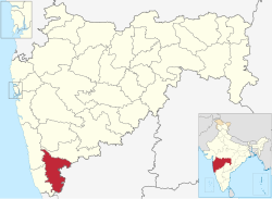
Chandgad is a Small city and tehsil headquarters of chandgad taluka, of Kolhapur district that is in the Indian state of Maharashtra.
Jat is a town and taluka headquarters in Miraj subdivision of Sangli district in southern Maharashtra.
Kadgaon is a town situated Gadhinglaj Taluka of Kolhapur district situated in the southwest corner of the state of Maharashtra, India. Kadgaon is about 4 km from Gadhinglaj, 79 km from Kolhapur. Kadgaon is situated on MH SH 134 and is about 15 km from National Highway 48 (NH48). It is managed by Town Council. It is in the phase of transforming from a small town to a bustling city. It is the second-largest city after Gadhinglaj in Gadhinglaj Taluka also second largest city in Gadhinglaj sub division which Include talukas of Gadhinglaj, Ajra, Bhudargad, Chandgad. As of 2012 it has a population of about 20,851. Kadgaon has amenities that are of the level of Municipal Council in India. Kadgaon has developed as an industrial hub in recent years. It has a strong agricultural sector and is known for its sugarcane, jaggery and red chili production. It is well connected to all of Kolhapur and Maharashtra. It has a very excellent civic amenities. Like in most of the case in the Maharashtra the primary Language spoken is Marathi with 20,851 speaking as their primary Language.
Nesari is a village in Gadhinglaj Taluka of Kolhapur district in Maharashtra, India. As of 2011, it had a population of 21,000. It is about 20 kilometres from Gadhinglaj, and 30 kilometres from National Highway 48 (NH48).
Mahagaon is a town in Gadhinglaj Taluka, Kolhapur district, situated in the southwest corner of the state of Maharashtra, India, on the banks of the Hiranyakeshi river. It is about 10 kilometres (6.2 mi) south of Gadhinglaj and 14 kilometres (8.7 mi) from the city of Kadgaon. It is managed by a town council. In 2011, it had a population of about 20,108.
Mungurwadi is a town in Gadhinglaj Taluka of Kolhapur district in Maharashtra, India. In 2001 it had a population of 3,271, but as of 2011, it has a population of 12,199. It is a major market place and the tenth largest settlement in Gadhinglaj taluka. Mungurwadi is about 24 km from Gadhinglaj, 29 km from second-largest settlement Kadgaon and 12 km from National Highway 48 (NH48).
Haladi is a Town in Gadhinglaj Taluka Kolhapur district situated in the southwest corner of state Maharashtra, India. Harali is situated on banks of Hiranyakeshi river originated from the Great Amboli Ghats is about 7 km from Gadhinglaj towards south and 12 km from the second largest city Kadgaon in Gadhinglaj Taluka and just 2 km from Mahagaon,Gadhinglaj. It is managed by Town Council.In 2011 it has a population of about 9,856. Harali is the eight largest city and town in Gadhinglaj Taluka. Shri Appasaheb Nalawade Gadhinglaj Taluka Sahakari Sakhar Karkhana is situated in the town.
Maharashtra State Highway 134, commonly referred to as MH SH 134, is a normal state highway that runs south through Kolhapur district and Sindhudurg district in the state of Maharashtra, India. This state highway touches the cities of Sankeshwar-Gadhinglaj-Kadgaon-Ajra-Amboli and then proceeds from Maharashtra-Karnataka state border from East-West towards Sawantvadi in Sindhudurg. It covers a distance of over 110 km.

The Hiranyakeshi river is a left-bank tributary of the Ghataprabha River originating in the western ghats in the Sindhudurg district of Maharashtra.
Uttur is a town located in the southern part of Kolhapur District of Maharashtra. It is part of Ajara Tehsil. Uttur is also known for Saturday Weekly market place in Panchkroshi.
Terani is a village located in the south west of Maharashtra, state of India. Administered by a Gram Panchayat, it is located in the Gadhinglaj taluka of Kolhapur district. It is situated at the border of Maharashtra and Karnataka.
Medhewadi is a village in Ajara taluka, one of the southernmost talukas of Kolhapur District of the Indian state of Maharashtra. It is situated on the banks of Hiranyakeshi river.
Kaulage '''कौलगे''' is a village in Gadhinglaj Taluka in Kolhapur district of Maharashtra state India. The village is 10km away from Gadhinglaj. It is located on the Gadhinglaj-Ajara national highway 548 h and on the bank of Hiranyakeshi River. Dr.Prakash Shripad Shahapur The President of God sakhar Harali
Majare Karve is a small village/hamlet in Chandgad taluka in Kolhapur District of Maharashtra, India. It has own Panchayath with more than 1500 population. Situated on central point From Belguam and District office Chandgad on Belguam-Savantwadi highway. It belongs to Desh or Paschim Maharashtra region. It belongs to Pune Division.
Karambali is a Town in Gadhinglaj Taluka of Kolhapur district situated in the southwest corner of state Maharashtra, India. Karambali is situated on banks of mangai talav originated from the Great Amboli Ghats is about 30 km from Gadhinglaj towards south and 12 km from the second largest city Kadgaon in Gadhinglaj Taluka and just 2 km from Kaulage. It is managed by Town Council. In 2011 it has a population of about 15,856. Karambali is the eighth largest town in Gadhinglaj Taluka.